

Surf Forecasts:

Columbia St surf forecast from 3 Aug 2026:
- Best quality surf: Saturday 8 Aug, 8AM (local time) - 2.5ft (0.8m), 8s period, SE swell with glassy winds.
- Most powerful swell: Saturday 8 Aug, 5AM (local time) - 3ft (0.9m), 8s period, SE swell with 95 kJ wave energy.
- Next surfable swell (1★+): Saturday 8 Aug, 8AM (local time) - 2.5ft (0.8m), 8s period with SE swell.
Best Forecast Surf Conditions for Columbia St this week:
The surf forecast for Columbia St over the next 16 days: The first swell (rated 1 star or higher) is forecast to arrive on Saturday (Aug 08) at 8AM. The primary swell is predicted to be 0.8m and 8s period. The wind is predicted to be glassy as the swell arrives.
The most powerful waves expected at Columbia St in the next 16 days are 0.9m 8s and forecast to arrive on Saturday (Aug 08) at 5AM. Winds are predicted to be cross-shore at the time the swell arrives. The largest open ocean swell (not directed at the beach) is 1.8m 7s period and expected on Monday (Aug 03) at 11PM.
| Wave Type | Time (EDT) & Date | Wave Height & Period |
|---|---|---|
| Next good surf (1 star+) | 8AM (Sat 8th Aug) | 2.5ft (0.8m) 8s |
| Best Surf | 8AM (Sat 8th Aug) | 2.5ft (0.8m) 8s |
| Most Powerful | 5AM (Sat 8th Aug) | 3ft (0.9m) 8s |
Table - best surf conditions forecast for Columbia St over the next 16 days.
The Lowdown
Alright folks, Rusty here. Let’s get straight into it. We’ve got a long stretch ahead, and honestly, I’m not going to sugar-coat it—this one’s a bit of a dud for the next little while.
The first real surf we see is a bit of a non-starter. From Monday the 3rd right through to the end of the 16-day window, we’re looking at a persistent run of poor surf conditions. The only break on the radar is Columbia St, a sandbar setup that’s fairly exposed to the swell. The problem is, the swell that’s arriving is mostly from the SE and SSE, and the optimum direction for this spot is from the NE – so it’s a bit of a mismatch.
For the first week, the waves are tiny, generally under 3 ft, and the period is short, in the 6 to 8 second range. That means weak, choppy, close-out shorebreak. The wind is a big issue too. It’s almost always cross, cross-on, or onshore, with a couple of rare clean windows. Tuesday morning the 4th sees a bit of a cross-off breeze with only 1 ft of swell, but the energy is pathetic (15). Not worth a paddle. Thursday morning the 9th has a brief moment of glassy calm with 2 ft swell, but the energy is still weak (52) and the period is short. It’s a tease.
The second week doesn’t get any better. The swell remains small, mostly under 3 ft, and the period is still short. The wind is a mixed bag of cross, cross-on, and the occasional cross-off. The combined energy of all swells directed here only breaks into the three-digit range (114) on the afternoon of Monday the 17th, but even then, the swell is coming from the SSW with a short period of 6 seconds, and the wind is cross. It’s not going to offer anything rideable.
The water temperature is about average for this time of year, no major anomalies, so you won’t need a thick suit, but you will need patience.
Best on offer? There isn’t a standout. The only day that might be marginally less terrible is Sunday the 9th in the morning. It’s glassy, and there’s 2 ft of SE swell. The period is only 7 seconds, so it’ll be soft and lumpy at a sandbar, but if you’re desperate for a float, it’s the best of a bad bunch. Crowds are possible at Columbia St, so you might have some company for the ankle-snappers.
Honestly, this is a blank run. For the area, it’s not unusual to get these long flat spells. It’s more of a kite-surfing setup on those choppy, windy afternoons than a paddle-surfing one. Keep the board in the car, but don’t wax it up just yet. Forecasts can change, but for now, it’s a wait-and-see.
Rusty.
Short Range ForecastHeavy rain (total 34mm), heaviest during Mon morning. Warm (max 29°C on Wed afternoon, min 25°C on Tue morning). Mainly fresh winds. | Days 4-6 Weather SummaryLight rain (total 8mm), mostly falling on Thu morning. Warm (max 29°C on Thu afternoon, min 26°C on Fri night). Wind will be generally light. | ||||||||||||||||||||
Monday 3 | Tuesday 4 | Wednesday 5 | Thursday 6 | Friday 7 | Saturday 8 | Sunday 9 | |||||||||||||||
AM | PM | Night | AM | PM | Night | AM | PM | Night | AM | PM | Night | AM | PM | Night | AM | PM | Night | AM | PM | Night | |
Swell Height Map | 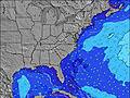 | 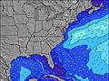 | 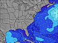 | 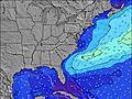 | 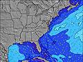 | 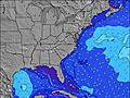 | 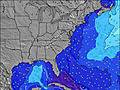 | ||||||||||||||
Wave Height (m) Direction Period (s) | S 7 | ESE 8 | SE 8 | SE 7 | SE 7 | SSE 6 | S 5 | SSE 6 | ESE 7 | ESE 7 | ESE 7 | S 5 | SE 6 | SE 7 | SE 8 | SE 8 | SE 8 | SE 7 | SE 7 | SE 7 | SE 7 |
Wave Graph | |||||||||||||||||||||
0 | 39 | 10 | 45 | 37 | 0 | 47 | 53 | 31 | 26 | 18 | 15 | 32 | 62 | 93 | 90 | 60 | 44 | 26 | 24 | 22 | |
Wind (km/h) | |||||||||||||||||||||
Wind State on-shore cross-onshore cross-shore cross-offshore off-shore glassy | cross-on | cross | cross | cross | cross-on | cross-on | cross-on | cross-on | cross-on | cross-on | cross-on | cross-on | cross-on | cross-on | cross | cross-on | cross-on | cross-on | cross-on | cross-on | cross |
High Tide | 11:20AM1.30m | 11:38PM1.27m | 12:09PM1.34m | 00:25AM1.22m | 1:00PM1.37m | 1:14AM1.16m | 1:55PM1.40m | 2:10AM1.11m | 2:56PM1.42m | 3:15AM1.09m | 4:04PM1.46m | 4:27AM1.11m | 5:10PM1.52m | ||||||||
Low Tide | 5:25PM0.17m | 5:42AM0.05m | 6:24PM0.23m | 6:32AM0.08m | 7:38PM0.27m | 7:35AM0.09m | 8:52PM0.27m | 8:41AM0.08m | 9:57PM0.23m | 9:44AM0.05m | 10:55PM0.17m | 10:43AM0.01m | 11:52PM0.11m | ||||||||
6:22 | — | — | 6:24 | — | — | 6:24 | — | — | 6:24 | — | — | 6:26 | — | — | 6:26 | — | — | 6:26 | — | — | |
— | 8:09 | — | — | 8:09 | — | — | 8:08 | — | — | 8:07 | — | — | 8:07 | — | — | 8:06 | — | — | 8:05 | — | |
mm | 6 | 2 | 4 | 7 | 3 | 7 | 3 | — | 2 | 5 | — | — | 1 | 1 | — | 1 | — | — | 2 | 1 | 2 |
Temp °C | 26 | 28 | 26 | 25 | 28 | 27 | 28 | 29 | 28 | 28 | 29 | 28 | 28 | 28 | 28 | 28 | 28 | 27 | 28 | 26 | 26 |
Feels °C | 26 | 27 | 25 | 28 | 29 | 28 | 30 | 30 | 31 | 30 | 31 | 32 | 31 | 30 | 31 | 31 | 29 | 29 | 30 | 26 | 27 |
Swell 1 Height (m) Direction Period (s) | — | ESE 8 | SE 8 | SE 7 | SE 7 | — | SSE 6 | — | ESE 7 | S 5 | ESE 7 | SSE 6 | SE 6 | SE 7 | SE 8 | SE 8 | SE 8 | SE 7 | SE 7 | SE 7 | SE 7 |
— | 39 | 10 | 45 | 37 | — | 64 | — | 31 | 25 | 18 | 41 | 32 | 62 | 93 | 90 | 60 | 44 | 26 | 24 | 22 | |
Swell 2 Height (m) Direction Period (s) | — | — | — | — | — | — | — | — | — | ESE 7 | E 10 | E 10 | E 10 | E 9 | E 9 | — | — | — | S 4 | — | E 8 |
— | — | — | — | — | — | — | — | — | 26 | 2 | 2 | 2 | 2 | 2 | — | — | — | 6 | — | 1 | |
Swell 3 Height (m) Direction Period (s) | — | — | — | — | — | — | E 12 | — | — | — | — | — | — | — | — | — | — | — | — | — | — |
— | — | — | — | — | — | 3 | — | — | — | — | — | — | — | — | — | — | — | — | — | — | |
Wind waves Height (m) Direction Period (s) | S 7 | S 7 | S 7 | S 6 | S 6 | SSE 6 | S 5 | SSE 6 | S 5 | SSW 5 | S 5 | S 5 | — | — | — | — | SSW 3 | S 4 | S 4 | S 4 | S 4 |
261 | 187 | 306 | 127 | 47 | 127 | 47 | 53 | 29 | 14 | 13 | 15 | — | — | — | — | 3 | 7 | 9 | 7 | 10 | |
Nearest Offshore or Glassy | |||||||||||||||||||||
Distance (km) | 540 | 583 | 759 | 331 | 1 | 2 | 343 | 2 | 21 | 580 | 21 | 953 | 772 | 746 | 953 | 557 | 21 | 563 | 1 | 33 | 21 |
Best forecast wave conditions in North Carolina | |||||||||||||||||||||
Best forecast wave conditions in United States | |||||||||||||||||||||
Header Global | |||||||||||||||||||||
- Map Icons:
 Break
Break Live Wave Height (m)
 Live Wind Speed (km/h)
 Surf Rating (10 Max)
 Ocean Swells (m)
- Wind Speed (km/h)
Latest Updates


FREE! Surf-Forecast.com widget for your website
The surf report / weather widget below is available to embed on third party websites free of charge and provides a summary of our Columbia St surf forecast. Simply grab the html code snippet that we provide and paste it into your own site. You can choose your preferred language and metric/imperial units for the surf forecast feed to suit users of your site. Click here to get the code.
Information about the Columbia St Surf forecast
The above surf forecast table for Columbia St provides essential information for determining whether the surfing conditions will be good over the next 16 days. A general guide to surfing at Columbia St can be found by selecting the local surf guide option on the grey menu. Our Columbia St surf forecast is unique since it includes wave energy (power) that defines the real feel of the surf rather than just the height or the period. If you surf the same spot (Columbia St) regularly then make a mental note of the wave energy from the surf forecast table each time you go. Very soon you may start to choose your surf days based on the wave energy alone combined with our forecast of favourable offshore wind conditions. Our star ratings will help here and of course you will also find the usual wave height and period predictions on our surf forecasts as well as a full break down of the swell components under our advanced users option (to reveal that, click the little Einstein character under the tide times).
Further information to help with frequently asked questions about our surf forecast for Columbia St may be found under the help tab on the top menu and also by moving your mouse over the question marks on the surf forecast table itself. Please always bear in mind that the forecast is for near-shore open water and local factors at each surf break influence the actual breaking wave height, such as the beach / reef profile, water depths offshore and shelter.
Columbia St is 12 km (7 miles) from the city of Wilmington. If you plan a vacation in North Carolina, look for hotels and other accommodation in Wilmington. Wilmington has rooms for a wide range of budgets as well as car hire and transport links.
 Nearest