

Surf Forecasts:

Fox Hill Point surf forecast from 3 Aug 2026:
- Best quality surf: Monday 3 Aug, 11PM (local time) - 5ft (1.5m), 8s period, SSE swell with offshore winds.
- Most powerful swell: Monday 3 Aug, 8PM (local time) - 8ft (2.4m), 8s period, S swell with 743 kJ wave energy.
- Next surfable swell (1★+): Monday 3 Aug, 11PM (local time) - 5ft (1.5m), 8s period with SSE swell.
Best Forecast Surf Conditions for Fox Hill Point this week:
The surf forecast for Fox Hill Point over the next 16 days: The first swell (rated 1 star or higher) is forecast to arrive on Monday (Aug 03) at 11PM. The primary swell is predicted to be 1.5m and 8s period. The wind is predicted to be offshore as the swell arrives.
The most powerful waves expected at Fox Hill Point in the next 16 days are 2.4m 8s and forecast to arrive on Monday (Aug 03) at 8PM. Winds are predicted to be offshore at the time the swell arrives. The largest open ocean swell (not directed at the beach) is 0.6m 4s period and expected on Monday (Aug 03) at 11PM.
| Wave Type | Time (EDT) & Date | Wave Height & Period |
|---|---|---|
| Next good surf (1 star+) | 11PM (Mon 3rd Aug) | 5ft (1.5m) 8s |
| Best Surf | 11PM (Mon 3rd Aug) | 5ft (1.5m) 8s |
| Most Powerful | 8PM (Mon 3rd Aug) | 8ft (2.4m) 8s |
Table - best surf conditions forecast for Fox Hill Point over the next 16 days.
The Lowdown
Alright, Rusty here, checking in.
To be blunt, the next couple of weeks are looking pretty grim for Fox Hill Point. This reef setup is a classic SE swell magnet, but the problem is we just don't have the swell or the conditions lining up. Looking at the 16-day window, there's a massive gap with no real surf on offer. It’s a long stretch of flat, small, or messy conditions that just aren't worth paddling out for.
The water temp is sitting at 65°, which is about 2° cooler than the usual for this time of year. Nothing crazy, just a touch nippier than average.
The whole period kicks off with a thundery Monday. On Monday, August 3rd, we see a jump in swell to 7 ft from the SSE, but the wind is a strong 35 km/h cross-off, churning things up. It’s a lot of energy – you can feel it in the 452 (moderate wave energy) – but it’s not clean surf. The wave comment says "poor surf conditions" and that’s the story for the whole block.
From Tuesday, August 4th all the way through to the end of the second week, the swell drops right off. We’re talking ankle to knee-high dribble at best, mostly from the SE or ESE. The wind does offer some nice windows – like the glassy morning on Thursday, August 6th, and several offshore and glassy spells that follow – but with swell heights barely scraping 2 ft, it’s just not enough to push a wave. The energy readings are all in the double digits, mostly under 100 (weak wave energy), which tells you everything you need to know.
Even by the 14th and 15th, when the swell tries to push back to 3 ft, the wind is stubbornly cross-onshore, making it choppy and ugly. The setup is a beach and reef, but with these onshore winds, it’d be more fun for a kite surfer than someone on a paddle board.
There is no standout session here. The best you can hope for is a tiny, glassy knee-high wave on a morning when the wind is offshore, but it’s a stretch to even call it a wave. Just a flat spell for the books.
Stay patient, the forecasts can change.
Rusty.
Short Range ForecastModerate rain (total 17mm), heaviest on Mon afternoon. Warm (max 31°C on Tue afternoon, min 18°C on Mon night). Winds decreasing (fresh winds from the SSW on Mon afternoon, calm by Wed morning). | Days 4-6 Weather SummaryLight rain (total 4mm), mostly falling on Thu night. Warm (max 34°C on Fri afternoon, min 23°C on Thu morning). Wind will be generally light. | ||||||||||||||||||||
Monday 3 | Tuesday 4 | Wednesday 5 | Thursday 6 | Friday 7 | Saturday 8 | Sunday 9 | |||||||||||||||
AM | PM | Night | AM | PM | Night | AM | PM | Night | AM | PM | Night | AM | PM | Night | AM | PM | Night | AM | PM | Night | |
Swell Height Map | 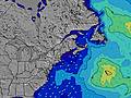 | 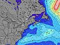 | 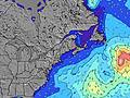 | 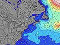 | 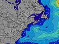 | 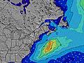 | 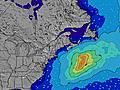 | ||||||||||||||
Wave Height (m) Direction Period (s) | SSE 5 | SSE 8 | SSE 8 | SSE 8 | SSE 7 | SE 7 | SE 7 | SE 7 | SE 6 | SE 6 | SE 6 | SSE 5 | SE 7 | SE 8 | SE 8 | SE 8 | SE 8 | SE 8 | SSE 4 | SSE 3 | SSE 5 |
Wave Graph | |||||||||||||||||||||
83 | 452 | 149 | 43 | 56 | 22 | 23 | 22 | 32 | 18 | 6 | 19 | 9 | 14 | 10 | 16 | 9 | 9 | 2 | 5 | 9 | |
Wind (km/h) | |||||||||||||||||||||
Wind State on-shore cross-onshore cross-shore cross-offshore off-shore glassy | cross-off | cross-off | off | off | cross-off | off | cross-on | on | off | glassy | cross | cross-off | off | glassy | off | glassy | cross | cross-off | cross-off | off | cross-off |
High Tide | 3:08PM3.18m | 3:28AM3.04m | 3:51PM3.20m | 4:18AM2.95m | 4:41PM3.21m | 5:14AM2.87m | 5:36PM3.23m | 6:17AM2.83m | 6:38PM3.28m | 7:23AM2.86m | 7:43PM3.37m | 8:30AM2.95m | 8:47PM3.49m | ||||||||
Low Tide | 8:54AM0.61m | 9:21PM0.67m | 9:35AM0.68m | 10:10PM0.67m | 10:22AM0.75m | 11:05PM0.67m | 11:15AM0.81m | 00:06AM0.64m | 12:16PM0.84m | 1:11AM0.58m | 1:21PM0.81m | 2:17AM0.46m | 2:27PM0.72m | 3:19AM0.32m | |||||||
5:35 | — | — | 5:35 | — | — | 5:37 | — | — | 5:37 | — | — | 5:39 | — | — | 5:41 | — | — | 5:41 | — | — | |
— | 8:01 | — | — | 8:00 | — | — | 7:59 | — | — | 7:58 | — | — | 7:57 | — | — | 7:54 | — | — | 7:53 | — | |
mm | 7 | 9 | 1 | — | — | — | — | — | — | — | — | 3 | — | — | — | — | 1 | — | — | — | — |
Temp °C | 24 | 24 | 22 | 27 | 31 | 28 | 23 | 24 | 24 | 29 | 31 | 29 | 31 | 34 | 31 | 28 | 29 | 27 | 30 | 34 | 31 |
Feels °C | 23 | 22 | 20 | 25 | 28 | 27 | 22 | 27 | 27 | 30 | 30 | 32 | 31 | 34 | 33 | 31 | 30 | 29 | 32 | 34 | 32 |
Swell 1 Height (m) Direction Period (s) | SE 9 | — | SSE 8 | SSE 8 | — | SSE 5 | SE 7 | SE 7 | SE 6 | SE 6 | SE 6 | SSE 5 | SSE 6 | SE 8 | SE 8 | SE 8 | SE 8 | SSE 4 | SSE 4 | E 9 | SSE 5 |
3 | — | 149 | 43 | — | 20 | 23 | 22 | 32 | 18 | 6 | 19 | 6 | 14 | 10 | 16 | 9 | 5 | 1 | 2 | 9 | |
Swell 2 Height (m) Direction Period (s) | — | — | — | — | — | SE 7 | E 10 | — | E 9 | E 9 | SSE 8 | SE 8 | SE 7 | E 9 | SSE 3 | E 8 | E 9 | SE 8 | SE 7 | E 8 | SE 10 |
— | — | — | — | — | 22 | 2 | — | 2 | 2 | 6 | 2 | 9 | 2 | 1 | 1 | 1 | 9 | 2 | 1 | 4 | |
Swell 3 Height (m) Direction Period (s) | — | — | — | — | — | E 10 | — | E 9 | E 9 | — | E 9 | E 10 | E 9 | E 9 | E 8 | — | — | E 8 | E 8 | E 8 | E 9 |
— | — | — | — | — | 2 | — | 2 | 2 | — | 2 | 2 | 2 | 2 | 1 | — | — | 1 | 1 | 1 | 1 | |
Wind waves Height (m) Direction Period (s) | SSE 5 | SSE 8 | W 3 | WSW 3 | SSE 7 | WSW 3 | — | — | SW 2 | — | SSE 3 | — | — | — | — | — | SSE 3 | S 4 | — | SSE 3 | — |
83 | 452 | 5 | 1 | 56 | 1 | — | — | 1 | — | 4 | — | — | — | — | — | 3 | 10 | — | 5 | — | |
Nearest Offshore or Glassy | |||||||||||||||||||||
Distance (km) | 589 | 368 | 0 | 37 | 1 | 37 | 163 | 124 | 165 | 228 | 199 | 180 | 183 | 402 | 171 | 228 | 589 | 290 | 238 | 396 | 532 |
Best forecast wave conditions in New Hampshire | |||||||||||||||||||||
Best forecast wave conditions in United States | |||||||||||||||||||||
Header Global | |||||||||||||||||||||
- Map Icons:
 Break
Break Live Wave Height (m)
 Live Wind Speed (km/h)
 Surf Rating (10 Max)
 Ocean Swells (m)
- Wind Speed (km/h)
Latest Updates


FREE! Surf-Forecast.com widget for your website
The surf report / weather widget below is available to embed on third party websites free of charge and provides a summary of our Fox Hill Point surf forecast. Simply grab the html code snippet that we provide and paste it into your own site. You can choose your preferred language and metric/imperial units for the surf forecast feed to suit users of your site. Click here to get the code.
Information about the Fox Hill Point Surf forecast
The above surf forecast table for Fox Hill Point provides essential information for determining whether the surfing conditions will be good over the next 16 days. A general guide to surfing at Fox Hill Point can be found by selecting the local surf guide option on the grey menu. Our Fox Hill Point surf forecast is unique since it includes wave energy (power) that defines the real feel of the surf rather than just the height or the period. If you surf the same spot (Fox Hill Point) regularly then make a mental note of the wave energy from the surf forecast table each time you go. Very soon you may start to choose your surf days based on the wave energy alone combined with our forecast of favourable offshore wind conditions. Our star ratings will help here and of course you will also find the usual wave height and period predictions on our surf forecasts as well as a full break down of the swell components under our advanced users option (to reveal that, click the little Einstein character under the tide times).
Further information to help with frequently asked questions about our surf forecast for Fox Hill Point may be found under the help tab on the top menu and also by moving your mouse over the question marks on the surf forecast table itself. Please always bear in mind that the forecast is for near-shore open water and local factors at each surf break influence the actual breaking wave height, such as the beach / reef profile, water depths offshore and shelter.
Fox Hill Point is 6 km (4 miles) from Hampton. If you plan a vacation in New Hampshire, look for hotels and other accommodation in Hampton. Hampton has rooms for a wide range of budgets as well as car hire and transport links.
 Nearest