

Surf Forecasts:

Point Grenville surf forecast from 19 Jul 2026:
- Best quality surf: Monday 20 Jul, 5AM (local time) - 5ft (1.6m), 8s period, WNW swell with glassy winds.
- Most powerful swell: Saturday 25 Jul, 8PM (local time) - 3ft (0.9m), 21s period, SW swell with 763 kJ wave energy.
- Next surfable swell (1★+): Monday 20 Jul, 5AM (local time) - 5ft (1.6m), 8s period with WNW swell.
Best Forecast Surf Conditions for Point Grenville this week:
The surf forecast for Point Grenville over the next 16 days: The first swell (rated 1 star or higher) is forecast to arrive on Monday (Jul 20) at 5AM. The primary swell is predicted to be 1.6m and 8s period with a secondary swell of 0.6m and 17s. The wind is predicted to be glassy as the swell arrives.
The most powerful waves expected at Point Grenville in the next 16 days are 0.9m 21s and forecast to arrive on Saturday (Jul 25) at 8PM. Winds are predicted to be cross-onshore at the time the swell arrives. The largest open ocean swell (not directed at the beach) is 0.4m 13s period and expected on Saturday (Jul 25) at 11PM.
| Wave Type | Time (PDT) & Date | Wave Height & Period |
|---|---|---|
| Next good surf (1 star+) | 5AM (Mon 20th Jul) | 5ft (1.6m) 8s |
| Best Surf | 5AM (Mon 20th Jul) | 5ft (1.6m) 8s |
| Most Powerful | 8PM (Sat 25th Jul) | 3ft (0.9m) 21s |
Table - best surf conditions forecast for Point Grenville over the next 16 days.
The Lowdown
Alright, folks, Rusty here. Let’s break down what’s on offer at Point Grenville over the next couple of weeks. This is a consistent beginner-friendly beach and reef break that’s sheltered and loves a solid NW swell, but the wind has been a real pain. For the first week and a half, it’s mostly poor surf with onshore and cross-onshore winds, choppy conditions, and only marginal or zero scores. The swell hangs around 3 ft to 5 ft from the WNW, but the wind never cleans up properly. There’s a gap of about six days with no real recommendation—just a few “marginal” tags, nothing you’d paddle out for.
Then on Sunday July 26th morning, we finally get a window. The wind flips to a light cross-offshore from the SSE at 9 mph, cleaning the surface right up. Swell is only 3 ft from the SW, but it’s a long-period groundswell at 20 seconds—that gives it some real push and better shape, though it’s a bit small. Combined energy is moderate (540). The direction isn’t the optimum NW, but with clean conditions and a consistent break, it’s the best on offer. Crowds are possible, but it’s a Sunday morning, so you might have a few locals out. The rest of that day is only marginal, and the following week stays poor—smaller SW swell, cross-onshore winds, and choppy mess. By Saturday August 1st and Sunday August 2nd, the swell picks back to 5 ft–6 ft from the WNW, but the wind is back to cross-on and gusty, so it’s still poor. The whole stretch is a bit of a write-off except for that one clean morning.
If you’re a beginner, that 3 ft is fine, but don’t expect much else. For the more experienced, the long-period SW might actually make the reef section work okay, but it’s a gamble. Honestly, the only day worth wetting a line is Sunday July 26th morning. Everything else is either too messy or too small. Keep an eye on the forecasts, though—this area can turn around quickly.
Rusty.
Short Range ForecastMostly dry. Very mild (max 19°C on Mon night, min 12°C on Sat night). Wind will be generally light. | Days 5-7 Weather SummaryMostly dry. Very mild (max 16°C on Tue night, min 13°C on Wed night). Wind will be generally light. | ||||||||||||||||||
Sunday 19 | Monday 20 | Tuesday 21 | Wednesday 22 | Thursday 23 | Friday 24 | ||||||||||||||
Night | AM | PM | Night | AM | PM | Night | AM | PM | Night | AM | PM | Night | AM | PM | Night | AM | PM | Night | |
Swell Height Map |  | 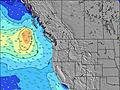 | 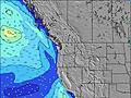 | 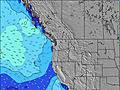 | 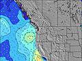 | 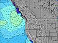 | 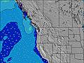 | ||||||||||||
Wave Height (m) Direction Period (s) | SW 18 | WNW 8 | WNW 8 | WNW 8 | WNW 8 | WNW 8 | WNW 8 | SW 16 | SW 16 | WNW 8 | WNW 8 | WNW 9 | WNW 9 | WNW 9 | WNW 9 | WNW 9 | SW 26 | WNW 8 | SW 24 |
Wave Graph | |||||||||||||||||||
316 | 176 | 263 | 327 | 323 | 232 | 202 | 248 | 248 | 217 | 249 | 297 | 261 | 267 | 273 | 300 | 329 | 254 | 661 | |
Wind (km/h) | |||||||||||||||||||
Wind State on-shore cross-onshore cross-shore cross-offshore off-shore glassy | cross-on | on | cross-on | cross | cross-on | cross-on | glassy | cross-on | on | glassy | cross-on | on | cross | cross | cross-on | cross | on | cross-on | cross-on |
High Tide | 4:29AM2.09m | 5:18PM2.33m | 5:26AM1.83m | 6:00PM2.30m | 6:32AM1.62m | 6:44PM2.25m | 7:51AM1.48m | 7:33PM2.21m | 9:20AM1.46m | 8:26PM2.18m | 10:40AM1.52m | 9:21PM2.18m | |||||||
Low Tide | 10:27PM0.38m | 10:35AM0.02m | 11:26PM0.36m | 11:17AM0.30m | 00:27AM0.33m | 12:03PM0.56m | 1:32AM0.27m | 12:56PM0.80m | 2:37AM0.20m | 1:59PM0.96m | 3:38AM0.11m | 3:07PM1.05m | 4:32AM0.00m | ||||||
— | 5:39 | — | — | 5:39 | — | — | 5:41 | — | — | 5:43 | — | — | 5:43 | — | — | 5:45 | — | — | |
9:07 | — | — | 9:06 | — | — | 9:05 | — | — | 9:04 | — | — | 9:02 | — | — | 9:01 | — | — | 9:00 | |
mm | — | — | — | — | — | — | — | — | — | — | — | — | — | — | — | — | — | — | — |
Temp °C | 13 | 13 | 14 | 14 | 16 | 18 | 19 | 18 | 17 | 16 | 16 | 15 | 15 | 14 | 15 | 14 | 13 | 13 | 13 |
Feels °C | 9 | 11 | 11 | 11 | 15 | 16 | 17 | 17 | 15 | 15 | 16 | 14 | 15 | 13 | 13 | 13 | 12 | 10 | 9 |
Swell 1 Height (m) Direction Period (s) | WNW 9 | WNW 8 | WNW 8 | WNW 8 | WNW 8 | WNW 8 | WNW 8 | WNW 8 | WNW 8 | WNW 8 | WNW 8 | WNW 9 | WNW 9 | WNW 9 | WNW 9 | WNW 9 | WNW 8 | WNW 8 | WNW 8 |
108 | 176 | 263 | 327 | 323 | 232 | 202 | 149 | 154 | 217 | 249 | 297 | 261 | 267 | 273 | 300 | 273 | 254 | 208 | |
Swell 2 Height (m) Direction Period (s) | SW 18 | W 14 | W 14 | SW 16 | SW 17 | SW 17 | SW 16 | SW 16 | SW 16 | SW 15 | SW 14 | SW 14 | SW 14 | SW 14 | SW 14 | SW 14 | SW 14 | SW 14 | SW 24 |
316 | 150 | 148 | 219 | 243 | 227 | 159 | 248 | 248 | 183 | 169 | 169 | 167 | 127 | 93 | 128 | 102 | 100 | 661 | |
Swell 3 Height (m) Direction Period (s) | W 15 | SW 19 | SW 16 | W 14 | WNW 13 | WNW 13 | WNW 13 | WNW 12 | WNW 12 | WNW 10 | WSW 21 | SW 21 | S 12 | SSW 11 | SW 19 | S 10 | SW 26 | SW 26 | SW 14 |
218 | 175 | 65 | 103 | 57 | 56 | 33 | 29 | 28 | 58 | 44 | 17 | 11 | 24 | 58 | 17 | 329 | 168 | 92 | |
Wind waves Height (m) Direction Period (s) | NW 5 | — | — | — | — | — | — | — | NW 3 | — | — | — | — | — | — | — | — | WNW 8 | — |
29 | — | — | — | — | — | — | — | 1 | — | — | — | — | — | — | — | — | 165 | — | |
Nearest Offshore or Glassy | |||||||||||||||||||
Distance (km) | 7 | 42 | 107 | 7 | 7 | 107 | 0 | 115 | 233 | 0 | 45 | 45 | 45 | 45 | 115 | 7 | 115 | 809 | 115 |
Best forecast wave conditions in Washington State | |||||||||||||||||||
Best forecast wave conditions in United States | |||||||||||||||||||
Header Global | |||||||||||||||||||
- Map Icons:
 Break
Break Live Wave Height (m)
 Live Wind Speed (km/h)
 Surf Rating (10 Max)
 Ocean Swells (m)
- Wind Speed (km/h)


FREE! Surf-Forecast.com widget for your website
The surf report / weather widget below is available to embed on third party websites free of charge and provides a summary of our Point Grenville surf forecast. Simply grab the html code snippet that we provide and paste it into your own site. You can choose your preferred language and metric/imperial units for the surf forecast feed to suit users of your site. Click here to get the code.
Information about the Point Grenville Surf forecast
The above surf forecast table for Point Grenville provides essential information for determining whether the surfing conditions will be good over the next 16 days. A general guide to surfing at Point Grenville can be found by selecting the local surf guide option on the grey menu. Our Point Grenville surf forecast is unique since it includes wave energy (power) that defines the real feel of the surf rather than just the height or the period. If you surf the same spot (Point Grenville) regularly then make a mental note of the wave energy from the surf forecast table each time you go. Very soon you may start to choose your surf days based on the wave energy alone combined with our forecast of favourable offshore wind conditions. Our star ratings will help here and of course you will also find the usual wave height and period predictions on our surf forecasts as well as a full break down of the swell components under our advanced users option (to reveal that, click the little Einstein character under the tide times).
Further information to help with frequently asked questions about our surf forecast for Point Grenville may be found under the help tab on the top menu and also by moving your mouse over the question marks on the surf forecast table itself. Please always bear in mind that the forecast is for near-shore open water and local factors at each surf break influence the actual breaking wave height, such as the beach / reef profile, water depths offshore and shelter.
Point Grenville is 49 km (30 miles) from Aberdeen. If you plan a vacation in Washington State, look for hotels and other accommodation in Aberdeen. Aberdeen has rooms for a wide range of budgets as well as car hire and transport links.
 Nearest