

Surf Forecasts:

Cox Bay surf forecast from 3 Aug 2026:
- Best quality surf: Thursday 6 Aug, 11PM (local time) - 6ft (1.8m), 7s period, WNW swell with glassy winds.
- Most powerful swell: Tuesday 4 Aug, 11PM (local time) - 6ft (1.9m), 8s period, WNW swell with 456 kJ wave energy.
- Next surfable swell (1★+): Tuesday 4 Aug, 5AM (local time) - 4ft (1.2m), 7s period with WNW swell.
Best Forecast Surf Conditions for Cox Bay this week:
The surf forecast for Cox Bay over the next 16 days: The first swell (rated 1 star or higher) is forecast to arrive on Tuesday (Aug 04) at 5AM. The primary swell is predicted to be 1.2m and 7s period with a secondary swell of 0.4m and 13s. The wind is predicted to be glassy as the swell arrives.
The most powerful waves expected at Cox Bay in the next 16 days are 1.9m 8s and forecast to arrive on Tuesday (Aug 04) at 11PM. Winds are predicted to be cross-onshore at the time the swell arrives.
| Wave Type | Time (PDT) & Date | Wave Height & Period |
|---|---|---|
| Next good surf (1 star+) | 5AM (Tue 4th Aug) | 4ft (1.2m) 7s |
| Best Surf | 11PM (Thu 6th Aug) | 6ft (1.8m) 7s |
| Most Powerful | 11PM (Tue 4th Aug) | 6ft (1.9m) 8s |
Table - best surf conditions forecast for Cox Bay over the next 16 days.
The Lowdown
Alright folks, Rusty here. Grab a coffee, let’s look at what’s heading our way for Cox Bay over the next couple of weeks.
First off, I gotta be straight with you – the next few days are a bit of a write-off for a proper paddle. We’ve got a bit of swell on the table, but the wind and conditions are just not cooperating. The water’s sitting at 60°, which is about normal for this time of year, so at least it’s not a shock when you get in.
We’re looking at a bit of a frustrating start. Monday the 3rd through Tuesday the 4th offers waves around 3 ft to 5 ft from the W and WNW, but the periods are short, around 7 to 8 seconds. The wind is mostly onshore or cross-onshore, which is just making everything a bit of a messy, choppy closeout. The wave energy is moderate, hitting around 220 on Monday, but it’s not a clean, rideable energy. We’re stuck in the marginal zone.
Things don’t really improve through Wednesday the 5th. Still that short-period WNW swell, and the wind keeps swinging around onshore. It’s frustrating – you can see the energy in the water, but it’s just not shaping up.
Now, here’s a little glimmer of hope. Thursday the 6th is the best bet in this first week. The swell drops a touch to 4 ft from the WNW, but the wind finally plays ball. The morning sees a light cross-offshore breeze from the SSE, cleaning things up nicely. But the real standout is the Thursday afternoon session. The wind goes *glass* – a flat calm from the WNW. The waves will be 4 ft with a 7-second period, and the energy is moderate (257). It’s not a big day, but it will be clean, fun, and uncrowded-looking. That’s the one to circle.
The weekend rolls in, and we lose it again. Friday the 7th through Sunday the 9th brings a mix of short-period junk and rising onshore winds, with the swell bumping up to 6 ft on Saturday afternoon. That’s too big for the messy conditions, and the 12 mph onshore wind on Sunday afternoon will be a total mess. Not worth the paddle.
Then we hit a real lull. From Monday the 10th through Thursday the 13th, the swell drops right off – we’re talking 1 ft to 2 ft. The energy is still moderate in the 200-300 range, but it’s long-period groundswell from the SSW. That kind of 15-18 second period is usually better at a point break or reef, not a beach-and-point setup like Cox Bay. It’ll just be straight and weak. The wind is mostly onshore, so it’s a no-go for a proper surf. This is a blank few days.
Okay, here’s the second standout. Friday the 14th morning – that’s a sneaky good one. The swell picks up to 4 ft from the W, with a 7-second period. The wind is a light cross-offshore from the SSE again, and the wave energy is solid at 332. The report says “expect good surf conditions,” and with a clean, light offshore breeze, that’s a legit window. After that, the afternoon goes back to onshore junk, so hit the early session.
The second week is a mixed bag of small, long-period swells and some tricky wind. Saturday the 15th and Sunday the 16th have those 18-19 second SSW groundswells, but they’re tiny – 1 ft to 2 ft – and the wind is mostly cross-on or onshore. The energy is strong (530 on Sunday morning), but it’s not going to make a quality wave at this beach.
The very last day of the forecast, Tuesday the 18th, offers a brief moment of hope. The morning session is glassy with a 2 ft SSW groundswell. It’s small, but it’ll be clean. That’s your “chill longboard” session if you’re desperate for a glide.
Overall, the pick of the 16 days is Thursday the 6th afternoon for the glassy clean conditions, and Friday the 14th morning for the best combination of size and clean offshore wind. The rest of the time, we’re fighting onshore winds or waiting for the swell to show up properly.
Rusty out.
Short Range ForecastMostly dry. Very mild (max 18°C on Mon night, min 14°C on Mon morning). Wind will be generally light. | Days 4-6 Weather SummaryMostly dry. Very mild (max 16°C on Thu morning, min 13°C on Thu night). Wind will be generally light. | ||||||||||||||||||||
Monday 3 | Tuesday 4 | Wednesday 5 | Thursday 6 | Friday 7 | Saturday 8 | Sunday 9 | |||||||||||||||
AM | PM | Night | AM | PM | Night | AM | PM | Night | AM | PM | Night | AM | PM | Night | AM | PM | Night | AM | PM | Night | |
Swell Height Map | 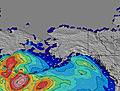 | 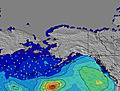 | 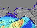 | 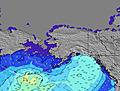 | 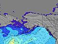 | 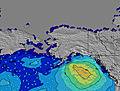 | 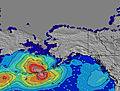 | ||||||||||||||
Wave Height (m) Direction Period (s) | W 7 | W 7 | WNW 7 | WNW 7 | WNW 8 | WNW 8 | WNW 8 | WNW 8 | WNW 8 | WNW 8 | WNW 7 | WNW 7 | W 6 | SW 18 | WNW 6 | WNW 6 | WNW 6 | WNW 7 | SW 18 | WNW 6 | WNW 7 |
Wave Graph | |||||||||||||||||||||
102 | 77 | 139 | 121 | 270 | 370 | 257 | 259 | 322 | 169 | 160 | 315 | 88 | 88 | 108 | 155 | 212 | 219 | 150 | 134 | 247 | |
Wind (km/h) | |||||||||||||||||||||
Wind State on-shore cross-onshore cross-shore cross-offshore off-shore glassy | on | cross-on | cross | cross-on | cross-on | glassy | cross | cross-on | glassy | cross-off | glassy | glassy | cross | on | glassy | cross-on | on | glassy | on | on | cross-on |
High Tide | 4:38PM3.21m | 4:56AM2.76m | 5:15PM3.24m | 5:54AM2.58m | 5:59PM3.26m | 7:08AM2.45m | 6:53PM3.26m | 8:38AM2.41m | 7:59PM3.28m | 10:07AM2.50m | 9:11PM3.34m | 11:18AM2.66m | 10:19PM3.44m | ||||||||
Low Tide | 10:10AM0.80m | 11:01PM0.96m | 10:45AM1.03m | 11:56PM0.92m | 11:25AM1.30m | 00:59AM0.87m | 12:16PM1.55m | 2:10AM0.80m | 1:27PM1.76m | 3:24AM0.67m | 2:55PM1.83m | 4:34AM0.47m | 4:17PM1.75m | ||||||||
5:58 | — | — | 5:58 | — | — | 6:01 | — | — | 6:01 | — | — | 6:03 | — | — | 6:05 | — | — | 6:05 | — | — | |
— | — | 9:00 | — | 8:58 | — | — | 8:57 | — | — | 8:54 | — | — | 8:52 | — | — | 8:52 | — | — | 8:50 | — | |
mm | — | — | — | — | — | — | — | — | — | — | — | — | — | — | — | — | — | — | — | — | — |
Temp °C | 16 | 16 | 18 | 17 | 17 | 18 | 17 | 16 | 17 | 16 | 15 | 14 | 14 | 14 | 14 | 14 | 14 | 15 | 14 | 15 | 15 |
Feels °C | 14 | 13 | 17 | 16 | 16 | 17 | 17 | 16 | 17 | 15 | 15 | 14 | 14 | 13 | 12 | 13 | 13 | 12 | 14 | 12 | 12 |
Swell 1 Height (m) Direction Period (s) | W 7 | SSW 13 | WNW 7 | WNW 7 | WNW 8 | WNW 8 | WNW 8 | WNW 8 | WNW 8 | WNW 8 | SW 14 | WNW 7 | W 6 | SSW 13 | SW 13 | W 6 | SSW 12 | WNW 7 | W 6 | SSW 17 | SW 16 |
102 | 68 | 139 | 121 | 192 | 370 | 257 | 259 | 322 | 169 | 68 | 206 | 88 | 65 | 84 | 94 | 59 | 219 | 78 | 116 | 122 | |
Swell 2 Height (m) Direction Period (s) | SSW 13 | SW 18 | SW 13 | W 9 | SW 16 | SW 15 | SW 15 | SW 15 | SW 14 | SW 14 | S 13 | SSW 13 | SSW 13 | SW 18 | SW 18 | SW 13 | SSW 19 | SSW 13 | SW 18 | SW 12 | SW 12 |
69 | 48 | 42 | 43 | 40 | 57 | 55 | 34 | 69 | 70 | 14 | 69 | 67 | 82 | 50 | 42 | 74 | 64 | 150 | 35 | 36 | |
Swell 3 Height (m) Direction Period (s) | SW 18 | S 12 | SW 16 | SW 13 | SW 13 | SSW 12 | SSW 12 | SSW 12 | S 14 | S 13 | SW 20 | W 13 | W 12 | W 15 | WNW 11 | SW 18 | SW 16 | SW 16 | SW 12 | W 13 | W 12 |
49 | 3 | 41 | 43 | 26 | 14 | 14 | 14 | 16 | 14 | 15 | 28 | 11 | 17 | 22 | 81 | 42 | 41 | 37 | 28 | 11 | |
Wind waves Height (m) Direction Period (s) | — | W 7 | — | — | WNW 8 | — | — | — | — | — | WNW 7 | WNW 7 | — | WNW 5 | WNW 6 | WNW 6 | WNW 6 | — | — | WNW 6 | WNW 7 |
— | 77 | — | — | 270 | — | — | — | — | — | 160 | 315 | — | 88 | 108 | 155 | 212 | — | — | 134 | 247 | |
Nearest Offshore or Glassy | |||||||||||||||||||||
Distance (km) | 119 | 151 | 1 | 119 | 810 | 0 | 119 | 763 | 0 | 0 | 0 | 0 | 135 | 1019 | 0 | 151 | 2793 | 0 | 119 | 749 | 123 |
Best forecast wave conditions in Vancouver Island | |||||||||||||||||||||
Best forecast wave conditions in Canada | |||||||||||||||||||||
Header Global | |||||||||||||||||||||
- Map Icons:
 Break
Break Live Wave Height (m)
 Live Wind Speed (km/h)
 Surf Rating (10 Max)
 Ocean Swells (m)
- Wind Speed (km/h)
Latest Updates


FREE! Surf-Forecast.com widget for your website
The surf report / weather widget below is available to embed on third party websites free of charge and provides a summary of our Cox Bay surf forecast. Simply grab the html code snippet that we provide and paste it into your own site. You can choose your preferred language and metric/imperial units for the surf forecast feed to suit users of your site. Click here to get the code.
Information about the Cox Bay Surf forecast
The above surf forecast table for Cox Bay provides essential information for determining whether the surfing conditions will be good over the next 16 days. A general guide to surfing at Cox Bay can be found by selecting the local surf guide option on the grey menu. Our Cox Bay surf forecast is unique since it includes wave energy (power) that defines the real feel of the surf rather than just the height or the period. If you surf the same spot (Cox Bay) regularly then make a mental note of the wave energy from the surf forecast table each time you go. Very soon you may start to choose your surf days based on the wave energy alone combined with our forecast of favourable offshore wind conditions. Our star ratings will help here and of course you will also find the usual wave height and period predictions on our surf forecasts as well as a full break down of the swell components under our advanced users option (to reveal that, click the little Einstein character under the tide times).
Further information to help with frequently asked questions about our surf forecast for Cox Bay may be found under the help tab on the top menu and also by moving your mouse over the question marks on the surf forecast table itself. Please always bear in mind that the forecast is for near-shore open water and local factors at each surf break influence the actual breaking wave height, such as the beach / reef profile, water depths offshore and shelter.
Cox Bay is 77 km (48 miles) from Gold River. If you plan a holiday in Vancouver Island, look for hotels and other accommodation in Gold River. Gold River has rooms for a wide range of budgets as well as car hire and transport links.
 Nearest