

Surf Forecasts:

Niyodo Rivermouth surf forecast from 21 Jul 2026:
- Best quality surf: Sunday 26 Jul, 6PM (local time) - 2.5ft (0.8m), 9s period, S swell with glassy winds.
- Most powerful swell: Tuesday 28 Jul, 6AM (local time) - 2.5ft (0.8m), 10s period, SSW swell with 128 kJ wave energy.
- Next surfable swell (1★+): Wednesday 22 Jul, 6AM (local time) - 1.5ft (0.4m), 10s period with E swell.
Best Forecast Surf Conditions for Niyodo Rivermouth this week:
The surf forecast for Niyodo Rivermouth over the next 16 days: The first swell (rated 1 star or higher) is forecast to arrive on Wednesday (Jul 22) at 6AM. The primary swell is predicted to be 0.4m and 10s period with a secondary swell of 0.3m and 10s. Another secondary swell of 0.3m and 3s is also forecast. The wind is predicted to be glassy as the swell arrives.
The most powerful waves expected at Niyodo Rivermouth in the next 16 days are 0.8m 10s and forecast to arrive on Tuesday (Jul 28) at 6AM. Winds are predicted to be offshore at the time the swell arrives.
| Wave Type | Time (JST) & Date | Wave Height & Period |
|---|---|---|
| Next good surf (1 star+) | 6AM (Wed 22nd Jul) | 1.5ft (0.4m) 10s |
| Best Surf | 6PM (Sun 26th Jul) | 2.5ft (0.8m) 9s |
| Most Powerful | 6AM (Tue 28th Jul) | 2.5ft (0.8m) 10s |
Table - best surf conditions forecast for Niyodo Rivermouth over the next 16 days.
The Lowdown
Alright folks, Rusty here. Let's have a look at what's on the cards for the Niyodo Rivermouth.
Right off the bat, it's a slow start. We're looking at a few days of tiny, weak energy with practically nothing to get excited about. The swell is low and the period is short, so don't bother paddling out just yet. The first few days only have a combined energy of 47 (weak) and it's described as poor surf conditions. That's just the way it goes sometimes.
Things start to stir on Friday the 24th. The morning glass-off with a light SSW breeze will have the surface clean, but the swell is still tiny at 1ft from the SE with a long 18-second period. That long period will help the shape, but it's a long wait for a very small wave. The combined energy is still only 80 (weak). It's surfable, but only just.
Saturday morning the 25th is dead calm with glassy conditions, and the swell edges up to 1ft from the SE again, but with a 16-second period. The energy climbs to 140 (moderate) but it's still very ordinary. It's a real struggle to get going.
The best of the first week looks like Tuesday the 28th. A clean, glassy morning with a 3ft SSW swell and a 10-second period. The combined energy is 203 (moderate) and the forecast says "expect good surf conditions". It's not big, but it might be the most fun you'll have all week. Keep an eye on the afternoon though, the wind shifts and it gets messy.
The stand-out session, and the one I'd circle on the calendar, is the morning of Thursday the 30th. We've got clean, glassy conditions with a 4ft swell from the SSW at 11 seconds. The combined energy jumps to 427 (moderate) and the conditions are described as good. It's the first time the swell has some push to it, and with the wind being dead calm, it's going to be a rare treat. It's still a rivermouth, so expect some fun peaky waves.
The second week has a real mixed bag. The morning of Saturday the 1st of August looks okay with a glassy 2ft SE swell, but then Sunday the 2nd of August is where it gets interesting. The morning brings a clean 5ft SSE swell with a 12-second period and a combined energy of 1009 (strong). The forecast says "excellent surf conditions for experienced surfers". That's a solid session for anyone who knows what they're doing.
But hold on to your board... the 3rd, 4th, and 5th of August see a massive pulse of energy. We're looking at 13ft to 10ft swells from the SSE with periods up to 16 seconds. The combined energy hits 7962 (very strong). The forecast is clear: "the swell is predicted to be too big for this break." This is for experts only, and even then, it's a Niyodo Rivermouth – it's a river mouth, so those long-period groundswells could be breaking straight and dangerous. The wind is glassy, but the power is just too much. Later on the 5th and into the 6th, it drops back to a more manageable 6ft to 8ft, but the wind on the 6th gets up to 12 mph from the NNW, which is a cross-offshore wind, so it might be a bit tricky but at least it's clean.
So, to wrap it up: the first week is a struggle with tiny, weak waves. The real standout is the morning of Thursday the 30th of July for a clean, fun-sized swell. The second week brings a massive, dangerous swell for the experts only, but the best and most manageable session for the experienced crowd is the morning of Sunday the 2nd of August.
Stay safe out there.
Rusty.
Short Range ForecastLight rain (total 2mm), mostly falling on Fri afternoon. Warm (max 31°C on Thu morning, min 26°C on Tue night). Wind will be generally light. | Days 5-7 Weather SummaryModerate rain (total 10mm), heaviest on Sat afternoon. Warm (max 31°C on Sat morning, min 26°C on Sun night). Wind will be generally light. | ||||||||||||||||||
Wednesday 22 | Thursday 23 | Friday 24 | Saturday 25 | Sunday 26 | Monday 27 | ||||||||||||||
Night | AM | PM | Night | AM | PM | Night | AM | PM | Night | AM | PM | Night | AM | PM | Night | AM | PM | Night | |
Swell Height Map |  |  |  |  | 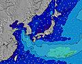 | 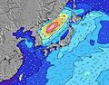 | 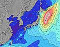 | ||||||||||||
Wave Height (m) Direction Period (s) | ESE 11 | E 11 | E 10 | E 10 | E 10 | SE 10 | SE 18 | SE 18 | SE 18 | SE 16 | SE 16 | SE 16 | SE 16 | SE 15 | S 9 | S 9 | S 9 | S 9 | SE 14 |
Wave Graph | |||||||||||||||||||
22 | 36 | 18 | 17 | 18 | 17 | 51 | 49 | 49 | 43 | 93 | 91 | 87 | 78 | 83 | 99 | 74 | 73 | 71 | |
Wind (km/h) | |||||||||||||||||||
Wind State on-shore cross-onshore cross-shore cross-offshore off-shore glassy | glassy | glassy | on | glassy | glassy | on | glassy | glassy | on | glassy | glassy | on | off | glassy | on | glassy | glassy | cross-on | glassy |
High Tide | 10:46PM1.56m | 12:17PM1.26m | 11:25PM1.51m | 2:21PM1.26m | 00:20AM1.46m | 4:03PM1.34m | 1:37AM1.44m | 4:53PM1.44m | 2:50AM1.47m | 5:27PM1.53m | 3:48AM1.54m | 5:56PM1.60m | |||||||
Low Tide | 5:45AM0.66m | 5:07PM1.03m | 6:59AM0.64m | 6:19PM1.16m | 8:17AM0.59m | 8:22PM1.21m | 9:22AM0.50m | 9:48PM1.18m | 10:13AM0.41m | 10:39PM1.11m | 10:54AM0.31m | 11:15PM1.04m | |||||||
— | 5:09 | — | — | 5:09 | — | — | 5:11 | — | — | 5:11 | — | — | 5:11 | — | — | 5:13 | — | — | |
7:13 | — | 7:12 | — | — | 7:12 | — | — | 7:10 | — | — | 7:10 | — | — | 7:09 | — | — | 7:08 | — | |
mm | — | — | — | — | — | — | — | — | 2 | — | — | 3 | 2 | 3 | 2 | — | — | — | 2 |
Temp °C | 28 | 30 | 30 | 27 | 31 | 31 | 28 | 31 | 31 | 28 | 31 | 31 | 28 | 29 | 30 | 28 | 31 | 30 | 27 |
Feels °C | 35 | 34 | 34 | 33 | 35 | 36 | 34 | 35 | 36 | 34 | 36 | 36 | 34 | 34 | 34 | 34 | 34 | 33 | 31 |
Swell 1 Height (m) Direction Period (s) | E 8 | E 11 | E 10 | SW 4 | E 10 | SE 10 | E 10 | SE 18 | SE 18 | SE 11 | SE 11 | SE 10 | SE 10 | S 10 | S 9 | S 9 | S 9 | S 9 | S 8 |
12 | 36 | 18 | 3 | 18 | 15 | 17 | 49 | 49 | 42 | 41 | 37 | 35 | 65 | 83 | 99 | 74 | 73 | 71 | |
Swell 2 Height (m) Direction Period (s) | ESE 11 | ESE 10 | ESE 11 | E 10 | SE 9 | E 10 | SE 10 | SE 10 | SE 9 | SE 16 | SE 16 | SE 16 | SE 16 | SE 10 | SE 11 | SE 11 | SE 10 | SE 10 | SE 10 |
22 | 10 | 11 | 17 | 14 | 17 | 16 | 14 | 14 | 43 | 93 | 91 | 87 | 50 | 55 | 57 | 37 | 50 | 51 | |
Swell 3 Height (m) Direction Period (s) | E 11 | SSW 3 | SSE 8 | ESE 10 | SSW 4 | SE 19 | SE 18 | E 10 | E 9 | E 9 | E 9 | S 8 | S 7 | SE 15 | SE 15 | SE 14 | SE 14 | SE 14 | SE 14 |
9 | 1 | 6 | 10 | 1 | 15 | 51 | 17 | 16 | 7 | 6 | 11 | 17 | 78 | 77 | 74 | 72 | 71 | 48 | |
Wind waves Height (m) Direction Period (s) | SSW 3 | — | SSW 3 | — | — | SSW 4 | SW 4 | — | — | — | — | — | SW 4 | — | — | — | — | — | SW 3 |
1 | — | 1 | — | — | 1 | 2 | — | — | — | — | — | 1 | — | — | — | — | — | 2 | |
Nearest Offshore or Glassy | |||||||||||||||||||
Distance (km) | 51 | 29 | 920 | 229 | 61 | 433 | 0 | 0 | 51 | 0 | 0 | 51 | 0 | 0 | 51 | 0 | 0 | 65 | 0 |
Best forecast wave conditions in Shikoku | |||||||||||||||||||
Best forecast wave conditions in Japan | |||||||||||||||||||
Header Global | |||||||||||||||||||
- Map Icons:
 Break
Break Live Wave Height (m)
 Live Wind Speed (km/h)
 Surf Rating (10 Max)
 Ocean Swells (m)
- Wind Speed (km/h)


FREE! Surf-Forecast.com widget for your website
The surf report / weather widget below is available to embed on third party websites free of charge and provides a summary of our Niyodo Rivermouth surf forecast. Simply grab the html code snippet that we provide and paste it into your own site. You can choose your preferred language and metric/imperial units for the surf forecast feed to suit users of your site. Click here to get the code.
Information about the Niyodo Rivermouth Surf forecast
The above surf forecast table for Niyodo Rivermouth provides essential information for determining whether the surfing conditions will be good over the next 16 days. A general guide to surfing at Niyodo Rivermouth can be found by selecting the local surf guide option on the grey menu. Our Niyodo Rivermouth surf forecast is unique since it includes wave energy (power) that defines the real feel of the surf rather than just the height or the period. If you surf the same spot (Niyodo Rivermouth) regularly then make a mental note of the wave energy from the surf forecast table each time you go. Very soon you may start to choose your surf days based on the wave energy alone combined with our forecast of favourable offshore wind conditions. Our star ratings will help here and of course you will also find the usual wave height and period predictions on our surf forecasts as well as a full break down of the swell components under our advanced users option (to reveal that, click the little Einstein character under the tide times).
Further information to help with frequently asked questions about our surf forecast for Niyodo Rivermouth may be found under the help tab on the top menu and also by moving your mouse over the question marks on the surf forecast table itself. Please always bear in mind that the forecast is for near-shore open water and local factors at each surf break influence the actual breaking wave height, such as the beach / reef profile, water depths offshore and shelter.
Niyodo Rivermouth is 15 km (9 miles) from Kochi. If you plan a holiday in Shikoku, look for hotels and other accommodation in Kochi. Kochi has rooms for a wide range of budgets as well as car hire and transport links.
 Nearest