

Surf Forecasts:

Susuki surf forecast from 14 Jul 2026:
- Best quality surf: Wednesday 15 Jul, 12PM (local time) - 1.5ft (0.4m), 10s period, ESE swell with cross-offshore winds.
- Most powerful swell: Sunday 19 Jul, 12AM (local time) - 2ft (0.6m), 9s period, E swell with 63 kJ wave energy.
- Next surfable swell (1★+): Wednesday 15 Jul, 12PM (local time) - 1.5ft (0.4m), 10s period with ESE swell.
Best Forecast Surf Conditions for Susuki this week:
The surf forecast for Susuki over the next 16 days: The first swell (rated 1 star or higher) is forecast to arrive on Wednesday (Jul 15) at 12PM. The primary swell is predicted to be 0.4m and 10s period. The wind is predicted to be cross-offshore as the swell arrives.
The most powerful waves expected at Susuki in the next 16 days are 0.6m 9s and forecast to arrive on Sunday (Jul 19) at 12AM. Winds are predicted to be glassy at the time the swell arrives. The largest open ocean swell (not directed at the beach) is 1.4m 5s period and expected on Thursday (Jul 16) at 3PM.
| Wave Type | Time (JST) & Date | Wave Height & Period |
|---|---|---|
| Next good surf (1 star+) | 12PM (Wed 15th Jul) | 1.5ft (0.4m) 10s |
| Best Surf | 12PM (Wed 15th Jul) | 1.5ft (0.4m) 10s |
| Most Powerful | 12AM (Sun 19th Jul) | 2ft (0.6m) 9s |
Table - best surf conditions forecast for Susuki over the next 16 days.
The Lowdown
Alright, let's look at what’s cooking at Susuki. For the first week and a half, it’s dead flat. Swell is barely a ripple, like 1 to 2 feet, with wave energy weaker than a whisper. There's a long stretch where nothing is worth even looking at. You'll be waiting until late July for anything to happen.
The first real chance comes on Sunday, July 26th. We get a building ESE swell pushing to about 3 feet in the morning, with a solid 15-second period – that’s real groundswell. The energy climbs to moderate levels. The wind is light offshore from the SSW, so the waves will be clean and glassy. This is your best window. The swell direction is SE, which is exactly what this break needs. Just know, you won’t be the only one out there.
Monday the 27th sees the swell get bigger, around 4 feet, with the same long period. The energy is strong, but the wind swings onshore from the ESE, so it’ll get a bit choppier. Still rideable, but Sunday morning is the call.
By Tuesday the 29th, the swell jumps to a hefty 8 feet with a super long 19-second period and massive energy. That’s expert-only territory, way too big for most. The wind is onshore and messy, so unless you’ve got a death wish, it’s a pass.
Water temp is about 77°, which is a touch cooler than average for this time of year, but nothing you’ll really notice.
So, bottom line: pencil in Sunday morning, July 26th. That’s your session.
- Rusty
Short Range ForecastMostly dry. Warm (max 31°C on Thu morning, min 26°C on Tue night). Wind will be generally light. | Days 4-6 Weather SummaryMostly dry. Warm (max 29°C on Fri morning, min 26°C on Fri night). Wind will be generally light. | ||||||||||||||||||||
Tuesday 14 | Wednesday 15 | Thursday 16 | Friday 17 | Saturday 18 | Sunday 19 | Monday 20 | |||||||||||||||
AM | PM | Night | AM | PM | Night | AM | PM | Night | AM | PM | Night | AM | PM | Night | AM | PM | Night | AM | PM | Night | |
Swell Height Map |  |  |  | 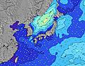 | 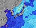 | 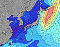 | 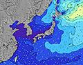 | ||||||||||||||
Wave Height (m) Direction Period (s) | SE 12 | SE 12 | E 10 | SE 11 | ESE 10 | ESE 10 | E 9 | E 8 | E 8 | E 10 | E 9 | E 9 | E 9 | E 9 | E 9 | E 9 | E 9 | SE 9 | E 9 | E 11 | SE 8 |
Wave Graph | |||||||||||||||||||||
22 | 22 | 17 | 18 | 31 | 31 | 36 | 35 | 36 | 44 | 58 | 55 | 54 | 55 | 63 | 41 | 40 | 38 | 27 | 37 | 15 | |
Wind (km/h) | |||||||||||||||||||||
Wind State on-shore cross-onshore cross-shore cross-offshore off-shore glassy | glassy | cross-on | cross-on | glassy | cross-off | cross-off | off | cross-off | cross-on | on | cross-on | glassy | on | cross | glassy | glassy | cross-off | off | cross-off | cross-off | glassy |
High Tide | 6:17PM1.57m | 4:56AM1.63m | 6:42PM1.61m | 5:36AM1.65m | 7:09PM1.64m | 6:18AM1.64m | 7:38PM1.66m | 7:02AM1.60m | 8:10PM1.67m | 7:49AM1.52m | 8:44PM1.66m | 8:41AM1.42m | 9:22PM1.63m | ||||||||
Low Tide | 11:26AM0.20m | 11:42PM1.04m | 11:58AM0.19m | 00:15AM0.97m | 12:30PM0.21m | 00:51AM0.89m | 1:03PM0.25m | 1:32AM0.82m | 1:38PM0.34m | 2:16AM0.76m | 2:14PM0.46m | 3:06AM0.72m | 2:52PM0.61m | ||||||||
4:43 | — | — | 4:43 | — | — | 4:45 | — | — | 4:46 | — | — | 4:46 | — | — | 4:47 | — | — | 4:48 | — | — | |
— | 7:00 | — | — | 7:00 | — | — | 7:00 | — | — | 7:00 | — | — | 6:59 | — | — | 6:59 | — | — | 6:58 | — | |
mm | — | — | — | — | — | — | — | — | — | — | — | — | — | — | — | — | — | — | — | — | — |
Temp °C | 28 | 28 | 27 | 30 | 30 | 27 | 31 | 30 | 27 | 29 | 28 | 27 | 28 | 28 | 27 | 28 | 29 | 27 | 29 | 29 | 27 |
Feels °C | 32 | 30 | 32 | 32 | 31 | 29 | 34 | 31 | 32 | 31 | 30 | 31 | 32 | 31 | 32 | 33 | 32 | 31 | 32 | 31 | 32 |
Swell 1 Height (m) Direction Period (s) | SSW 11 | SSW 10 | SW 10 | SSW 9 | SW 9 | SW 9 | E 9 | E 8 | SW 8 | SW 8 | SW 8 | SW 7 | SW 7 | E 9 | E 9 | E 9 | E 9 | SE 9 | SSE 8 | E 11 | SW 8 |
382 | 272 | 220 | 145 | 118 | 79 | 36 | 35 | 131 | 79 | 67 | 54 | 32 | 55 | 63 | 41 | 40 | 38 | 27 | 37 | 21 | |
Swell 2 Height (m) Direction Period (s) | SE 12 | E 10 | E 10 | ESE 10 | ESE 10 | ESE 10 | SE 11 | SE 11 | E 8 | E 10 | E 9 | E 9 | E 9 | SW 7 | SW 7 | SE 8 | SE 8 | E 9 | E 9 | SE 8 | SE 8 |
22 | 17 | 17 | 18 | 31 | 31 | 18 | 18 | 36 | 44 | 58 | 55 | 54 | 29 | 16 | 28 | 20 | 25 | 24 | 17 | 15 | |
Swell 3 Height (m) Direction Period (s) | E 9 | SE 12 | SE 10 | SE 11 | SE 10 | SE 11 | S 13 | — | SE 10 | SE 10 | SE 10 | SE 9 | SE 9 | SE 8 | SE 8 | SW 7 | SE 10 | SW 4 | SW 6 | SW 6 | E 8 |
15 | 22 | 17 | 18 | 15 | 18 | 3 | — | 16 | 14 | 14 | 13 | 27 | 33 | 16 | 15 | 24 | 3 | 14 | 11 | 12 | |
Wind waves Height (m) Direction Period (s) | — | — | — | — | SW 3 | SW 4 | SW 8 | SW 5 | — | — | — | — | — | — | — | — | SW 6 | — | — | — | E 3 |
— | — | — | — | 3 | 21 | 169 | 91 | — | — | — | — | — | — | — | — | 27 | — | — | — | 1 | |
Nearest Offshore or Glassy | |||||||||||||||||||||
Distance (km) | 8 | 212 | 7 | 7 | 212 | 8 | 0 | 66 | 7 | 7 | 107 | 0 | 7 | 393 | 0 | 0 | 0 | 0 | 0 | 214 | 212 |
Best forecast wave conditions in Shizuoka | |||||||||||||||||||||
Best forecast wave conditions in Japan | |||||||||||||||||||||
Header Global | |||||||||||||||||||||
- Map Icons:
 Break
Break Live Wave Height (m)
 Live Wind Speed (km/h)
 Surf Rating (10 Max)
 Ocean Swells (m)
- Wind Speed (km/h)


FREE! Surf-Forecast.com widget for your website
The surf report / weather widget below is available to embed on third party websites free of charge and provides a summary of our Susuki surf forecast. Simply grab the html code snippet that we provide and paste it into your own site. You can choose your preferred language and metric/imperial units for the surf forecast feed to suit users of your site. Click here to get the code.
Information about the Susuki Surf forecast
The above surf forecast table for Susuki provides essential information for determining whether the surfing conditions will be good over the next 16 days. A general guide to surfing at Susuki can be found by selecting the local surf guide option on the grey menu. Our Susuki surf forecast is unique since it includes wave energy (power) that defines the real feel of the surf rather than just the height or the period. If you surf the same spot (Susuki) regularly then make a mental note of the wave energy from the surf forecast table each time you go. Very soon you may start to choose your surf days based on the wave energy alone combined with our forecast of favourable offshore wind conditions. Our star ratings will help here and of course you will also find the usual wave height and period predictions on our surf forecasts as well as a full break down of the swell components under our advanced users option (to reveal that, click the little Einstein character under the tide times).
Further information to help with frequently asked questions about our surf forecast for Susuki may be found under the help tab on the top menu and also by moving your mouse over the question marks on the surf forecast table itself. Please always bear in mind that the forecast is for near-shore open water and local factors at each surf break influence the actual breaking wave height, such as the beach / reef profile, water depths offshore and shelter.
Susuki is 2 km (1 miles) from Sagara. If you plan a holiday in Shizuoka, look for hotels and other accommodation in Sagara. Sagara has rooms for a wide range of budgets as well as car hire and transport links.
 Nearest