

Surf Forecasts:

Osaki Point surf forecast from 3 Aug 2026:
- Best quality surf: Wednesday 5 Aug, 12PM (local time) - 16ft (5.0m), 17s period, ESE swell with onshore winds.
- Most powerful swell: Thursday 6 Aug, 9PM (local time) - 21ft (6.5m), 16s period, SE swell with 22,569 kJ wave energy.
- Next surfable swell (1★+): Wednesday 5 Aug, 12PM (local time) - 16ft (5.0m), 17s period with ESE swell.
Best Forecast Surf Conditions for Osaki Point this week:
The surf forecast for Osaki Point over the next 16 days: The first swell (rated 1 star or higher) is forecast to arrive on Wednesday (Aug 05) at 12PM. The primary swell is predicted to be 5.0m and 17s period. The wind is predicted to be onshore as the swell arrives.
The most powerful waves expected at Osaki Point in the next 16 days are 6.5m 16s and forecast to arrive on Thursday (Aug 06) at 9PM. Winds are predicted to be onshore at the time the swell arrives.
| Wave Type | Time (JST) & Date | Wave Height & Period |
|---|---|---|
| Next good surf (1 star+) | 12PM (Wed 5th Aug) | 16ft (5.0m) 17s |
| Best Surf | 12PM (Wed 5th Aug) | 16ft (5.0m) 17s |
| Most Powerful | 9PM (Thu 6th Aug) | 21ft (6.5m) 16s |
Table - best surf conditions forecast for Osaki Point over the next 16 days.
The Lowdown
Alright, let's get this out there. The long-range models have been lighting up for a solid week of waves here at Osaki Point, but there's a catch. We're looking at a real window of opportunity, but it comes with size and wind that will sort the men from the boys. The water's sitting around 85° which is a touch warmer than normal for this time of year, so you can leave the hood at home.
The forecast kicks off Monday afternoon, August 3rd, with the first of the swell showing its face. It's a cross-on breeze from the ESE at 9 mph and the swell is a rough 6ft with a long 16-second period. The energy is already strong, with a combined energy reading of 1860. It's a bit unsettled with a risk of thunderstorms and the surface will be fairly choppy. Not a classic, but it's a start. This one’s more about getting your eye in.
Tuesday the 4th sees things start to build. The morning is still on the messy side with an 8ft swell and a moderate cross-onshore breeze. But by Tuesday afternoon, the ocean starts to wake up. Swell jumps to 12ft from the ESE with a 17-second period, and the energy is pumping at 7597. Still cross-on, but the power is there. This is the moment where you start paying attention.
Wednesday the 5th is where it gets interesting. The wind swings around to the ENE, blowing straight offshore at 12 mph. The sky clears up and we see the swell jump to 16ft in the morning, and then 18ft by the afternoon, from the SE. The period is a solid 16-17 seconds. The energy readings are getting up there – 12340 and then a massive 16187. This is proper groundswell. However, the comment is clear: the swell is predicted to be too big for this break. We're talking expert territory here, and even then, it's going to be a washing machine. Conditions are favorable, but this is a "don't try this at home" kind of day unless you're seriously charging.
Thursday the 6th pushes it even further. Offshore winds hold at 22 mph, but the swell is now 20ft in the morning and 21ft by the afternoon. The energy readings are insane – 19204 in the morning and a colossal 41216 in the afternoon. This is a beast. Again, way too big for a safe or enjoyable session for most. This is for the elite, the chargers. The break will be maxed out and dangerous.
Friday the 7th is the peak. Morning sees 21ft of SSE swell with those strong offshore breezes, energy at 21776. But by the afternoon, it starts to deteriorate. The energy drops to 12948, and the report turns to "poor surf conditions" with a risk of t-storms. The swell direction shifts to the south, and it seems the combination of size and shifting winds makes it a mess. From Friday afternoon through the weekend and into early next week, the outlook is poor. The swell holds in the 15ft range but the wind stays strong and onshore, creating stormy, lumpy conditions. It's a write-off.
Monday the 10th sees the swell easing but still with fresh cross-onshore winds, keeping things lumpy and poor. This runs through Tuesday the 11th, where the swell drops to 8ft and the period drops to 13 seconds, but the quality just isn't there.
We get a bit of a reprieve on Wednesday the 12th. The wind drops to a light breeze, and the swell settles around 7ft from the SSW with an 11-12 second period. The energy is weak, with readings under 1500. It's marginal, but the lighter wind means it might clean up a touch. Same story on Thursday the 13th with 6ft waves, but it's still questionable.
From Friday the 14th through to the end of the window on Tuesday the 18th, it's mostly poor. The swell drops off, the period gets shorter, and the winds stay onshore. There are a couple of days with lighter breezes, but the surf is small, weak, and disorganized. The energy readings are down in the 500-750 range, which is telling you there's just not much out there. It’s a classic end to a big pulse, fading back to nothing.
So, the standout window is Wednesday the 5th and Thursday the 6th. That's the big, powerful groundswell with favorable offshore winds. But it's for experts only, and even then, it's pushing the limits of what Osaki Point can handle. If you're not a pro, sit this one out and watch from the shore. The conditions after that are a write-off. For the average surfer, there’s not much to get excited about for a solid stretch until maybe the 12th, but even then, it’s small and weak.
This is Rusty, signing off. Respect the ocean.
Short Range ForecastLight rain (total 5mm), mostly falling on Mon afternoon. Warm (max 30°C on Wed afternoon, min 25°C on Tue night). Winds increasing (light winds from the NE on Tue night, fresh winds from the ENE by Thu morning). | Days 5-7 Weather SummaryHeavy rain (total 107mm), heaviest during Sat night. Warm (max 29°C on Thu afternoon, min 26°C on Sat night). Mainly strong winds. | |||||||||||||||||||
Mon 3 | Tuesday 4 | Wednesday 5 | Thursday 6 | Friday 7 | Saturday 8 | Sunday 9 | ||||||||||||||
PM | Night | AM | PM | Night | AM | PM | Night | AM | PM | Night | AM | PM | Night | AM | PM | Night | AM | PM | Night | |
Swell Height Map |  |  |  | 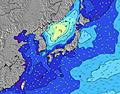 | 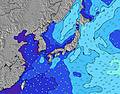 | 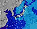 | 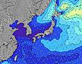 | |||||||||||||
Wave Height (m) Direction Period (s) | ESE 16 | ESE 17 | ESE 16 | ESE 17 | ESE 16 | ESE 16 | SE 17 | SE 16 | SE 16 | SE 16 | SE 16 | SSE 16 | S 16 | S 16 | SSW 16 | SSW 16 | S 16 | SSW 16 | SSW 16 | SSW 16 |
Wave Graph | ||||||||||||||||||||
1697 | 2895 | 3479 | 7597 | 8918 | 12340 | 16187 | 16561 | 19204 | 21353 | 21142 | 20071 | 9668 | 10216 | 9591 | 9629 | 13957 | 10250 | 8947 | 6895 | |
Wind (km/h) | ||||||||||||||||||||
Wind State on-shore cross-onshore cross-shore cross-offshore off-shore glassy | cross-on | on | cross-on | cross-on | on | on | on | on | on | on | on | on | on | on | on | on | on | on | on | cross-on |
High Tide | 8:51PM1.72m | 9:03AM1.57m | 9:20PM1.69m | 10:00AM1.46m | 9:53PM1.64m | 11:18AM1.35m | 10:36PM1.58m | 1:19PM1.32m | 11:39PM1.53m | 3:22PM1.41m | 1:12AM1.52m | 4:30PM1.55m | 2:43AM1.58m | |||||||
Low Tide | 3:02AM0.57m | 3:03PM0.60m | 3:48AM0.54m | 3:40PM0.78m | 4:45AM0.52m | 4:27PM0.97m | 6:01AM0.50m | 5:44PM1.14m | 7:34AM0.44m | 7:56PM1.21m | 8:58AM0.31m | 9:36PM1.16m | ||||||||
— | — | 5:16 | — | — | 5:16 | — | — | 5:18 | — | — | 5:18 | — | — | 5:18 | — | — | 5:20 | — | — | |
7:00 | — | — | 7:00 | — | — | 7:00 | — | — | 6:59 | — | — | 6:58 | — | — | 6:57 | — | — | 6:55 | — | |
mm | 1 | 4 | — | — | — | — | — | — | — | 3 | 5 | 2 | 2 | 6 | 8 | 13 | 57 | 11 | 5 | 5 |
Temp °C | 29 | 27 | 27 | 27 | 26 | 29 | 30 | 27 | 30 | 29 | 27 | 28 | 29 | 27 | 27 | 27 | 27 | 26 | 27 | 27 |
Feels °C | 33 | 30 | 29 | 29 | 28 | 29 | 31 | 28 | 29 | 28 | 27 | 27 | 28 | 27 | 27 | 27 | 27 | 25 | 25 | 26 |
Swell 1 Height (m) Direction Period (s) | ESE 16 | ESE 17 | ESE 16 | ESE 17 | ESE 16 | ESE 16 | SE 17 | SE 16 | SE 16 | SE 16 | SE 16 | SSE 16 | S 16 | S 16 | SSW 16 | SSW 16 | S 16 | SSW 16 | SSW 16 | SSW 16 |
1697 | 2895 | 3479 | 7597 | 8918 | 12340 | 16187 | 16561 | 19204 | 19863 | 21142 | 20071 | 9668 | 10216 | 9591 | 9629 | 13957 | 10250 | 8947 | 6895 | |
Swell 2 Height (m) Direction Period (s) | S 8 | — | — | — | — | — | — | — | — | — | — | — | — | — | E 15 | — | — | — | — | — |
4 | — | — | — | — | — | — | — | — | — | — | — | — | — | 17 | — | — | — | — | — | |
Swell 3 Height (m) Direction Period (s) | S 8 | — | — | — | — | — | — | — | — | — | — | — | — | — | — | — | — | — | — | — |
4 | — | — | — | — | — | — | — | — | — | — | — | — | — | — | — | — | — | — | — | |
Wind waves Height (m) Direction Period (s) | ESE 6 | E 7 | E 8 | — | — | — | — | — | — | SE 16 | E 9 | E 9 | ESE 10 | ESE 10 | ESE 9 | ESE 9 | ESE 8 | ESE 9 | ESE 9 | ESE 9 |
155 | 329 | 588 | — | — | — | — | — | — | 21353 | 1486 | 1705 | 3280 | 2201 | 1695 | 1458 | 1162 | 1968 | 2133 | 1522 | |
Nearest Offshore or Glassy | ||||||||||||||||||||
Distance (km) | 22 | 22 | 22 | 42 | 20 | 22 | 222 | 30 | 528 | 483 | 387 | 528 | 526 | 30 | 483 | 483 | 483 | 528 | 483 | 1061 |
Best forecast wave conditions in Shikoku | ||||||||||||||||||||
Best forecast wave conditions in Japan | ||||||||||||||||||||
Header Global | ||||||||||||||||||||
- Map Icons:
 Break
Break Live Wave Height (m)
 Live Wind Speed (km/h)
 Surf Rating (10 Max)
 Ocean Swells (m)
- Wind Speed (km/h)
Latest Updates


FREE! Surf-Forecast.com widget for your website
The surf report / weather widget below is available to embed on third party websites free of charge and provides a summary of our Osaki Point surf forecast. Simply grab the html code snippet that we provide and paste it into your own site. You can choose your preferred language and metric/imperial units for the surf forecast feed to suit users of your site. Click here to get the code.
Information about the Osaki Point Surf forecast
The above surf forecast table for Osaki Point provides essential information for determining whether the surfing conditions will be good over the next 16 days. A general guide to surfing at Osaki Point can be found by selecting the local surf guide option on the grey menu. Our Osaki Point surf forecast is unique since it includes wave energy (power) that defines the real feel of the surf rather than just the height or the period. If you surf the same spot (Osaki Point) regularly then make a mental note of the wave energy from the surf forecast table each time you go. Very soon you may start to choose your surf days based on the wave energy alone combined with our forecast of favourable offshore wind conditions. Our star ratings will help here and of course you will also find the usual wave height and period predictions on our surf forecasts as well as a full break down of the swell components under our advanced users option (to reveal that, click the little Einstein character under the tide times).
Further information to help with frequently asked questions about our surf forecast for Osaki Point may be found under the help tab on the top menu and also by moving your mouse over the question marks on the surf forecast table itself. Please always bear in mind that the forecast is for near-shore open water and local factors at each surf break influence the actual breaking wave height, such as the beach / reef profile, water depths offshore and shelter.
Osaki Point is 14 km (9 miles) from Muroto. If you plan a holiday in Shikoku, look for hotels and other accommodation in Muroto. Muroto has rooms for a wide range of budgets as well as car hire and transport links.
 Nearest