

Surf Forecasts:

Tsurigasaki Surfing Beach (Tokyo 2020) surf forecast from 3 Aug 2026:
- Most powerful swell: Wednesday 5 Aug, 12PM (local time) - 13ft (4.0m), 16s period, SE swell with 7,334 kJ wave energy.
Best Forecast Surf Conditions for Tsurigasaki Surfing Beach (Tokyo 2020) this week:
The most powerful waves expected at Tsurigasaki Surfing Beach (Tokyo 2020) in the next 16 days are 4.0m 16s and forecast to arrive on Wednesday (Aug 05) at 12PM. Winds are predicted to be cross-onshore at the time the swell arrives. The largest open ocean swell (not directed at the beach) is 1.7m 14s period and expected on Friday (Aug 07) at 12PM.
| Wave Type | Time (JST) & Date | Wave Height & Period |
|---|---|---|
| Next good surf (1 star+) | - | - |
| Best Surf | - | - |
| Most Powerful | 12PM (Wed 5th Aug) | 13ft (4.0m) 16s |
Table - best surf conditions forecast for Tsurigasaki Surfing Beach (Tokyo 2020) over the next 16 days.
The Lowdown
Alright, Rusty here. Let's have a look at what's on the table for the next couple of weeks.
Alright, folks, it's a bit of a rough start. The forecast is showing a real mixed bag for Tsurigasaki Surfing Beach (Tokyo 2020). The water temp is about average for this time of year, so no surprises there.
The first few days are a write-off, to be honest. Tuesday the 4th and Wednesday the 5th are seeing a solid 12 ft to 13 ft of SE swell, but with a fresh 19 mph cross-onshore wind. It's messy, lumpy, and just plain poor surf conditions. The wave energy is strong to very strong (6610-7121), but it's unsurfable with that wind. We're looking at a gap of a few days with no real recommendations.
Then Thursday the 6th morning shows a bit of promise. The swell drops to 10 ft from the SSE, wind dies to a gentle 9 mph onshore. It's still a marginal call, but the energy is moderate (3581). The afternoon gets a bit choppy again. The rest of the week and into the weekend is a mix of onshore winds and choppy, messy conditions. There's swell, but the quality is just not there.
The only standout, and I mean the *only* one worth getting a little excited about, is further out. Look at Wednesday the 12th of August. The wind swings to a clean cross-offshore from the SSW at 22 mph. The swell is a modest 6 ft from the east, with a moderate energy (890). It's a small window, and the break is inconsistent, so you'll need patience. But for a couple of sessions, it'll be clean. The best bet is the morning session.
The following week is a real gamble. There's some decent swell energy, like a 10 ft SE swell on Sunday the 16th (moderate to strong energy around 4023), but it's always paired with an onshore or cross-onshore wind. It's a lot of potential that just doesn't line up. The very end of the outlook, around Tuesday the 18th, shows a 8 ft ESE swell with a light cross-shore breeze, but it's still a marginal call. It's worth keeping an eye on, but don't book the time off work just yet.
It's a challenging forecast. The swell is there, but the wind is just not playing ball. It's a bit of a blank run for the area.
Rusty.
Short Range ForecastMostly dry. Warm (max 28°C on Thu morning, min 22°C on Tue night). Mainly fresh winds. | Days 5-7 Weather SummaryLight rain (total 6mm), mostly falling on Thu night. Warm (max 28°C on Fri morning, min 25°C on Sat night). Wind will be generally light. | ||||||||||||||||||
Tuesday 4 | Wednesday 5 | Thursday 6 | Friday 7 | Saturday 8 | Sunday 9 | ||||||||||||||
Night | AM | PM | Night | AM | PM | Night | AM | PM | Night | AM | PM | Night | AM | PM | Night | AM | PM | Night | |
Swell Height Map |  |  |  |  | 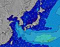 | 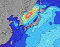 | 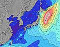 | ||||||||||||
Wave Height (m) Direction Period (s) | SE 16 | SE 16 | SE 16 | SE 16 | SE 15 | SE 15 | SSE 14 | SSE 14 | SSE 14 | S 14 | S 14 | SE 9 | SE 9 | SE 9 | SE 9 | SE 14 | ESE 13 | ESE 13 | ESE 13 |
Wave Graph | |||||||||||||||||||
3569 | 6018 | 6286 | 7056 | 7046 | 6719 | 5046 | 3213 | 3516 | 2753 | 1335 | 924 | 924 | 542 | 481 | 1179 | 1151 | 1110 | 1211 | |
Wind (km/h) | |||||||||||||||||||
Wind State on-shore cross-onshore cross-shore cross-offshore off-shore glassy | cross-on | cross-on | cross-on | cross-on | cross-on | cross-on | cross-on | on | cross-on | cross-on | cross-on | cross-on | cross-on | cross-on | cross-on | on | on | on | cross-on |
High Tide | 7:22AM1.25m | 7:38PM1.44m | 8:23AM1.15m | 8:04PM1.43m | 9:51AM1.06m | 8:36PM1.41m | 12:32PM1.05m | 9:18PM1.39m | 10:24PM1.37m | 3:49PM1.28m | 11:59PM1.37m | ||||||||
Low Tide | 1:30AM0.56m | 1:15PM0.56m | 2:18AM0.49m | 1:44PM0.72m | 3:16AM0.44m | 2:11PM0.89m | 4:28AM0.39m | 2:33PM1.04m | 5:54AM0.32m | 7:14AM0.22m | 7:20PM1.20m | ||||||||
— | 4:48 | — | — | 4:48 | — | — | 4:50 | — | — | 4:50 | — | — | 4:52 | — | — | 4:52 | — | — | |
6:39 | — | 6:38 | — | — | 6:37 | — | — | 6:37 | — | — | 6:36 | — | — | 6:35 | — | — | 6:34 | — | |
mm | — | — | — | — | — | — | — | — | — | 3 | 2 | 1 | — | — | — | — | — | — | — |
Temp °C | 24 | 24 | 24 | 24 | 25 | 25 | 25 | 28 | 28 | 26 | 28 | 27 | 26 | 27 | 27 | 26 | 27 | 27 | 24 |
Feels °C | 22 | 21 | 21 | 23 | 25 | 25 | 28 | 30 | 31 | 28 | 29 | 28 | 28 | 29 | 29 | 29 | 27 | 26 | 22 |
Swell 1 Height (m) Direction Period (s) | SE 16 | SE 16 | SE 16 | SE 16 | SE 15 | SE 15 | SSE 14 | SSE 14 | SSE 14 | S 14 | SE 9 | SE 9 | SE 9 | SE 9 | SE 9 | SE 14 | ESE 13 | ESE 13 | ESE 13 |
3569 | 6018 | 6286 | 7056 | 7046 | 6719 | 5046 | 3213 | 3516 | 2753 | 747 | 924 | 798 | 542 | 481 | 1179 | 1151 | 1110 | 1211 | |
Swell 2 Height (m) Direction Period (s) | E 14 | E 14 | E 13 | E 13 | ENE 12 | — | E 17 | ESE 10 | ESE 10 | ESE 10 | S 14 | SSW 14 | SSW 14 | SSW 14 | SSW 14 | SSW 15 | SSW 15 | SSW 16 | SSW 16 |
59 | 57 | 54 | 86 | 50 | — | 22 | 348 | 433 | 511 | 1335 | 994 | 742 | 815 | 850 | 911 | 822 | 915 | 733 | |
Swell 3 Height (m) Direction Period (s) | — | E 13 | — | — | E 18 | — | ENE 16 | E 16 | E 16 | E 15 | E 15 | E 15 | E 14 | SE 13 | SE 12 | ENE 14 | ENE 13 | — | SSE 9 |
— | 92 | — | — | 25 | — | 26 | 20 | 20 | 41 | 39 | 39 | 37 | 85 | 120 | 38 | 35 | — | 33 | |
Wind waves Height (m) Direction Period (s) | ENE 7 | ENE 7 | ENE 7 | — | — | — | — | — | — | — | — | — | SE 9 | — | — | — | — | — | — |
229 | 443 | 387 | — | — | — | — | — | — | — | — | — | 924 | — | — | — | — | — | — | |
Nearest Offshore or Glassy | |||||||||||||||||||
Distance (km) | 562 | 565 | 62 | 565 | 562 | 62 | 23 | 18 | 115 | 1 | 73 | 125 | 1 | 73 | 115 | 18 | 73 | 125 | 1070 |
Best forecast wave conditions in Chiba | |||||||||||||||||||
Best forecast wave conditions in Japan | |||||||||||||||||||
Header Global | |||||||||||||||||||
- Map Icons:
 Break
Break Live Wave Height (m)
 Live Wind Speed (km/h)
 Surf Rating (10 Max)
 Ocean Swells (m)
- Wind Speed (km/h)
Latest Updates


FREE! Surf-Forecast.com widget for your website
The surf report / weather widget below is available to embed on third party websites free of charge and provides a summary of our Tsurigasaki Surfing Beach (Tokyo 2020) surf forecast. Simply grab the html code snippet that we provide and paste it into your own site. You can choose your preferred language and metric/imperial units for the surf forecast feed to suit users of your site. Click here to get the code.
Information about the Tsurigasaki Surfing Beach (Tokyo 2020) Surf forecast
The above surf forecast table for Tsurigasaki Surfing Beach (Tokyo 2020) provides essential information for determining whether the surfing conditions will be good over the next 16 days. A general guide to surfing at Tsurigasaki Surfing Beach (Tokyo 2020) can be found by selecting the local surf guide option on the grey menu. Our Tsurigasaki Surfing Beach (Tokyo 2020) surf forecast is unique since it includes wave energy (power) that defines the real feel of the surf rather than just the height or the period. If you surf the same spot (Tsurigasaki Surfing Beach (Tokyo 2020)) regularly then make a mental note of the wave energy from the surf forecast table each time you go. Very soon you may start to choose your surf days based on the wave energy alone combined with our forecast of favourable offshore wind conditions. Our star ratings will help here and of course you will also find the usual wave height and period predictions on our surf forecasts as well as a full break down of the swell components under our advanced users option (to reveal that, click the little Einstein character under the tide times).
Further information to help with frequently asked questions about our surf forecast for Tsurigasaki Surfing Beach (Tokyo 2020) may be found under the help tab on the top menu and also by moving your mouse over the question marks on the surf forecast table itself. Please always bear in mind that the forecast is for near-shore open water and local factors at each surf break influence the actual breaking wave height, such as the beach / reef profile, water depths offshore and shelter.
 Nearest