

Surf Forecasts:

Ohara surf forecast from 3 Aug 2026:
- Best quality surf: Wednesday 5 Aug, 9PM (local time) - 11ft (3.5m), 15s period, SSE swell with cross-onshore winds.
- Most powerful swell: Wednesday 5 Aug, 9AM (local time) - 13ft (4.0m), 16s period, SE swell with 7,912 kJ wave energy.
- Next surfable swell (1★+): Wednesday 5 Aug, 9PM (local time) - 11ft (3.5m), 15s period with SSE swell.
Best Forecast Surf Conditions for Ohara this week:
The surf forecast for Ohara over the next 16 days: The first swell (rated 1 star or higher) is forecast to arrive on Wednesday (Aug 05) at 9PM. The primary swell is predicted to be 3.5m and 15s period with a secondary swell of 0.2m and 17s. Another secondary swell of 1.8m and 11s is also forecast. The wind is predicted to be cross-onshore as the swell arrives.
The most powerful waves expected at Ohara in the next 16 days are 4.0m 16s and forecast to arrive on Wednesday (Aug 05) at 9AM. Winds are predicted to be cross-onshore at the time the swell arrives.
| Wave Type | Time (JST) & Date | Wave Height & Period |
|---|---|---|
| Next good surf (1 star+) | 9PM (Wed 5th Aug) | 11ft (3.5m) 15s |
| Best Surf | 9PM (Wed 5th Aug) | 11ft (3.5m) 15s |
| Most Powerful | 9AM (Wed 5th Aug) | 13ft (4.0m) 16s |
Table - best surf conditions forecast for Ohara over the next 16 days.
The Lowdown
Alright folks, Rusty here. Let’s talk about what’s on the menu for the next couple of weeks. We’ve only got one spot in the frame, and it’s a bit of a waiting game.
First up, the water is sitting at a warm 81°, which is about a degree and a half above the usual for this time of year. Nothing wild, but it’s a nice little bonus.
The first few days are a write-off. We’ve got a big, powerful groundswell from the SE rolling in with a period of 17 seconds, but the wind is a nasty cross-onshore, and the wave energy is through the roof (3223). It’s just lumpy, blown-out junk. That swell builds through Tuesday and Wednesday, hitting a peak of 13ft with energy readings over 7900, but the wind stays onshore. It’s a mess. There’s a solid 4-5 day gap here where you’d be better off doing anything else.
Thursday, August 6th things start to get interesting. The wind switches to a clean cross-offshore, and the swell drops to a more manageable 10ft from the SSE with a period of 14 seconds. The energy is still high (3622), but it’s clean. However, the notes say this is still too big for Ohara, so unless you’re a very experienced surfer, stay out of the water. This window is for the brave only.
Friday through Sunday sees the swell drop back into the 5ft to 8ft range, but the wind stays clean and cross-offshore. The energy is winding down, but the conditions are looking nice. Watch out for the warning signs though – the reports say these are “marginal” or “questionable” tide conditions. It might be a bit fat or too shallow at certain times, but if you hit the tide right, there could be a clean, fun wave.
The real standout, the one I’d circle on the calendar, is Thursday, August 13th. The wind is light and cross-offshore, the swell is 5ft from the E with a 11-second period, and the energy is a modest 870. The notes say “expect very good surf conditions.” This is the best bet on offer. Clean, lined-up waves, nothing too heavy, and the crowd is only a “sometimes” problem, so you might have it fairly uncrowded.
Friday, August 14th is also a good shout. The swell drops to 4ft, but the wind stays clean and cross-offshore. It’s a smaller day, but still very good.
Then we hit the weekend of the 15th and 16th. The swell jumps back up to 10ft and 12ft, and the wind swings back onshore. It gets big and messy again. The energy on the 15th afternoon is a massive 2753, but it’s blown out. The notes say it’s too big for the break anyway. The following week looks like a slow, gradual decline with small, weak, onshore slop. Nothing to get excited about.
So, the short story: the first few days are a loss. The sweet spot is the clean, moderate swell from August 6th to the 14th, with the absolute best day being Thursday, August 13th for the cleanest, most user-friendly conditions.
Rusty out.
Short Range ForecastSome drizzle, heaviest during Wed night. Warm (max 28°C on Thu morning, min 23°C on Mon night). Winds decreasing (fresh winds from the NE on Tue morning, light winds from the NNE by Wed night). | Days 5-7 Weather SummaryHeavy rain (total 21mm), heaviest during Fri morning. Warm (max 28°C on Fri morning, min 25°C on Thu night). Wind will be generally light. | |||||||||||||||||||
Mon 3 | Tuesday 4 | Wednesday 5 | Thursday 6 | Friday 7 | Saturday 8 | Sunday 9 | ||||||||||||||
PM | Night | AM | PM | Night | AM | PM | Night | AM | PM | Night | AM | PM | Night | AM | PM | Night | AM | PM | Night | |
Swell Height Map |  |  |  | 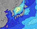 | 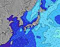 | 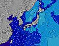 | 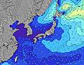 | |||||||||||||
Wave Height (m) Direction Period (s) | SE 17 | ESE 16 | SE 16 | SE 16 | SE 16 | SE 16 | SE 15 | SSE 14 | SSE 14 | SSE 14 | S 14 | S 15 | S 15 | SSW 14 | SSW 14 | SSW 15 | SSW 15 | ESE 13 | ESE 14 | E 13 |
Wave Graph | ||||||||||||||||||||
2970 | 4855 | 6018 | 6286 | 5845 | 7912 | 6633 | 4737 | 3213 | 3288 | 2557 | 2289 | 2012 | 1257 | 1402 | 1045 | 1059 | 958 | 1223 | 1443 | |
Wind (km/h) | ||||||||||||||||||||
Wind State on-shore cross-onshore cross-shore cross-offshore off-shore glassy | cross-on | cross-on | cross-on | cross-on | cross-on | cross-on | cross-on | on | cross | cross-off | cross | cross-off | cross-off | cross-off | cross-off | cross-off | cross | cross | cross-on | on |
High Tide | 7:19PM1.37m | 7:25AM1.21m | 7:42PM1.38m | 8:25AM1.11m | 8:08PM1.37m | 9:54AM1.02m | 8:39PM1.36m | 1:01PM1.01m | 9:20PM1.34m | 10:31PM1.32m | 4:05PM1.23m | 00:13AM1.33m | ||||||||
Low Tide | 1:35AM0.54m | 1:22PM0.55m | 2:23AM0.49m | 1:48PM0.70m | 3:21AM0.45m | 2:13PM0.86m | 4:35AM0.41m | 2:16PM1.01m | 6:04AM0.33m | 7:27AM0.23m | 7:30PM1.17m | |||||||||
— | — | 4:48 | — | — | 4:48 | — | — | 4:50 | — | — | 4:50 | — | — | 4:50 | — | — | 4:52 | — | — | |
6:39 | — | — | 6:38 | — | — | 6:37 | — | — | 6:37 | — | — | 6:37 | — | — | 6:36 | — | — | 6:34 | — | |
mm | — | — | — | — | — | — | — | 1 | — | — | 3 | 7 | 6 | 4 | — | — | 1 | — | — | — |
Temp °C | 25 | 24 | 24 | 24 | 23 | 25 | 26 | 26 | 28 | 27 | 26 | 28 | 28 | 26 | 27 | 27 | 25 | 27 | 26 | 24 |
Feels °C | 23 | 22 | 21 | 21 | 21 | 25 | 27 | 30 | 31 | 28 | 27 | 29 | 29 | 28 | 29 | 29 | 28 | 27 | 25 | 23 |
Swell 1 Height (m) Direction Period (s) | SE 17 | ESE 16 | SE 16 | SE 16 | SE 16 | SE 16 | SE 15 | SSE 14 | SSE 14 | SSE 14 | S 14 | S 15 | S 15 | SE 9 | SE 9 | SE 9 | SE 9 | ESE 13 | ESE 14 | E 13 |
2970 | 4855 | 6018 | 6286 | 5845 | 7912 | 6633 | 4737 | 3213 | 3288 | 2557 | 2289 | 2012 | 586 | 502 | 568 | 664 | 958 | 1223 | 1443 | |
Swell 2 Height (m) Direction Period (s) | E 14 | E 14 | E 14 | E 13 | E 13 | E 18 | — | E 17 | ESE 10 | ESE 10 | ESE 10 | ESE 9 | SE 9 | SSW 14 | SSW 14 | SSW 15 | SSW 15 | SSW 15 | SSW 15 | SSW 16 |
61 | 59 | 57 | 54 | 86 | 25 | — | 22 | 356 | 314 | 434 | 450 | 528 | 1257 | 1402 | 1045 | 1059 | 811 | 953 | 904 | |
Swell 3 Height (m) Direction Period (s) | — | — | E 13 | — | — | — | — | ENE 16 | E 16 | E 16 | E 15 | E 15 | E 15 | E 14 | SE 12 | SE 12 | SSE 9 | SSE 9 | SSE 9 | SSE 9 |
— | — | 130 | — | — | — | — | 26 | 20 | 20 | 41 | 39 | 39 | 37 | 75 | 122 | 33 | 126 | 96 | 45 | |
Wind waves Height (m) Direction Period (s) | ENE 7 | ENE 7 | ENE 7 | ENE 7 | ENE 7 | — | — | — | — | — | — | ESE 9 | — | — | SE 9 | — | — | — | — | — |
192 | 286 | 443 | 397 | 186 | — | — | — | — | — | — | 627 | — | — | 743 | — | — | — | — | — | |
Nearest Offshore or Glassy | ||||||||||||||||||||
Distance (km) | 623 | 563 | 213 | 58 | 563 | 560 | 58 | 14 | 58 | 123 | 58 | 58 | 58 | 123 | 72 | 0 | 9 | 72 | 72 | 1077 |
Best forecast wave conditions in Chiba | ||||||||||||||||||||
Best forecast wave conditions in Japan | ||||||||||||||||||||
Header Global | ||||||||||||||||||||
- Map Icons:
 Break
Break Live Wave Height (m)
 Live Wind Speed (km/h)
 Surf Rating (10 Max)
 Ocean Swells (m)
- Wind Speed (km/h)
Latest Updates


FREE! Surf-Forecast.com widget for your website
The surf report / weather widget below is available to embed on third party websites free of charge and provides a summary of our Ohara surf forecast. Simply grab the html code snippet that we provide and paste it into your own site. You can choose your preferred language and metric/imperial units for the surf forecast feed to suit users of your site. Click here to get the code.
Information about the Ohara Surf forecast
The above surf forecast table for Ohara provides essential information for determining whether the surfing conditions will be good over the next 16 days. A general guide to surfing at Ohara can be found by selecting the local surf guide option on the grey menu. Our Ohara surf forecast is unique since it includes wave energy (power) that defines the real feel of the surf rather than just the height or the period. If you surf the same spot (Ohara) regularly then make a mental note of the wave energy from the surf forecast table each time you go. Very soon you may start to choose your surf days based on the wave energy alone combined with our forecast of favourable offshore wind conditions. Our star ratings will help here and of course you will also find the usual wave height and period predictions on our surf forecasts as well as a full break down of the swell components under our advanced users option (to reveal that, click the little Einstein character under the tide times).
Further information to help with frequently asked questions about our surf forecast for Ohara may be found under the help tab on the top menu and also by moving your mouse over the question marks on the surf forecast table itself. Please always bear in mind that the forecast is for near-shore open water and local factors at each surf break influence the actual breaking wave height, such as the beach / reef profile, water depths offshore and shelter.
Ohara is 2 km (1 miles) from Ohara. If you plan a holiday in Chiba, look for hotels and other accommodation in Ohara. Ohara has rooms for a wide range of budgets as well as car hire and transport links.
 Nearest