

Surf Forecasts:

Amatu surf forecast from 10 Jul 2026:
- Best quality surf: Monday 13 Jul, 6AM (local time) - 5.5ft (1.7m), 14s period, SSW swell with cross-offshore winds.
- Most powerful swell: Saturday 11 Jul, 3PM (local time) - 8ft (2.5m), 16s period, SSW swell with 3,465 kJ wave energy.
- Next surfable swell (1★+): Monday 13 Jul, 6AM (local time) - 5.5ft (1.7m), 14s period with SSW swell.
Best Forecast Surf Conditions for Amatu this week:
The surf forecast for Amatu over the next 16 days: The first swell (rated 1 star or higher) is forecast to arrive on Monday (Jul 13) at 6AM. The primary swell is predicted to be 1.7m and 14s period with a secondary swell of 0.4m and 9s. Another secondary swell of 1.0m and 5s is also forecast. The wind is predicted to be cross-offshore as the swell arrives.
The most powerful waves expected at Amatu in the next 16 days are 2.5m 16s and forecast to arrive on Saturday (Jul 11) at 3PM. Winds are predicted to be cross-onshore at the time the swell arrives.
| Wave Type | Time (JST) & Date | Wave Height & Period |
|---|---|---|
| Next good surf (1 star+) | 6AM (Mon 13th Jul) | 5.5ft (1.7m) 14s |
| Best Surf | 6AM (Mon 13th Jul) | 5.5ft (1.7m) 14s |
| Most Powerful | 3PM (Sat 11th Jul) | 8ft (2.5m) 16s |
Table - best surf conditions forecast for Amatu over the next 16 days.
Alright, Rusty here. Let’s check the waves over the next couple weeks.
Water temp’s sittin’ about average for this time of year – no big anomaly.
We’ve got a slow start. First real chance to surf ain’t until Monday the 13th. That morning the wind goes offshore from the northeast, and the swell is 5ft from the SSW, 13-second groundswell. The combined energy is moderate (914). Conditions will be clean, but this break is inconsistent, so don’t expect nonstop action. Good for beginners though. Tuesday the 14th morning is smaller – 3ft SSW, 11-second period, clean again, but weak energy (285).
Wednesday the 15th and Thursday the 16th are no good – onshore wind and tiny swell.
Then Friday the 17th morning the wind goes glassy, dead calm, but the swell is only 3ft from the east, 9-second period. Really weak (117). You can get some small glassy waves, but they’re pretty ordinary.
The next week is all small and cross-onshore slop until Monday the 21st – 4ft east swell, 11-second period, but the wind is still cross-onshore. Energy is moderate (376). Nothin’ special.
Now, the real standout is Wednesday the 23rd of July morning. A solid 10ft S swell with a 14-second period – that’s a long-period groundswell, lots of power. Wind is cross-offshore from the north-northeast at 18 mph, so the waves will be clean. Energy is strong (3773). At 10ft, this is for experts only – way too big for beginners. Because it’s long-period and exposed, at a beach break it might close out a bit, but for the guys who can handle it, that’s the session to aim for. Crowds are possible – this spot can get a few people when it’s good, and it’s inconsistent, so when it fires, people show up.
Sunday the 26th morning has another pulse: 6ft S swell, 7-second period, cross-offshore wind – clean, but the period is short, so the waves will be weaker. Energy is moderate (652). Fun, but not the big one.
Bottom line: if you’re looking for the best, circle Wednesday the 23rd of July. That’s the one. The rest is small or choppy, with a couple clean but weak days. Beginners, aim for Monday the 13th.
Rusty.
Short Range ForecastModerate rain (total 10mm), heaviest on Sun night. Warm (max 28°C on Mon morning, min 23°C on Fri night). Wind will be generally light. | Days 5-7 Weather SummarySome drizzle, heaviest during Mon night. Warm (max 28°C on Thu morning, min 23°C on Mon night). Wind will be generally light. | ||||||||||||||||||||
Saturday 11 | Sunday 12 | Monday 13 | Tuesday 14 | Wednesday 15 | Thursday 16 | Fri 17 | |||||||||||||||
Night | AM | PM | Night | AM | PM | Night | AM | PM | Night | AM | PM | Night | AM | PM | Night | AM | PM | Night | AM | PM | |
Swell Height Map |  |  |  |  | 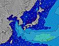 | 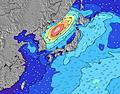 | 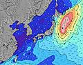 | 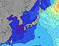 | |||||||||||||
Wave Height (m) Direction Period (s) | SSW 16 | SSW 16 | SSW 16 | SSW 16 | SSW 16 | SSW 16 | SW 14 | SSW 13 | SW 12 | SW 12 | SSW 11 | SSW 11 | SSW 10 | ESE 9 | ESE 9 | ESE 8 | ESE 8 | E 8 | E 8 | E 9 | E 9 |
Wave Graph | |||||||||||||||||||||
3228 | 3375 | 3465 | 2968 | 3192 | 2697 | 1220 | 784 | 379 | 178 | 215 | 149 | 90 | 82 | 101 | 120 | 164 | 147 | 116 | 94 | 99 | |
Wind (km/h) | |||||||||||||||||||||
Wind State on-shore cross-onshore cross-shore cross-offshore off-shore glassy | cross-on | cross-on | cross-on | cross-on | cross-on | cross-on | cross | cross-off | cross | cross-off | cross-off | cross | glassy | on | on | glassy | cross-on | cross-on | glassy | glassy | cross-on |
High Tide | 11:59PM1.34m | 3:42PM1.29m | 1:08AM1.39m | 4:33PM1.39m | 2:13AM1.46m | 5:16PM1.46m | 3:12AM1.53m | 5:55PM1.48m | 4:06AM1.58m | 6:30PM1.49m | 4:59AM1.59m | 7:02PM1.48m | 5:50AM1.55m | ||||||||
Low Tide | 7:51AM0.19m | 8:03PM1.12m | 8:50AM0.04m | 9:17PM1.12m | 9:44AM-0.07m | 10:10PM1.08m | 10:33AM-0.12m | 10:55PM1.01m | 11:20AM-0.11m | 11:37PM0.93m | 12:03PM-0.03m | 00:17AM0.85m | 12:43PM0.10m | ||||||||
— | 4:33 | — | — | 4:33 | — | — | 4:33 | — | — | 4:35 | — | — | 4:35 | — | — | 4:35 | — | — | 4:35 | — | |
6:55 | — | 6:54 | — | — | 6:54 | — | — | 6:54 | — | — | 6:53 | — | — | 6:53 | — | — | 6:52 | — | — | 6:52 | |
mm | — | — | — | — | — | 1 | 6 | 1 | 2 | 1 | — | — | — | — | — | — | — | — | — | — | — |
Temp °C | 23 | 26 | 26 | 24 | 26 | 25 | 26 | 28 | 27 | 24 | 27 | 26 | 24 | 27 | 27 | 24 | 28 | 28 | 25 | 28 | 29 |
Feels °C | 25 | 27 | 27 | 24 | 27 | 27 | 30 | 30 | 30 | 27 | 28 | 28 | 28 | 29 | 29 | 27 | 31 | 31 | 29 | 32 | 31 |
Swell 1 Height (m) Direction Period (s) | SSW 16 | SSW 16 | SSW 16 | SSW 16 | SSW 16 | SSW 16 | SW 14 | SSW 13 | SW 12 | SSW 8 | SSW 11 | SSW 11 | SSW 10 | ESE 9 | ESE 9 | ESE 8 | ESE 8 | E 8 | E 8 | E 9 | E 9 |
3228 | 3375 | 3465 | 2968 | 3192 | 2697 | 1220 | 784 | 379 | 87 | 215 | 149 | 90 | 82 | 101 | 120 | 164 | 147 | 116 | 94 | 99 | |
Swell 2 Height (m) Direction Period (s) | E 10 | E 9 | E 9 | E 9 | E 9 | E 9 | E 9 | E 9 | SSW 6 | SW 12 | E 10 | E 10 | ESE 10 | SSW 10 | SW 9 | SW 9 | SW 9 | SW 8 | SSW 8 | SSE 7 | SSE 6 |
90 | 60 | 58 | 58 | 59 | 40 | 41 | 26 | 72 | 178 | 48 | 48 | 74 | 64 | 42 | 40 | 20 | 18 | 27 | 9 | 8 | |
Swell 3 Height (m) Direction Period (s) | — | — | — | SE 14 | SSE 10 | SE 10 | SE 10 | SE 10 | E 9 | E 9 | SE 12 | SE 12 | SE 11 | SE 10 | SE 9 | SE 9 | SSE 9 | SE 11 | SE 10 | SE 10 | SE 9 |
— | — | — | 8 | 40 | 24 | 25 | 15 | 26 | 26 | 22 | 21 | 18 | 17 | 14 | 13 | 8 | 18 | 25 | 14 | 21 | |
Wind waves Height (m) Direction Period (s) | — | — | — | SSW 4 | — | — | SSW 5 | SW 6 | — | — | — | SE 4 | — | — | S 5 | S 4 | SSW 9 | SSW 3 | — | — | SSW 2 |
— | — | — | 22 | — | — | 39 | 89 | — | — | — | 3 | — | — | 2 | 7 | 70 | 3 | — | — | 1 | |
Nearest Offshore or Glassy | |||||||||||||||||||||
Distance (km) | 24 | 24 | 24 | 87 | 75 | 35 | 35 | 0 | 16 | 0 | 0 | 16 | 0 | 24 | 24 | 0 | 24 | 24 | 0 | 0 | 24 |
Best forecast wave conditions in Chiba | |||||||||||||||||||||
Best forecast wave conditions in Japan | |||||||||||||||||||||
Header Global | |||||||||||||||||||||
- Map Icons:
 Break
Break Live Wave Height (m)
 Live Wind Speed (km/h)
 Surf Rating (10 Max)
 Ocean Swells (m)
- Wind Speed (km/h)


FREE! Surf-Forecast.com widget for your website
The surf report / weather widget below is available to embed on third party websites free of charge and provides a summary of our Amatu surf forecast. Simply grab the html code snippet that we provide and paste it into your own site. You can choose your preferred language and metric/imperial units for the surf forecast feed to suit users of your site. Click here to get the code.
Information about the Amatu Surf forecast
The above surf forecast table for Amatu provides essential information for determining whether the surfing conditions will be good over the next 16 days. A general guide to surfing at Amatu can be found by selecting the local surf guide option on the grey menu. Our Amatu surf forecast is unique since it includes wave energy (power) that defines the real feel of the surf rather than just the height or the period. If you surf the same spot (Amatu) regularly then make a mental note of the wave energy from the surf forecast table each time you go. Very soon you may start to choose your surf days based on the wave energy alone combined with our forecast of favourable offshore wind conditions. Our star ratings will help here and of course you will also find the usual wave height and period predictions on our surf forecasts as well as a full break down of the swell components under our advanced users option (to reveal that, click the little Einstein character under the tide times).
Further information to help with frequently asked questions about our surf forecast for Amatu may be found under the help tab on the top menu and also by moving your mouse over the question marks on the surf forecast table itself. Please always bear in mind that the forecast is for near-shore open water and local factors at each surf break influence the actual breaking wave height, such as the beach / reef profile, water depths offshore and shelter.
Amatu is 9 km (6 miles) from Kawaguchi. If you plan a holiday in Chiba, look for hotels and other accommodation in Kawaguchi. Kawaguchi has rooms for a wide range of budgets as well as car hire and transport links.
 Nearest