

Surf Forecasts:

Shida surf forecast from 3 Aug 2026:
- Best quality surf: Wednesday 5 Aug, 9PM (local time) - 11ft (3.5m), 15s period, SSE swell with cross-onshore winds.
- Most powerful swell: Wednesday 5 Aug, 9AM (local time) - 13ft (4.0m), 16s period, SE swell with 7,912 kJ wave energy.
- Next surfable swell (1★+): Wednesday 5 Aug, 9PM (local time) - 11ft (3.5m), 15s period with SSE swell.
Best Forecast Surf Conditions for Shida this week:
The surf forecast for Shida over the next 16 days: The first swell (rated 1 star or higher) is forecast to arrive on Wednesday (Aug 05) at 9PM. The primary swell is predicted to be 3.5m and 15s period with a secondary swell of 0.2m and 17s. Another secondary swell of 1.8m and 11s is also forecast. The wind is predicted to be cross-onshore as the swell arrives.
The most powerful waves expected at Shida in the next 16 days are 4.0m 16s and forecast to arrive on Wednesday (Aug 05) at 9AM. Winds are predicted to be cross-onshore at the time the swell arrives.
| Wave Type | Time (JST) & Date | Wave Height & Period |
|---|---|---|
| Next good surf (1 star+) | 9PM (Wed 5th Aug) | 11ft (3.5m) 15s |
| Best Surf | 9PM (Wed 5th Aug) | 11ft (3.5m) 15s |
| Most Powerful | 9AM (Wed 5th Aug) | 13ft (4.0m) 16s |
Table - best surf conditions forecast for Shida over the next 16 days.
The Lowdown
Alright folks, Rusty here. Let's have a look at what's on the cards for the Shida (Big Island) stretch over the next couple of weeks. It's a bit of a mixed bag, but there are a couple of windows where it could get real fun.
The water is sitting at a warm 81°, which is a touch warmer than normal for this time of year, so you'll be comfortable in a shorty or just boardshorts.
The outlook kicks off on Monday, August 3rd, but don't get your hopes up for the first few days. We've got a solid 8ft SE groundswell (17-second period) rolling in, but the wind is a fresh, lumpy cross-on from the NE at 19 mph. The combined swell energy is a moderate 3223, but the conditions are just poor. It stays like this through Tuesday and Wednesday, with the swell actually building to a burly 13ft. The wind stays cross-on and choppy, making it a complete write-off for paddle surfing. Honestly, with that much size and onshore wind, it's looking more like a kite surfer's playground than a surfer's. The combined energy peaks at a very strong 7937 on Wednesday morning.
Things start to shift on Thursday, August 6th. The swell drops to 10ft from the SSE with a 14-second period, and the wind swings to a gentle cross-shore in the morning, cleaning up the faces a bit. The combined energy is still strong at 3589. The forecast notes say the wind and tide are favorable, but that swell is still predicted to be too big for this break. It's a marginal call, but for experienced guys only.
Friday the 7th sees the swell drop to 8ft from the S, and we get a clean, cross-off breeze. The combined energy is still strong (3405), but the forecast is calling it marginal with questionable tide conditions. It's a step in the right direction, but not a standout.
The real standout comes on Saturday, August 8th, in the afternoon. The swell is a more manageable 5ft from the SSW, with a long 15-second period. The wind is a gentle cross-off from the ESE, keeping the surface clean. The combined energy is a moderate 1735. The forecast is calling it "excellent surf conditions for experienced surfers." This is the best bet in the first week. The long period means the waves will have plenty of energy, but at a point break like Shida, it should set up nicely with clean lines.
Sunday the 9th is a drop-off, with the swell shifting to the ESE and the wind turning cross-on again, killing the quality.
The middle of the week (Monday 10th to Wednesday 12th) is a mess. Strong onshore winds and lumpy conditions make it a no-go until Wednesday afternoon, August 12th. That afternoon, the wind swings offshore from the SSW at a gentle 9 mph, with a 6ft E swell at 12 seconds. The combined energy is moderate (1161), and it's clean. A very good, but not epic, option.
Thursday the 13th and Friday the 14th offer small, clean waves with light winds. The swell drops to 4ft with a short 10-second period, so the combined energy falls to a weak 554. It's a great chance for a longboard or a fun session on a fish, but it's not going to be powerful.
Looking into the second week, Saturday the 15th of August looks interesting but tricky. The morning is messy, but the afternoon sees a big jump in swell to 12ft from the E (10-second period) with a moderate cross-shore wind. The combined energy rockets to a strong 2753. The forecast says it's too big for this break, so it's a serious expert-only session if it cleans up, but the short period might make it unruly.
The final few days from Sunday the 16th onward are a write-off with persistent cross-on winds and lumpy conditions, despite some lingering swell.
So, the pick of the lot is the afternoon of Saturday, August 8th with the clean 5ft SSW groundswell. The second-best window is the afternoon of Wednesday, August 12th with the offshore winds and 6ft E swell.
Rusty.
Short Range ForecastMostly dry. Warm (max 28°C on Thu morning, min 22°C on Mon night). Winds decreasing (fresh winds from the NE on Tue morning, light winds from the NNE by Wed night). | Days 5-7 Weather SummaryModerate rain (total 18mm), heaviest on Fri morning. Warm (max 28°C on Thu afternoon, min 25°C on Thu night). Wind will be generally light. | |||||||||||||||||||
Mon 3 | Tuesday 4 | Wednesday 5 | Thursday 6 | Friday 7 | Saturday 8 | Sunday 9 | ||||||||||||||
PM | Night | AM | PM | Night | AM | PM | Night | AM | PM | Night | AM | PM | Night | AM | PM | Night | AM | PM | Night | |
Swell Height Map |  |  |  | 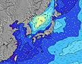 | 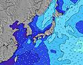 | 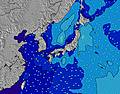 | 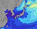 | |||||||||||||
Wave Height (m) Direction Period (s) | SE 17 | ESE 16 | SE 16 | SE 16 | SE 16 | SE 16 | SE 15 | SSE 14 | SSE 14 | SSE 14 | S 14 | S 15 | S 15 | SSW 14 | SSW 14 | SSW 15 | SSW 15 | ESE 13 | ESE 14 | E 13 |
Wave Graph | ||||||||||||||||||||
2970 | 4855 | 6018 | 6286 | 5845 | 7912 | 6633 | 4737 | 3213 | 3288 | 2557 | 2289 | 2012 | 1257 | 1402 | 1045 | 1059 | 958 | 1223 | 1443 | |
Wind (km/h) | ||||||||||||||||||||
Wind State on-shore cross-onshore cross-shore cross-offshore off-shore glassy | cross-on | cross-on | cross-on | cross-on | cross-on | cross-on | cross-on | on | cross | cross-off | cross | cross-off | cross-off | cross-off | cross-off | cross-off | cross | cross | cross-on | on |
High Tide | 7:15PM1.44m | 7:22AM1.25m | 7:38PM1.44m | 8:23AM1.15m | 8:04PM1.43m | 9:51AM1.06m | 8:36PM1.41m | 12:32PM1.05m | 9:18PM1.39m | 10:24PM1.37m | 3:49PM1.28m | 11:59PM1.37m | ||||||||
Low Tide | 1:30AM0.56m | 1:15PM0.56m | 2:18AM0.49m | 1:44PM0.72m | 3:16AM0.44m | 2:11PM0.89m | 4:28AM0.39m | 2:33PM1.04m | 5:54AM0.32m | 7:14AM0.22m | 7:20PM1.20m | |||||||||
— | — | 4:48 | — | — | 4:48 | — | — | 4:50 | — | — | 4:50 | — | — | 4:50 | — | — | 4:52 | — | — | |
6:39 | — | — | 6:39 | — | — | 6:38 | — | — | 6:37 | — | — | 6:37 | — | — | 6:36 | — | — | 6:35 | — | |
mm | — | — | — | — | — | — | — | — | — | — | 3 | 6 | 4 | 4 | — | — | 1 | — | — | — |
Temp °C | 24 | 23 | 24 | 24 | 23 | 25 | 26 | 25 | 28 | 28 | 26 | 28 | 28 | 26 | 28 | 28 | 26 | 27 | 27 | 24 |
Feels °C | 22 | 21 | 21 | 21 | 22 | 25 | 27 | 28 | 31 | 30 | 28 | 29 | 29 | 28 | 30 | 30 | 29 | 27 | 27 | 23 |
Swell 1 Height (m) Direction Period (s) | SE 17 | ESE 16 | SE 16 | SE 16 | SE 16 | SE 16 | SE 15 | SSE 14 | SSE 14 | SSE 14 | S 14 | S 15 | S 15 | SE 9 | SE 9 | SE 9 | SE 9 | ESE 13 | ESE 14 | E 13 |
2970 | 4855 | 6018 | 6286 | 5845 | 7912 | 6633 | 4737 | 3213 | 3288 | 2557 | 2289 | 2012 | 586 | 502 | 568 | 664 | 958 | 1223 | 1443 | |
Swell 2 Height (m) Direction Period (s) | E 14 | E 14 | E 14 | E 13 | E 13 | E 18 | — | E 17 | ESE 10 | ESE 10 | ESE 10 | ESE 9 | SE 9 | SSW 14 | SSW 14 | SSW 15 | SSW 15 | SSW 15 | SSW 15 | SSW 16 |
61 | 59 | 57 | 54 | 86 | 25 | — | 22 | 356 | 314 | 434 | 450 | 528 | 1257 | 1402 | 1045 | 1059 | 811 | 953 | 904 | |
Swell 3 Height (m) Direction Period (s) | — | — | E 13 | — | — | — | — | ENE 16 | E 16 | E 16 | E 15 | E 15 | E 15 | E 14 | SE 12 | SE 12 | SSE 9 | SSE 9 | SSE 9 | SSE 9 |
— | — | 130 | — | — | — | — | 26 | 20 | 20 | 41 | 39 | 39 | 37 | 75 | 122 | 33 | 126 | 96 | 45 | |
Wind waves Height (m) Direction Period (s) | ENE 7 | ENE 7 | ENE 7 | ENE 7 | ENE 7 | — | — | — | — | — | — | ESE 9 | — | — | SE 9 | — | — | — | — | — |
192 | 286 | 443 | 397 | 186 | — | — | — | — | — | — | 627 | — | — | 743 | — | — | — | — | — | |
Nearest Offshore or Glassy | ||||||||||||||||||||
Distance (km) | 626 | 565 | 216 | 63 | 565 | 563 | 63 | 22 | 63 | 125 | 63 | 63 | 63 | 125 | 74 | 0 | 17 | 74 | 74 | 1071 |
Best forecast wave conditions in Chiba | ||||||||||||||||||||
Best forecast wave conditions in Japan | ||||||||||||||||||||
Header Global | ||||||||||||||||||||
- Map Icons:
 Break
Break Live Wave Height (m)
 Live Wind Speed (km/h)
 Surf Rating (10 Max)
 Ocean Swells (m)
- Wind Speed (km/h)
Latest Updates


FREE! Surf-Forecast.com widget for your website
The surf report / weather widget below is available to embed on third party websites free of charge and provides a summary of our Shida surf forecast. Simply grab the html code snippet that we provide and paste it into your own site. You can choose your preferred language and metric/imperial units for the surf forecast feed to suit users of your site. Click here to get the code.
Information about the Shida Surf forecast
The above surf forecast table for Shida provides essential information for determining whether the surfing conditions will be good over the next 16 days. A general guide to surfing at Shida can be found by selecting the local surf guide option on the grey menu. Our Shida surf forecast is unique since it includes wave energy (power) that defines the real feel of the surf rather than just the height or the period. If you surf the same spot (Shida) regularly then make a mental note of the wave energy from the surf forecast table each time you go. Very soon you may start to choose your surf days based on the wave energy alone combined with our forecast of favourable offshore wind conditions. Our star ratings will help here and of course you will also find the usual wave height and period predictions on our surf forecasts as well as a full break down of the swell components under our advanced users option (to reveal that, click the little Einstein character under the tide times).
Further information to help with frequently asked questions about our surf forecast for Shida may be found under the help tab on the top menu and also by moving your mouse over the question marks on the surf forecast table itself. Please always bear in mind that the forecast is for near-shore open water and local factors at each surf break influence the actual breaking wave height, such as the beach / reef profile, water depths offshore and shelter.
Shida is 9 km (6 miles) from the city of Ohara. If you plan a holiday in Chiba, look for hotels and other accommodation in Ohara. Ohara has rooms for a wide range of budgets as well as car hire and transport links.
 Nearest