

Surf Forecasts:

Kaifu Rivermouth surf forecast from 6 Jul 2026:
- Best quality surf: Friday 10 Jul, 6AM (local time) - 11ft (3.5m), 16s period, S swell with glassy winds.
- Most powerful swell: Saturday 11 Jul, 12AM (local time) - 13ft (4.0m), 17s period, S swell with 9,426 kJ wave energy.
- Next surfable swell (1★+): Tuesday 7 Jul, 6AM (local time) - 3.5ft (1.0m), 13s period with SE swell.
Best Forecast Surf Conditions for Kaifu Rivermouth this week:
The surf forecast for Kaifu Rivermouth over the next 16 days: The first swell (rated 1 star or higher) is forecast to arrive on Tuesday (Jul 07) at 6AM. The primary swell is predicted to be 1.0m and 13s period with a secondary swell of 0.8m and 16s. Another secondary swell of 1.1m and 6s is also forecast. The wind is predicted to be glassy as the swell arrives.
The most powerful waves expected at Kaifu Rivermouth in the next 16 days are 4.0m 17s and forecast to arrive on Saturday (Jul 11) at 12AM. Winds are predicted to be cross-onshore at the time the swell arrives.
| Wave Type | Time (JST) & Date | Wave Height & Period |
|---|---|---|
| Next good surf (1 star+) | 6AM (Tue 7th Jul) | 3.5ft (1.0m) 13s |
| Best Surf | 6AM (Fri 10th Jul) | 11ft (3.5m) 16s |
| Most Powerful | 12AM (Sat 11th Jul) | 13ft (4.0m) 17s |
Table - best surf conditions forecast for Kaifu Rivermouth over the next 16 days.
Updates in hr min s Forecast update imminent
Alright folks, Rusty here. Let’s get into it for this stretch.
The forecast kicks off nicely on Tuesday, July 7th, at Kaifu Rivermouth. We’ve got a bit of cloud cover, but that’s about it for drama. The water is sittin’ at 76.3°, which is a bit colder than normal for this time of year, so you might want a light spring suit if you’re sensitive. First thing Tuesday morning, we’re looking at a clean 3.3 ft swell out of the southeast, with a period of 12 seconds. The wind is glassy, just a whisper from the ESE at 3 mph. That’s the kind of morning that makes you grateful you dragged yourself out of bed. The combined swell energy is moderate at 817, and the conditions are calling for very good surf. The afternoon holds up nicely too, with the swell bumping to 3.6 ft and the period stretching to a juicy 16 seconds. Still glassy, still clean. This is the standout of the entire outlook, no question. Tuesday is your day.
Now, Wednesday the 8th through Saturday the 11th sees the swell pumping up, but it gets messy. We’re talking 6.9 ft to 13.1 ft of southerly and south-southeast swell, with periods hanging around 15 to 17 seconds. That’s a lot of energy—combined values between 2685 and up over 8300. But here’s the rub: the wind is onshore or cross-onshore for most of it, and the tide conditions look questionable. This is big, powerful, but unruly. For experienced surfers only, and even then, you’re dealing with a washing machine. If you’re a kiter, this setup might be more your speed than a paddle surfer’s dream.
Things settle down by Sunday the 12th. The swell drops to 5.6 ft out of the SSW, with a 14-second period. The wind goes glassy from the NE at 3 mph in the morning. That’s clean, but the combined energy is moderate at 1553. It’s a good session for experienced folks, but not a standout.
From Monday the 13th through to the end of the second week, it’s a bit of a mixed bag. The swell drops right off, mostly under 4.9 ft, with periods short to moderate. There are some glassy windows on the mornings of the 14th, 15th, 16th, 19th, 20th, and 21st—but the swell is small, and the energy is weak (often under 400). The 22nd of July shows a little promise: a 6.9 ft groundswell from the south, period of 14 seconds, combined energy 1735, and glassy conditions in the morning. That’s a distant look, but worth keeping an eye on. It’s about the only thing in the second week that might get the heart rate up, but it’s a long way off and uncertain.
Overall, if you can only surf once, make it Tuesday morning, July 7th. That’s the cleanest, most inviting session on offer.
Short Range ForecastMostly dry. Warm (max 26°C on Wed morning, min 23°C on Tue night). Wind will be generally light. | Days 4-6 Weather SummaryLight rain (total 3mm), mostly falling on Fri morning. Warm (max 27°C on Fri morning, min 24°C on Fri night). Wind will be generally light. | ||||||||||||||||||||
Tuesday 7 | Wednesday 8 | Thursday 9 | Friday 10 | Saturday 11 | Sunday 12 | Monday 13 | |||||||||||||||
AM | PM | Night | AM | PM | Night | AM | PM | Night | AM | PM | Night | AM | PM | Night | AM | PM | Night | AM | PM | Night | |
Swell Height Map |  |  |  | 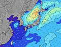 | 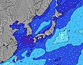 | 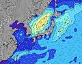 | 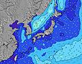 | ||||||||||||||
Wave Height (m) Direction Period (s) | SE 15 | SE 16 | SE 16 | SE 15 | SE 16 | SSE 15 | SSE 15 | SSE 15 | SSE 16 | S 16 | S 17 | S 17 | S 16 | SSW 16 | SSW 15 | SSW 14 | SSW 13 | S 11 | S 11 | S 10 | S 10 |
Wave Graph | |||||||||||||||||||||
306 | 620 | 2009 | 1882 | 2453 | 2734 | 3469 | 3940 | 4819 | 6966 | 8317 | 9426 | 7387 | 6209 | 4022 | 1127 | 497 | 396 | 332 | 270 | 204 | |
Wind (km/h) | |||||||||||||||||||||
Wind State on-shore cross-onshore cross-shore cross-offshore off-shore glassy | glassy | glassy | cross-on | on | on | glassy | on | on | glassy | on | cross-on | cross-on | on | on | glassy | glassy | cross | off | glassy | cross-on | glassy |
High Tide | 10:17AM1.42m | 10:55PM1.60m | 11:38AM1.36m | 11:41PM1.58m | 1:20PM1.35m | 00:36AM1.58m | 3:00PM1.43m | 1:41AM1.60m | 4:18PM1.55m | 2:47AM1.65m | 5:16PM1.67m | 3:49AM1.73m | 6:04PM1.75m | ||||||||
Low Tide | 4:23PM0.66m | 5:30AM0.68m | 5:17PM0.83m | 6:40AM0.57m | 6:30PM0.98m | 7:54AM0.44m | 8:00PM1.08m | 9:03AM0.28m | 9:23PM1.10m | 10:04AM0.12m | 10:28PM1.08m | 10:59AM-0.01m | 11:22PM1.02m | ||||||||
4:58 | — | — | 4:58 | — | — | 4:58 | — | — | 4:58 | — | — | 5:00 | — | — | 5:01 | — | — | 5:01 | — | — | |
— | 7:15 | — | — | 7:15 | — | — | 7:15 | — | — | 7:15 | — | — | 7:15 | — | — | 7:14 | — | — | 7:14 | — | |
mm | — | — | — | — | — | — | — | — | — | 1 | — | — | — | — | — | 1 | 1 | — | 1 | — | 1 |
Temp °C | 25 | 25 | 24 | 26 | 26 | 23 | 26 | 26 | 25 | 27 | 26 | 25 | 27 | 26 | 24 | 25 | 26 | 24 | 27 | 29 | 25 |
Feels °C | 29 | 29 | 27 | 28 | 29 | 27 | 29 | 29 | 30 | 31 | 29 | 29 | 31 | 31 | 28 | 30 | 30 | 28 | 31 | 32 | 29 |
Swell 1 Height (m) Direction Period (s) | SE 12 | SE 16 | SE 16 | SE 15 | SE 16 | SSE 15 | SSE 15 | SSE 15 | SSE 16 | S 16 | S 17 | S 17 | S 16 | SSW 16 | SSW 15 | SSW 14 | SSW 13 | S 11 | S 11 | S 10 | S 10 |
306 | 620 | 2009 | 1882 | 2453 | 2734 | 3469 | 3940 | 4819 | 6966 | 8317 | 9426 | 7387 | 6209 | 4022 | 1127 | 497 | 396 | 332 | 270 | 204 | |
Swell 2 Height (m) Direction Period (s) | SE 15 | ESE 8 | SSE 20 | SSE 18 | SSE 18 | ESE 5 | S 20 | S 16 | S 20 | — | — | — | — | — | SE 12 | SSE 12 | S 12 | SW 12 | SE 10 | SE 10 | ESE 9 |
280 | 116 | 275 | 803 | 917 | 37 | 919 | 1751 | 1267 | — | — | — | — | — | 23 | 418 | 322 | 73 | 39 | 17 | 26 | |
Swell 3 Height (m) Direction Period (s) | ESE 7 | SE 12 | — | — | — | ESE 8 | — | — | E 8 | — | — | — | — | — | — | SE 14 | SE 11 | SE 11 | E 9 | ESE 9 | SE 10 |
70 | 224 | — | — | — | 14 | — | — | 68 | — | — | — | — | — | — | 8 | 55 | 40 | 6 | 16 | 15 | |
Wind waves Height (m) Direction Period (s) | E 7 | E 8 | E 7 | — | ESE 6 | — | E 8 | E 8 | — | — | — | — | — | — | — | — | — | — | — | — | — |
161 | 266 | 209 | — | 112 | — | 34 | 84 | — | — | — | — | — | — | — | — | — | — | — | — | — | |
Nearest Offshore or Glassy | |||||||||||||||||||||
Distance (km) | 0 | 0 | 2 | 23 | 23 | 0 | 23 | 584 | 0 | 23 | 6 | 6 | 23 | 23 | 0 | 0 | 4 | 0 | 0 | 6 | 0 |
Best forecast wave conditions in Shikoku | |||||||||||||||||||||
Best forecast wave conditions in Japan | |||||||||||||||||||||
Header Global | |||||||||||||||||||||
- Map Icons:
 Break
Break Live Wave Height (m)
 Live Wind Speed (km/h)
 Surf Rating (10 Max)
 Ocean Swells (m)
- Wind Speed (km/h)


FREE! Surf-Forecast.com widget for your website
The surf report / weather widget below is available to embed on third party websites free of charge and provides a summary of our Kaifu Rivermouth surf forecast. Simply grab the html code snippet that we provide and paste it into your own site. You can choose your preferred language and metric/imperial units for the surf forecast feed to suit users of your site. Click here to get the code.
Information about the Kaifu Rivermouth Surf forecast
The above surf forecast table for Kaifu Rivermouth provides essential information for determining whether the surfing conditions will be good over the next 16 days. A general guide to surfing at Kaifu Rivermouth can be found by selecting the local surf guide option on the grey menu. Our Kaifu Rivermouth surf forecast is unique since it includes wave energy (power) that defines the real feel of the surf rather than just the height or the period. If you surf the same spot (Kaifu Rivermouth) regularly then make a mental note of the wave energy from the surf forecast table each time you go. Very soon you may start to choose your surf days based on the wave energy alone combined with our forecast of favourable offshore wind conditions. Our star ratings will help here and of course you will also find the usual wave height and period predictions on our surf forecasts as well as a full break down of the swell components under our advanced users option (to reveal that, click the little Einstein character under the tide times).
Further information to help with frequently asked questions about our surf forecast for Kaifu Rivermouth may be found under the help tab on the top menu and also by moving your mouse over the question marks on the surf forecast table itself. Please always bear in mind that the forecast is for near-shore open water and local factors at each surf break influence the actual breaking wave height, such as the beach / reef profile, water depths offshore and shelter.
Kaifu Rivermouth is 40 km (25 miles) from Muroto. If you plan a holiday in Shikoku, look for hotels and other accommodation in Muroto. Muroto has rooms for a wide range of budgets as well as car hire and transport links.
 Nearest