

Surf Forecasts:

Ozaki surf forecast from 14 Jul 2026:
- Best quality surf: Tuesday 14 Jul, 6PM (local time) - 3.5ft (1.1m), 9s period, SSW swell with glassy winds.
- Most powerful swell: Tuesday 14 Jul, 12PM (local time) - 4ft (1.2m), 10s period, SSW swell with 258 kJ wave energy.
- Next surfable swell (1★+): Tuesday 14 Jul, 6PM (local time) - 3.5ft (1.1m), 9s period with SSW swell.
Best Forecast Surf Conditions for Ozaki this week:
The surf forecast for Ozaki over the next 16 days: The first swell (rated 1 star or higher) is forecast to arrive on Tuesday (Jul 14) at 6PM. The primary swell is predicted to be 1.1m and 9s period with a secondary swell of 0.3m and 12s. The wind is predicted to be glassy as the swell arrives.
The most powerful waves expected at Ozaki in the next 16 days are 1.2m 10s and forecast to arrive on Tuesday (Jul 14) at 12PM. Winds are predicted to be cross-onshore at the time the swell arrives. The largest open ocean swell (not directed at the beach) is 1.3m 8s period and expected on Thursday (Jul 16) at 6AM.
| Wave Type | Time (JST) & Date | Wave Height & Period |
|---|---|---|
| Next good surf (1 star+) | 6PM (Tue 14th Jul) | 3.5ft (1.1m) 9s |
| Best Surf | 6PM (Tue 14th Jul) | 3.5ft (1.1m) 9s |
| Most Powerful | 12PM (Tue 14th Jul) | 4ft (1.2m) 10s |
Table - best surf conditions forecast for Ozaki over the next 16 days.
The Lowdown
Alright, let me tell ya, it's been a bit of a flat spell here at Ozaki. The forecast for the next couple of weeks is pretty grim, I gotta be honest.
We're looking at a long stretch of tiny, weak waves. From Tuesday the 14th right through to the end of the month, the swell is barely a whisper. The first solid window of surf isn't really on the cards. There's a big gap with practically nothing rideable for days on end. The energy is mostly in the teens or single digits – a measly 15 to 18 (combined energy) – which is barely enough to tickle your ankles. The water is a warm 79°, but that doesn't help the waves. It's about average for the time of year, so no surprises there.
The only real standout, and I'm using that term loosely, is on the morning of Saturday the 26th of July. We might see a pulse of groundswell hit. The swell will be a tiny 1 ft from the SE, but with a very long period of 15 seconds, it'll have some push. The combined energy will climb to a moderate 115, and the wind will be glassy. It's not much, but it's something. A long period swell like that at a beach break can be a bit tricky, breaking straight, but on a glassy morning it's worth a look.
Other than that, the week of the 29th of July gets a bit of size, with a solid 12 ft ESE swell on the Wednesday afternoon, but that's a different story. That swell has a massive 7596 combined energy, but it's coming with a strong onshore wind. The notes say it's too big for this break, and with the wind, it's a complete write-off for a paddle. Honestly, that setup might be more interesting for the kite crew than for us surfers.
So, the takeaway is patience. A few tiny, glassy windows might give you a knee-high wave, but don't expect any fireworks. The forecast can always change, but right now, it's a quiet one.
Rusty.
Short Range ForecastMostly dry. Warm (max 30°C on Tue morning, min 27°C on Tue night). Wind will be generally light. | Days 4-6 Weather SummaryMostly dry. Warm (max 30°C on Fri afternoon, min 27°C on Fri night). Wind will be generally light. | ||||||||||||||||||||
Tuesday 14 | Wednesday 15 | Thursday 16 | Friday 17 | Saturday 18 | Sunday 19 | Monday 20 | |||||||||||||||
AM | PM | Night | AM | PM | Night | AM | PM | Night | AM | PM | Night | AM | PM | Night | AM | PM | Night | AM | PM | Night | |
Swell Height Map |  |  |  | 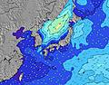 | 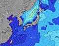 | 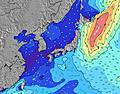 | 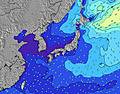 | ||||||||||||||
Wave Height (m) Direction Period (s) | SSW 10 | SSW 10 | SSW 9 | SE 11 | SE 11 | SE 11 | SE 10 | SE 10 | SE 10 | SE 10 | SE 10 | SE 10 | SE 10 | SE 9 | SE 8 | SE 8 | SE 8 | SE 9 | SE 8 | SE 8 | SE 8 |
Wave Graph | |||||||||||||||||||||
307 | 253 | 146 | 18 | 18 | 18 | 16 | 15 | 15 | 15 | 15 | 14 | 15 | 28 | 24 | 16 | 16 | 13 | 18 | 18 | 17 | |
Wind (km/h) | |||||||||||||||||||||
Wind State on-shore cross-onshore cross-shore cross-offshore off-shore glassy | cross-on | cross | cross-off | cross-on | cross | glassy | cross-on | cross-on | glassy | cross-on | glassy | glassy | glassy | cross | glassy | glassy | cross | cross-off | glassy | glassy | off |
High Tide | 6:47PM1.80m | 5:39AM1.86m | 7:26PM1.82m | 6:29AM1.88m | 8:02PM1.80m | 7:17AM1.84m | 8:37PM1.77m | 8:04AM1.75m | 9:09PM1.72m | 8:53AM1.63m | 9:40PM1.67m | 9:45AM1.49m | 10:10PM1.61m | ||||||||
Low Tide | 11:49AM-0.08m | 00:10AM0.94m | 12:35PM-0.10m | 00:53AM0.87m | 1:18PM-0.04m | 1:36AM0.79m | 1:59PM0.08m | 2:19AM0.73m | 2:36PM0.25m | 3:03AM0.69m | 3:12PM0.45m | 3:49AM0.67m | 3:46PM0.65m | ||||||||
5:03 | — | — | 5:03 | — | — | 5:03 | — | — | 5:05 | — | — | 5:05 | — | — | 5:05 | — | — | 5:07 | — | — | |
— | 7:14 | — | — | 7:13 | — | — | 7:13 | — | — | 7:13 | — | — | 7:12 | — | — | 7:12 | — | — | 7:10 | — | |
mm | — | — | — | — | — | — | — | — | — | — | — | — | — | — | — | — | — | — | — | 1 | — |
Temp °C | 30 | 30 | 29 | 30 | 30 | 28 | 30 | 30 | 29 | 29 | 30 | 27 | 29 | 30 | 28 | 29 | 30 | 28 | 29 | 30 | 28 |
Feels °C | 34 | 34 | 34 | 35 | 33 | 32 | 34 | 34 | 35 | 33 | 34 | 31 | 33 | 33 | 33 | 32 | 34 | 33 | 34 | 35 | 32 |
Swell 1 Height (m) Direction Period (s) | SSW 10 | SSW 10 | SSW 9 | SSW 9 | SSW 8 | SSW 8 | SSW 8 | SSW 7 | SSW 7 | SW 7 | SW 7 | SW 6 | SW 6 | SW 6 | SW 6 | SW 6 | SW 6 | SSW 5 | SW 6 | SW 6 | SW 6 |
307 | 253 | 146 | 124 | 143 | 136 | 150 | 114 | 93 | 75 | 47 | 18 | 20 | 19 | 18 | 16 | 27 | 9 | 28 | 26 | 15 | |
Swell 2 Height (m) Direction Period (s) | E 9 | SE 12 | SE 12 | SE 11 | E 10 | ESE 10 | ESE 9 | ESE 10 | E 9 | E 8 | E 8 | E 9 | E 9 | E 9 | E 9 | E 9 | E 9 | E 9 | SE 8 | SE 8 | SE 8 |
15 | 22 | 21 | 18 | 16 | 31 | 29 | 31 | 28 | 12 | 12 | 28 | 41 | 39 | 45 | 40 | 44 | 26 | 18 | 18 | 17 | |
Swell 3 Height (m) Direction Period (s) | SE 10 | E 9 | E 9 | E 10 | SE 11 | SE 11 | SE 10 | SE 10 | SE 10 | SE 10 | SE 10 | SE 10 | SE 10 | SE 9 | SE 8 | SE 8 | SE 8 | SE 9 | E 9 | E 9 | E 9 |
15 | 15 | 15 | 17 | 18 | 18 | 16 | 15 | 15 | 15 | 15 | 14 | 15 | 28 | 24 | 16 | 16 | 13 | 26 | 25 | 14 | |
Wind waves Height (m) Direction Period (s) | — | — | — | — | — | — | — | — | — | — | — | — | — | — | — | — | — | SW 5 | — | — | — |
— | — | — | — | — | — | — | — | — | — | — | — | — | — | — | — | — | 12 | — | — | — | |
Nearest Offshore or Glassy | |||||||||||||||||||||
Distance (km) | 19 | 3 | 0 | 22 | 3 | 3 | 22 | 51 | 3 | 3 | 3 | 3 | 3 | 3 | 3 | 3 | 3 | 221 | 3 | 3 | 266 |
Best forecast wave conditions in Shikoku | |||||||||||||||||||||
Best forecast wave conditions in Japan | |||||||||||||||||||||
Header Global | |||||||||||||||||||||
- Map Icons:
 Break
Break Live Wave Height (m)
 Live Wind Speed (km/h)
 Surf Rating (10 Max)
 Ocean Swells (m)
- Wind Speed (km/h)


FREE! Surf-Forecast.com widget for your website
The surf report / weather widget below is available to embed on third party websites free of charge and provides a summary of our Ozaki surf forecast. Simply grab the html code snippet that we provide and paste it into your own site. You can choose your preferred language and metric/imperial units for the surf forecast feed to suit users of your site. Click here to get the code.
Information about the Ozaki Surf forecast
The above surf forecast table for Ozaki provides essential information for determining whether the surfing conditions will be good over the next 16 days. A general guide to surfing at Ozaki can be found by selecting the local surf guide option on the grey menu. Our Ozaki surf forecast is unique since it includes wave energy (power) that defines the real feel of the surf rather than just the height or the period. If you surf the same spot (Ozaki) regularly then make a mental note of the wave energy from the surf forecast table each time you go. Very soon you may start to choose your surf days based on the wave energy alone combined with our forecast of favourable offshore wind conditions. Our star ratings will help here and of course you will also find the usual wave height and period predictions on our surf forecasts as well as a full break down of the swell components under our advanced users option (to reveal that, click the little Einstein character under the tide times).
Further information to help with frequently asked questions about our surf forecast for Ozaki may be found under the help tab on the top menu and also by moving your mouse over the question marks on the surf forecast table itself. Please always bear in mind that the forecast is for near-shore open water and local factors at each surf break influence the actual breaking wave height, such as the beach / reef profile, water depths offshore and shelter.
Ozaki is 11 km (7 miles) from Muroto. If you plan a holiday in Shikoku, look for hotels and other accommodation in Muroto. Muroto has rooms for a wide range of budgets as well as car hire and transport links.
 Nearest