
Surf Forecasts:

Puertecillo surf forecast from 2 Aug 2026:
- Best quality surf: Saturday 8 Aug, 5PM (local time) - 10ft (3.0m), 13s period, SW swell with cross-offshore winds.
- Most powerful swell: Sunday 9 Aug, 5AM (local time) - 11ft (3.5m), 14s period, SW swell with 4,857 kJ wave energy.
- Next surfable swell (1★+): Sunday 2 Aug, 5PM (local time) - 10ft (3.0m), 12s period with W swell.
Best Forecast Surf Conditions for Puertecillo this week:
The surf forecast for Puertecillo over the next 16 days: The first swell (rated 1 star or higher) is forecast to arrive on Sunday (Aug 02) at 5PM. The primary swell is predicted to be 3.0m and 12s period with a secondary swell of 0.3m and 15s. The wind is predicted to be cross-offshore as the swell arrives.
The most powerful waves expected at Puertecillo in the next 16 days are 3.5m 14s and forecast to arrive on Sunday (Aug 09) at 5AM. Winds are predicted to be cross-offshore at the time the swell arrives.
| Wave Type | Time (-04) & Date | Wave Height & Period |
|---|---|---|
| Next good surf (1 star+) | 5PM (Sun 2nd Aug) | 10ft (3.0m) 12s |
| Best Surf | 5PM (Sat 8th Aug) | 10ft (3.0m) 13s |
| Most Powerful | 5AM (Sun 9th Aug) | 11ft (3.5m) 14s |
Table - best surf conditions forecast for Puertecillo over the next 16 days.
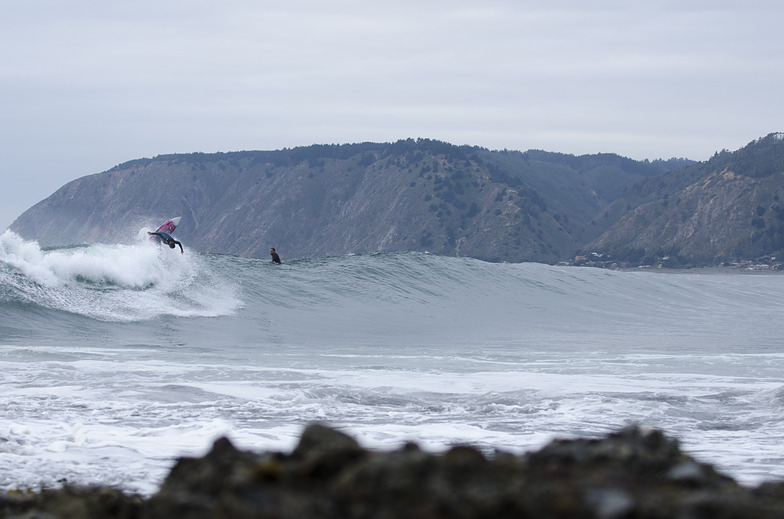
The Lowdown
Alright folks, Rusty here. Let’s have a good look at what’s coming our way for Puertecillo over the next couple of weeks.
We’ve got a solid run of surf ahead, starting with a bit of a pulse already on Sunday. The water temp is sitting at 56.5°F – that’s pretty normal for this time of year, no surprises there. The main event looks like it’s going to be the clean, glassy windows we get early next week, and then there’s a proper standout further down the line that’s worth keeping an eye on.
First up, Sunday the 2nd is a bit of a mixed bag. The swell is a solid 9.8ft from the west, with a 12-second period, so there’s plenty of energy (2893). The morning is cloudy with a cross-off northeast breeze at 12 mph, which cleans it up a bit. The afternoon looks better with lighter winds, 6 mph, also cross-off. This is advanced territory at 9.8ft, so not one for the groms. The afternoon session is the pick of Sunday.
Now, Monday the 3rd is where it gets tasty. Morning and afternoon are both glassy – that’s a light air from the ESE and then north, 3 mph. Swell is a bit smaller at 7.2ft from the west, still a 12-second period, and the energy is moderate (1484-1493). This is excellent for experienced surfers. The glassy conditions are a massive plus, making for clean, lined-up waves at this point break. This is a standout.
Tuesday the 4th starts to get a bit more wind-affected. The morning has a cross-off south wind at 9 mph, with 6.9ft WSW swell, but the afternoon turns cross-shore from the SSW at 12 mph, making it choppier. The swell drops to 5.9ft in the afternoon. It’s still surfable but not as clean.
Wednesday the 5th has a similar story. Morning is clear with a light cross-shore SSW wind at 6 mph, and 6.9ft WSW swell. The afternoon sees the wind pick up to 9 mph, but the swell jumps to 7.9ft with a longer 14-second period, so more energy (2385). Still, it’s cross-shore, so it’s a bit lumpy.
Thursday the 6th is a write-off. Strong north wind at 25 mph in the morning with rain, and the swell is only 5.6ft. The afternoon is no better with a cross-onshore wind. Forget it.
Friday the 7th is marginal. The swell is dropping to 5.2ft, and the wind is cross-shore to cross-onshore. Not great.
Saturday the 8th brings a bit of hope. The morning is still marginal with 4.3ft swell, but the afternoon is a real turn-up. Light SSE wind at 6 mph, cross-off, and the swell jumps back to 9.8ft from the SW with a 13-second period. The energy is strong (3116). This is excellent for experienced surfers, and the clean conditions make it a standout afternoon session.
Sunday the 9th is another big one. The morning has light SSE wind at 6 mph, cross-off, with 9.8ft SW swell and a 14-second period, giving a very strong energy (4696). The afternoon is similar but windier at 12 mph, still cross-off, and the energy goes up to 6811. That’s a lot of power. The morning is the pick for cleaner conditions.
From Monday the 10th through Wednesday the 12th, we’ve got solid 9.8ft to 8.2ft SW swell, but the wind is a persistent cross-off from the south at 15-19 mph, which keeps it clean but a bit bumpy. The period drops to 10 seconds, so it’s a bit more wobbly. This is still advanced surf.
Thursday the 13th sees the swell drop to 4.3ft from the WSW, long period of 16 seconds, but a cross-off south wind at 12 mph keeps it clean. It’s a smaller day.
Friday the 14th is small and messy. The morning is 5.9ft SW with a short 8-second period, cross-off but clean. The afternoon is poor with a cross-shore wind.
Saturday the 15th has a morning session with 6.6ft SW swell, 8-second period, cross-off and clean. The afternoon is a bit of a surprise with a 4.6ft SW swell but a very long 17-second period, giving moderate energy (2036). The wind is cross-shore, so it’s a bit lumpy.
Now, the real standout of the second week is Sunday the 16th. The morning is glassy – a light air from the SW at 3 mph – with 8.2ft SW swell and a 15-second period. The energy is strong (2773). This is excellent for experienced surfers, and the glassy conditions will make for some perfect, long-period groundswell lines at this point break. This is a serious standout.
The final days, Monday the 17th, see a drop in swell to 6.2ft
Short Range ForecastLight rain (total 2mm), mostly falling on Sun morning. Very mild (max 17°C on Mon afternoon, min 11°C on Sun morning). Wind will be generally light. | Days 4-6 Weather SummaryModerate rain (total 17mm), heaviest on Thu afternoon. Very mild (max 15°C on Wed morning, min 9°C on Fri night). Mainly fresh winds. | ||||||||||||||||||||
Sunday 2 | Monday 3 | Tuesday 4 | Wednesday 5 | Thursday 6 | Friday 7 | Saturday 8 | |||||||||||||||
AM | PM | Night | AM | PM | Night | AM | PM | Night | AM | PM | Night | AM | PM | Night | AM | PM | Night | AM | PM | Night | |
Swell Height Map |  |  |  | 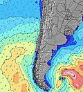 | 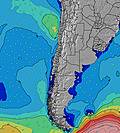 | 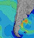 | 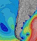 | ||||||||||||||
Wave Height (m) Direction Period (s) | W 12 | W 12 | W 12 | W 12 | W 12 | WSW 12 | WSW 12 | WSW 12 | WSW 12 | WSW 12 | WSW 14 | WSW 14 | WSW 13 | WSW 13 | WSW 11 | SW 9 | SW 8 | SW 15 | SW 10 | SW 13 | SW 14 |
Wave Graph | |||||||||||||||||||||
2751 | 2568 | 1914 | 1369 | 1412 | 1518 | 1252 | 887 | 683 | 1280 | 2379 | 1724 | 1002 | 1488 | 1080 | 399 | 363 | 535 | 637 | 3028 | 4649 | |
Wind (km/h) | |||||||||||||||||||||
Wind State on-shore cross-onshore cross-shore cross-offshore off-shore glassy | cross-off | cross-off | cross-off | glassy | glassy | cross | cross-off | cross | cross-off | cross | cross | cross | cross | cross-on | cross | cross | cross-on | cross | cross | cross-off | cross-off |
High Tide | 12:35PM1.31m | 1:10AM1.05m | 1:09PM1.21m | 1:49AM1.08m | 1:48PM1.10m | 2:35AM1.11m | 2:35PM0.97m | 3:33AM1.13m | 3:40PM0.85m | 4:44AM1.17m | 5:12PM0.77m | 6:03AM1.24m | 6:50PM0.76m | ||||||||
Low Tide | 7:05PM0.15m | 6:56AM0.29m | 7:34PM0.19m | 7:44AM0.35m | 8:07PM0.24m | 8:45AM0.40m | 8:48PM0.29m | 10:07AM0.44m | 9:43PM0.35m | 11:47AM0.42m | 10:57PM0.37m | 1:16PM0.32m | 00:19AM0.35m | ||||||||
7:39 | — | — | 7:37 | — | — | 7:37 | — | — | 7:37 | — | — | 7:35 | — | — | 7:35 | — | — | 7:33 | — | — | |
— | 6:07 | — | — | 6:08 | — | — | 6:09 | — | — | 6:10 | — | — | 6:10 | — | — | 6:12 | — | — | 6:13 | — | |
mm | 2 | — | — | — | — | — | — | — | — | — | — | — | 2 | 11 | — | — | — | 4 | — | 2 | — |
Temp °C | 13 | 14 | 15 | 15 | 17 | 16 | 14 | 15 | 14 | 15 | 15 | 14 | 14 | 14 | 12 | 10 | 11 | 11 | 10 | 10 | 9 |
Feels °C | 9 | 12 | 13 | 14 | 16 | 14 | 13 | 12 | 11 | 13 | 12 | 12 | 7 | 12 | 8 | 4 | 5 | 8 | 5 | 5 | 5 |
Swell 1 Height (m) Direction Period (s) | W 12 | W 12 | W 12 | W 12 | W 12 | WSW 12 | WSW 12 | WSW 12 | WSW 12 | WSW 12 | WSW 14 | WSW 14 | WSW 13 | WSW 13 | WSW 11 | W 10 | W 10 | SW 15 | SW 13 | WNW 9 | SW 14 |
2751 | 2568 | 1914 | 1369 | 1412 | 1518 | 1252 | 887 | 683 | 1280 | 2379 | 1724 | 1002 | 1488 | 1080 | 362 | 186 | 535 | 637 | 16 | 4649 | |
Swell 2 Height (m) Direction Period (s) | SW 11 | WNW 15 | SSW 10 | SW 10 | SW 9 | SSW 8 | SW 19 | SW 19 | SW 18 | SW 16 | NW 12 | NW 11 | NW 12 | NW 12 | SW 12 | SW 12 | SW 12 | W 10 | W 9 | SW 21 | SW 18 |
142 | 43 | 10 | 115 | 64 | 26 | 133 | 179 | 366 | 432 | 6 | 5 | 6 | 5 | 297 | 205 | 161 | 92 | 43 | 72 | 510 | |
Swell 3 Height (m) Direction Period (s) | — | — | — | — | SW 21 | SW 20 | NW 12 | NW 12 | NW 12 | NW 12 | — | — | — | — | SSW 18 | SW 17 | SW 16 | SW 11 | SW 21 | — | — |
— | — | — | — | 17 | 61 | 6 | 6 | 6 | 5 | — | — | — | — | 31 | 135 | 251 | 94 | 72 | — | — | |
Wind waves Height (m) Direction Period (s) | ENE 4 | — | — | — | — | — | SSW 7 | SW 5 | SW 6 | — | — | — | — | — | — | SW 9 | SW 8 | SW 8 | SW 10 | SW 13 | — |
6 | — | — | — | — | — | 11 | 61 | 75 | — | — | — | — | — | — | 399 | 363 | 173 | 573 | 3028 | — | |
Nearest Offshore or Glassy | |||||||||||||||||||||
Distance (km) | 16 | 0 | 0 | 0 | 0 | 33 | 33 | 33 | 0 | 33 | 33 | 6 | 173 | 134 | 137 | 136 | 1553 | 59 | 33 | 0 | 33 |
Best forecast wave conditions in Santiago | |||||||||||||||||||||
Best forecast wave conditions in Chile | |||||||||||||||||||||
Header Global | |||||||||||||||||||||
- Map Icons:
 Break
Break Live Wave Height (m)
 Live Wind Speed (km/h)
 Surf Rating (10 Max)
 Ocean Swells (m)
- Wind Speed (km/h)
Latest Updates


FREE! Surf-Forecast.com widget for your website
The surf report / weather widget below is available to embed on third party websites free of charge and provides a summary of our Puertecillo surf forecast. Simply grab the html code snippet that we provide and paste it into your own site. You can choose your preferred language and metric/imperial units for the surf forecast feed to suit users of your site. Click here to get the code.
Information about the Puertecillo Surf forecast
The above surf forecast table for Puertecillo provides essential information for determining whether the surfing conditions will be good over the next 16 days. A general guide to surfing at Puertecillo can be found by selecting the local surf guide option on the grey menu. Our Puertecillo surf forecast is unique since it includes wave energy (power) that defines the real feel of the surf rather than just the height or the period. If you surf the same spot (Puertecillo) regularly then make a mental note of the wave energy from the surf forecast table each time you go. Very soon you may start to choose your surf days based on the wave energy alone combined with our forecast of favourable offshore wind conditions. Our star ratings will help here and of course you will also find the usual wave height and period predictions on our surf forecasts as well as a full break down of the swell components under our advanced users option (to reveal that, click the little Einstein character under the tide times).
Further information to help with frequently asked questions about our surf forecast for Puertecillo may be found under the help tab on the top menu and also by moving your mouse over the question marks on the surf forecast table itself. Please always bear in mind that the forecast is for near-shore open water and local factors at each surf break influence the actual breaking wave height, such as the beach / reef profile, water depths offshore and shelter.
Puertecillo is 63 km (39 miles) from San Antonio. If you plan a holiday in Santiago, look for hotels and other accommodation in San Antonio. San Antonio has rooms for a wide range of budgets as well as car hire and transport links.
 Nearest