

Surf Forecasts:

El Gringo surf forecast from 2 Aug 2026:
- Best quality surf: Wednesday 5 Aug, 8AM (local time) - 6ft (1.8m), 12s period, SW swell with glassy winds.
- Most powerful swell: Thursday 6 Aug, 8PM (local time) - 6ft (1.8m), 16s period, SW swell with 1,675 kJ wave energy.
- Next surfable swell (1★+): Sunday 2 Aug, 8PM (local time) - 3ft (0.9m), 10s period with SW swell.
Best Forecast Surf Conditions for El Gringo this week:
The surf forecast for El Gringo over the next 16 days: The first swell (rated 1 star or higher) is forecast to arrive on Sunday (Aug 02) at 8PM. The primary swell is predicted to be 0.9m and 10s period with a secondary swell of 0.6m and 13s. The wind is predicted to be glassy as the swell arrives.
The most powerful waves expected at El Gringo in the next 16 days are 1.8m 16s and forecast to arrive on Thursday (Aug 06) at 8PM. Winds are predicted to be glassy at the time the swell arrives.
| Wave Type | Time (-04) & Date | Wave Height & Period |
|---|---|---|
| Next good surf (1 star+) | 8PM (Sun 2nd Aug) | 3ft (0.9m) 10s |
| Best Surf | 8AM (Wed 5th Aug) | 6ft (1.8m) 12s |
| Most Powerful | 8PM (Thu 6th Aug) | 6ft (1.8m) 16s |
Table - best surf conditions forecast for El Gringo over the next 16 days.
The Lowdown
Alright, let's talk waves. Rusty here, and we've got a 16-day outlook for the region, and it's all about El Gringo. This is an exposed reef break, and it's strictly for the advanced crew. The water is running about 66°, which is a touch warmer than normal for this time of year.
The first few days are a waiting game. We're seeing small surf around 3ft, with weak energy and light winds that aren't doing us any favors. It's marginal out there, not enough to get you excited.
Monday and Tuesday see the swell start to push up to 5ft, with the period stretching to 12 seconds. This is real groundswell energy building. The mornings are the pick, with light offshore winds, but it's still a bit lumpy.
Wednesday holds that 6ft swell, and the energy is climbing. Winds go a little cross-onshore, so the surface isn't perfect, but there's some push behind it.
Thursday is when things get serious. The afternoon sees the swell jump to 6ft with a very long 16-second period, and the energy surges to a strong 1646. This is where the reef starts to show its teeth. It's an advanced spot, and with that much power, you better have your wits about you.
Friday and Saturday keep the surf in the 5ft to 5ft range, with solid 12-14 second periods. The wind stays offshore, keeping it clean. It's a solid stretch of surf, but we're building towards something bigger.
Then we hit Sunday, August 9th. The swell jumps to 7ft out of the SSW, and the energy is strong. It's a bigger, gruntier swell, and it's a taste of what's to come. Remember, anything over 5ft is pushing past beginner territory, and at 7ft, you need to know what you're doing.
The following Monday, August 10th, is the big one. The afternoon sees the swell jump to a solid 8ft out of the SSW with a 16-second period, and the energy absolutely explodes to 3652. This is heavy, powerful surf for experts only.
Tuesday holds that size, with 8ft easing to 8ft, and the energy remains strong. It's another day of big, clean waves. Wednesday backs off a touch to 7ft, but it's still a serious swell.
The surf then eases into the 6ft range for Thursday and Friday, still with that SSW direction. It's good, solid surf with clean conditions.
Now, for the standouts. One is Saturday afternoon, August 15th. The wind drops to nothing, and it goes completely glassy with a clean 4ft SSW swell. That's a magic hour for the reef.
But the real gem is Sunday morning, August 16th. We've got a 4ft SW swell with a 14-second period and glassy conditions. It's going to be as perfect as it gets, a clean, long-period groundswell wrapping around the reef. This is the one to circle on the calendar.
Then, to close it out, Monday morning, August 17th, brings another excellent session. A 6ft SW swell with a 16-second period, and it's glassy again. Experienced surfers will be in heaven.
If you can only get out once, make it that Sunday the 16th. If you're chasing the big ones, the 10th and 11th are your days.
Stay safe. This reef commands respect.
Rusty.
Short Range ForecastMostly dry. Very mild (max 19°C on Sun afternoon, min 15°C on Mon night). Wind will be generally light. | Days 4-6 Weather SummaryMostly dry. Warm (max 20°C on Wed afternoon, min 15°C on Fri night). Wind will be generally light. | ||||||||||||||||||||
Sunday 2 | Monday 3 | Tuesday 4 | Wednesday 5 | Thursday 6 | Friday 7 | Saturday 8 | |||||||||||||||
AM | PM | Night | AM | PM | Night | AM | PM | Night | AM | PM | Night | AM | PM | Night | AM | PM | Night | AM | PM | Night | |
Swell Height Map |  |  |  | 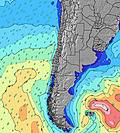 | 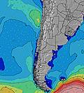 | 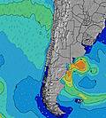 | 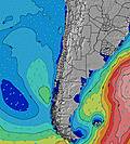 | ||||||||||||||
Wave Height (m) Direction Period (s) | SW 10 | SW 10 | SW 12 | SW 12 | SSW 13 | SW 12 | SW 12 | SW 12 | SW 12 | SW 12 | SW 12 | SW 12 | SW 17 | SW 16 | SW 15 | SW 14 | SW 14 | SW 13 | SW 13 | SW 12 | SW 10 |
Wave Graph | |||||||||||||||||||||
192 | 196 | 278 | 568 | 630 | 785 | 976 | 869 | 884 | 899 | 899 | 624 | 700 | 1571 | 1344 | 1077 | 874 | 744 | 710 | 281 | 452 | |
Wind (km/h) | |||||||||||||||||||||
Wind State on-shore cross-onshore cross-shore cross-offshore off-shore glassy | on | on | glassy | on | on | glassy | cross-on | cross-on | glassy | cross-on | cross-on | glassy | cross-on | on | glassy | on | on | glassy | on | on | glassy |
High Tide | 11:22AM1.12m | 00:00AM0.85m | 11:55AM1.05m | 00:43AM0.88m | 12:31PM0.97m | 1:32AM0.93m | 1:15PM0.87m | 2:29AM0.97m | 2:10PM0.78m | 3:35AM1.03m | 3:23PM0.70m | 4:45AM1.10m | 4:49PM0.65m | ||||||||
Low Tide | 6:01PM0.20m | 5:37AM0.32m | 6:30PM0.20m | 6:27AM0.37m | 7:03PM0.21m | 7:28AM0.41m | 7:41PM0.23m | 8:45AM0.43m | 8:29PM0.24m | 10:16AM0.43m | 9:27PM0.25m | 11:45AM0.38m | 10:35PM0.24m | ||||||||
7:07 | — | — | 7:07 | — | — | 7:07 | — | — | 7:05 | — | — | 7:05 | — | — | 7:05 | — | — | 7:05 | — | — | |
— | 6:25 | — | — | 6:27 | — | — | 6:27 | — | — | 6:27 | — | — | 6:28 | — | — | 6:28 | — | — | 6:28 | — | |
mm | — | — | — | — | — | — | — | — | — | — | — | — | — | — | — | — | — | — | — | — | — |
Temp °C | 18 | 19 | 16 | 18 | 19 | 16 | 18 | 19 | 16 | 19 | 20 | 17 | 18 | 19 | 16 | 18 | 19 | 16 | 17 | 18 | 16 |
Feels °C | 18 | 18 | 17 | 18 | 18 | 16 | 18 | 19 | 17 | 19 | 20 | 18 | 18 | 19 | 17 | 18 | 19 | 17 | 16 | 17 | 16 |
Swell 1 Height (m) Direction Period (s) | SW 10 | SW 10 | SW 12 | SW 12 | SSW 13 | SW 12 | SW 12 | SW 12 | SW 12 | SW 12 | SW 12 | SW 12 | SW 12 | SW 16 | SW 15 | SW 14 | SW 14 | SW 13 | SW 13 | SSW 8 | SW 10 |
192 | 196 | 278 | 568 | 630 | 785 | 976 | 869 | 884 | 899 | 899 | 624 | 389 | 1571 | 1344 | 1077 | 874 | 744 | 710 | 235 | 452 | |
Swell 2 Height (m) Direction Period (s) | WSW 14 | WSW 14 | SW 9 | WSW 13 | WSW 12 | — | — | — | SSW 21 | SW 20 | SW 19 | SSW 10 | SW 17 | SSW 8 | SSW 8 | SSW 7 | SSW 7 | S 20 | SW 18 | SW 12 | SW 16 |
140 | 131 | 132 | 96 | 103 | — | — | — | 42 | 97 | 184 | 100 | 700 | 75 | 54 | 43 | 29 | 7 | 49 | 281 | 206 | |
Swell 3 Height (m) Direction Period (s) | S 6 | SSW 14 | WSW 13 | — | — | — | — | — | — | — | SSW 10 | SW 18 | SSW 9 | — | — | — | — | S 20 | SW 18 | SW 18 | SW 24 |
17 | 71 | 118 | — | — | — | — | — | — | — | 20 | 255 | 79 | — | — | — | — | 7 | 49 | 78 | 22 | |
Wind waves Height (m) Direction Period (s) | — | SSW 6 | — | — | — | — | — | — | — | — | — | — | — | — | — | — | — | — | — | — | — |
— | 19 | — | — | — | — | — | — | — | — | — | — | — | — | — | — | — | — | — | — | — | |
Nearest Offshore or Glassy | |||||||||||||||||||||
Distance (km) | 0 | 143 | 0 | 143 | 112 | 0 | 194 | 18 | 0 | 143 | 79 | 0 | 143 | 147 | 0 | 143 | 143 | 0 | 143 | 143 | 0 |
Best forecast wave conditions in Atacama | |||||||||||||||||||||
Best forecast wave conditions in Chile | |||||||||||||||||||||
Header Global | |||||||||||||||||||||
- Map Icons:
 Break
Break Live Wave Height (m)
 Live Wind Speed (km/h)
 Surf Rating (10 Max)
 Ocean Swells (m)
- Wind Speed (km/h)
Latest Updates


FREE! Surf-Forecast.com widget for your website
The surf report / weather widget below is available to embed on third party websites free of charge and provides a summary of our El Gringo surf forecast. Simply grab the html code snippet that we provide and paste it into your own site. You can choose your preferred language and metric/imperial units for the surf forecast feed to suit users of your site. Click here to get the code.
Information about the El Gringo Surf forecast
The above surf forecast table for El Gringo provides essential information for determining whether the surfing conditions will be good over the next 16 days. A general guide to surfing at El Gringo can be found by selecting the local surf guide option on the grey menu. Our El Gringo surf forecast is unique since it includes wave energy (power) that defines the real feel of the surf rather than just the height or the period. If you surf the same spot (El Gringo) regularly then make a mental note of the wave energy from the surf forecast table each time you go. Very soon you may start to choose your surf days based on the wave energy alone combined with our forecast of favourable offshore wind conditions. Our star ratings will help here and of course you will also find the usual wave height and period predictions on our surf forecasts as well as a full break down of the swell components under our advanced users option (to reveal that, click the little Einstein character under the tide times).
Further information to help with frequently asked questions about our surf forecast for El Gringo may be found under the help tab on the top menu and also by moving your mouse over the question marks on the surf forecast table itself. Please always bear in mind that the forecast is for near-shore open water and local factors at each surf break influence the actual breaking wave height, such as the beach / reef profile, water depths offshore and shelter.
El Gringo is 5 km (3 miles) from the city of Arica. If you plan a holiday in Atacama, look for hotels and other accommodation in Arica. Arica has rooms for a wide range of budgets as well as car hire and transport links.
 Nearest