

Surf Forecasts:

Supertubes surf forecast from 16 Jul 2026:
- Best quality surf: Sunday 19 Jul, 11PM (local time) - 10ft (3.0m), 13s period, SW swell with glassy winds.
- Most powerful swell: Saturday 18 Jul, 2PM (local time) - 16ft (5.0m), 16s period, WSW swell with 12,421 kJ wave energy.
- Next surfable swell (1★+): Sunday 19 Jul, 11PM (local time) - 10ft (3.0m), 13s period with SW swell.
Best Forecast Surf Conditions for Supertubes this week:
The surf forecast for Supertubes over the next 16 days: The first swell (rated 1 star or higher) is forecast to arrive on Sunday (Jul 19) at 11PM. The primary swell is predicted to be 3.0m and 13s period. The wind is predicted to be glassy as the swell arrives.
The most powerful waves expected at Supertubes in the next 16 days are 5.0m 16s and forecast to arrive on Saturday (Jul 18) at 2PM. Winds are predicted to be onshore at the time the swell arrives. The largest open ocean swell (not directed at the beach) is 0.8m 5s period and expected on Thursday (Jul 23) at 2PM.
| Wave Type | Time (AWST) & Date | Wave Height & Period |
|---|---|---|
| Next good surf (1 star+) | 11PM (Sun 19th Jul) | 10ft (3.0m) 13s |
| Best Surf | 11PM (Sun 19th Jul) | 10ft (3.0m) 13s |
| Most Powerful | 2PM (Sat 18th Jul) | 16ft (5.0m) 16s |
Table - best surf conditions forecast for Supertubes over the next 16 days.
The Lowdown
G’day, Rusty here, love your work. Alright, let’s look at what’s coming up for Supertubes. This is a real reef set-up, so you know it’s got that shape and power when it’s on. The next 16 days have some serious ups and downs, so we need to pick the windows.
The first few days? We’re paying the price. Friday the 17th and Saturday the 18th are a write-off. Friday’s got a messy cross-shore wind and on Saturday, a big, powerful W swell from 15 ft to 16 ft rolls in, but it’s hammered by strong onshore winds. That’s not surfable conditions, that’s a washing machine. The combined energy is massive at 9128 on Saturday morning and 11476 on Saturday afternoon, but it’s all for nothing with the wind. Sunday the 19th is still pretty average with a cross-onshore wind and a lumpy 10 ft swell, so you’re dodging a bullet there.
Now, Monday the 20th is where we start to see a glimmer. The morning brings a clean 8 ft SW swell with a light cross-offshore NNE breeze. The combined energy is 2641, and it’s described as excellent for experienced surfers. That’s a window, but it’s not the main event.
The real standout? Look at Wednesday the 22nd. The afternoon has a solid 12 ft SW swell with a clean 14-second period, and the wind is a clean cross-offshore from the SE. The energy is 4124, and it’s clean. You’ll need some experience for that size, but the reef will handle it.
Then, hold onto your board for Thursday the 23rd. Morning and afternoon both have a moderate offshore wind from the east, with a 8 ft SW swell in the morning and 7 ft in the arvo. The period is a good 14 seconds, and the combined energy is 2223 and 1800. It’s described as excellent for experienced surfers. That’s a full day of quality.
Looking further out, the end of July and start of August have some epic potential, but it’s a longer-range call. On Wednesday the 29th, the afternoon shows a 7 ft SW swell with a 17-second period and a light cross-offshore breeze. The energy is 4156 and it’s excellent for experienced surfers. Then Thursday the 30th is a beauty: morning has a 6 ft SW swell with a 20-second period and light breeze, energy at 4610. The arvo is glassy with a 7 ft WSW swell and a 20-second period, energy at 4230. That’s a dreamy, long-period groundswell, which will be a treat on this reef. That’s the best on offer if it holds – a true standout day.
The crowd profile at Supertubes is “sometimes” busy, so you’ll likely have company on those good days, but it’s not a total circus.
The water temperature is about average for the time of year, so no need to dig out the steamer just yet.
So, in short: the first few days are a right-off. Monday the 20th is a small window. But the real action kicks off Wednesday the 22nd and Thursday the 23rd, with a potential classic on Thursday the 30th. Keep an eye on that one.
Rusty.
Short Range ForecastModerate rain (total 15mm), heaviest on Fri night. Very mild (max 18°C on Fri morning, min 14°C on Sun morning). Winds increasing (light winds from the SSW on Thu night, strong winds from the WNW by Fri night). | Days 5-7 Weather SummaryLight rain (total 6mm), mostly falling on Mon night. Very mild (max 16°C on Mon night, min 11°C on Wed morning). Winds increasing (light winds from the E on Sun night, fresh winds from the S by Tue night). | ||||||||||||||||||
Friday 17 | Saturday 18 | Sunday 19 | Monday 20 | Tuesday 21 | Wednesday 22 | ||||||||||||||
Night | AM | PM | Night | AM | PM | Night | AM | PM | Night | AM | PM | Night | AM | PM | Night | AM | PM | Night | |
Swell Height Map |  |  |  |  | 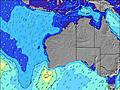 | 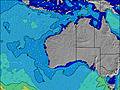 | 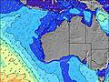 | ||||||||||||
Wave Height (m) Direction Period (s) | WSW 13 | WSW 12 | WSW 12 | W 13 | W 12 | WSW 16 | WSW 15 | WSW 14 | WSW 13 | SW 13 | SW 12 | SW 11 | SW 14 | SW 12 | SW 14 | SW 13 | SW 13 | SW 14 | SW 14 |
Wave Graph | |||||||||||||||||||
1965 | 1333 | 1151 | 5687 | 5819 | 11476 | 6428 | 3771 | 2986 | 3031 | 1776 | 850 | 2050 | 1674 | 3020 | 3883 | 4961 | 4124 | 3555 | |
Wind (km/h) | |||||||||||||||||||
Wind State on-shore cross-onshore cross-shore cross-offshore off-shore glassy | on | cross | cross | on | on | on | on | cross-on | cross-on | cross-off | cross-off | on | cross-on | cross-on | cross-on | cross | cross-off | cross-off | off |
High Tide | 11:07AM0.66m | 10:59AM0.56m | 9:40AM0.48m | 4:19AM0.45m | 8:25AM0.45m | 4:13AM0.51m | 4:40AM0.57m | ||||||||||||
Low Tide | 8:20PM0.09m | 8:43PM0.18m | 7:54PM0.27m | 6:28PM0.29m | 6:22AM0.45m | 5:34PM0.27m | 4:23PM0.22m | 4:03PM0.16m | |||||||||||
— | 7:20 | — | — | 7:20 | — | — | 7:20 | — | — | 7:20 | — | — | 7:18 | — | — | 7:18 | — | — | |
5:29 | — | 5:30 | — | — | 5:30 | — | — | 5:30 | — | — | 5:31 | — | — | 5:32 | — | — | 5:32 | — | |
mm | 1 | — | 1 | 7 | 2 | — | 1 | 2 | 1 | — | — | 2 | 2 | — | — | 2 | — | — | — |
Temp °C | 16 | 18 | 18 | 17 | 15 | 15 | 15 | 15 | 15 | 15 | 14 | 15 | 16 | 15 | 14 | 15 | 12 | 13 | 11 |
Feels °C | 15 | 13 | 13 | 11 | 5 | 7 | 8 | 10 | 10 | 12 | 11 | 12 | 11 | 9 | 8 | 9 | 5 | 6 | 4 |
Swell 1 Height (m) Direction Period (s) | WSW 13 | WSW 12 | WSW 12 | — | WSW 17 | WSW 16 | WSW 15 | WSW 14 | WSW 13 | SW 13 | SW 12 | SW 11 | — | SW 12 | — | SW 13 | SW 13 | SW 14 | SW 14 |
1965 | 1333 | 1151 | — | 3309 | 11476 | 6428 | 3771 | 2986 | 3031 | 1776 | 850 | — | 1674 | — | 3883 | 4961 | 4124 | 3555 | |
Swell 2 Height (m) Direction Period (s) | NW 7 | WNW 7 | WNW 7 | — | — | — | — | — | — | — | SW 14 | SW 14 | — | SW 15 | — | — | — | — | — |
156 | 62 | 33 | — | — | — | — | — | — | — | 865 | 514 | — | 551 | — | — | — | — | — | |
Swell 3 Height (m) Direction Period (s) | WNW 12 | WNW 12 | WNW 12 | — | — | — | — | — | — | — | — | — | — | — | — | — | — | — | — |
14 | 14 | 13 | — | — | — | — | — | — | — | — | — | — | — | — | — | — | — | — | |
Wind waves Height (m) Direction Period (s) | — | NNW 7 | N 5 | W 13 | W 12 | — | — | — | — | — | — | — | SW 14 | — | SW 14 | — | — | — | — |
— | 79 | 106 | 5687 | 5819 | — | — | — | — | — | — | — | 2050 | — | 3020 | — | — | — | — | |
Nearest Offshore or Glassy | |||||||||||||||||||
Distance (km) | 11 | 77 | 161 | 262 | 663 | 362 | 217 | 24 | 7 | 0 | 0 | 217 | 24 | 11 | 12 | 67 | 25 | 1 | 0 |
Best forecast wave conditions in Margaret River | |||||||||||||||||||
Best forecast wave conditions in Australia | |||||||||||||||||||
Header Global | |||||||||||||||||||
- Map Icons:
 Break
Break Live Wave Height (m)
 Live Wind Speed (km/h)
 Surf Rating (10 Max)
 Ocean Swells (m)
- Wind Speed (km/h)


FREE! Surf-Forecast.com widget for your website
The surf report / weather widget below is available to embed on third party websites free of charge and provides a summary of our Supertubes surf forecast. Simply grab the html code snippet that we provide and paste it into your own site. You can choose your preferred language and metric/imperial units for the surf forecast feed to suit users of your site. Click here to get the code.
Information about the Supertubes Surf forecast
The above surf forecast table for Supertubes provides essential information for determining whether the surfing conditions will be good over the next 16 days. A general guide to surfing at Supertubes can be found by selecting the local surf guide option on the grey menu. Our Supertubes surf forecast is unique since it includes wave energy (power) that defines the real feel of the surf rather than just the height or the period. If you surf the same spot (Supertubes) regularly then make a mental note of the wave energy from the surf forecast table each time you go. Very soon you may start to choose your surf days based on the wave energy alone combined with our forecast of favourable offshore wind conditions. Our star ratings will help here and of course you will also find the usual wave height and period predictions on our surf forecasts as well as a full break down of the swell components under our advanced users option (to reveal that, click the little Einstein character under the tide times).
Further information to help with frequently asked questions about our surf forecast for Supertubes may be found under the help tab on the top menu and also by moving your mouse over the question marks on the surf forecast table itself. Please always bear in mind that the forecast is for near-shore open water and local factors at each surf break influence the actual breaking wave height, such as the beach / reef profile, water depths offshore and shelter.
Supertubes is 67 km (42 miles) from the city of Bunbury. If you plan a holiday in Margaret River, look for hotels and other accommodation in Bunbury. Bunbury has rooms for a wide range of budgets as well as car hire and transport links.
 Nearest