

Surf Forecasts:

Huzzawouie (Huzzas) surf forecast from 3 Aug 2026:
- Best quality surf: Saturday 8 Aug, 11AM (local time) - 20ft (6.0m), 16s period, SW swell with cross-offshore winds.
- Most powerful swell: Saturday 8 Aug, 2PM (local time) - 18ft (5.5m), 16s period, SW swell with 16,110 kJ wave energy.
- Next surfable swell (1★+): Saturday 8 Aug, 11AM (local time) - 20ft (6.0m), 16s period with SW swell.
Best Forecast Surf Conditions for Huzzawouie (Huzzas) this week:
The surf forecast for Huzzawouie (Huzzas) over the next 16 days: The first swell (rated 1 star or higher) is forecast to arrive on Saturday (Aug 08) at 11AM. The primary swell is predicted to be 6.0m and 16s period. The wind is predicted to be cross-offshore as the swell arrives.
The most powerful waves expected at Huzzawouie (Huzzas) in the next 16 days are 5.5m 16s and forecast to arrive on Saturday (Aug 08) at 2PM. Winds are predicted to be cross-offshore at the time the swell arrives.
| Wave Type | Time (AWST) & Date | Wave Height & Period |
|---|---|---|
| Next good surf (1 star+) | 11AM (Sat 8th Aug) | 20ft (6.0m) 16s |
| Best Surf | 11AM (Sat 8th Aug) | 20ft (6.0m) 16s |
| Most Powerful | 2PM (Sat 8th Aug) | 18ft (5.5m) 16s |
Table - best surf conditions forecast for Huzzawouie (Huzzas) over the next 16 days.
The Lowdown
Alright, I’m Rusty, and here’s how it’s looking for Huzzawouie (Huzzas) over the next couple of weeks.
We’ve got a bit of a wait for the good stuff. The first few days are a write-off. Monday the 3rd and Tuesday the 4th are a mess – strong winds, messy cross-onshore chop, and the swell is just not cooperating. You’re better off staying home.
The first real glimmer of hope comes Wednesday the 5th. The swell is already pumping at 15 ft from the WSW, with a long 16-second period. The energy is massive (10,372), and the wind goes light and cross-shore. It’s still a bit raw and the conditions are marginal, but for the experienced crew, there’ll be some thumping sets. The water is 68°, which is about 4° warmer than normal – that’s a nice little bonus.
Thursday the 6th is still solid, but the wind picks up again, making it less clean. By Friday the 7th, forget it – strong winds and storms roll in, the waves get ugly. Saturday the 8th is a real tease. The swell is huge – 20 ft from the SW with a 16-second period – and the wind is clean cross-off. But the forecast says it’s simply too big for this break. That’s a ledge only for the absolute lunatics, if anyone.
The standout period, and the one to circle on your calendar, is Monday the 11th of August. Look at this: 25 ft of SW groundswell, 17-second period, and the wind is a clean cross-off. The swell energy is off the charts at 35,506. This is a massive, powerful, very long-period swell. At a reef break like this, if the direction holds, it could be a session of a lifetime if you’re an expert. But do not paddle out unless you know what you’re doing – 25 ft is not a joke. It’s only for experts.
The following week is a step down in size but still has moments. Wednesday the 13th of August morning is a special window. The swell drops to 10 ft from the SW, but the wind is glassy. Absolutely glassy. For a couple of hours, if the tide is right, you’ll have clean, makeable waves. After that, the wind swings around but stays offshore or clean for much of the week. Friday the 14th afternoon has a solid 13 ft SW swell with a 16-second period and offshore winds – that’s a very good, clean option for the experts.
The last few days of the window (16th-18th) see the swell holding around 13 ft, but the wind turns cross-onshore again, chopping it up. It’s not the best, but the 16th afternoon has light winds and a decent chance for a session.
So, to boil it down: Monday the 11th of August is the massive, undeniable standout – huge, clean, and for experts only. The other gem is Wednesday the 13th of August morning – smaller, glassy, and perfect for a more relaxed paddle if you’re not trying to get pounded. The rest of the time is a mix of too big, too windy, or just okay.
Rusty.
Short Range ForecastModerate rain (total 18mm), heaviest on Mon night. Very mild (max 18°C on Mon afternoon, min 12°C on Mon morning). Winds decreasing (fresh winds from the SW on Mon night, calm by Wed afternoon). | Days 4-6 Weather SummaryHeavy rain (total 27mm), heaviest during Thu night. Very mild (max 17°C on Thu morning, min 12°C on Fri night). Winds increasing (light winds from the WNW on Thu night, strong winds from the SW by Fri night). | ||||||||||||||||||||
Monday 3 | Tuesday 4 | Wednesday 5 | Thursday 6 | Friday 7 | Saturday 8 | Sunday 9 | |||||||||||||||
AM | PM | Night | AM | PM | Night | AM | PM | Night | AM | PM | Night | AM | PM | Night | AM | PM | Night | AM | PM | Night | |
Swell Height Map |  |  |  | 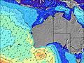 | 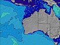 | 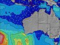 | 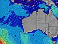 | ||||||||||||||
Wave Height (m) Direction Period (s) | SW 15 | SW 16 | SW 15 | WSW 18 | WSW 16 | WSW 16 | WSW 16 | WSW 16 | WSW 16 | WSW 16 | WSW 16 | WSW 16 | WSW 15 | WSW 15 | SW 14 | SW 16 | SW 16 | SW 16 | SW 16 | SW 15 | SW 14 |
Wave Graph | |||||||||||||||||||||
1254 | 1532 | 1672 | 7350 | 6347 | 4883 | 10372 | 10265 | 9301 | 7429 | 6274 | 6829 | 5712 | 7482 | 11267 | 15847 | 16066 | 13101 | 8786 | 6809 | 5796 | |
Wind (km/h) | |||||||||||||||||||||
Wind State on-shore cross-onshore cross-shore cross-offshore off-shore glassy | cross-on | on | cross | cross-on | cross-on | cross-on | cross | on | on | on | on | on | cross-on | cross | cross | cross-off | cross-off | cross | cross-on | cross-on | cross-on |
High Tide | 11:43AM0.70m | 1:29AM0.72m | 11:27AM0.59m | 2:06AM0.78m | 3:03AM0.84m | 4:24AM0.90m | 5:45AM0.95m | 6:51AM1.00m | |||||||||||||
Low Tide | 6:25PM0.52m | 9:04AM0.58m | 5:15PM0.53m | 2:30PM0.46m | 2:35PM0.36m | 3:09PM0.28m | 3:46PM0.22m | 4:24PM0.20m | |||||||||||||
7:11 | — | — | 7:09 | — | — | 7:09 | — | — | 7:07 | — | — | 7:07 | — | — | 7:07 | — | — | 7:05 | — | — | |
— | 5:40 | — | — | 5:42 | — | — | 5:42 | — | — | 5:43 | — | — | 5:44 | — | — | 5:45 | — | — | 5:45 | — | |
mm | — | — | 12 | — | — | — | 2 | — | 4 | 2 | 1 | 11 | 8 | 4 | 1 | — | — | — | — | — | 2 |
Temp °C | 16 | 18 | 15 | 15 | 14 | 16 | 16 | 16 | 16 | 17 | 17 | 16 | 16 | 15 | 15 | 13 | 13 | 14 | 15 | 15 | 15 |
Feels °C | 11 | 13 | 11 | 9 | 9 | 11 | 12 | 15 | 15 | 13 | 13 | 13 | 11 | 10 | 7 | 5 | 7 | 8 | 12 | 10 | 9 |
Swell 1 Height (m) Direction Period (s) | SW 15 | SW 16 | SW 15 | WSW 18 | WSW 16 | WSW 16 | WSW 16 | WSW 16 | WSW 16 | WSW 16 | WSW 16 | WSW 16 | WSW 15 | — | — | — | SW 16 | SW 16 | SW 16 | SW 15 | SW 14 |
1254 | 1532 | 1672 | 7350 | 6347 | 4883 | 10372 | 10265 | 9301 | 7429 | 6274 | 6829 | 5712 | — | — | — | 16066 | 13101 | 8786 | 6809 | 5796 | |
Swell 2 Height (m) Direction Period (s) | S 8 | — | WSW 20 | — | — | — | — | — | — | — | — | — | — | — | — | — | — | — | SW 21 | SW 21 | SW 20 |
51 | — | 1056 | — | — | — | — | — | — | — | — | — | — | — | — | — | — | — | 664 | 458 | 634 | |
Swell 3 Height (m) Direction Period (s) | — | — | — | — | — | — | — | — | — | — | — | — | — | — | — | — | — | — | — | — | NW 11 |
— | — | — | — | — | — | — | — | — | — | — | — | — | — | — | — | — | — | — | — | 5 | |
Wind waves Height (m) Direction Period (s) | N 4 | NNW 4 | W 6 | — | — | — | — | — | NW 4 | — | — | — | — | WSW 15 | SW 14 | SW 16 | — | — | — | — | — |
30 | 31 | 116 | — | — | — | — | — | 24 | — | — | — | — | 7482 | 11267 | 15847 | — | — | — | — | — | |
Nearest Offshore or Glassy | |||||||||||||||||||||
Distance (km) | 45 | 54 | 251 | 874 | 359 | 202 | 1 | 1 | 84 | 170 | 221 | 170 | 202 | 630 | 2004 | 33 | 33 | 1 | 33 | 359 | 324 |
Best forecast wave conditions in Margaret River | |||||||||||||||||||||
Best forecast wave conditions in Australia | |||||||||||||||||||||
Header Global | |||||||||||||||||||||
- Map Icons:
 Break
Break Live Wave Height (m)
 Live Wind Speed (km/h)
 Surf Rating (10 Max)
 Ocean Swells (m)
- Wind Speed (km/h)
Latest Updates


FREE! Surf-Forecast.com widget for your website
The surf report / weather widget below is available to embed on third party websites free of charge and provides a summary of our Huzzawouie (Huzzas) surf forecast. Simply grab the html code snippet that we provide and paste it into your own site. You can choose your preferred language and metric/imperial units for the surf forecast feed to suit users of your site. Click here to get the code.
Information about the Huzzawouie (Huzzas) Surf forecast
The above surf forecast table for Huzzawouie (Huzzas) provides essential information for determining whether the surfing conditions will be good over the next 16 days. A general guide to surfing at Huzzawouie (Huzzas) can be found by selecting the local surf guide option on the grey menu. Our Huzzawouie (Huzzas) surf forecast is unique since it includes wave energy (power) that defines the real feel of the surf rather than just the height or the period. If you surf the same spot (Huzzawouie (Huzzas)) regularly then make a mental note of the wave energy from the surf forecast table each time you go. Very soon you may start to choose your surf days based on the wave energy alone combined with our forecast of favourable offshore wind conditions. Our star ratings will help here and of course you will also find the usual wave height and period predictions on our surf forecasts as well as a full break down of the swell components under our advanced users option (to reveal that, click the little Einstein character under the tide times).
Further information to help with frequently asked questions about our surf forecast for Huzzawouie (Huzzas) may be found under the help tab on the top menu and also by moving your mouse over the question marks on the surf forecast table itself. Please always bear in mind that the forecast is for near-shore open water and local factors at each surf break influence the actual breaking wave height, such as the beach / reef profile, water depths offshore and shelter.
Huzzawouie (Huzzas) is 84 km (52 miles) from the city of Bunbury. If you plan a holiday in Margaret River, look for hotels and other accommodation in Bunbury. Bunbury has rooms for a wide range of budgets as well as car hire and transport links.
 Nearest