

Surf Forecasts:

Cow Bombie surf forecast from 2 Jul 2026:
- Best quality surf: Monday 6 Jul, 11PM (local time) - 13ft (4.0m), 15s period, WSW swell with offshore winds.
- Most powerful swell: Tuesday 7 Jul, 5AM (local time) - 13ft (4.0m), 16s period, SW swell with 7,995 kJ wave energy.
- Next surfable swell (1★+): Friday 3 Jul, 2AM (local time) - 11ft (3.5m), 14s period with SW swell.
Best Forecast Surf Conditions for Cow Bombie this week:
The surf forecast for Cow Bombie over the next 16 days: The first swell (rated 1 star or higher) is forecast to arrive on Friday (Jul 03) at 2AM. The primary swell is predicted to be 3.5m and 14s period with a secondary swell of 1.2m and 11s. The wind is predicted to be cross-offshore as the swell arrives.
The most powerful waves expected at Cow Bombie in the next 16 days are 4.0m 16s and forecast to arrive on Tuesday (Jul 07) at 5AM. Winds are predicted to be offshore at the time the swell arrives. The largest open ocean swell (not directed at the beach) is 1.5m 6s period and expected on Saturday (Jul 04) at 5PM.
| Wave Type | Time (AWST) & Date | Wave Height & Period |
|---|---|---|
| Next good surf (1 star+) | 2AM (Fri 3rd Jul) | 11ft (3.5m) 14s |
| Best Surf | 11PM (Mon 6th Jul) | 13ft (4.0m) 15s |
| Most Powerful | 5AM (Tue 7th Jul) | 13ft (4.0m) 16s |
Table - best surf conditions forecast for Cow Bombie over the next 16 days.
Updates in hr min s Forecast update imminent
Alright, surfers, Rusty here. Let’s look ahead at what’s on the cards for the coming weeks.
We’re starting off with a solid pulse of south-west groundswell, and it’s not going to be a quick session. The first real action is Friday morning the 3rd of July, and it's all focused on one spot.
Cow Bombie is an exposed reef break that demands respect – this is strictly for the experienced crew. It’s inconsistent by nature, so you need patience, but when it comes, it comes with serious power. On Friday morning we’ve got a clean 10-foot SW groundswell with a long 14-second period, making for some real push. The wind is a cross-offshore light breeze, so the face should be smooth. The wave energy is strong at 3200, and it’s looking excellent for those with the skill to handle it. This is proper stuff.
The swell holds through the weekend but the wind gets a bit more challenging. Saturday morning the 4th of July still has 10-foot SW swell, but a moderate 16 mph cross-off breeze will make it a bit lumpy. By Sunday the 5th of July, a strong onshore wind makes a mess of things.
Now, here’s where it gets interesting. Look ahead to Monday the 6th of July. The swell jumps to a powerful 13 feet from the WSW with a 15-second period. The wave energy is very strong (6317). The morning is clean with a moderate cross-off breeze. This is still too big for beginners (over 8 feet) and is expert-only territory, but it could be a wild session for those who can handle the peaky sets.
But the highlight of the whole outlook lands on Sunday the 12th of July. That morning, Cow Bombie will see a massive 13-foot SW groundswell with an exceptionally long 17-second period. The combined wave energy is extremely strong, reading 10335. To top it off, we’ve got a gentle cross-off breeze keeping it clean. The afternoon is forecast to be glassy with zero wind, which is about as perfect as it gets at a gnarly reef. This is a standout day, but it’s two weeks out, so keep an eye on the long-range forecasts. It’s promising, but don’t book the plane ticket just yet.
After that, the swell drops back to the 8-foot to 10-foot range, with cleaner conditions through Tuesday the 14th of July under a moderate offshore easterly. By Thursday the 16th of July, the wind swings north and starts to blow with fresh strength, making the surf lumpy, before a full-blown onshore mess closes out the window on Friday the 17th of July with heavy rain and strong winds.
In summary: Cow Bombie is your only game in town, and for the experienced surfer, the 12th of July is the real date to circle on the calendar – a huge groundswell with glassy conditions. The first week has some solid moments too, especially Monday and Tuesday.
Stay safe, respect the reef, and I’ll see you out there.
- Rusty
Short Range ForecastModerate rain (total 11mm), heaviest on Sun afternoon. Very mild (max 18°C on Sat night, min 12°C on Fri night). Winds increasing (light winds from the ESE on Thu night, strong winds from the NW by Sun morning). | Days 5-7 Weather SummaryMostly dry. Very mild (max 16°C on Sun night, min 10°C on Mon night). Wind will be generally light. | ||||||||||||||||||||
Friday 3 | Saturday 4 | Sunday 5 | Monday 6 | Tuesday 7 | Wednesday 8 | Thu 9 | |||||||||||||||
Night | AM | PM | Night | AM | PM | Night | AM | PM | Night | AM | PM | Night | AM | PM | Night | AM | PM | Night | AM | PM | |
Swell Height Map |  |  |  |  | 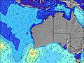 | 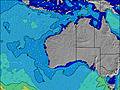 | 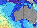 | 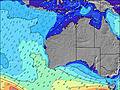 | |||||||||||||
Wave Height (m) Direction Period (s) | SW 14 | SW 14 | SW 14 | SW 14 | SW 17 | SW 16 | SW 15 | SW 14 | WSW 15 | WSW 14 | WSW 15 | WSW 15 | WSW 15 | SW 16 | SW 16 | SW 14 | WSW 15 | WSW 16 | WSW 14 | WSW 14 | WSW 13 |
Wave Graph | |||||||||||||||||||||
4132 | 3140 | 2498 | 2815 | 4587 | 3039 | 1568 | 821 | 1527 | 3721 | 6317 | 7185 | 7426 | 6947 | 4948 | 2746 | 2378 | 3968 | 3334 | 2872 | 2515 | |
Wind (km/h) | |||||||||||||||||||||
Wind State on-shore cross-onshore cross-shore cross-offshore off-shore glassy | cross-off | cross-off | cross-off | cross-off | cross-off | cross-off | cross | cross-on | cross | cross-off | cross-off | cross-off | off | off | cross-off | off | cross-off | cross | off | glassy | cross-off |
High Tide | 10:23AM1.07m | 10:56AM0.99m | 11:24AM0.88m | 11:19AM0.77m | 4:47AM0.78m | 5:02AM0.84m | 5:36AM0.92m | ||||||||||||||
Low Tide | 7:39PM0.45m | 7:59PM0.48m | 8:12PM0.53m | 8:08PM0.57m | 6:31PM0.59m | 3:04PM0.51m | 3:22PM0.40m | ||||||||||||||
— | 7:24 | — | — | 7:24 | — | — | 7:24 | — | — | 7:24 | — | — | 7:24 | — | — | 7:24 | — | — | 7:24 | — | |
5:22 | — | 5:22 | — | — | 5:22 | — | — | 5:22 | — | — | 5:23 | — | — | 5:23 | — | — | 5:24 | — | — | 5:24 | |
mm | — | — | — | — | — | — | 1 | 4 | 6 | — | — | — | — | — | — | — | — | — | — | — | — |
Temp °C | 14 | 15 | 16 | 15 | 14 | 17 | 18 | 17 | 17 | 16 | 14 | 15 | 12 | 12 | 15 | 14 | 13 | 15 | 14 | 14 | 16 |
Feels °C | 11 | 12 | 13 | 11 | 8 | 11 | 12 | 10 | 11 | 10 | 9 | 10 | 7 | 8 | 12 | 10 | 11 | 15 | 12 | 13 | 14 |
Swell 1 Height (m) Direction Period (s) | SW 14 | SW 14 | SW 14 | SW 14 | SW 17 | SW 16 | SW 15 | SW 14 | WSW 15 | WSW 14 | WSW 15 | WSW 15 | WSW 15 | SW 16 | SW 16 | SW 14 | WSW 15 | WSW 16 | WSW 14 | WSW 14 | WSW 13 |
4132 | 3140 | 2498 | 2815 | 4587 | 3039 | 1568 | 821 | 1527 | 3721 | 6317 | 7185 | 7426 | 6947 | 4948 | 2746 | 2378 | 3968 | 3334 | 2872 | 2515 | |
Swell 2 Height (m) Direction Period (s) | S 11 | SW 20 | S 10 | SSE 9 | — | — | — | S 9 | WSW 8 | NNW 6 | — | — | — | — | — | — | WSW 18 | W 21 | WSW 20 | WSW 18 | — |
371 | 60 | 115 | 139 | — | — | — | 2 | 310 | 13 | — | — | — | — | — | — | 1199 | 9 | 127 | 249 | — | |
Swell 3 Height (m) Direction Period (s) | SW 21 | — | — | — | — | — | — | — | NNW 6 | — | — | — | — | — | — | — | — | — | — | — | — |
18 | — | — | — | — | — | — | — | 94 | — | — | — | — | — | — | — | — | — | — | — | — | |
Wind waves Height (m) Direction Period (s) | — | — | — | NE 4 | NNE 5 | N 6 | NNW 6 | NW 7 | — | S 5 | — | — | — | — | — | — | — | — | — | — | S 5 |
— | — | — | 10 | 82 | 154 | 374 | 403 | — | 58 | — | — | — | — | — | — | — | — | — | — | 42 | |
Nearest Offshore or Glassy | |||||||||||||||||||||
Distance (km) | 0 | 0 | 0 | 1 | 166 | 160 | 145 | 279 | 87 | 18 | 2 | 2 | 0 | 0 | 0 | 0 | 0 | 1 | 0 | 0 | 0 |
Best forecast wave conditions in Margaret River | |||||||||||||||||||||
Best forecast wave conditions in Australia | |||||||||||||||||||||
Header Global | |||||||||||||||||||||
- Map Icons:
 Break
Break Live Wave Height (m)
 Live Wind Speed (km/h)
 Surf Rating (10 Max)
 Ocean Swells (m)
- Wind Speed (km/h)


FREE! Surf-Forecast.com widget for your website
The surf report / weather widget below is available to embed on third party websites free of charge and provides a summary of our Cow Bombie surf forecast. Simply grab the html code snippet that we provide and paste it into your own site. You can choose your preferred language and metric/imperial units for the surf forecast feed to suit users of your site. Click here to get the code.
Information about the Cow Bombie Surf forecast
The above surf forecast table for Cow Bombie provides essential information for determining whether the surfing conditions will be good over the next 16 days. A general guide to surfing at Cow Bombie can be found by selecting the local surf guide option on the grey menu. Our Cow Bombie surf forecast is unique since it includes wave energy (power) that defines the real feel of the surf rather than just the height or the period. If you surf the same spot (Cow Bombie) regularly then make a mental note of the wave energy from the surf forecast table each time you go. Very soon you may start to choose your surf days based on the wave energy alone combined with our forecast of favourable offshore wind conditions. Our star ratings will help here and of course you will also find the usual wave height and period predictions on our surf forecasts as well as a full break down of the swell components under our advanced users option (to reveal that, click the little Einstein character under the tide times).
Further information to help with frequently asked questions about our surf forecast for Cow Bombie may be found under the help tab on the top menu and also by moving your mouse over the question marks on the surf forecast table itself. Please always bear in mind that the forecast is for near-shore open water and local factors at each surf break influence the actual breaking wave height, such as the beach / reef profile, water depths offshore and shelter.
Cow Bombie is 83 km (52 miles) from the city of Bunbury. If you plan a holiday in Margaret River, look for hotels and other accommodation in Bunbury. Bunbury has rooms for a wide range of budgets as well as car hire and transport links.
 Nearest