

Surf Forecasts:

Aganoa Beach surf forecast from 8 Jul 2026:
- Best quality surf: Thursday 9 Jul, 10AM (local time) - 4.5ft (1.3m), 17s period, SW swell with offshore winds.
- Most powerful swell: Thursday 9 Jul, 4PM (local time) - 4.5ft (1.4m), 17s period, SW swell with 1,091 kJ wave energy.
- Next surfable swell (1★+): Thursday 9 Jul, 4AM (local time) - 3.5ft (1.1m), 18s period with SW swell.
Best Forecast Surf Conditions for Aganoa Beach this week:
The surf forecast for Aganoa Beach over the next 16 days: The first swell (rated 1 star or higher) is forecast to arrive on Thursday (Jul 09) at 4AM. The primary swell is predicted to be 1.1m and 18s period with a secondary swell of 0.8m and 10s. Another secondary swell of 0.6m and 6s is also forecast. The wind is predicted to be offshore as the swell arrives.
The most powerful waves expected at Aganoa Beach in the next 16 days are 1.4m 17s and forecast to arrive on Thursday (Jul 09) at 4PM. Winds are predicted to be glassy at the time the swell arrives. The largest open ocean swell (not directed at the beach) is 1.1m 5s period and expected on Tuesday (Jul 14) at 4AM.
| Wave Type | Time (+13) & Date | Wave Height & Period |
|---|---|---|
| Next good surf (1 star+) | 4AM (Thu 9th Jul) | 3.5ft (1.1m) 18s |
| Best Surf | 10AM (Thu 9th Jul) | 4.5ft (1.3m) 17s |
| Most Powerful | 4PM (Thu 9th Jul) | 4.5ft (1.4m) 17s |
Table - best surf conditions forecast for Aganoa Beach over the next 16 days.
Alright, Rusty here. Let’s talk about what’s in the water.
First off, Wednesday the 8th of July is a bit of a non-starter—just a small 3ft swell out of the SSE with a short 10-second period, not much to work with. The real highlight comes in on Thursday morning, the 9th of July. We’ve got a proper groundswell from the SW, about 4ft, with a long 17-second period. The wind is light offshore from the ENE, glassy clean, perfect for Aganoa Beach. Combined swell energy is at 1138 (moderate), so there’s some real power behind it. Water temp is 81°, about normal for this time of year.
That Thursday afternoon still has the same long-period swell, but the wind turns cross-shore, so not as clean. By Friday, conditions go downhill fast with cross-on winds and chop, and we’re looking at poor surf through Saturday and Sunday. Swell holds around 4-5ft, but the chop kills it.
We get a little clean-up on Monday the 13th and Tuesday the 14th with cross-off winds, but the swell is small—around 3-4ft—and periods drop to 12-13 seconds, so just marginal.
Then we see a bigger pulse around Thursday the 16th of July with a 6-7ft SE swell, but the period is a short 8 seconds. That’s windswell, not groundswell. Clean with cross-off winds, but short period means lumpy, fat waves. Over 5ft, so too big for beginners.
Into the second week, Saturday the 18th of July brings a 7ft SE swell at 13 seconds, with combined energy very high at 2416 (strong). But the wind is a strong breeze from the SE at 25 mph, so it’s clean but a battle. Only for experienced surfers.
The best of the second week is Monday the 20th to Wednesday the 22nd. Swell drops to 3-3ft from the SSE, with glassy offshore wind (ENE) on Monday afternoon, and light offshore or cross-off winds through Tuesday and Wednesday. Combined energy is weak (around 300-500), but small clean surf is often more fun than big bumpy stuff. Periods of 11-12 seconds give decent shape. Aganoa Beach can get crowds “sometimes,” so you might have it mostly to yourself.
To sum it up: Thursday morning the 9th of July is your best shot—long groundswell, offshore wind, good size for intermediates. The second week’s pick is Monday the 20th to Wednesday the 22nd for clean small waves.
Rusty, signing off.
Short Range ForecastHeavy rain (total 29mm), heaviest during Thu morning. Warm (max 26°C on Wed night, min 24°C on Fri night). Wind will be generally light. | Days 4-6 Weather SummarySome drizzle, heaviest during Mon night. Warm (max 25°C on Sun morning, min 24°C on Sat night). Mainly fresh winds. | ||||||||||||||||||||
Thursday 9 | Friday 10 | Saturday 11 | Sunday 12 | Monday 13 | Tuesday 14 | Wednesday 15 | |||||||||||||||
AM | PM | Night | AM | PM | Night | AM | PM | Night | AM | PM | Night | AM | PM | Night | AM | PM | Night | AM | PM | Night | |
Swell Height Map | 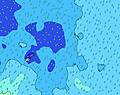 |  |  | 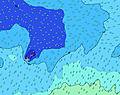 | 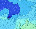 | 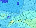 | 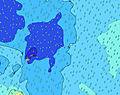 | ||||||||||||||
Wave Height (m) Direction Period (s) | SW 17 | SW 17 | SW 16 | SW 15 | SW 14 | SW 14 | SW 12 | SSW 12 | SSW 13 | SSW 15 | SSW 14 | SSW 13 | SW 12 | SW 16 | S 13 | S 12 | S 12 | SSE 12 | SSE 8 | SSE 8 | SSE 9 |
Wave Graph | |||||||||||||||||||||
962 | 1091 | 871 | 795 | 721 | 540 | 353 | 426 | 378 | 776 | 668 | 514 | 227 | 203 | 238 | 290 | 280 | 583 | 487 | 306 | 644 | |
Wind (km/h) | |||||||||||||||||||||
Wind State on-shore cross-onshore cross-shore cross-offshore off-shore glassy | off | glassy | cross | cross | cross-on | cross | cross-on | cross-on | cross | cross-off | cross-off | cross-off | cross-off | cross-off | cross-off | cross-off | cross-off | cross-off | cross-off | cross-off | cross-off |
High Tide | 1:40PM0.96m | 2:12AM1.11m | 2:44PM0.98m | 3:11AM1.17m | 3:46PM1.02m | 4:09AM1.24m | 4:45PM1.06m | 5:05AM1.29m | 5:42PM1.10m | 6:00AM1.33m | 6:37PM1.13m | 6:55AM1.34m | 7:31PM1.15m | ||||||||
Low Tide | 7:32AM0.28m | 7:44PM0.24m | 8:37AM0.21m | 8:45PM0.20m | 9:39AM0.13m | 9:45PM0.16m | 10:38AM0.06m | 10:44PM0.11m | 11:34AM-0.00m | 11:40PM0.07m | 12:28PM-0.04m | 00:35AM0.05m | 1:21PM-0.04m | 1:30AM0.06m | |||||||
6:52 | — | — | 6:52 | — | — | 6:52 | — | — | 6:52 | — | — | 6:52 | — | — | 6:52 | — | — | 6:52 | — | — | |
— | 6:14 | — | — | 6:15 | — | — | 6:15 | — | — | 6:15 | — | — | 6:15 | — | — | 6:15 | — | — | 6:15 | — | |
mm | 7 | 4 | 6 | — | 1 | 2 | — | — | — | — | — | — | — | — | 1 | — | — | 3 | — | 1 | 5 |
Temp °C | 26 | 26 | 25 | 25 | 25 | 25 | 24 | 24 | 24 | 25 | 24 | 25 | 25 | 25 | 25 | 25 | 25 | 25 | 26 | 25 | 25 |
Feels °C | 31 | 31 | 26 | 26 | 26 | 25 | 23 | 23 | 23 | 25 | 23 | 25 | 24 | 24 | 24 | 23 | 24 | 22 | 24 | 22 | 22 |
Swell 1 Height (m) Direction Period (s) | SW 17 | SW 17 | SW 16 | SW 15 | SW 14 | SW 14 | SW 12 | SSW 12 | SSW 13 | SSW 15 | SSW 14 | SSW 13 | SW 12 | SW 12 | S 13 | S 12 | S 12 | SSW 16 | S 11 | S 11 | SW 14 |
962 | 1091 | 871 | 795 | 721 | 540 | 353 | 426 | 378 | 776 | 668 | 514 | 227 | 112 | 206 | 290 | 280 | 160 | 121 | 110 | 51 | |
Swell 2 Height (m) Direction Period (s) | SSE 10 | ENE 8 | NE 8 | NE 8 | ENE 8 | NE 8 | SW 18 | SW 18 | SW 16 | SW 19 | SW 18 | SW 18 | SW 16 | SW 16 | SW 17 | SW 15 | SW 16 | SSW 16 | SW 15 | SW 14 | NNE 8 |
90 | 64 | 57 | 34 | 27 | 18 | 81 | 79 | 268 | 181 | 316 | 246 | 208 | 203 | 238 | 186 | 261 | 50 | 106 | 103 | 7 | |
Swell 3 Height (m) Direction Period (s) | N 11 | SSE 10 | SE 10 | SE 10 | SE 10 | SE 10 | SE 10 | SE 10 | NE 10 | NE 9 | NE 9 | NE 8 | SSW 12 | S 14 | SW 13 | ENE 6 | NE 9 | NNE 9 | SSW 15 | NNE 8 | S 13 |
2 | 67 | 49 | 53 | 38 | 38 | 27 | 17 | 24 | 22 | 21 | 18 | 52 | 93 | 79 | 11 | 41 | 15 | 43 | 7 | 14 | |
Wind waves Height (m) Direction Period (s) | ENE 9 | — | SSE 4 | S 4 | S 4 | S 5 | S 4 | — | — | SSE 4 | S 4 | E 6 | SSE 4 | SSE 4 | SE 5 | SSE 6 | SSE 6 | SSE 12 | SSE 8 | SSE 8 | SSE 9 |
88 | — | 12 | 16 | 16 | 36 | 33 | — | — | 16 | 9 | 15 | 17 | 20 | 43 | 45 | 50 | 583 | 487 | 306 | 644 | |
Nearest Offshore or Glassy | |||||||||||||||||||||
Distance (km) | 194 | 0 | 28 | 580 | 89 | 580 | 580 | 65 | 580 | 580 | 583 | 871 | 592 | 871 | 2263 | 1159 | 1212 | 1206 | 1206 | 2256 | 872 |
Best forecast wave conditions in Savaii | |||||||||||||||||||||
Best forecast wave conditions in Samoa | |||||||||||||||||||||
Header Global | |||||||||||||||||||||
- Map Icons:
 Break
Break Live Wave Height (m)
 Live Wind Speed (km/h)
 Surf Rating (10 Max)
 Ocean Swells (m)
- Wind Speed (km/h)


FREE! Surf-Forecast.com widget for your website
The surf report / weather widget below is available to embed on third party websites free of charge and provides a summary of our Aganoa Beach surf forecast. Simply grab the html code snippet that we provide and paste it into your own site. You can choose your preferred language and metric/imperial units for the surf forecast feed to suit users of your site. Click here to get the code.
Information about the Aganoa Beach Surf forecast
The above surf forecast table for Aganoa Beach provides essential information for determining whether the surfing conditions will be good over the next 16 days. A general guide to surfing at Aganoa Beach can be found by selecting the local surf guide option on the grey menu. Our Aganoa Beach surf forecast is unique since it includes wave energy (power) that defines the real feel of the surf rather than just the height or the period. If you surf the same spot (Aganoa Beach) regularly then make a mental note of the wave energy from the surf forecast table each time you go. Very soon you may start to choose your surf days based on the wave energy alone combined with our forecast of favourable offshore wind conditions. Our star ratings will help here and of course you will also find the usual wave height and period predictions on our surf forecasts as well as a full break down of the swell components under our advanced users option (to reveal that, click the little Einstein character under the tide times).
Further information to help with frequently asked questions about our surf forecast for Aganoa Beach may be found under the help tab on the top menu and also by moving your mouse over the question marks on the surf forecast table itself. Please always bear in mind that the forecast is for near-shore open water and local factors at each surf break influence the actual breaking wave height, such as the beach / reef profile, water depths offshore and shelter.
Agami is 16 km (10 miles) from the city of Alexandria. If you plan a holiday in Mediterranean Coast -Egypt, look for hotels and other accommodation in Alexandria. Alexandria has rooms for a wide range of budgets as well as car hire and transport links.
 Nearest