

Surf Forecasts:

Momi Bay surf forecast from 1 Aug 2026:
- Best quality surf: Friday 7 Aug, 9AM (local time) - 6ft (1.9m), 7s period, SE swell with offshore winds.
- Most powerful swell: Monday 3 Aug, 3PM (local time) - 8ft (2.4m), 13s period, SSW swell with 1,930 kJ wave energy.
- Next surfable swell (1★+): Saturday 1 Aug, 6PM (local time) - 3ft (0.9m), 15s period with SSW swell.
Best Forecast Surf Conditions for Momi Bay this week:
The surf forecast for Momi Bay over the next 16 days: The first swell (rated 1 star or higher) is forecast to arrive on Saturday (Aug 01) at 6PM. The primary swell is predicted to be 0.9m and 15s period with a secondary swell of 0.6m and 9s. The wind is predicted to be cross-offshore as the swell arrives.
The most powerful waves expected at Momi Bay in the next 16 days are 2.4m 13s and forecast to arrive on Monday (Aug 03) at 3PM. Winds are predicted to be cross-offshore at the time the swell arrives. The largest open ocean swell (not directed at the beach) is 1.3m 5s period and expected on Tuesday (Aug 04) at 3PM.
| Wave Type | Time (+12) & Date | Wave Height & Period |
|---|---|---|
| Next good surf (1 star+) | 6PM (Sat 1st Aug) | 3ft (0.9m) 15s |
| Best Surf | 9AM (Fri 7th Aug) | 6ft (1.9m) 7s |
| Most Powerful | 3PM (Mon 3rd Aug) | 8ft (2.4m) 13s |
Table - best surf conditions forecast for Momi Bay over the next 16 days.
The Lowdown
Alright, Rusty here. Let’s have a look at what’s coming down the line for us.
First up, the water is sitting at a warm 78°, which is pretty much bang on average for this time of year, so no surprises there.
The first bit of action we’ve got is on Saturday morning, 1st August, at Momi Bay. It’s a reef break, fairly consistent, and it’s sheltered from the swell. The wind’s glassy, coming out of the ENE at 3 mph, so the surface will be like a mirror. We’re looking at a 3ft SSW swell with a period of 14 seconds—that’s a long-period groundswell, which will wrap in nicely here. The combined energy is moderate at 518. It’s a good, clean start, but the swell is modest, so it’s more of a fun, small-wave session for intermediates.
The standout session in this whole outlook is hands down Monday morning, 3rd August. The swell jumps to 5ft from the SSW (13-second period), and the wind is a clean cross-offshore from the SSE at 16 mph. The combined energy ramps up to a strong 1001. The waves will have real push and shape, and the wind keeps the faces tidy. Later that same day, Monday afternoon, it gets even bigger at 8ft, but with the same cross-off wind, it’s pushing into the expert-only zone. The energy is very strong at 2020. For most of us, the morning session is the sweet spot.
Tuesday morning, 4th August, is another solid call with a 6ft SSW swell, 12-second period, and clean cross-off winds. The energy is strong at 1187. This is a proper, powerful reef wave that will hold its shape.
Later in the week, on Friday morning, 7th August, we’ve got a 6ft SE swell, but the period is a short 7 seconds. The wind is offshore from the ESE, so it’ll be clean, but the short period means it’ll be a bit softer and more crumbly. A good option for a fun session, but not the same quality as the Monday.
Looking further out, the surf drops off significantly after the 7th. There’s a gap of a few days with very small, weak swell, and then we get a pulse on Wednesday morning, 12th August, with a 5ft S swell, but the period is a short 6 seconds, so it’s not going to have much grunt. The real return to quality is Thursday morning, 13th August, with a 7ft S swell, 11-second period, and light cross-off winds. The combined energy is moderate-strong at 1059. That’s a promising one, but it’s over a week out, so we’ll have to keep an eye on it.
All in all, the best of the best is Monday morning, 3rd August. That’s the one to circle on the calendar. After that, it’s a mixed bag of smaller, cleaner days and some bigger, wind-affected ones.
This is Rusty, signing off.
Short Range ForecastMostly dry. Warm (max 24°C on Sat afternoon, min 19°C on Mon night). Winds increasing (calm on Sat morning, fresh winds from the SSE by Mon afternoon). | Days 4-6 Weather SummaryMostly dry. Warm (max 24°C on Wed morning, min 18°C on Tue night). Mainly fresh winds. | ||||||||||||||||||||
Saturday 1 | Sunday 2 | Monday 3 | Tuesday 4 | Wednesday 5 | Thursday 6 | Friday 7 | |||||||||||||||
AM | PM | Night | AM | PM | Night | AM | PM | Night | AM | PM | Night | AM | PM | Night | AM | PM | Night | AM | PM | Night | |
Swell Height Map | 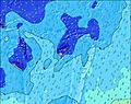 | 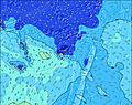 | 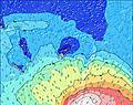 | 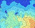 | 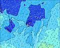 | 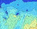 | 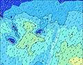 | ||||||||||||||
Wave Height (m) Direction Period (s) | SSW 14 | SSW 15 | SSW 13 | SSW 14 | SSW 14 | SSW 14 | SSW 13 | SSW 13 | SSW 13 | SSW 12 | S 12 | SSW 19 | SSW 18 | SSW 17 | SSW 16 | SSW 16 | SSW 16 | SSW 14 | SE 7 | SSW 13 | SE 9 |
Wave Graph | |||||||||||||||||||||
425 | 443 | 229 | 342 | 561 | 731 | 796 | 1930 | 1467 | 970 | 1079 | 983 | 1056 | 986 | 993 | 788 | 649 | 437 | 372 | 219 | 542 | |
Wind (km/h) | |||||||||||||||||||||
Wind State on-shore cross-onshore cross-shore cross-offshore off-shore glassy | glassy | cross | cross-off | cross-off | cross | cross-off | cross-off | cross-off | cross-off | cross-off | cross-off | cross-off | cross-off | cross-off | cross-off | cross-off | cross-off | cross-off | off | off | off |
High Tide | 8:29PM1.49m | 8:26AM1.51m | 9:06PM1.51m | 9:08AM1.45m | 9:45PM1.51m | 9:56AM1.39m | 10:29PM1.52m | 10:52AM1.32m | 11:20PM1.51m | 11:58AM1.27m | 00:19AM1.52m | 1:12PM1.26m | 1:23AM1.54m | ||||||||
Low Tide | 2:10PM0.22m | 2:25AM0.44m | 2:45PM0.26m | 3:08AM0.44m | 3:22PM0.31m | 3:55AM0.44m | 4:04PM0.38m | 4:48AM0.43m | 4:52PM0.44m | 5:49AM0.41m | 5:49PM0.50m | 6:57AM0.37m | 6:57PM0.53m | ||||||||
6:37 | — | — | 6:37 | — | — | 6:37 | — | — | 6:35 | — | — | 6:35 | — | — | 6:35 | — | — | 6:35 | — | — | |
— | 5:55 | — | — | 5:55 | — | — | 5:57 | — | — | 5:57 | — | — | 5:57 | — | — | 5:58 | — | — | 5:58 | — | |
mm | — | — | — | — | — | — | — | — | — | — | — | — | — | — | — | — | — | — | — | — | — |
Temp °C | 23 | 24 | 22 | 23 | 23 | 21 | 22 | 21 | 20 | 23 | 22 | 20 | 24 | 23 | 21 | 24 | 24 | 22 | 25 | 24 | 21 |
Feels °C | 24 | 24 | 23 | 20 | 19 | 18 | 18 | 16 | 17 | 21 | 18 | 17 | 22 | 21 | 17 | 21 | 22 | 20 | 22 | 21 | 18 |
Swell 1 Height (m) Direction Period (s) | SSW 14 | SSW 15 | SSW 13 | SSW 14 | SSW 14 | SSW 14 | SSW 13 | SSW 13 | SSW 13 | SSW 12 | S 12 | SSW 10 | SSE 9 | SSW 17 | SSW 16 | SSW 16 | SSW 16 | SSW 14 | S 13 | S 12 | SSE 10 |
425 | 443 | 229 | 342 | 561 | 731 | 796 | 1930 | 1467 | 970 | 1079 | 382 | 295 | 986 | 993 | 788 | 649 | 437 | 276 | 196 | 227 | |
Swell 2 Height (m) Direction Period (s) | SSE 10 | SSE 10 | SSE 11 | SSE 11 | SSE 12 | SE 12 | SE 12 | SE 14 | SE 14 | SW 23 | SSW 21 | SSE 10 | SSW 18 | S 12 | SSE 8 | SSE 8 | S 18 | S 15 | SSE 8 | SSW 13 | SSW 13 |
78 | 75 | 103 | 82 | 93 | 72 | 48 | 52 | 49 | 135 | 567 | 232 | 1056 | 73 | 185 | 192 | 163 | 352 | 98 | 219 | 113 | |
Swell 3 Height (m) Direction Period (s) | SSE 12 | SE 11 | SSW 16 | — | S 24 | NW 13 | SW 21 | SSW 20 | SSW 20 | SW 18 | S 16 | SSW 19 | SSW 11 | SSW 10 | S 11 | S 11 | SSE 10 | SSE 10 | SSW 14 | NNW 12 | SSW 16 |
15 | 33 | 171 | — | 11 | 7 | 18 | 38 | 37 | 82 | 42 | 983 | 151 | 38 | 64 | 61 | 36 | 35 | 307 | 14 | 25 | |
Wind waves Height (m) Direction Period (s) | — | SSE 10 | — | — | S 3 | S 4 | S 6 | — | SE 11 | SE 5 | SE 5 | SSE 10 | SSE 9 | SSE 8 | SSE 8 | SE 8 | SSE 8 | SE 8 | SE 7 | SSE 8 | SE 9 |
— | 117 | — | — | 5 | 8 | 139 | — | 59 | 51 | 79 | 500 | 547 | 313 | 469 | 581 | 219 | 151 | 372 | 98 | 542 | |
Nearest Offshore or Glassy | |||||||||||||||||||||
Distance (km) | 0 | 849 | 0 | 81 | 270 | 62 | 909 | 1173 | 62 | 850 | 849 | 11 | 11 | 11 | 1237 | 1283 | 11 | 1268 | 0 | 0 | 1237 |
Best forecast wave conditions in Viti Levu | |||||||||||||||||||||
Best forecast wave conditions in Fiji | |||||||||||||||||||||
Header Global | |||||||||||||||||||||
- Map Icons:
 Break
Break Live Wave Height (m)
 Live Wind Speed (km/h)
 Surf Rating (10 Max)
 Ocean Swells (m)
- Wind Speed (km/h)
Latest Updates


FREE! Surf-Forecast.com widget for your website
The surf report / weather widget below is available to embed on third party websites free of charge and provides a summary of our Momi Bay surf forecast. Simply grab the html code snippet that we provide and paste it into your own site. You can choose your preferred language and metric/imperial units for the surf forecast feed to suit users of your site. Click here to get the code.
Information about the Momi Bay Surf forecast
The above surf forecast table for Momi Bay provides essential information for determining whether the surfing conditions will be good over the next 16 days. A general guide to surfing at Momi Bay can be found by selecting the local surf guide option on the grey menu. Our Momi Bay surf forecast is unique since it includes wave energy (power) that defines the real feel of the surf rather than just the height or the period. If you surf the same spot (Momi Bay) regularly then make a mental note of the wave energy from the surf forecast table each time you go. Very soon you may start to choose your surf days based on the wave energy alone combined with our forecast of favourable offshore wind conditions. Our star ratings will help here and of course you will also find the usual wave height and period predictions on our surf forecasts as well as a full break down of the swell components under our advanced users option (to reveal that, click the little Einstein character under the tide times).
Further information to help with frequently asked questions about our surf forecast for Momi Bay may be found under the help tab on the top menu and also by moving your mouse over the question marks on the surf forecast table itself. Please always bear in mind that the forecast is for near-shore open water and local factors at each surf break influence the actual breaking wave height, such as the beach / reef profile, water depths offshore and shelter.
Are you planning a holiday in Viti Levu? If you are looking for accommodation near Momi Bay, camping, hotels and holiday cottages in Viti Levu, consider staying in Nandi which is 19 km (12 miles) away. Alternatively, find information about places to stay and car hire in Lautoka which is 40 km (25 miles) away
 Nearest