

Surf Forecasts:

Malama Lefts surf forecast from 21 Jul 2026:
- Best quality surf: Thursday 23 Jul, 10AM (local time) - 2.5ft (0.8m), 7s period, E swell with glassy winds.
- Most powerful swell: Wednesday 22 Jul, 1AM (local time) - 4.5ft (1.3m), 7s period, E swell with 181 kJ wave energy.
- Next surfable swell (1★+): Thursday 23 Jul, 10AM (local time) - 2.5ft (0.8m), 7s period with E swell.
Best Forecast Surf Conditions for Malama Lefts this week:
The surf forecast for Malama Lefts over the next 16 days: The first swell (rated 1 star or higher) is forecast to arrive on Thursday (Jul 23) at 10AM. The primary swell is predicted to be 0.8m and 7s period. The wind is predicted to be glassy as the swell arrives.
The most powerful waves expected at Malama Lefts in the next 16 days are 1.3m 7s and forecast to arrive on Wednesday (Jul 22) at 1AM. Winds are predicted to be onshore at the time the swell arrives. The largest open ocean swell (not directed at the beach) is 1.2m 6s period and expected on Friday (Jul 24) at 10AM.
| Wave Type | Time (+13) & Date | Wave Height & Period |
|---|---|---|
| Next good surf (1 star+) | 10AM (Thu 23rd Jul) | 2.5ft (0.8m) 7s |
| Best Surf | 10AM (Thu 23rd Jul) | 2.5ft (0.8m) 7s |
| Most Powerful | 1AM (Wed 22nd Jul) | 4.5ft (1.3m) 7s |
Table - best surf conditions forecast for Malama Lefts over the next 16 days.
The Lowdown
G’day, Rusty here. Look, I’m gonna be straight with you – this 16-day window is a bit of a write-off for Malama Lefts. We’ve got a solid, consistent break on our hands, but the conditions just aren’t lining up to make it any good.
The water temp is sitting right on 82°, which is bang on average for the time of year, so no surprises there.
The only real window that even comes close to being worth a look is Thursday the 23rd. We’ve got tiny 3ft swell rolling in from the east, with a short 7-second period – not much push behind it. The energy is weak (70). But the wind? Glassy, both morning and afternoon. That’s the kind of clean surface that makes even a small wave feel like a treat. It’s surfable, but very ordinary – a real knee-boarder special. If you’re desperate for a few little turns with no wind chop, that’s your moment.
Everything else is a mess. From Tuesday the 21st right through to Wednesday the 5th of August, it’s either cross-onshore winds, strong breezes, or near-gales blowing the place out. The swell picks up a bit towards the end of July and into early August, hitting 6ft to 7ft, with moderate energy (497 to 621), but it’s all cooked by howling onshore winds from the southeast. Short period waves (7 to 8 seconds) just get chopped to pieces.
This break is a reef, so on a good day it can handle size, but with these winds, it’s just a blown-out mess. Honestly, this setup looks more interesting for kite surfing than paddle surfing – strong winds and decent-sized swell, but no quality for a surfer.
There’s a long gap of no good surf here. The 23rd is the only flicker, then it’s a blank run all the way through to the 5th of August. It’s a tough stretch, but spots like this can turn around fast when the wind shifts. Forecasts can change.
Rusty.
Short Range ForecastLight rain (total 5mm), mostly falling on Wed morning. Warm (max 27°C on Thu afternoon, min 25°C on Tue afternoon). Mainly fresh winds. | Days 5-7 Weather SummaryLight rain (total 4mm), mostly falling on Fri night. Warm (max 26°C on Sat morning, min 25°C on Fri afternoon). Wind will be generally light. | |||||||||||||||||||
Tue 21 | Wednesday 22 | Thursday 23 | Friday 24 | Saturday 25 | Sunday 26 | Monday 27 | ||||||||||||||
PM | Night | AM | PM | Night | AM | PM | Night | AM | PM | Night | AM | PM | Night | AM | PM | Night | AM | PM | Night | |
Swell Height Map |  |  |  | 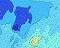 | 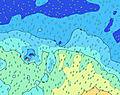 | 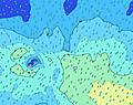 | 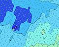 | |||||||||||||
Wave Height (m) Direction Period (s) | E 7 | E 7 | E 7 | E 7 | E 8 | E 7 | E 7 | E 7 | NNE 10 | NE 10 | E 7 | E 7 | E 8 | E 8 | E 8 | E 8 | E 8 | E 8 | E 8 | E 8 |
Wave Graph | ||||||||||||||||||||
223 | 181 | 159 | 131 | 115 | 70 | 70 | 51 | 11 | 16 | 107 | 94 | 90 | 72 | 28 | 55 | 55 | 61 | 47 | 47 | |
Wind (km/h) | ||||||||||||||||||||
Wind State on-shore cross-onshore cross-shore cross-offshore off-shore glassy | cross-on | on | on | cross-on | cross-on | glassy | glassy | cross | cross | cross | cross-on | cross-on | cross-on | cross-on | cross | cross-on | cross | cross-on | cross-on | cross-on |
High Tide | 00:40AM0.97m | 1:10PM0.86m | 1:38AM0.96m | 2:13PM0.84m | 2:33AM0.96m | 3:08PM0.84m | 3:21AM0.98m | 3:55PM0.86m | 4:04AM1.01m | 4:36PM0.89m | 4:44AM1.05m | 5:13PM0.92m | ||||||||
Low Tide | 7:02AM0.36m | 7:11PM0.38m | 8:09AM0.36m | 8:10PM0.38m | 9:06AM0.33m | 9:02PM0.37m | 9:52AM0.29m | 9:47PM0.33m | 10:32AM0.25m | 10:28PM0.29m | 11:09AM0.21m | 11:05PM0.26m | ||||||||
— | — | 6:52 | — | — | 6:52 | — | — | 6:52 | — | — | 6:50 | — | — | 6:50 | — | — | 6:50 | — | — | |
6:17 | — | — | 6:17 | — | — | 6:19 | — | — | 6:19 | — | — | 6:19 | — | — | 6:19 | — | — | 6:20 | — | |
mm | — | — | 1 | — | — | — | — | 3 | 1 | — | 1 | — | — | 3 | — | — | — | — | — | — |
Temp °C | 25 | 25 | 25 | 26 | 26 | 26 | 27 | 26 | 25 | 25 | 25 | 26 | 26 | 26 | 26 | 26 | 26 | 26 | 25 | 26 |
Feels °C | 23 | 24 | 26 | 27 | 27 | 29 | 31 | 26 | 24 | 25 | 25 | 27 | 27 | 27 | 27 | 27 | 27 | 27 | 25 | 26 |
Swell 1 Height (m) Direction Period (s) | SSE 12 | SSE 12 | SSE 11 | SSE 11 | E 8 | E 7 | E 7 | E 7 | SSW 15 | SSW 14 | SSW 13 | S 11 | S 11 | S 12 | S 13 | S 13 | S 12 | S 12 | S 12 | S 11 |
82 | 79 | 47 | 44 | 115 | 70 | 70 | 51 | 73 | 69 | 57 | 64 | 61 | 190 | 280 | 268 | 190 | 139 | 132 | 89 | |
Swell 2 Height (m) Direction Period (s) | SSW 19 | SSW 18 | SSW 17 | SSW 16 | S 20 | S 18 | S 17 | S 16 | NNE 10 | NE 10 | NE 9 | NNE 9 | NE 9 | NE 8 | E 8 | NE 8 | NE 8 | NE 8 | E 8 | E 8 |
125 | 106 | 100 | 53 | 194 | 238 | 154 | 129 | 11 | 16 | 23 | 32 | 20 | 18 | 28 | 17 | 17 | 9 | 47 | 47 | |
Swell 3 Height (m) Direction Period (s) | S 11 | S 10 | SW 16 | S 22 | SE 11 | SE 11 | SE 10 | NE 8 | SE 10 | SE 10 | SE 11 | S 16 | S 15 | NE 13 | NE 8 | ENE 12 | ENE 12 | NE 11 | NE 11 | NE 11 |
9 | 8 | 10 | 37 | 30 | 29 | 27 | 2 | 4 | 4 | 5 | 21 | 40 | 7 | 18 | 14 | 14 | 19 | 31 | 29 | |
Wind waves Height (m) Direction Period (s) | E 7 | E 7 | E 7 | E 7 | — | — | — | SSE 4 | ESE 6 | E 7 | E 7 | E 7 | E 8 | E 8 | ESE 4 | E 8 | E 8 | E 8 | — | — |
223 | 181 | 159 | 131 | — | — | — | 16 | 121 | 92 | 107 | 94 | 90 | 72 | 14 | 55 | 55 | 61 | — | — | |
Nearest Offshore or Glassy | ||||||||||||||||||||
Distance (km) | 611 | 28 | 28 | 28 | 28 | 0 | 0 | 1226 | 898 | 898 | 619 | 177 | 28 | 28 | 176 | 48 | 611 | 611 | 2266 | 619 |
Best forecast wave conditions in Savaii | ||||||||||||||||||||
Best forecast wave conditions in Samoa | ||||||||||||||||||||
Header Global | ||||||||||||||||||||
- Map Icons:
 Break
Break Live Wave Height (m)
 Live Wind Speed (km/h)
 Surf Rating (10 Max)
 Ocean Swells (m)
- Wind Speed (km/h)


FREE! Surf-Forecast.com widget for your website
The surf report / weather widget below is available to embed on third party websites free of charge and provides a summary of our Malama Lefts surf forecast. Simply grab the html code snippet that we provide and paste it into your own site. You can choose your preferred language and metric/imperial units for the surf forecast feed to suit users of your site. Click here to get the code.
Information about the Malama Lefts Surf forecast
The above surf forecast table for Malama Lefts provides essential information for determining whether the surfing conditions will be good over the next 16 days. A general guide to surfing at Malama Lefts can be found by selecting the local surf guide option on the grey menu. Our Malama Lefts surf forecast is unique since it includes wave energy (power) that defines the real feel of the surf rather than just the height or the period. If you surf the same spot (Malama Lefts) regularly then make a mental note of the wave energy from the surf forecast table each time you go. Very soon you may start to choose your surf days based on the wave energy alone combined with our forecast of favourable offshore wind conditions. Our star ratings will help here and of course you will also find the usual wave height and period predictions on our surf forecasts as well as a full break down of the swell components under our advanced users option (to reveal that, click the little Einstein character under the tide times).
Further information to help with frequently asked questions about our surf forecast for Malama Lefts may be found under the help tab on the top menu and also by moving your mouse over the question marks on the surf forecast table itself. Please always bear in mind that the forecast is for near-shore open water and local factors at each surf break influence the actual breaking wave height, such as the beach / reef profile, water depths offshore and shelter.
Malabar is 4 km (2 miles) from Maroubra. If you plan a holiday in Sydney South Coast, look for hotels and other accommodation in Maroubra. Maroubra has rooms for a wide range of budgets as well as car hire and transport links.
 Nearest