

Surf Forecasts:

Currumbin Point surf forecast from 31 Jul 2026:
- Best quality surf: Sunday 2 Aug, 4PM (local time) - 2ft (0.6m), 15s period, SE swell with cross-offshore winds.
- Most powerful swell: Sunday 2 Aug, 4PM (local time) - 2ft (0.6m), 15s period, SE swell with 171 kJ wave energy.
- Next surfable swell (1★+): Sunday 2 Aug, 1AM (local time) - 3.5ft (1.1m), 6s period with ESE swell.
Best Forecast Surf Conditions for Currumbin Point this week:
The surf forecast for Currumbin Point over the next 16 days: The first swell (rated 1 star or higher) is forecast to arrive on Sunday (Aug 02) at 1AM. The primary swell is predicted to be 1.1m and 6s period with a secondary swell of 0.4m and 10s. Another secondary swell of 0.2m and 8s is also forecast. The wind is predicted to be cross-offshore as the swell arrives.
The most powerful waves expected at Currumbin Point in the next 16 days are 0.6m 15s and forecast to arrive on Sunday (Aug 02) at 4PM. Winds are predicted to be cross-offshore at the time the swell arrives. The largest open ocean swell (not directed at the beach) is 1.1m 6s period and expected on Saturday (Aug 01) at 10PM.
| Wave Type | Time (AEST) & Date | Wave Height & Period |
|---|---|---|
| Next good surf (1 star+) | 1AM (Sun 2nd Aug) | 3.5ft (1.1m) 6s |
| Best Surf | 4PM (Sun 2nd Aug) | 2ft (0.6m) 15s |
| Most Powerful | 4PM (Sun 2nd Aug) | 2ft (0.6m) 15s |
Table - best surf conditions forecast for Currumbin Point over the next 16 days.
The Lowdown
Alright, Rusty here again. Let’s break it down.
The next couple of weeks are slow to start. The first few days are flat and messy, with no real surf. The first real chance to get wet doesn’t come until Sunday, the 2nd of August.
The best of the bunch is Sunday afternoon. We’re looking at a 2ft swell from the SE, but the period jumps up to 15 seconds – that’s real groundswell. The combined energy is 371 (moderate), and with a light breeze and cross-off wind, it’ll be clean. That’s the standout. It’s small, but for a point break like Currumbin Point, that long period will wrap around nicely.
Monday morning, the 3rd, is worth a mention too. Glassy conditions, 3ft from the SE with an 11-second period, and energy at 191 (moderate). It’s a small, clean morning wave. Not a stand-out, but better than the flat days before and after.
After that, it’s a long, dry gap. From the 4th right through to the 13th of August, it’s pretty much forgettable. Tiny, weak, or onshore. A few brief moments of glass in the mornings, but the wave heights are barely a ripple. The 13th shows a pulse of 3ft from the SE with a 9-second period, but the wind is stronger and it’s more of a same-again vibe.
The tail end of the forecast, on the 16th of August, throws up a bit more size: 5ft from the SE. But the period drops to a short, choppy 7 seconds, and the energy is 390 (moderate). The wind is cross-off which keeps it clean, but that short period will make it lumpy and less forgiving. It’s a late call, so keep an eye on it, but it ain’t the cleanest.
Water temp is sitting at 69°, which is about normal for this time of year. A bit of a chill, but nothing crazy.
So, for the whole 16-day window, your best bet is that Sunday afternoon session on the 2nd of August at Currumbin Point. It’s the only real standout. Everything else is a long, quiet wait.
Rusty.
Short Range ForecastLight rain (total 2mm), mostly falling on Sat afternoon. Very mild (max 17°C on Sat afternoon, min 14°C on Sun night). Wind will be generally light. | Days 4-6 Weather SummaryLight rain (total 3mm), mostly falling on Thu afternoon. Warm (max 20°C on Tue morning, min 14°C on Wed night). Wind will be generally light. | ||||||||||||||||||||
Saturday 1 | Sunday 2 | Monday 3 | Tuesday 4 | Wednesday 5 | Thursday 6 | Friday 7 | |||||||||||||||
AM | PM | Night | AM | PM | Night | AM | PM | Night | AM | PM | Night | AM | PM | Night | AM | PM | Night | AM | PM | Night | |
Swell Height Map |  |  |  |  | 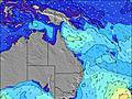 | 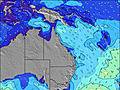 | 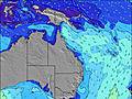 | ||||||||||||||
Wave Height (m) Direction Period (s) | SSE 6 | SE 10 | ESE 6 | SE 16 | SE 15 | SE 10 | SE 11 | SE 10 | SE 10 | ESE 9 | ESE 10 | E 9 | E 8 | E 8 | E 8 | E 8 | ESE 8 | E 7 | E 7 | E 7 | E 7 |
Wave Graph | |||||||||||||||||||||
30 | 28 | 77 | 66 | 171 | 82 | 137 | 127 | 98 | 30 | 38 | 76 | 86 | 78 | 43 | 34 | 22 | 24 | 38 | 40 | 40 | |
Wind (km/h) | |||||||||||||||||||||
Wind State on-shore cross-onshore cross-shore cross-offshore off-shore glassy | cross-off | cross-off | cross-off | cross-off | cross-off | off | glassy | cross-on | cross-off | cross-on | on | cross | glassy | cross | off | cross-off | cross | glassy | glassy | cross-on | off |
High Tide | 9:55PM1.72m | 10:22AM1.33m | 10:29PM1.64m | 11:03AM1.35m | 11:08PM1.54m | 11:50AM1.37m | 11:52PM1.41m | 12:47PM1.40m | 00:46AM1.28m | 1:54PM1.44m | 1:54AM1.16m | 3:09PM1.51m | 3:16AM1.09m | ||||||||
Low Tide | 3:26PM0.39m | 4:26AM0.32m | 4:07PM0.41m | 4:58AM0.31m | 4:52PM0.44m | 5:35AM0.31m | 5:47PM0.49m | 6:18AM0.31m | 6:54PM0.54m | 7:10AM0.32m | 8:18PM0.56m | 8:12AM0.33m | 9:49PM0.52m | ||||||||
6:28 | — | — | 6:28 | — | — | 6:26 | — | — | 6:26 | — | — | 6:26 | — | — | 6:24 | — | — | 6:24 | — | — | |
— | 5:15 | — | — | 5:15 | — | — | 5:16 | — | — | 5:16 | — | — | 5:17 | — | — | 5:17 | — | — | 5:19 | — | |
mm | — | 2 | — | — | — | — | — | — | — | — | — | — | — | — | — | — | 1 | 2 | — | — | — |
Temp °C | 16 | 17 | 17 | 17 | 17 | 15 | 17 | 17 | 16 | 20 | 19 | 17 | 20 | 18 | 15 | 17 | 17 | 17 | 18 | 18 | 16 |
Feels °C | 13 | 13 | 13 | 14 | 15 | 14 | 16 | 15 | 15 | 17 | 17 | 15 | 18 | 15 | 13 | 15 | 16 | 16 | 16 | 16 | 15 |
Swell 1 Height (m) Direction Period (s) | E 5 | SE 10 | SE 10 | ESE 6 | SE 10 | E 6 | E 6 | SE 10 | SE 10 | ESE 9 | SE 8 | E 9 | E 8 | E 8 | E 8 | ENE 7 | ENE 7 | E 7 | E 7 | E 7 | E 7 |
14 | 28 | 35 | 66 | 51 | 50 | 38 | 127 | 98 | 30 | 32 | 76 | 86 | 78 | 43 | 31 | 20 | 24 | 38 | 40 | 40 | |
Swell 2 Height (m) Direction Period (s) | SE 10 | ENE 6 | E 8 | SE 10 | ESE 15 | SE 10 | SE 11 | E 6 | ENE 6 | ENE 7 | ESE 10 | NNE 3 | E 18 | E 18 | ENE 8 | E 8 | ESE 8 | ESE 8 | SE 11 | SE 10 | SE 10 |
17 | 4 | 5 | 34 | 85 | 82 | 137 | 26 | 11 | 17 | 38 | 1 | 6 | 6 | 38 | 34 | 22 | 11 | 18 | 27 | 25 | |
Swell 3 Height (m) Direction Period (s) | ENE 6 | E 9 | E 17 | SE 16 | SE 15 | ESE 14 | ESE 13 | E 15 | E 14 | SE 9 | ENE 6 | E 19 | NE 9 | S 9 | E 18 | E 16 | SE 11 | SSE 10 | E 15 | E 15 | NE 7 |
4 | 2 | 6 | 63 | 171 | 73 | 16 | 4 | 4 | 20 | 11 | 7 | 3 | 1 | 6 | 5 | 4 | 10 | 4 | 4 | 8 | |
Wind waves Height (m) Direction Period (s) | SSE 6 | SE 6 | ESE 6 | ESE 6 | E 6 | — | — | — | — | — | NE 2 | — | — | — | — | SSE 4 | ESE 2 | — | — | — | — |
30 | 36 | 77 | 22 | 64 | — | — | — | — | — | 1 | — | — | — | — | 1 | 1 | — | — | — | — | |
Nearest Offshore or Glassy | |||||||||||||||||||||
Distance (km) | 6 | 6 | 0 | 0 | 0 | 0 | 0 | 7 | 0 | 5 | 21 | 2 | 0 | 7 | 0 | 0 | 7 | 2 | 2 | 7 | 0 |
Best forecast wave conditions in Gold Coast | |||||||||||||||||||||
Best forecast wave conditions in Australia | |||||||||||||||||||||
Header Global | |||||||||||||||||||||
- Map Icons:
 Break
Break Live Wave Height (m)
 Live Wind Speed (km/h)
 Surf Rating (10 Max)
 Ocean Swells (m)
- Wind Speed (km/h)
Latest Updates


FREE! Surf-Forecast.com widget for your website
The surf report / weather widget below is available to embed on third party websites free of charge and provides a summary of our Currumbin Point surf forecast. Simply grab the html code snippet that we provide and paste it into your own site. You can choose your preferred language and metric/imperial units for the surf forecast feed to suit users of your site. Click here to get the code.
Information about the Currumbin Point Surf forecast
The above surf forecast table for Currumbin Point provides essential information for determining whether the surfing conditions will be good over the next 16 days. A general guide to surfing at Currumbin Point can be found by selecting the local surf guide option on the grey menu. Our Currumbin Point surf forecast is unique since it includes wave energy (power) that defines the real feel of the surf rather than just the height or the period. If you surf the same spot (Currumbin Point) regularly then make a mental note of the wave energy from the surf forecast table each time you go. Very soon you may start to choose your surf days based on the wave energy alone combined with our forecast of favourable offshore wind conditions. Our star ratings will help here and of course you will also find the usual wave height and period predictions on our surf forecasts as well as a full break down of the swell components under our advanced users option (to reveal that, click the little Einstein character under the tide times).
Further information to help with frequently asked questions about our surf forecast for Currumbin Point may be found under the help tab on the top menu and also by moving your mouse over the question marks on the surf forecast table itself. Please always bear in mind that the forecast is for near-shore open water and local factors at each surf break influence the actual breaking wave height, such as the beach / reef profile, water depths offshore and shelter.
Currumbin Point is 10 km (6 miles) from Banora Point. If you plan a holiday in Gold Coast, look for hotels and other accommodation in Banora Point. Banora Point has rooms for a wide range of budgets as well as car hire and transport links.
 Nearest