

Surf Forecasts:

Palm beach surf forecast from 8 Jul 2026:
- Best quality surf: Wednesday 8 Jul, 7PM (local time) - 10ft (3.0m), 11s period, SSE swell with cross-offshore winds.
- Most powerful swell: Wednesday 8 Jul, 7PM (local time) - 10ft (3.0m), 11s period, SSE swell with 2,128 kJ wave energy.
- Next surfable swell (1★+): Wednesday 8 Jul, 7PM (local time) - 10ft (3.0m), 11s period with SSE swell.
Best Forecast Surf Conditions for Palm beach this week:
The surf forecast for Palm beach over the next 16 days: The first swell (rated 1 star or higher) is forecast to arrive on Wednesday (Jul 08) at 7PM. The primary swell is predicted to be 3.0m and 11s period with a secondary swell of 1.8m and 11s. The wind is predicted to be cross-offshore as the swell arrives.
The most powerful waves expected at Palm beach in the next 16 days are 3.0m 11s and forecast to arrive on Wednesday (Jul 08) at 7PM. Winds are predicted to be cross-offshore at the time the swell arrives. The largest open ocean swell (not directed at the beach) is 0.4m 3s period and expected on Thursday (Jul 09) at 1PM.
| Wave Type | Time (AEST) & Date | Wave Height & Period |
|---|---|---|
| Next good surf (1 star+) | 7PM (Wed 8th Jul) | 10ft (3.0m) 11s |
| Best Surf | 7PM (Wed 8th Jul) | 10ft (3.0m) 11s |
| Most Powerful | 7PM (Wed 8th Jul) | 10ft (3.0m) 11s |
Table - best surf conditions forecast for Palm beach over the next 16 days.
Alright folks, Rusty here. Let's have a look at what Palm Beach has got cookin' for the next couple of weeks.
Right now, there's a bit of a wait. The surf's not really on the table until Wednesday, July 8th, and even then, it's a bit of a mixed bag for a few days.
The first proper swell we see rolls in on Wednesday morning, July 8th. We're looking at a 6ft swell from the SE with an 11-second period. The water temp is sitting at a pretty normal 70°, so nothing wild there. That SE swell direction is a bit off from the optimum for the break, and we've got a solid cross-off wind from the south at 16 mph. It’s surfable, but the energy is only moderate (875) and the forecast calls it marginal. Not the day to clear the calendar.
Thursday, July 9th, the morning kicks up a bit more size – 8ft from the SSE with that same 11-second period. The energy jumps up to strong (1707), but the wind is still a cross-off from the south. That size strays into the too-big-for-beginners territory, and the conditions are still only rated marginal. It's a step up from Wednesday, but still not clean, lined-up perfection.
Honestly, the standout for this whole stretch is looking like Saturday morning, July 11th. Don't get too excited by the numbers – it's only 3ft from the SE. But the kicker is the wind. It’s glassy. Dead calm from the WNW at 3 mph. For a break that can get a bit of a crowd, this morning window is your best bet for the cleanest, most user-friendly surf. The period is a short-ish 10 seconds, so it won't be packing a massive punch, but for a longboard or a funboard, that glassy 3ft is going to be a whole lot more fun than the choppier 7ft days.
After that, the energy drops right off. From Sunday, July 12th, all the way through the rest of the forecast, we're looking at very small surf, mostly under 2ft, with poor conditions. There are a few glassy mornings in there, like on the 15th and 20th, but with wave energy down to single digits (10 and 20), you'd be hard-pressed to get wet. There's a brief uptick on the afternoon of Monday, July 20th, with a 4ft SSE pulse, but the wind is a cross-onshore and conditions are flagged as poor.
So, in a nutshell: wait for the glassy Saturday morning of July 11th if you want clean, small waves. Everything else is either too small, too messy, or too far away. The long-range stuff into the third week looks very flat, so enjoy that Saturday window if you can.
Rusty.
Short Range ForecastLight rain (total 3mm), mostly falling on Thu afternoon. Very mild (max 18°C on Wed morning, min 13°C on Thu night). Wind will be generally light. | Days 4-6 Weather SummaryMostly dry. Warm (max 21°C on Sun afternoon, min 11°C on Mon night). Wind will be generally light. | ||||||||||||||||||||
Wednesday 8 | Thursday 9 | Friday 10 | Saturday 11 | Sunday 12 | Monday 13 | Tuesday 14 | |||||||||||||||
AM | PM | Night | AM | PM | Night | AM | PM | Night | AM | PM | Night | AM | PM | Night | AM | PM | Night | AM | PM | Night | |
Swell Height Map | 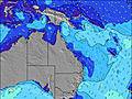 |  |  | 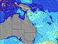 | 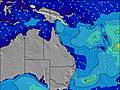 | 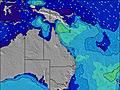 | 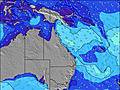 | ||||||||||||||
Wave Height (m) Direction Period (s) | SE 11 | SE 11 | SE 11 | SSE 11 | ESE 10 | SE 10 | SE 10 | SSE 10 | SE 11 | SE 10 | ESE 12 | ESE 11 | ESE 10 | ESE 10 | ESE 10 | ESE 9 | ESE 9 | ESE 10 | ESE 10 | ESE 10 | ESE 10 |
Wave Graph | |||||||||||||||||||||
875 | 778 | 1745 | 1254 | 354 | 356 | 250 | 778 | 220 | 115 | 275 | 180 | 141 | 90 | 65 | 35 | 32 | 10 | 10 | 10 | 9 | |
Wind (km/h) | |||||||||||||||||||||
Wind State on-shore cross-onshore cross-shore cross-offshore off-shore glassy | cross-off | cross-off | cross-off | cross-off | cross-off | cross-off | cross-off | cross | cross-off | glassy | cross-on | cross-off | cross-off | cross-off | off | cross | cross-off | off | glassy | on | cross-off |
High Tide | 2:14PM1.23m | 2:04AM1.20m | 3:19PM1.35m | 3:17AM1.09m | 4:24PM1.50m | 4:33AM1.03m | 5:26PM1.66m | 5:42AM1.01m | 6:23PM1.81m | 6:42AM1.03m | 7:17PM1.92m | 7:36AM1.07m | 8:07PM1.98m | ||||||||
Low Tide | 8:12PM0.48m | 8:35AM0.20m | 9:42PM0.45m | 9:32AM0.19m | 11:06PM0.35m | 10:33AM0.16m | 00:16AM0.23m | 11:31AM0.09m | 1:15AM0.13m | 12:27PM0.02m | 2:06AM0.05m | 1:19PM-0.03m | 2:53AM0.01m | ||||||||
6:37 | — | — | 6:37 | — | — | 6:37 | — | — | 6:37 | — | — | 6:37 | — | — | 6:37 | — | — | 6:37 | — | — | |
— | 5:04 | — | — | 5:04 | — | — | 5:04 | — | — | 5:05 | — | — | 5:05 | — | — | 5:06 | — | — | 5:06 | — | |
mm | — | — | — | — | 2 | 1 | — | — | — | — | — | — | — | — | — | — | — | — | — | — | — |
Temp °C | 18 | 18 | 16 | 18 | 15 | 15 | 17 | 17 | 15 | 18 | 18 | 16 | 20 | 21 | 15 | 18 | 20 | 15 | 16 | 16 | 14 |
Feels °C | 13 | 13 | 12 | 14 | 12 | 12 | 14 | 14 | 13 | 16 | 15 | 14 | 15 | 17 | 11 | 15 | 17 | 11 | 13 | 14 | 12 |
Swell 1 Height (m) Direction Period (s) | — | — | SE 11 | SE 11 | ESE 10 | SE 10 | SE 10 | SE 10 | SE 11 | SE 10 | ESE 12 | ESE 11 | ESE 10 | ESE 10 | ESE 10 | ESE 9 | ESE 9 | ESE 8 | ESE 10 | ESE 10 | ESE 10 |
— | — | 615 | 453 | 354 | 356 | 250 | 265 | 220 | 115 | 275 | 180 | 141 | 90 | 65 | 35 | 32 | 7 | 10 | 10 | 9 | |
Swell 2 Height (m) Direction Period (s) | — | — | — | — | — | — | ESE 14 | — | — | ESE 13 | SE 12 | SSE 9 | S 9 | SSE 9 | SSE 8 | SSE 8 | S 6 | ESE 10 | ESE 8 | SE 7 | — |
— | — | — | — | — | — | 79 | — | — | 101 | 273 | 84 | 40 | 25 | 22 | 13 | 7 | 10 | 6 | 2 | — | |
Swell 3 Height (m) Direction Period (s) | — | — | — | — | — | — | — | — | — | — | — | — | — | — | — | — | S 8 | S 10 | — | SE 4 | — |
— | — | — | — | — | — | — | — | — | — | — | — | — | — | — | — | 6 | 2 | — | 1 | — | |
Wind waves Height (m) Direction Period (s) | SE 11 | SE 11 | SE 11 | SSE 11 | S 3 | — | — | SSE 10 | — | — | — | NW 3 | NW 2 | WNW 3 | WNW 2 | — | — | — | S 4 | — | — |
875 | 778 | 1745 | 1254 | 3 | — | — | 778 | — | — | — | 2 | 2 | 3 | 1 | — | — | — | 5 | — | — | |
Nearest Offshore or Glassy | |||||||||||||||||||||
Distance (km) | 9 | 9 | 0 | 2 | 2 | 0 | 2 | 4 | 0 | 0 | 61 | 0 | 2 | 0 | 0 | 2 | 0 | 10 | 66 | 346 | 283 |
Best forecast wave conditions in Gold Coast | |||||||||||||||||||||
Best forecast wave conditions in Australia | |||||||||||||||||||||
Header Global | |||||||||||||||||||||
- Map Icons:
 Break
Break Live Wave Height (m)
 Live Wind Speed (km/h)
 Surf Rating (10 Max)
 Ocean Swells (m)
- Wind Speed (km/h)


FREE! Surf-Forecast.com widget for your website
The surf report / weather widget below is available to embed on third party websites free of charge and provides a summary of our Palm beach surf forecast. Simply grab the html code snippet that we provide and paste it into your own site. You can choose your preferred language and metric/imperial units for the surf forecast feed to suit users of your site. Click here to get the code.
Information about the Palm beach Surf forecast
The above surf forecast table for Palm beach provides essential information for determining whether the surfing conditions will be good over the next 16 days. A general guide to surfing at Palm beach can be found by selecting the local surf guide option on the grey menu. Our Palm beach surf forecast is unique since it includes wave energy (power) that defines the real feel of the surf rather than just the height or the period. If you surf the same spot (Palm beach) regularly then make a mental note of the wave energy from the surf forecast table each time you go. Very soon you may start to choose your surf days based on the wave energy alone combined with our forecast of favourable offshore wind conditions. Our star ratings will help here and of course you will also find the usual wave height and period predictions on our surf forecasts as well as a full break down of the swell components under our advanced users option (to reveal that, click the little Einstein character under the tide times).
Further information to help with frequently asked questions about our surf forecast for Palm beach may be found under the help tab on the top menu and also by moving your mouse over the question marks on the surf forecast table itself. Please always bear in mind that the forecast is for near-shore open water and local factors at each surf break influence the actual breaking wave height, such as the beach / reef profile, water depths offshore and shelter.
Palm beach is 13 km (8 miles) from Surfers Paradise. If you plan a holiday in Gold Coast, look for hotels and other accommodation in Surfers Paradise. Surfers Paradise has rooms for a wide range of budgets as well as car hire and transport links.
 Nearest