

Surf Forecasts:

Turtles surf forecast from 3 Aug 2026:
- Best quality surf: Thursday 6 Aug, 11AM (local time) - 8ft (2.5m), 16s period, WSW swell with cross-offshore winds.
- Most powerful swell: Sunday 9 Aug, 11AM (local time) - 10ft (3.0m), 17s period, SW swell with 4,867 kJ wave energy.
- Next surfable swell (1★+): Tuesday 4 Aug, 11PM (local time) - 6.5ft (2.0m), 18s period with WSW swell.
Best Forecast Surf Conditions for Turtles this week:
The surf forecast for Turtles over the next 16 days: The first swell (rated 1 star or higher) is forecast to arrive on Tuesday (Aug 04) at 11PM. The primary swell is predicted to be 2.0m and 18s period with a secondary swell of 0.7m and 5s. The wind is predicted to be cross-offshore as the swell arrives.
The most powerful waves expected at Turtles in the next 16 days are 3.0m 17s and forecast to arrive on Sunday (Aug 09) at 11AM. Winds are predicted to be cross-offshore at the time the swell arrives. The largest open ocean swell (not directed at the beach) is 1.1m 5s period and expected on Monday (Aug 10) at 2AM.
| Wave Type | Time (AWST) & Date | Wave Height & Period |
|---|---|---|
| Next good surf (1 star+) | 11PM (Tue 4th Aug) | 6.5ft (2.0m) 18s |
| Best Surf | 11AM (Thu 6th Aug) | 8ft (2.5m) 16s |
| Most Powerful | 11AM (Sun 9th Aug) | 10ft (3.0m) 17s |
Table - best surf conditions forecast for Turtles over the next 16 days.
The Lowdown
G’day, I’m Rusty. Let’s talk about Turtles – a reef break that’s wide open to the swell and needs that SSW direction to really fire. This one’s for the advanced surfers only, fairly consistent, but you’ll have company because crowds are often padding out back. Water temp’s about normal for the season, nothing weird.
Tuesday starts slow: 1.3m swell from the WSW, 16-second period, but it’s only marginal thanks to a cross-off breeze and moderate energy (1113). Tuesday afternoon bumps to 1.6m with a 19-second period (1778 energy) – still not quite clicking.
Wednesday brings 2.3m in the morning (2648 energy), holding at 2.1m in the afternoon – solid groundswell, but the cross-off wind keeps it from being perfect. Thursday morning is where it gets real: 2.5m from the WSW, 16 seconds, with a gentle SSE breeze and clean conditions – 3548 energy, moderate-to-strong. The forecast calls it excellent for experienced surfers. That’s the one to aim for.
Friday morning cleans up again with 2.2m (2488 energy) and a light NE breeze – proper lines. Then Friday afternoon the wind goes onshore from the WSW and it’s done. Saturday gets messy with a fresh S breeze, and Sunday we’ve got 3.0m from the SW (4877 energy) – that’s very strong energy, big and clean, but over 2.5m means experts only. That long 17-second period will have it bending around the reef in lully sets.
Monday the 10th is blown out by strong S winds, Tuesday the 11th is 1.9m with a strong breeze – not worth it. Mid-week is quiet, but Thursday the 13th morning has a nice offshore from the ESE with 2.1m (2119 energy) – clean.
Second week: Friday the 14th morning is a beauty – 1.6m from the SW, 15-second period, with a clean offshore from the ENE (1096 energy). That’s a session for the purists. Saturday the 15th picks up to 2.0m (2136 energy) with a gentle NE cross-off – clean again. Monday the 17th morning is the big one: 3.0m from the WSW (4330 energy), 16 seconds, with a light ESE offshore – epic for the advanced crew, but watch the long-range forecast.
After that, the swell fades and the winds turn chunky. Best calls: Thursday 6th August morning, Friday 14th August morning, and Monday 17th August morning. Turtles is the only break on the menu.
Rusty.
Short Range ForecastHeavy rain (total 24mm), heaviest during Tue morning. Warm (max 23°C on Wed afternoon, min 18°C on Tue morning). Winds decreasing (fresh winds from the NNE on Mon night, light winds from the NE by Tue night). | Days 5-7 Weather SummaryMostly dry. Warm (max 22°C on Sat afternoon, min 15°C on Sun morning). Winds increasing (light winds from the WNW on Fri afternoon, fresh winds from the SSE by Sat night). | ||||||||||||||||||
Tuesday 4 | Wednesday 5 | Thursday 6 | Friday 7 | Saturday 8 | Sunday 9 | ||||||||||||||
Night | AM | PM | Night | AM | PM | Night | AM | PM | Night | AM | PM | Night | AM | PM | Night | AM | PM | Night | |
Swell Height Map |  |  |  |  | 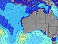 | 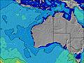 | 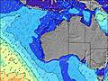 | ||||||||||||
Wave Height (m) Direction Period (s) | SW 14 | WSW 16 | WSW 19 | WSW 17 | WSW 16 | WSW 16 | WSW 16 | WSW 16 | WSW 16 | WSW 16 | WSW 16 | SW 16 | SW 15 | WSW 15 | WSW 15 | SW 15 | SW 17 | SW 16 | SW 16 |
Wave Graph | |||||||||||||||||||
857 | 811 | 1753 | 2594 | 2648 | 2178 | 3100 | 3548 | 3548 | 3024 | 2472 | 2291 | 2401 | 2098 | 1885 | 2482 | 4867 | 4498 | 3482 | |
Wind (km/h) | |||||||||||||||||||
Wind State on-shore cross-onshore cross-shore cross-offshore off-shore glassy | cross | cross-off | cross-off | cross-off | cross-off | cross-off | cross-off | cross-off | cross | cross | cross-off | on | cross-off | cross-off | cross | cross-off | cross-off | cross-off | cross-off |
High Tide | 1:21AM1.10m | 1:16PM0.90m | 1:48AM1.15m | 2:00PM0.80m | 2:19AM1.17m | 2:52PM0.69m | 2:57AM1.19m | 4:03PM0.58m | 3:46AM1.19m | 6:11PM0.52m | 4:52AM1.18m | ||||||||
Low Tide | 7:25AM0.37m | 7:03PM0.28m | 8:11AM0.34m | 7:24PM0.34m | 9:07AM0.33m | 7:45PM0.40m | 10:20AM0.32m | 8:03PM0.45m | 12:03PM0.30m | 8:07PM0.50m | 1:47PM0.23m | ||||||||
— | 7:00 | — | — | 7:00 | — | — | 6:58 | — | — | 6:58 | — | — | 6:58 | — | — | 6:56 | — | — | |
6:02 | — | 6:04 | — | — | 6:04 | — | — | 6:05 | — | — | 6:05 | — | — | 6:05 | — | — | 6:06 | — | |
mm | 9 | 9 | 4 | 2 | — | — | — | — | — | — | — | — | — | — | — | — | — | — | — |
Temp °C | 20 | 19 | 18 | 19 | 20 | 23 | 21 | 21 | 23 | 21 | 20 | 21 | 21 | 20 | 22 | 19 | 18 | 22 | 18 |
Feels °C | 15 | 16 | 17 | 20 | 18 | 21 | 19 | 20 | 21 | 19 | 20 | 21 | 20 | 16 | 17 | 12 | 12 | 17 | 11 |
Swell 1 Height (m) Direction Period (s) | SW 14 | WSW 16 | WSW 19 | WSW 17 | WSW 16 | WSW 16 | WSW 16 | WSW 16 | WSW 16 | WSW 16 | WSW 16 | SW 16 | SW 15 | WSW 15 | WSW 15 | SW 15 | SW 17 | SW 16 | SW 16 |
857 | 811 | 1753 | 2594 | 2648 | 2178 | 3100 | 3548 | 3548 | 3024 | 2472 | 2291 | 2401 | 2098 | 1885 | 2482 | 4867 | 4498 | 3482 | |
Swell 2 Height (m) Direction Period (s) | W 12 | N 6 | N 5 | N 6 | NNE 6 | — | — | — | — | — | WNW 13 | NW 12 | NW 11 | NW 11 | NW 11 | WSW 18 | WNW 10 | WNW 10 | W 21 |
3 | 75 | 25 | 21 | 11 | — | — | — | — | — | 16 | 23 | 33 | 31 | 29 | 778 | 10 | 10 | 449 | |
Swell 3 Height (m) Direction Period (s) | — | W 21 | — | — | — | — | — | — | — | — | — | — | — | — | — | NW 11 | — | — | — |
— | 227 | — | — | — | — | — | — | — | — | — | — | — | — | — | 18 | — | — | — | |
Wind waves Height (m) Direction Period (s) | N 6 | — | ENE 3 | — | — | — | — | — | — | — | — | — | SSW 4 | SSW 5 | S 5 | SSE 4 | — | S 5 | S 5 |
173 | — | 4 | — | — | — | — | — | — | — | — | — | 12 | 35 | 88 | 33 | — | 42 | 54 | |
Nearest Offshore or Glassy | |||||||||||||||||||
Distance (km) | 243 | 251 | 241 | 0 | 7 | 25 | 25 | 0 | 545 | 241 | 0 | 241 | 1693 | 1693 | 1700 | 424 | 521 | 251 | 424 |
Best forecast wave conditions in North West WA | |||||||||||||||||||
Best forecast wave conditions in Australia | |||||||||||||||||||
Header Global | |||||||||||||||||||
- Map Icons:
 Break
Break Live Wave Height (m)
 Live Wind Speed (km/h)
 Surf Rating (10 Max)
 Ocean Swells (m)
- Wind Speed (km/h)
Latest Updates


FREE! Surf-Forecast.com widget for your website
The surf report / weather widget below is available to embed on third party websites free of charge and provides a summary of our Turtles surf forecast. Simply grab the html code snippet that we provide and paste it into your own site. You can choose your preferred language and metric/imperial units for the surf forecast feed to suit users of your site. Click here to get the code.
Information about the Turtles Surf forecast
The above surf forecast table for Turtles provides essential information for determining whether the surfing conditions will be good over the next 16 days. A general guide to surfing at Turtles can be found by selecting the local surf guide option on the grey menu. Our Turtles surf forecast is unique since it includes wave energy (power) that defines the real feel of the surf rather than just the height or the period. If you surf the same spot (Turtles) regularly then make a mental note of the wave energy from the surf forecast table each time you go. Very soon you may start to choose your surf days based on the wave energy alone combined with our forecast of favourable offshore wind conditions. Our star ratings will help here and of course you will also find the usual wave height and period predictions on our surf forecasts as well as a full break down of the swell components under our advanced users option (to reveal that, click the little Einstein character under the tide times).
Further information to help with frequently asked questions about our surf forecast for Turtles may be found under the help tab on the top menu and also by moving your mouse over the question marks on the surf forecast table itself. Please always bear in mind that the forecast is for near-shore open water and local factors at each surf break influence the actual breaking wave height, such as the beach / reef profile, water depths offshore and shelter.
 Nearest