

Surf Forecasts:

Drummonds surf forecast from 2 Aug 2026:
- Best quality surf: Tuesday 4 Aug, 8PM (local time) - 8ft (2.4m), 17s period, SW swell with cross-offshore winds.
- Most powerful swell: Saturday 8 Aug, 5PM (local time) - 11ft (3.5m), 16s period, SW swell with 6,285 kJ wave energy.
- Next surfable swell (1★+): Sunday 2 Aug, 5PM (local time) - 7ft (2.1m), 14s period with SW swell.
Best Forecast Surf Conditions for Drummonds this week:
The surf forecast for Drummonds over the next 16 days: The first swell (rated 1 star or higher) is forecast to arrive on Sunday (Aug 02) at 5PM. The primary swell is predicted to be 2.1m and 14s period. The wind is predicted to be cross-offshore as the swell arrives.
The most powerful waves expected at Drummonds in the next 16 days are 3.5m 16s and forecast to arrive on Saturday (Aug 08) at 5PM. Winds are predicted to be cross-offshore at the time the swell arrives. The largest open ocean swell (not directed at the beach) is 0.5m 4s period and expected on Sunday (Aug 02) at 11PM.
| Wave Type | Time (AWST) & Date | Wave Height & Period |
|---|---|---|
| Next good surf (1 star+) | 5PM (Sun 2nd Aug) | 7ft (2.1m) 14s |
| Best Surf | 8PM (Tue 4th Aug) | 8ft (2.4m) 17s |
| Most Powerful | 5PM (Sat 8th Aug) | 11ft (3.5m) 16s |
Table - best surf conditions forecast for Drummonds over the next 16 days.
The Lowdown
Alright, Rusty here. Let’s talk about what we’ve got coming up at Drummonds.
We’ve got a solid run of surf on the way, but it’s not all clean, you gotta pick your moments. The water’s sitting at 67°F, a bit colder than we’d normally expect for this time of year, so you’ll want the thick rubber.
Sunday the 2nd kicks it off with a clean 8ft SW swell, period a long 14 seconds, and a moderate cross-off breeze. The combined energy is pumping at 2216 (moderate), but it’s one for the experienced crew at that size. Sunday afternoon holds similar lines, a touch smaller at 7ft, still clean, still cross-off. Decent way to start.
Monday the 3rd gets messy. The swell drops to 5ft, but the wind swings cross-on and it gets choppy. I’d give it a miss. Tuesday the 4th is a weird one: a very long 19 second period groundswell, but only 5ft in the morning. That long period will make it break straight, better for a point or reef, but Drummonds might be a bit tricky. The combined energy is still good (1888) but it’s cross-shore and light, with small ripples. Afternoon bumps to 8ft with a longer 18 second period, but the cross-shore wind puts a chop on it. Worth a look if you’re keen, but not perfect.
Wednesday the 5th cleans up with a 7ft SW groundswell, 16 seconds, and a cross-off breeze. Nice lines. Afternoon gets bigger at 8ft, but the cross-shore wind chops it up a touch. Still rideable.
Now, the standout in this whole window is Thursday the 6th morning. Swell hits 10ft from the SW, 16 second period, with a light cross-onshore wind that’s just enough to keep it lined up. The combined energy is a massive 4751 (strong). This is big, powerful, proper groundswell. Only for experts – anyone else will be in over their head.
Friday the 7th afternoon also looks strong: 10ft, 16 seconds, cross-shore wind, and the energy jumps to 8210 (very strong). That’s a lot of water moving around. Good for the experienced, but you’ll be working hard.
Saturday the 8th afternoon keeps the swell pumping at 12ft from the SW, 16 seconds, combined energy of 6285 (strong), and it’s clean with a cross-off breeze. Another expert-only session.
Sunday the 9th morning is a real jewel. You’ve got 10ft SW groundswell, 16 seconds, and a clean offshore wind from the East. That’s as good as it gets for a session when it’s big. The combined energy sits at 3904 (strong). This is the best on offer for clean, powerful waves.
The second week gets a bit rougher. The 10th and 11th are blown out with onshore winds, and the 11th has thunderstorms with 25 mph winds – hide your boards. The 12th is a write-off too: strong cross-shore winds and lumpy, poor surf. The 13th cleans up for the morning with 10ft and a cross-off wind, but the energy is still high (4899). By the 15th (Saturday morning), you’ve got a clean 8ft SW groundswell, 16 seconds, and a moderate offshore breeze. Very solid, very clean. The 16th drops right off to 4ft with an offshore wind – small, clean, beginner-friendly. The 17th has a small 5ft swell but a light offshore in the afternoon, which could be a fun little session if you’re not after power.
Overall, the big standout is Thursday morning the 6th for power, and Sunday the 9th for clean, big waves. If you’re experienced, don’t miss those. If you’re learning, wait for the 16th or 17th.
- Rusty
Short Range ForecastLight rain (total 5mm), mostly falling on Tue morning. Warm (max 22°C on Sun afternoon, min 12°C on Sun morning). Wind will be generally light. | Days 4-6 Weather SummarySome drizzle, heaviest during Fri afternoon. Very mild (max 18°C on Wed afternoon, min 13°C on Wed night). Wind will be generally light. | ||||||||||||||||||||
Sunday 2 | Monday 3 | Tuesday 4 | Wednesday 5 | Thursday 6 | Friday 7 | Saturday 8 | |||||||||||||||
AM | PM | Night | AM | PM | Night | AM | PM | Night | AM | PM | Night | AM | PM | Night | AM | PM | Night | AM | PM | Night | |
Swell Height Map |  |  |  | 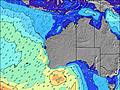 | 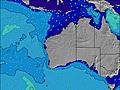 | 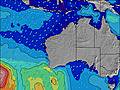 | 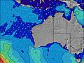 | ||||||||||||||
Wave Height (m) Direction Period (s) | SW 14 | SW 14 | SW 13 | SW 15 | SW 15 | SW 16 | SW 19 | SW 18 | SW 17 | SW 16 | SW 16 | SW 16 | SW 16 | SW 16 | SW 16 | SW 16 | SW 16 | SW 15 | SW 15 | SW 16 | SW 16 |
Wave Graph | |||||||||||||||||||||
2216 | 1632 | 984 | 1108 | 936 | 803 | 1460 | 3304 | 3243 | 2269 | 3345 | 4580 | 4751 | 3756 | 2790 | 3182 | 4560 | 4385 | 3624 | 6285 | 5377 | |
Wind (km/h) | |||||||||||||||||||||
Wind State on-shore cross-onshore cross-shore cross-offshore off-shore glassy | cross-off | cross-off | cross-off | cross-on | cross-on | cross | cross | cross | off | cross-off | cross | off | cross-on | cross-on | on | on | cross | cross | cross-off | cross-off | cross-off |
High Tide | 10:54AM0.53m | 1:47AM0.47m | 11:13AM0.46m | 2:07AM0.52m | 11:13AM0.38m | 2:33AM0.57m | 10:17AM0.30m | 3:09AM0.62m | 3:57AM0.66m | 4:55AM0.70m | |||||||||||
Low Tide | 6:14PM0.15m | 6:17AM0.34m | 6:26PM0.17m | 7:27AM0.32m | 6:35PM0.20m | 9:15AM0.30m | 6:37PM0.21m | 2:16PM0.18m | 2:43PM0.09m | 3:19PM0.02m | |||||||||||
7:03 | — | — | 7:03 | — | — | 7:03 | — | — | 7:01 | — | — | 7:01 | — | — | 7:01 | — | — | 7:00 | — | — | |
— | 5:51 | — | — | 5:51 | — | — | 5:52 | — | — | 5:52 | — | — | 5:52 | — | — | 5:53 | — | — | 5:53 | — | |
mm | — | — | — | — | — | 1 | 4 | — | — | — | — | — | — | — | — | — | 1 | — | — | — | — |
Temp °C | 18 | 22 | 18 | 20 | 21 | 19 | 18 | 18 | 17 | 17 | 18 | 16 | 17 | 18 | 17 | 18 | 18 | 16 | 17 | 18 | 15 |
Feels °C | 14 | 20 | 14 | 16 | 17 | 18 | 18 | 16 | 15 | 13 | 15 | 12 | 16 | 15 | 13 | 13 | 15 | 11 | 13 | 14 | 11 |
Swell 1 Height (m) Direction Period (s) | SW 14 | SW 14 | SW 13 | SW 15 | SW 15 | SW 16 | SW 19 | SW 18 | SW 17 | SW 16 | SW 16 | SW 16 | SW 16 | SW 16 | SW 16 | SW 16 | SW 16 | SW 15 | SW 15 | SW 16 | SW 16 |
2216 | 1632 | 984 | 1108 | 936 | 803 | 1460 | 3304 | 3243 | 2269 | 3345 | 4580 | 4751 | 3756 | 2790 | 3182 | 4560 | 4385 | 3624 | 6285 | 5377 | |
Swell 2 Height (m) Direction Period (s) | — | — | SW 18 | — | — | W 5 | SW 14 | — | — | — | — | — | — | — | — | — | — | — | — | — | SW 26 |
— | — | 319 | — | — | 18 | 366 | — | — | — | — | — | — | — | — | — | — | — | — | — | 26 | |
Swell 3 Height (m) Direction Period (s) | — | — | — | — | — | SW 22 | WSW 6 | — | — | — | — | — | — | — | — | — | — | — | — | — | — |
— | — | — | — | — | 75 | 62 | — | — | — | — | — | — | — | — | — | — | — | — | — | — | |
Wind waves Height (m) Direction Period (s) | — | — | — | — | WNW 3 | W 5 | — | — | — | — | — | — | — | — | — | — | SW 16 | SW 15 | — | — | — |
— | — | — | — | 7 | 46 | — | — | — | — | — | — | — | — | — | — | 3650 | 3511 | — | — | — | |
Nearest Offshore or Glassy | |||||||||||||||||||||
Distance (km) | 2 | 0 | 0 | 36 | 698 | 36 | 6 | 530 | 0 | 11 | 578 | 0 | 114 | 752 | 524 | 2207 | 2148 | 2153 | 11 | 524 | 73 |
Best forecast wave conditions in North West WA | |||||||||||||||||||||
Best forecast wave conditions in Australia | |||||||||||||||||||||
Header Global | |||||||||||||||||||||
- Map Icons:
 Break
Break Live Wave Height (m)
 Live Wind Speed (km/h)
 Surf Rating (10 Max)
 Ocean Swells (m)
- Wind Speed (km/h)
Latest Updates


FREE! Surf-Forecast.com widget for your website
The surf report / weather widget below is available to embed on third party websites free of charge and provides a summary of our Drummonds surf forecast. Simply grab the html code snippet that we provide and paste it into your own site. You can choose your preferred language and metric/imperial units for the surf forecast feed to suit users of your site. Click here to get the code.
Information about the Drummonds Surf forecast
The above surf forecast table for Drummonds provides essential information for determining whether the surfing conditions will be good over the next 16 days. A general guide to surfing at Drummonds can be found by selecting the local surf guide option on the grey menu. Our Drummonds surf forecast is unique since it includes wave energy (power) that defines the real feel of the surf rather than just the height or the period. If you surf the same spot (Drummonds) regularly then make a mental note of the wave energy from the surf forecast table each time you go. Very soon you may start to choose your surf days based on the wave energy alone combined with our forecast of favourable offshore wind conditions. Our star ratings will help here and of course you will also find the usual wave height and period predictions on our surf forecasts as well as a full break down of the swell components under our advanced users option (to reveal that, click the little Einstein character under the tide times).
Further information to help with frequently asked questions about our surf forecast for Drummonds may be found under the help tab on the top menu and also by moving your mouse over the question marks on the surf forecast table itself. Please always bear in mind that the forecast is for near-shore open water and local factors at each surf break influence the actual breaking wave height, such as the beach / reef profile, water depths offshore and shelter.
Are you planning a holiday in North West WA? If you are looking for accommodation near Drummonds, camping, hotels and holiday cottages in North West WA, consider staying in Geraldton which is 12 km (7 miles) away.
 Nearest