

Surf Forecasts:

El Olon de Ilo surf forecast from 5 Jul 2026:
- Best quality surf: Sunday 5 Jul, 7AM (local time) - 3.5ft (1.0m), 20s period, SW swell with cross-offshore winds.
- Most powerful swell: Monday 6 Jul, 7AM (local time) - 6ft (1.9m), 17s period, SW swell with 2,187 kJ wave energy.
- Next surfable swell (1★+): Sunday 5 Jul, 7AM (local time) - 3.5ft (1.0m), 20s period with SW swell.
Best Forecast Surf Conditions for El Olon de Ilo this week:
The surf forecast for El Olon de Ilo over the next 16 days: The first swell (rated 1 star or higher) is forecast to arrive on Sunday (Jul 05) at 7AM. The primary swell is predicted to be 1.0m and 20s period with a secondary swell of 1.4m and 10s. The wind is predicted to be cross-offshore as the swell arrives.
The most powerful waves expected at El Olon de Ilo in the next 16 days are 1.9m 17s and forecast to arrive on Monday (Jul 06) at 7AM. Winds are predicted to be cross-offshore at the time the swell arrives.
| Wave Type | Time (-05) & Date | Wave Height & Period |
|---|---|---|
| Next good surf (1 star+) | 7AM (Sun 5th Jul) | 3.5ft (1.0m) 20s |
| Best Surf | 7AM (Sun 5th Jul) | 3.5ft (1.0m) 20s |
| Most Powerful | 7AM (Mon 6th Jul) | 6ft (1.9m) 17s |
Table - best surf conditions forecast for El Olon de Ilo over the next 16 days.
Updates in hr min s Forecast update imminent
Alright, this is Rusty, and I’m looking straight at the forecast for El Olon de Ilo. This is a reef setup, an advanced wave that doesn’t break all that often, so when it lines up, you pay attention. And for the next couple weeks, it’s got the potential to be a real standout.
The window is a long one – from right now through to Monday, July 20th. The only gap is right at the start, but we've got surf straight away, so we’re good. The water temperature is about what you’d expect for the time of year, nothing too unusual.
Let’s get into it. The first real highlight is Sunday, July 5th. We’ve got a solid 4ft to 5ft swell coming from the SW. The period is a massive 20 seconds – that’s a groundswell with serious energy (1450-1758). A long period like that will make the reef really come alive, shaping up nicely. Winds are light cross-offshore, so it’ll be clean for the experienced crew that this place demands. The water’s clear, too.
Then it builds. Monday July 6th pushes the swell up to 6ft out of the SW, with a period of 16 seconds. The energy numbers are getting up there (2225-2148), which is strong wave energy. Still with that clean, cross-offshore wind. This is big, expert-only territory.
The standout of the whole run might just be Tuesday, July 7th. Swell hangs around 6ft from the SSW, period still a juicy 16 seconds – and the wind goes completely glassy. Zero wind. That is as good as it gets for a reef like this. The waves will be smooth, powerful, and lined up perfect. Energy is still strong (1429-1611). That’s the session to circle.
We get a bit of a lull Wednesday the 8th – still surfable, but 4ft-4ft and the wind gets a little cross-onshore in the morning. The afternoon cleans up to glassy again (636-787 energy). From Thursday the 9th through the weekend, the swell stays in the 4ft to 5ft range, mostly cross-offshore winds, energy moderate to strong. Good options if you miss the peak.
The following week keeps offering waves. Another glass-off Saturday July 11th with 5ft swell and 16-second period (1405 energy) – that’s another prime window. Sunday the 12th drops off a touch and the wind turns onshore in the afternoon, so aim for the glassy morning. Monday July 13th picks up again, 6ft swell with glassy conditions in the afternoon (1230 energy). This is really consistent for a setup that’s often inconsistent.
Even the middle of the second week, July 16th to the 18th, is holding. Swells around 4ft-5ft, periods staying around 12-14 seconds, plenty of glassy sessions. The long-range stuff is promising, but less certain. Saturday the 18th afternoon gets a bit cross, so hit the glassy morning. By Sunday the 19th and Monday the 20th, it’s fading a bit – but still 4ft-5ft with glass or light wind. Energy drops (506-854), but it’s never a total write-off.
So, if you’re an advanced surfer that knows this reef, the pick of the lot is Tuesday July 7th – glassy, big, long-period SSW swell, and the place all to yourself. Second shout is Saturday July 11th for another glassy, powerful session. The rest of the time, there are plenty of clean, rippable waves, but these two days are the standouts.
Rusty.
Short Range ForecastMostly dry. Warm (max 21°C on Mon morning, min 17°C on Sat night). Wind will be generally light. | Days 4-6 Weather SummaryMostly dry. Warm (max 21°C on Thu morning, min 17°C on Tue night). Wind will be generally light. | ||||||||||||||||||||
Sunday 5 | Monday 6 | Tuesday 7 | Wednesday 8 | Thursday 9 | Friday 10 | Saturday 11 | |||||||||||||||
AM | PM | Night | AM | PM | Night | AM | PM | Night | AM | PM | Night | AM | PM | Night | AM | PM | Night | AM | PM | Night | |
Swell Height Map |  |  | 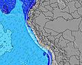 | 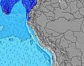 | 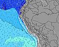 | 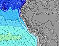 |  | ||||||||||||||
Wave Height (m) Direction Period (s) | SW 20 | SW 19 | SW 18 | SW 16 | SW 16 | SSW 16 | SSW 16 | SSW 16 | SSW 15 | SSW 15 | SSW 14 | SW 14 | SSW 16 | SSW 16 | SW 15 | SW 14 | SW 14 | SW 13 | SSW 16 | SSW 14 | SSW 14 |
Wave Graph | |||||||||||||||||||||
969 | 1472 | 1818 | 1988 | 1916 | 1765 | 1498 | 1322 | 818 | 711 | 561 | 476 | 700 | 1141 | 893 | 915 | 877 | 509 | 1199 | 969 | 904 | |
Wind (km/h) | |||||||||||||||||||||
Wind State on-shore cross-onshore cross-shore cross-offshore off-shore glassy | cross-off | cross-off | cross-off | cross-off | cross-off | cross-off | cross-off | glassy | glassy | cross-on | glassy | glassy | cross-off | cross-off | cross-off | cross | cross-off | glassy | glassy | glassy | glassy |
High Tide | 11:28AM0.93m | 00:31AM0.61m | 12:02PM0.86m | 1:21AM0.66m | 12:41PM0.78m | 2:15AM0.73m | 1:30PM0.69m | 3:11AM0.81m | 2:33PM0.62m | 4:08AM0.90m | 3:47PM0.56m | 5:05AM1.00m | 5:03PM0.53m | ||||||||
Low Tide | 4:50AM0.27m | 6:28PM0.13m | 5:40AM0.33m | 6:59PM0.14m | 6:43AM0.37m | 7:32PM0.13m | 8:00AM0.38m | 8:12PM0.13m | 9:28AM0.36m | 8:58PM0.12m | 10:51AM0.30m | 9:52PM0.10m | 12:02PM0.22m | 10:50PM0.07m | |||||||
6:16 | — | — | 6:16 | — | — | 6:16 | — | — | 6:16 | — | — | 6:16 | — | — | 6:16 | — | — | 6:16 | — | — | |
— | 5:22 | — | — | 5:22 | — | — | 5:22 | — | — | 5:23 | — | — | 5:23 | — | — | 5:23 | — | — | 5:24 | — | |
mm | — | — | — | — | — | — | — | — | — | — | — | — | — | — | — | — | — | — | — | — | — |
Temp °C | 19 | 19 | 20 | 21 | 20 | 19 | 20 | 18 | 19 | 20 | 19 | 18 | 21 | 19 | 19 | 20 | 19 | 19 | 20 | 18 | 18 |
Feels °C | 18 | 19 | 20 | 20 | 20 | 20 | 20 | 20 | 20 | 21 | 20 | 19 | 21 | 19 | 20 | 19 | 19 | 21 | 20 | 19 | 19 |
Swell 1 Height (m) Direction Period (s) | SSW 8 | SW 19 | SW 18 | SW 16 | SW 16 | SSW 16 | SSW 16 | SSW 16 | SSW 15 | SSW 15 | SSW 14 | SW 14 | SSW 16 | SSW 16 | SW 15 | SW 14 | SW 14 | SW 13 | SSW 16 | SSW 14 | SSW 14 |
273 | 1472 | 1818 | 1988 | 1916 | 1765 | 1498 | 1322 | 818 | 711 | 561 | 476 | 700 | 1141 | 893 | 915 | 877 | 509 | 1199 | 969 | 904 | |
Swell 2 Height (m) Direction Period (s) | SW 20 | SSW 8 | SSW 8 | SSW 9 | SSW 9 | SSW 9 | SSW 8 | SSW 8 | SSW 8 | SSW 7 | SSW 7 | SSW 7 | SSW 7 | SSW 7 | SSW 7 | SSW 7 | SSW 7 | SSW 8 | SSW 8 | SSW 8 | SSW 7 |
969 | 286 | 197 | 237 | 232 | 172 | 113 | 107 | 102 | 76 | 69 | 51 | 63 | 49 | 52 | 52 | 54 | 83 | 79 | 81 | 57 | |
Swell 3 Height (m) Direction Period (s) | SW 16 | — | SW 11 | — | — | — | — | — | — | — | W 18 | SW 18 | SW 13 | — | W 16 | — | WSW 13 | SSW 17 | WSW 12 | WSW 12 | WSW 11 |
208 | — | 30 | — | — | — | — | — | — | — | 6 | 316 | 175 | — | 5 | — | 17 | 311 | 127 | 94 | 68 | |
Wind waves Height (m) Direction Period (s) | — | — | — | — | — | — | — | — | — | — | — | — | — | — | — | — | — | — | — | — | — |
— | — | — | — | — | — | — | — | — | — | — | — | — | — | — | — | — | — | — | — | — | |
Nearest Offshore or Glassy | |||||||||||||||||||||
Distance (km) | 0 | 0 | 0 | 0 | 0 | 0 | 0 | 0 | 0 | 59 | 0 | 0 | 0 | 0 | 0 | 147 | 0 | 0 | 0 | 0 | 0 |
Best forecast wave conditions in Arequipa, Moquegua and Tacna | |||||||||||||||||||||
Best forecast wave conditions in Peru | |||||||||||||||||||||
Header Global | |||||||||||||||||||||
- Map Icons:
 Break
Break Live Wave Height (m)
 Live Wind Speed (km/h)
 Surf Rating (10 Max)
 Ocean Swells (m)
- Wind Speed (km/h)


FREE! Surf-Forecast.com widget for your website
The surf report / weather widget below is available to embed on third party websites free of charge and provides a summary of our El Olon de Ilo surf forecast. Simply grab the html code snippet that we provide and paste it into your own site. You can choose your preferred language and metric/imperial units for the surf forecast feed to suit users of your site. Click here to get the code.
Information about the El Olon de Ilo Surf forecast
The above surf forecast table for El Olon de Ilo provides essential information for determining whether the surfing conditions will be good over the next 16 days. A general guide to surfing at El Olon de Ilo can be found by selecting the local surf guide option on the grey menu. Our El Olon de Ilo surf forecast is unique since it includes wave energy (power) that defines the real feel of the surf rather than just the height or the period. If you surf the same spot (El Olon de Ilo) regularly then make a mental note of the wave energy from the surf forecast table each time you go. Very soon you may start to choose your surf days based on the wave energy alone combined with our forecast of favourable offshore wind conditions. Our star ratings will help here and of course you will also find the usual wave height and period predictions on our surf forecasts as well as a full break down of the swell components under our advanced users option (to reveal that, click the little Einstein character under the tide times).
Further information to help with frequently asked questions about our surf forecast for El Olon de Ilo may be found under the help tab on the top menu and also by moving your mouse over the question marks on the surf forecast table itself. Please always bear in mind that the forecast is for near-shore open water and local factors at each surf break influence the actual breaking wave height, such as the beach / reef profile, water depths offshore and shelter.
Are you planning a holiday in Arequipa, Moquegua and Tacna? If you are looking for accommodation near El Olon de Ilo, camping, hotels and holiday cottages in Arequipa, Moquegua and Tacna, consider staying in Ilo which is 11 km (7 miles) away. Other places in and around Arequipa, Moquegua and Tacna where you can find information about places to rent, and car hire include Moquegua which is 63 km (39 miles) away and Mollendo, 94 km (58 miles) away.
 Nearest