

Surf Forecasts:

Pico Alto surf forecast from 31 Jul 2026:
- Best quality surf: Thursday 6 Aug, 7PM (local time) - 5ft (1.6m), 16s period, SW swell with cross-offshore winds.
- Most powerful swell: Thursday 6 Aug, 7PM (local time) - 5ft (1.6m), 16s period, SW swell with 1,314 kJ wave energy.
- Next surfable swell (1★+): Friday 31 Jul, 1AM (local time) - 4ft (1.2m), 12s period with SW swell.
Best Forecast Surf Conditions for Pico Alto this week:
The surf forecast for Pico Alto over the next 16 days: The first swell (rated 1 star or higher) is forecast to arrive on Friday (Jul 31) at 1AM. The primary swell is predicted to be 1.2m and 12s period with a secondary swell of 0.5m and 11s. Another secondary swell of 0.6m and 4s is also forecast. The wind is predicted to be cross-offshore as the swell arrives.
The most powerful waves expected at Pico Alto in the next 16 days are 1.6m 16s and forecast to arrive on Thursday (Aug 06) at 7PM. Winds are predicted to be cross-offshore at the time the swell arrives.
| Wave Type | Time (-05) & Date | Wave Height & Period |
|---|---|---|
| Next good surf (1 star+) | 1AM (Fri 31st Jul) | 4ft (1.2m) 12s |
| Best Surf | 7PM (Thu 6th Aug) | 5ft (1.6m) 16s |
| Most Powerful | 7PM (Thu 6th Aug) | 5ft (1.6m) 16s |
Table - best surf conditions forecast for Pico Alto over the next 16 days.
The Lowdown
Alright folks, Rusty here. Let’s talk about what’s on the menu for the next couple of weeks.
The window kicks off on Thursday, July 30th, with a steady but not amazing pulse of swell. The real standout in this whole period is a solid, clean window that begins to develop around the 6th of August and holds into the 7th, and then there’s a very interesting long-period groundswell that lines up for the 14th of August. Outside of these, expect a lot of marginal conditions, so patience is key.
Pico Alto is the only game in town here. The first real chance to get wet is Thursday, July 30th afternoon. We’ve got a 4ft SW swell rolling in at a solid 12-second period, pushing a moderate combined wave energy of 693. The wind is a cross-shore from the south at 15 km/h, which will keep it decent but with a bit of a cross-chop. The water is a balmy 71°, which is a massive 9° warmer than normal for this time of year – that’s very unusual, so you’ll be surfing in a bath. Friday the 31st is a write-off with poor conditions, so give it a miss.
Saturday, August 1st morning sees a bit more size, with 5ft of S swell, but it’s short-period at 8 seconds and the wind is light offshore from the WSW. This could make for some clean, peaky walls, but the short period means it might be a bit fat and closed out on the takeoff. It’s a marginal call, but a chance for a paddle.
The real promise starts showing up on Thursday, August 6th. The afternoon session brings a 4ft SW swell with a very long 16-second period, and the combined energy jumps to 1074, which is strong. You’ve got light cross-shore winds from the south at 10 km/h. This is a classic groundswell setup for a reef like Pico Alto – long lines, heavy barrels, but the long period can make it a bit tricky to get into the rhythm. The sets will be fat and powerful, and the gaps between them will give you time to get out the back. This is for advanced surfers only. Friday, August 7th morning holds 5ft of SW swell at 14 seconds, but the wind turns slightly cross-onshore, so it won’t be as clean. The afternoon of the 7th is still decent with a cross-shore breeze.
The clear standout to circle on your calendar, however, is Friday, August 14th morning. We’re looking at a 3ft SW swell, but the period is a massive 18 seconds. The combined energy is still a strong 898. That’s a very long-period groundswell, and on a reef like Pico Alto, that means raw power and steep, ledgey takeoffs. The wind is light and cross-onshore from the SW, so it won’t be glassy, but it won’t be blown out either. This is a promising, long-range call for the experts to get some serious, heavy waves. The 14th afternoon is a bit more chopped up with a stronger cross-onshore wind.
The rest of the period is a grind of marginal conditions, low energy, and poor surf. Don’t expect much on the 8th, 9th, or 10th – it’s mostly small and weak. There’s a little spike of short-period stuff on the 11th and 12th, but nothing to write home about.
So, to sum it up: the best bet is the afternoon of Thursday, August 6th, with the cleanest conditions and the strongest energy. The backup is the very long-period groundswell on the morning of Friday, August 14th, though it’s a bit less certain being so far out. This is all expert-level territory when it gets solid, and while Pico is rarely crowded, expect a few locals on the good days.
Stay frothy.
Rusty.
Short Range ForecastMostly dry. Warm (max 22°C on Sat morning, min 18°C on Thu night). Wind will be generally light. | Days 5-7 Weather SummaryMostly dry. Warm (max 22°C on Tue morning, min 19°C on Sun afternoon). Wind will be generally light. | |||||||||||||||||||
Thu 30 | Friday 31 | Saturday 1 | Sunday 2 | Monday 3 | Tuesday 4 | Wednesday 5 | ||||||||||||||
PM | Night | AM | PM | Night | AM | PM | Night | AM | PM | Night | AM | PM | Night | AM | PM | Night | AM | PM | Night | |
Swell Height Map |  | 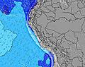 | 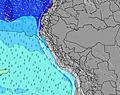 | 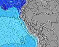 | 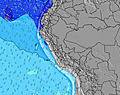 | 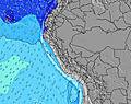 | 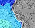 | |||||||||||||
Wave Height (m) Direction Period (s) | SW 12 | SW 12 | SW 12 | SW 12 | S 7 | S 8 | S 8 | S 8 | S 8 | SW 13 | SW 13 | SW 13 | SSW 11 | S 7 | SW 12 | SW 12 | SW 14 | SW 13 | SW 13 | SW 12 |
Wave Graph | ||||||||||||||||||||
537 | 437 | 272 | 197 | 311 | 299 | 235 | 248 | 235 | 208 | 138 | 130 | 200 | 128 | 207 | 220 | 248 | 488 | 473 | 367 | |
Wind (km/h) | ||||||||||||||||||||
Wind State on-shore cross-onshore cross-shore cross-offshore off-shore glassy | cross | cross-off | cross | cross | glassy | on | cross | cross | cross-on | cross-on | cross | cross-on | cross-on | cross | cross-on | cross-on | cross | cross | cross | cross-off |
High Tide | 6:21PM0.53m | 7:21AM0.92m | 7:01PM0.55m | 7:46AM0.90m | 7:43PM0.57m | 8:11AM0.86m | 8:29PM0.59m | 8:35AM0.82m | 9:21PM0.61m | 9:03AM0.76m | 10:22PM0.64m | 9:37AM0.69m | 11:34PM0.67m | |||||||
Low Tide | 00:15AM0.13m | 1:59PM0.29m | 00:47AM0.17m | 2:25PM0.28m | 1:20AM0.22m | 2:51PM0.26m | 1:57AM0.28m | 3:19PM0.24m | 2:41AM0.35m | 3:50PM0.22m | 3:40AM0.41m | 4:31PM0.20m | ||||||||
— | — | 6:26 | — | — | 6:26 | — | — | 6:26 | — | — | 6:24 | — | — | 6:24 | — | — | 6:24 | — | — | |
6:00 | — | — | 6:00 | — | — | 6:00 | — | — | 6:00 | — | — | 6:00 | — | — | 6:00 | — | — | 6:00 | — | |
mm | — | — | — | — | — | — | — | — | — | — | — | — | — | — | — | — | — | — | — | — |
Temp °C | 20 | 19 | 21 | 20 | 19 | 22 | 21 | 19 | 21 | 20 | 19 | 21 | 20 | 19 | 22 | 21 | 19 | 22 | 21 | 20 |
Feels °C | 19 | 19 | 20 | 19 | 21 | 21 | 21 | 19 | 21 | 20 | 20 | 20 | 20 | 20 | 22 | 21 | 20 | 22 | 21 | 21 |
Swell 1 Height (m) Direction Period (s) | SW 12 | SW 12 | SW 12 | SW 12 | S 7 | S 8 | S 8 | SW 11 | S 8 | S 8 | S 7 | S 7 | S 7 | S 7 | S 7 | SW 12 | S 8 | SW 13 | SW 13 | SW 12 |
537 | 437 | 272 | 197 | 311 | 299 | 235 | 162 | 235 | 193 | 124 | 97 | 124 | 127 | 106 | 220 | 124 | 488 | 473 | 367 | |
Swell 2 Height (m) Direction Period (s) | S 11 | S 11 | S 10 | SSW 10 | SW 12 | SW 11 | SW 11 | SW 14 | SW 10 | SW 13 | SW 9 | SW 13 | SSW 11 | SSW 11 | SW 12 | S 7 | SW 14 | S 8 | S 8 | S 8 |
37 | 59 | 51 | 33 | 169 | 237 | 233 | 169 | 120 | 208 | 87 | 130 | 200 | 128 | 207 | 57 | 248 | 93 | 90 | 89 | |
Swell 3 Height (m) Direction Period (s) | W 12 | S 5 | SW 16 | SW 17 | SW 15 | SW 16 | WSW 16 | W 12 | SW 14 | SW 10 | SW 13 | SW 9 | SW 12 | SW 13 | SSW 11 | SSW 8 | SW 11 | SW 20 | SW 19 | SW 18 |
3 | 2 | 11 | 45 | 60 | 124 | 95 | 3 | 96 | 59 | 138 | 64 | 72 | 88 | 97 | 70 | 140 | 107 | 183 | 258 | |
Wind waves Height (m) Direction Period (s) | S 11 | S 4 | S 5 | S 6 | — | — | — | S 8 | — | — | — | — | — | — | — | — | — | — | — | — |
116 | 12 | 45 | 144 | — | — | — | 248 | — | — | — | — | — | — | — | — | — | — | — | — | |
Nearest Offshore or Glassy | ||||||||||||||||||||
Distance (km) | 28 | 0 | 32 | 28 | 0 | 28 | 28 | 1 | 28 | 28 | 1 | 28 | 28 | 1 | 28 | 28 | 1 | 28 | 28 | 0 |
Best forecast wave conditions in Lima | ||||||||||||||||||||
Best forecast wave conditions in Peru | ||||||||||||||||||||
Header Global | ||||||||||||||||||||
- Map Icons:
 Break
Break Live Wave Height (m)
 Live Wind Speed (km/h)
 Surf Rating (10 Max)
 Ocean Swells (m)
- Wind Speed (km/h)
Latest Updates


FREE! Surf-Forecast.com widget for your website
The surf report / weather widget below is available to embed on third party websites free of charge and provides a summary of our Pico Alto surf forecast. Simply grab the html code snippet that we provide and paste it into your own site. You can choose your preferred language and metric/imperial units for the surf forecast feed to suit users of your site. Click here to get the code.
Information about the Pico Alto Surf forecast
The above surf forecast table for Pico Alto provides essential information for determining whether the surfing conditions will be good over the next 16 days. A general guide to surfing at Pico Alto can be found by selecting the local surf guide option on the grey menu. Our Pico Alto surf forecast is unique since it includes wave energy (power) that defines the real feel of the surf rather than just the height or the period. If you surf the same spot (Pico Alto) regularly then make a mental note of the wave energy from the surf forecast table each time you go. Very soon you may start to choose your surf days based on the wave energy alone combined with our forecast of favourable offshore wind conditions. Our star ratings will help here and of course you will also find the usual wave height and period predictions on our surf forecasts as well as a full break down of the swell components under our advanced users option (to reveal that, click the little Einstein character under the tide times).
Further information to help with frequently asked questions about our surf forecast for Pico Alto may be found under the help tab on the top menu and also by moving your mouse over the question marks on the surf forecast table itself. Please always bear in mind that the forecast is for near-shore open water and local factors at each surf break influence the actual breaking wave height, such as the beach / reef profile, water depths offshore and shelter.
Are you planning a holiday in Lima? If you are looking for accommodation near Pico Alto, camping, hotels and holiday cottages in Lima, consider staying in Lima which is 35 km (22 miles) away. Other places in and around Lima where you can find information about places to rent, and car hire include Mala which is 42 km (26 miles) away, Callao, Chosica and Ancon.
 Nearest