

Surf Forecasts:

Puerto Viejo surf forecast from 3 Aug 2026:
- Best quality surf: Thursday 6 Aug, 4PM (local time) - 4ft (1.2m), 16s period, SW swell with offshore winds.
- Most powerful swell: Thursday 6 Aug, 7PM (local time) - 4.5ft (1.3m), 16s period, SW swell with 803 kJ wave energy.
- Next surfable swell (1★+): Monday 3 Aug, 10AM (local time) - 3.5ft (1.0m), 8s period with S swell.
Best Forecast Surf Conditions for Puerto Viejo this week:
The surf forecast for Puerto Viejo over the next 16 days: The first swell (rated 1 star or higher) is forecast to arrive on Monday (Aug 03) at 10AM. The primary swell is predicted to be 1.0m and 8s period with a secondary swell of 0.5m and 12s. The wind is predicted to be cross-offshore as the swell arrives.
The most powerful waves expected at Puerto Viejo in the next 16 days are 1.3m 16s and forecast to arrive on Thursday (Aug 06) at 7PM. Winds are predicted to be offshore at the time the swell arrives.
| Wave Type | Time (-05) & Date | Wave Height & Period |
|---|---|---|
| Next good surf (1 star+) | 10AM (Mon 3rd Aug) | 3.5ft (1.0m) 8s |
| Best Surf | 4PM (Thu 6th Aug) | 4ft (1.2m) 16s |
| Most Powerful | 7PM (Thu 6th Aug) | 4.5ft (1.3m) 16s |
Table - best surf conditions forecast for Puerto Viejo over the next 16 days.
The Lowdown
Alright folks, Rusty here. Let’s look at what’s running for Puerto Viejo over the next couple of weeks.
We’ve got a solid run of surf ahead, with only a small slow start. The first real action kicks in on Monday the 3rd of August. It’s not going to be pumping straight away, but the pattern is set for a good week. The water temp is sitting about average for the time of year, so no surprises there.
Monday morning the 3rd sees a clean 3ft swell from the south, with a light cross-offshore breeze. The combined energy is moderate (279). It’s a decent start, nothing to write home about but enough to get wet. The afternoon drops a little to 3ft, still clean but ordinary.
Tuesday the 4th picks up. The swell comes from the southwest, still around 3ft to 3ft, but the period jumps to 12 seconds, and the energy is building (333 to 422). The wind stays light and cross-offshore. It’s clean and the waves are starting to get some shape.
Now, let’s talk about the standout. Thursday the 6th of August is the one to circle. The swell is 4ft from the southwest, but the period is 16 seconds, and the combined energy hits 793 – that’s strong, punchy energy. The wind goes offshore in the afternoon, glassy and clean. This is a proper groundswell, and at Puerto Viejo, with that point and beach setup, you’re looking at some long, lined-up waves. It’s a good day for the intermediate surfers, and the more experienced crew will be stoked too. The crowds are often around here, so get there early.
Friday the 7th holds in with 4ft swell and 14-second period, still clean. The energy is still strong (600). Saturday the 8th is a bit mixed – the morning has a cross-onshore breeze, but the afternoon cleans up nicely with a 4ft south swell and 8 seconds. Sunday the 9th is consistent, 4ft from the south, 9 seconds, light cross-offshore winds.
By Monday the 10th, the swell is up to 5ft, but the period drops to 9 seconds, and the energy is high (624). The morning wind is cross-shore, so the afternoon is the better bet.
Now, here’s the second standout. Tuesday the 11th of August. The swell is 5ft from the south, 12-second period, and the energy is again 793. The wind is offshore both morning and afternoon. This is big, powerful, and clean. It’s getting into the range where it’s a bit much for beginners, but for the intermediates and experts, this is a cracking day. The water might be a little more challenging, but the waves will be well-shaped.
After that, the surf settles a bit. The 12th and 13th see the swell drop to 4ft and then 2ft, but the period on the 13th is 18 seconds – very long period. That’s a groundswell that will love the point and reef sections, but at the beach break it might feel a bit fat. The 14th and 15th see a return to 3ft, 15-16 second swells, with clean conditions.
The second week holds a steady run of 4ft swells from the southwest, with 12-14 second periods and light winds. It’s not the high-energy of the first week, but it’s consistent and clean. There’s no major gap here – just a solid, reliable run of surf right through to the 18th.
So, the best on offer is Thursday the 6th and Tuesday the 11th. Both have strong energy, good size, and offshore winds. The rest of the fortnight is full of clean, surfable waves. Get on it.
Rusty.
Short Range ForecastMostly dry. Warm (max 21°C on Mon morning, min 18°C on Sun night). Wind will be generally light. | Days 4-6 Weather SummaryMostly dry. Warm (max 20°C on Thu morning, min 18°C on Thu night). Wind will be generally light. | ||||||||||||||||||||
Monday 3 | Tuesday 4 | Wednesday 5 | Thursday 6 | Friday 7 | Saturday 8 | Sunday 9 | |||||||||||||||
AM | PM | Night | AM | PM | Night | AM | PM | Night | AM | PM | Night | AM | PM | Night | AM | PM | Night | AM | PM | Night | |
Swell Height Map |  |  | 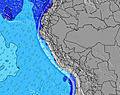 | 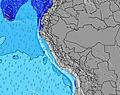 | 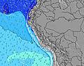 | 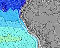 |  | ||||||||||||||
Wave Height (m) Direction Period (s) | S 8 | SSW 8 | S 8 | SW 12 | SW 12 | SW 12 | SW 13 | SW 12 | SSW 12 | SW 17 | SW 16 | SW 16 | SW 14 | SW 14 | SW 13 | SW 13 | SW 13 | S 8 | S 9 | S 9 | SSW 9 |
Wave Graph | |||||||||||||||||||||
121 | 101 | 121 | 212 | 306 | 341 | 363 | 295 | 378 | 290 | 728 | 701 | 528 | 459 | 295 | 199 | 205 | 177 | 225 | 230 | 326 | |
Wind (km/h) | |||||||||||||||||||||
Wind State on-shore cross-onshore cross-shore cross-offshore off-shore glassy | cross-off | cross-off | glassy | cross-off | cross-off | off | cross-off | off | off | cross-off | off | off | cross-off | off | off | cross-on | cross-off | off | cross-off | cross-off | cross-off |
High Tide | 8:41AM0.80m | 9:29PM0.60m | 9:09AM0.74m | 10:29PM0.63m | 9:43AM0.68m | 11:40PM0.66m | 10:28AM0.61m | 00:59AM0.71m | 11:33AM0.54m | 2:15AM0.78m | 1:00PM0.50m | 3:20AM0.86m | 2:27PM0.50m | ||||||||
Low Tide | 3:25PM0.23m | 2:48AM0.34m | 3:57PM0.21m | 3:48AM0.41m | 4:37PM0.19m | 5:20AM0.45m | 5:29PM0.17m | 7:27AM0.46m | 6:36PM0.15m | 9:06AM0.41m | 7:46PM0.11m | 10:11AM0.35m | 8:51PM0.06m | ||||||||
6:24 | — | — | 6:24 | — | — | 6:24 | — | — | 6:24 | — | — | 6:24 | — | — | 6:22 | — | — | 6:22 | — | — | |
— | 6:00 | — | — | 6:00 | — | — | 6:00 | — | — | 6:00 | — | — | 6:00 | — | — | 6:00 | — | — | 6:00 | — | |
mm | — | — | — | — | — | — | — | — | — | — | — | — | — | — | — | — | — | — | — | — | — |
Temp °C | 21 | 20 | 19 | 21 | 20 | 19 | 21 | 20 | 19 | 20 | 20 | 19 | 20 | 20 | 18 | 20 | 20 | 18 | 20 | 20 | 18 |
Feels °C | 21 | 20 | 20 | 21 | 20 | 20 | 21 | 20 | 20 | 19 | 19 | 19 | 20 | 20 | 18 | 20 | 20 | 18 | 20 | 21 | 19 |
Swell 1 Height (m) Direction Period (s) | S 8 | SSW 8 | S 8 | S 8 | SW 12 | SW 12 | SW 13 | SW 12 | SSW 12 | SW 12 | SW 16 | SW 16 | SW 14 | SW 14 | SSW 8 | S 8 | S 8 | S 8 | S 9 | S 9 | SSW 9 |
121 | 101 | 121 | 118 | 306 | 341 | 363 | 295 | 378 | 203 | 728 | 701 | 528 | 459 | 107 | 161 | 205 | 177 | 225 | 230 | 326 | |
Swell 2 Height (m) Direction Period (s) | SSW 12 | SSW 11 | SW 13 | SW 12 | SSW 8 | S 7 | S 7 | S 7 | SW 18 | SW 17 | S 8 | S 8 | S 7 | S 8 | SW 13 | SW 13 | SW 13 | SW 12 | SW 15 | SW 15 | SW 14 |
79 | 74 | 88 | 212 | 101 | 70 | 47 | 52 | 112 | 290 | 63 | 58 | 70 | 78 | 295 | 199 | 193 | 112 | 107 | 134 | 99 | |
Swell 3 Height (m) Direction Period (s) | SW 13 | WSW 12 | SSW 11 | W 13 | SW 20 | SW 20 | SW 19 | SW 19 | S 11 | S 7 | W 10 | S 9 | W 10 | NW 11 | SW 19 | SW 18 | SW 18 | SW 16 | SW 12 | SSW 11 | SW 19 |
79 | 57 | 41 | 3 | 15 | 16 | 58 | 95 | 2 | 52 | 2 | 6 | 2 | 4 | 15 | 12 | 48 | 93 | 48 | 12 | 133 | |
Wind waves Height (m) Direction Period (s) | — | — | — | — | — | — | — | — | — | — | — | — | — | — | — | — | — | — | — | — | — |
— | — | — | — | — | — | — | — | — | — | — | — | — | — | — | — | — | — | — | — | — | |
Nearest Offshore or Glassy | |||||||||||||||||||||
Distance (km) | 0 | 0 | 0 | 0 | 0 | 0 | 0 | 0 | 0 | 0 | 0 | 0 | 0 | 0 | 0 | 59 | 0 | 0 | 0 | 0 | 0 |
Best forecast wave conditions in Lima | |||||||||||||||||||||
Best forecast wave conditions in Peru | |||||||||||||||||||||
Header Global | |||||||||||||||||||||
- Map Icons:
 Break
Break Live Wave Height (m)
 Live Wind Speed (km/h)
 Surf Rating (10 Max)
 Ocean Swells (m)
- Wind Speed (km/h)
Latest Updates


FREE! Surf-Forecast.com widget for your website
The surf report / weather widget below is available to embed on third party websites free of charge and provides a summary of our Puerto Viejo surf forecast. Simply grab the html code snippet that we provide and paste it into your own site. You can choose your preferred language and metric/imperial units for the surf forecast feed to suit users of your site. Click here to get the code.
Information about the Puerto Viejo Surf forecast
The above surf forecast table for Puerto Viejo provides essential information for determining whether the surfing conditions will be good over the next 16 days. A general guide to surfing at Puerto Viejo can be found by selecting the local surf guide option on the grey menu. Our Puerto Viejo surf forecast is unique since it includes wave energy (power) that defines the real feel of the surf rather than just the height or the period. If you surf the same spot (Puerto Viejo) regularly then make a mental note of the wave energy from the surf forecast table each time you go. Very soon you may start to choose your surf days based on the wave energy alone combined with our forecast of favourable offshore wind conditions. Our star ratings will help here and of course you will also find the usual wave height and period predictions on our surf forecasts as well as a full break down of the swell components under our advanced users option (to reveal that, click the little Einstein character under the tide times).
Further information to help with frequently asked questions about our surf forecast for Puerto Viejo may be found under the help tab on the top menu and also by moving your mouse over the question marks on the surf forecast table itself. Please always bear in mind that the forecast is for near-shore open water and local factors at each surf break influence the actual breaking wave height, such as the beach / reef profile, water depths offshore and shelter.
Puerto Viejo is 11 km (7 miles) from Mala. If you plan a holiday in Lima, look for hotels and other accommodation in Mala. Mala has rooms for a wide range of budgets as well as car hire and transport links.
 Nearest