

Surf Forecasts:

Kugenuma Rivermouth surf forecast from 3 Aug 2026:
- Best quality surf: Wednesday 5 Aug, 3PM (local time) - 8ft (2.5m), 16s period, SSE swell with offshore winds.
- Most powerful swell: Wednesday 5 Aug, 12PM (local time) - 8ft (2.5m), 16s period, SSE swell with 3,786 kJ wave energy.
- Next surfable swell (1★+): Wednesday 5 Aug, 3PM (local time) - 8ft (2.5m), 16s period with SSE swell.
Best Forecast Surf Conditions for Kugenuma Rivermouth this week:
The surf forecast for Kugenuma Rivermouth over the next 16 days: The first swell (rated 1 star or higher) is forecast to arrive on Wednesday (Aug 05) at 3PM. The primary swell is predicted to be 2.5m and 16s period. The wind is predicted to be offshore as the swell arrives.
The most powerful waves expected at Kugenuma Rivermouth in the next 16 days are 2.5m 16s and forecast to arrive on Wednesday (Aug 05) at 12PM. Winds are predicted to be offshore at the time the swell arrives. The largest open ocean swell (not directed at the beach) is 1.1m 4s period and expected on Wednesday (Aug 05) at 3AM.
| Wave Type | Time (JST) & Date | Wave Height & Period |
|---|---|---|
| Next good surf (1 star+) | 3PM (Wed 5th Aug) | 8ft (2.5m) 16s |
| Best Surf | 3PM (Wed 5th Aug) | 8ft (2.5m) 16s |
| Most Powerful | 12PM (Wed 5th Aug) | 8ft (2.5m) 16s |
Table - best surf conditions forecast for Kugenuma Rivermouth over the next 16 days.
The Lowdown
Alright folks, Rusty here. Let’s get into it for Kugenuma Rivermouth. We’ve got a solid pulse of swell coming through this week, but you’ve got to pick your moments. The water is sitting at 83°, which is a touch warmer than normal for this time of year – feels like bathwater, so don’t bother with a thick wetsuit.
The action kicks off Monday morning, but it’s really just a tease. You’ll see some 2ft swell from the SE with a very long 16-second period, but the energy is weak (277) and the report says it’s marginal. The wind is a moderate offshore breeze from the NNE, which is clean, but the swell just isn’t there yet. Monday afternoon is similar, with 3ft and a bit more energy (449), but still not worth paddling out for.
Tuesday morning is where it starts to get interesting. The swell pushes up to 5ft from the SE, period still a long 17 seconds, and the energy jumps to a solid moderate (1138). The wind is a fresh offshore from the NNE, so it’ll be clean. The score is still holding back, but you can feel it building. Tuesday afternoon sees the swell hit 6ft, and the energy is now strong (1614), but the wind swings to a cross-off from the ENE, making it a bit less perfect.
Now, Wednesday morning is the real standout. The swell is a solid 8ft from the SSE, with a long 16-second period, and the energy is pumping (3731). The wind is a fresh offshore from the NNE, so it’s going to be clean and powerful. This is big, well overhead surf, so it’s for experienced surfers only. The afternoon is nearly as good, with the same 8ft swell and energy (3569), but the wind drops to a moderate offshore from the NE, making for excellent conditions. This is the best session on offer.
Thursday morning holds the 8ft from the S with a 15-second period and strong energy (3167). The wind is moderate offshore from the NE, so it’s still clean. Afternoon sees the wind go cross-shore from the ESE, which brings a bit of chop, so aim for the morning.
Friday morning is another good call with 8ft from the S and a long 16-second period, and the wind is light offshore from the NE. Clean, powerful, expert-only waves. The energy is still strong (3556). Friday afternoon is a write-off with thunderstorms and onshore wind.
Saturday morning is still decent, with 6ft from the S, a 14-second period, and light cross-off wind from the E. It’s a bit smaller and the energy is moderate (1819), but it’s clean and surfable for stronger intermediates. The afternoon gets messy.
From Sunday, the swell drops fast. Sunday morning has 3ft from the S, and by Monday it’s down to 2ft. The energy is weak (198) and it’s a fresh offshore, so it’s clean but tiny. After that, we hit a long flat spell. From the 10th of August through to the 18th, the swell stays under 3ft, with energy readings mostly below 150. It’s a proper lull. The wind is often offshore or cross-off, but with no swell, there’s nothing to ride. You’ll see a tiny bump of 2ft on the 17th, but the period drops to 8 seconds, which is just wind chop.
So, the standout is undoubtedly Wednesday, August 5th, and Thursday morning, August 6th. That’s when Kugenuma Rivermouth will be pumping with a solid 8ft groundswell from the SSE, offshore winds, and strong energy. It’s a rivermouth, so that long period swell will find a nice line. Just be aware, it’s only for the experienced crew. The rest of the window is either building or fading.
Rusty.
Short Range ForecastMostly dry. Warm (max 28°C on Wed afternoon, min 23°C on Mon night). Mainly fresh winds. | Days 4-6 Weather SummaryHeavy rain (total 30mm), heaviest during Fri night. Warm (max 31°C on Thu morning, min 25°C on Sat night). Wind will be generally light. | ||||||||||||||||||||
Monday 3 | Tuesday 4 | Wednesday 5 | Thursday 6 | Friday 7 | Saturday 8 | Sunday 9 | |||||||||||||||
AM | PM | Night | AM | PM | Night | AM | PM | Night | AM | PM | Night | AM | PM | Night | AM | PM | Night | AM | PM | Night | |
Swell Height Map |  |  |  | 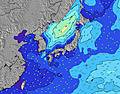 | 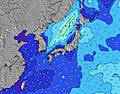 | 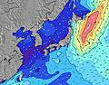 | 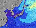 | ||||||||||||||
Wave Height (m) Direction Period (s) | SE 16 | SE 16 | SE 17 | SE 17 | SE 16 | SE 16 | SSE 16 | SSE 16 | SSE 15 | S 15 | S 16 | S 16 | S 16 | S 15 | S 14 | S 14 | S 14 | SW 14 | S 13 | SW 15 | SSW 14 |
Wave Graph | |||||||||||||||||||||
258 | 448 | 772 | 1120 | 1611 | 2676 | 3731 | 3569 | 3115 | 3093 | 3588 | 3230 | 3025 | 2405 | 1463 | 1382 | 1208 | 390 | 335 | 266 | 243 | |
Wind (km/h) | |||||||||||||||||||||
Wind State on-shore cross-onshore cross-shore cross-offshore off-shore glassy | off | off | off | off | cross-off | off | off | off | off | off | cross | cross-off | off | cross | cross | cross-off | cross-on | cross-off | off | cross-off | off |
High Tide | 8:00PM1.50m | 8:27AM1.25m | 8:29PM1.48m | 9:35AM1.12m | 9:01PM1.45m | 11:35AM1.03m | 9:37PM1.40m | 10:28PM1.35m | 5:09PM1.29m | 11:56PM1.32m | 5:08PM1.37m | 1:34AM1.33m | |||||||||
Low Tide | 1:31PM0.54m | 2:25AM0.56m | 1:56PM0.69m | 3:24AM0.54m | 2:16PM0.86m | 4:41AM0.53m | 2:02PM1.01m | 6:19AM0.48m | 7:46AM0.40m | 8:22PM1.25m | 8:49AM0.30m | 9:37PM1.20m | |||||||||
4:50 | — | — | 4:52 | — | — | 4:52 | — | — | 4:52 | — | — | 4:54 | — | — | 4:54 | — | — | 4:56 | — | — | |
— | 6:44 | — | — | 6:43 | — | — | 6:42 | — | — | 6:40 | — | — | 6:39 | — | — | 6:38 | — | — | 6:37 | — | |
mm | — | — | — | — | — | — | — | — | — | — | 1 | 6 | 3 | 4 | 15 | 1 | — | — | — | — | — |
Temp °C | 25 | 26 | 24 | 26 | 27 | 23 | 26 | 28 | 26 | 31 | 30 | 27 | 29 | 30 | 28 | 29 | 29 | 26 | 29 | 29 | 25 |
Feels °C | 24 | 24 | 21 | 22 | 24 | 20 | 24 | 28 | 26 | 32 | 32 | 29 | 32 | 31 | 30 | 32 | 30 | 28 | 26 | 25 | 21 |
Swell 1 Height (m) Direction Period (s) | SE 16 | SE 16 | SE 17 | SE 17 | SE 16 | SE 16 | SSE 16 | SSE 16 | SSE 15 | S 15 | S 16 | S 16 | S 16 | S 15 | S 14 | S 14 | S 14 | S 10 | S 13 | S 12 | SSW 14 |
258 | 448 | 772 | 1120 | 1611 | 2676 | 3731 | 3569 | 3115 | 3093 | 3588 | 3230 | 3025 | 2405 | 1463 | 1382 | 1208 | 268 | 335 | 233 | 243 | |
Swell 2 Height (m) Direction Period (s) | SE 22 | S 8 | E 14 | ENE 14 | E 13 | — | — | — | — | E 10 | ESE 10 | SE 10 | SE 10 | SE 9 | SE 9 | SE 9 | SE 9 | SW 14 | SW 15 | SW 15 | S 12 |
18 | 1 | 4 | 18 | 3 | — | — | — | — | 74 | 86 | 557 | 531 | 430 | 384 | 437 | 412 | 390 | 262 | 266 | 45 | |
Swell 3 Height (m) Direction Period (s) | S 8 | — | — | — | — | — | — | — | — | — | — | — | — | — | — | — | ESE 12 | ESE 12 | ESE 12 | ESE 12 | SE 8 |
1 | — | — | — | — | — | — | — | — | — | — | — | — | — | — | — | 30 | 15 | 30 | 14 | 17 | |
Wind waves Height (m) Direction Period (s) | NE 3 | NE 3 | NE 3 | NNE 3 | — | — | NNE 4 | — | — | — | — | — | — | — | — | — | — | — | — | ENE 3 | NE 4 |
5 | 5 | 7 | 8 | — | — | 40 | — | — | — | — | — | — | — | — | — | — | — | — | 3 | 15 | |
Nearest Offshore or Glassy | |||||||||||||||||||||
Distance (km) | 140 | 45 | 140 | 140 | 45 | 484 | 545 | 0 | 0 | 0 | 49 | 0 | 0 | 49 | 19 | 0 | 49 | 0 | 45 | 45 | 887 |
Best forecast wave conditions in Kanagawa | |||||||||||||||||||||
Best forecast wave conditions in Japan | |||||||||||||||||||||
Header Global | |||||||||||||||||||||
- Map Icons:
 Break
Break Live Wave Height (m)
 Live Wind Speed (km/h)
 Surf Rating (10 Max)
 Ocean Swells (m)
- Wind Speed (km/h)
Latest Updates


FREE! Surf-Forecast.com widget for your website
The surf report / weather widget below is available to embed on third party websites free of charge and provides a summary of our Kugenuma Rivermouth surf forecast. Simply grab the html code snippet that we provide and paste it into your own site. You can choose your preferred language and metric/imperial units for the surf forecast feed to suit users of your site. Click here to get the code.
Information about the Kugenuma Rivermouth Surf forecast
The above surf forecast table for Kugenuma Rivermouth provides essential information for determining whether the surfing conditions will be good over the next 16 days. A general guide to surfing at Kugenuma Rivermouth can be found by selecting the local surf guide option on the grey menu. Our Kugenuma Rivermouth surf forecast is unique since it includes wave energy (power) that defines the real feel of the surf rather than just the height or the period. If you surf the same spot (Kugenuma Rivermouth) regularly then make a mental note of the wave energy from the surf forecast table each time you go. Very soon you may start to choose your surf days based on the wave energy alone combined with our forecast of favourable offshore wind conditions. Our star ratings will help here and of course you will also find the usual wave height and period predictions on our surf forecasts as well as a full break down of the swell components under our advanced users option (to reveal that, click the little Einstein character under the tide times).
Further information to help with frequently asked questions about our surf forecast for Kugenuma Rivermouth may be found under the help tab on the top menu and also by moving your mouse over the question marks on the surf forecast table itself. Please always bear in mind that the forecast is for near-shore open water and local factors at each surf break influence the actual breaking wave height, such as the beach / reef profile, water depths offshore and shelter.
 Nearest