

Surf Forecasts:

Chigasaki Jetty surf forecast from 12 Jul 2026:
- Best quality surf: Monday 13 Jul, 6AM (local time) - 3.5ft (1.1m), 13s period, SSW swell with glassy winds.
- Most powerful swell: Sunday 19 Jul, 12AM (local time) - 5ft (1.6m), 9s period, SE swell with 402 kJ wave energy.
- Next surfable swell (1★+): Monday 13 Jul, 6AM (local time) - 3.5ft (1.1m), 13s period with SSW swell.
Best Forecast Surf Conditions for Chigasaki Jetty this week:
The surf forecast for Chigasaki Jetty over the next 16 days: The first swell (rated 1 star or higher) is forecast to arrive on Monday (Jul 13) at 6AM. The primary swell is predicted to be 1.1m and 13s period with a secondary swell of 0.1m and 10s. The wind is predicted to be glassy as the swell arrives.
The most powerful waves expected at Chigasaki Jetty in the next 16 days are 1.6m 9s and forecast to arrive on Sunday (Jul 19) at 12AM. Winds are predicted to be cross-onshore at the time the swell arrives. The largest open ocean swell (not directed at the beach) is 1.1m 5s period and expected on Thursday (Jul 16) at 6PM.
| Wave Type | Time (JST) & Date | Wave Height & Period |
|---|---|---|
| Next good surf (1 star+) | 6AM (Mon 13th Jul) | 3.5ft (1.1m) 13s |
| Best Surf | 6AM (Mon 13th Jul) | 3.5ft (1.1m) 13s |
| Most Powerful | 12AM (Sun 19th Jul) | 5ft (1.6m) 9s |
Table - best surf conditions forecast for Chigasaki Jetty over the next 16 days.
Alright, Rusty here, checkin' in with the outlook for Chigasaki Jetty. Gotta be straight with you – it's lookin' pretty bleak for the next couple weeks. A few tiny windows pop up, but mostly it's a whole lotta nothin'. The water temp is sittin' around average for the time of year, so that's one thing not workin' against us.
The first bit of hope shows up early Monday morning, 13 July. The swell is a 3ft from the SSW with a nice long period of 13 seconds, combined energy sittin' at 313. And get this – the wind is glassy, just dead calm. That's the good stuff for a beach/jetty setup like this, it'll be clean. The catch? The score is low, so don't expect a classic wave, but if you're hankering for a paddle, get out there early before the wind shifts.
Monday afternoon the wind swings onshore and the swell drops a hair, cross-shore chop messes it up – that's it for the day.
Tuesday morning, 14 July, the swell is tiny, 2ft, with a cross-shore wind, and the energy is weak (75). Just not worth it. The pattern keeps up: small, messy swell, cross-shore breezes, and poor conditions right through the rest of the week and into the next. There's a brief blip Friday afternoon, 17 July, when a 3ft SE swell with a 15-second period rolls in, the combined energy jumps up to 347, and the wind is light and cross-offshore, cleaning it up. That's a real glimmer, with that long period groundswell, but at a beach break like this it might break a bit straight. Still, the clean conditions make it your second best chance.
After that, it's a long dry spell. From Saturday the 18th right through to Tuesday the 28th, the same story: small waves from the SE or S, mostly under 2ft, cross-shore or onshore winds, and weak energy reading barely cracking triple digits a couple of times. There's a glassy morning on 22 July but with a tiny 1ft swell, it's just not enough to get excited about.
Honestly, the standout here is Monday morning, 13 July, if you're just desperate to get wet in clean, glassy conditions. The only other real shout is Friday afternoon, 17 July for a slightly punchier, cleaner wave. Otherwise, this stretch is a write-off for the paddle crowd – it's more of a kite-surfing setup with the consistent cross-shore wind. Keep an eye on the forecasts; it's not often this quiet for this long.
Rusty.
Short Range ForecastMostly dry. Warm (max 28°C on Mon morning, min 26°C on Sun night). Wind will be generally light. | Days 5-7 Weather SummaryLight rain (total 7mm), mostly falling on Fri afternoon. Warm (max 29°C on Sat afternoon, min 25°C on Fri night). Wind will be generally light. | ||||||||||||||||||||
Monday 13 | Tuesday 14 | Wednesday 15 | Thursday 16 | Friday 17 | Saturday 18 | Sun 19 | |||||||||||||||
Night | AM | PM | Night | AM | PM | Night | AM | PM | Night | AM | PM | Night | AM | PM | Night | AM | PM | Night | AM | PM | |
Swell Height Map |  |  |  |  | 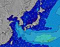 | 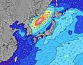 | 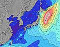 | 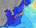 | |||||||||||||
Wave Height (m) Direction Period (s) | SSW 14 | SSW 13 | SSW 12 | SSW 11 | SSW 11 | SSW 10 | SSW 10 | SSW 9 | S 13 | S 13 | SSW 8 | SE 11 | SE 10 | SE 17 | SE 15 | SE 12 | SE 10 | SE 10 | SE 9 | SSE 10 | SSE 11 |
Wave Graph | |||||||||||||||||||||
569 | 302 | 206 | 140 | 66 | 59 | 38 | 34 | 5 | 5 | 7 | 5 | 4 | 98 | 301 | 203 | 177 | 157 | 402 | 178 | 215 | |
Wind (km/h) | |||||||||||||||||||||
Wind State on-shore cross-onshore cross-shore cross-offshore off-shore glassy | glassy | glassy | cross | glassy | cross | cross | cross-off | cross | cross | cross-off | cross-off | cross | cross | cross | cross-off | on | cross-on | on | cross-on | cross-on | cross-on |
High Tide | 2:07AM1.45m | 5:21PM1.45m | 3:07AM1.51m | 5:59PM1.48m | 4:02AM1.56m | 6:33PM1.48m | 4:55AM1.57m | 7:04PM1.46m | 5:45AM1.54m | 7:33PM1.44m | 6:35AM1.46m | 7:58PM1.42m | 7:26AM1.35m | ||||||||
Low Tide | 9:12PM1.12m | 9:48AM-0.02m | 10:07PM1.09m | 10:37AM-0.09m | 10:52PM1.03m | 11:23AM-0.09m | 11:35PM0.95m | 12:05PM-0.03m | 00:17AM0.86m | 12:43PM0.08m | 1:00AM0.77m | 1:19PM0.24m | 1:45AM0.69m | 1:50PM0.42m | |||||||
— | 4:37 | — | — | 4:37 | — | — | 4:37 | — | — | 4:39 | — | — | 4:39 | — | — | 4:39 | — | — | 4:41 | — | |
6:59 | — | 6:58 | — | — | 6:58 | — | — | 6:57 | — | — | 6:57 | — | — | 6:57 | — | — | 6:55 | — | — | 6:55 | |
mm | — | — | — | — | — | — | — | — | — | — | — | — | 3 | 2 | 2 | — | — | — | — | — | — |
Temp °C | 26 | 28 | 27 | 27 | 28 | 27 | 26 | 28 | 28 | 27 | 28 | 28 | 27 | 26 | 26 | 26 | 28 | 29 | 26 | 28 | 30 |
Feels °C | 30 | 31 | 30 | 31 | 29 | 28 | 28 | 30 | 29 | 29 | 32 | 30 | 31 | 31 | 30 | 31 | 28 | 30 | 27 | 28 | 30 |
Swell 1 Height (m) Direction Period (s) | SSW 14 | SSW 13 | SSW 12 | SSW 11 | SSW 11 | SSW 10 | SSW 10 | SSW 9 | SE 9 | SE 9 | SSW 8 | SE 10 | SE 10 | SE 17 | SE 15 | SE 12 | SE 10 | SE 10 | SE 9 | SSE 10 | SSE 11 |
569 | 302 | 206 | 140 | 66 | 59 | 38 | 34 | 3 | 3 | 7 | 4 | 4 | 98 | 301 | 203 | 177 | 157 | 123 | 178 | 215 | |
Swell 2 Height (m) Direction Period (s) | SSE 10 | SE 10 | SE 10 | SE 9 | SE 9 | SE 12 | SE 10 | SE 10 | SE 11 | SE 11 | SE 9 | SE 8 | E 10 | SE 10 | SE 9 | SSW 8 | S 8 | S 8 | SE 12 | SSE 11 | SSE 10 |
9 | 4 | 4 | 3 | 3 | 6 | 4 | 4 | 5 | 5 | 3 | 3 | 2 | 4 | 14 | 6 | 1 | 1 | 23 | 24 | 19 | |
Swell 3 Height (m) Direction Period (s) | SE 10 | SE 13 | SE 13 | SE 12 | SE 12 | SE 9 | S 14 | — | S 13 | S 13 | S 13 | SE 11 | — | SW 8 | ESE 9 | SW 9 | S 8 | S 8 | — | W 7 | — |
23 | 7 | 6 | 6 | 6 | 3 | 4 | — | 4 | 4 | 3 | 5 | — | 2 | 26 | 3 | 1 | 1 | — | 1 | — | |
Wind waves Height (m) Direction Period (s) | — | — | — | — | — | S 3 | S 3 | S 3 | S 4 | SSW 5 | SSW 5 | S 5 | S 5 | S 5 | S 4 | — | NE 3 | — | SE 9 | — | — |
— | — | — | — | — | 2 | 6 | 2 | 18 | 45 | 47 | 46 | 34 | 10 | 6 | — | 2 | — | 402 | — | — | |
Nearest Offshore or Glassy | |||||||||||||||||||||
Distance (km) | 0 | 0 | 64 | 0 | 32 | 85 | 85 | 85 | 91 | 85 | 215 | 85 | 84 | 13 | 0 | 7 | 7 | 45 | 3 | 14 | 23 |
Best forecast wave conditions in Kanagawa | |||||||||||||||||||||
Best forecast wave conditions in Japan | |||||||||||||||||||||
Header Global | |||||||||||||||||||||
- Map Icons:
 Break
Break Live Wave Height (m)
 Live Wind Speed (km/h)
 Surf Rating (10 Max)
 Ocean Swells (m)
- Wind Speed (km/h)


FREE! Surf-Forecast.com widget for your website
The surf report / weather widget below is available to embed on third party websites free of charge and provides a summary of our Chigasaki Jetty surf forecast. Simply grab the html code snippet that we provide and paste it into your own site. You can choose your preferred language and metric/imperial units for the surf forecast feed to suit users of your site. Click here to get the code.
Information about the Chigasaki Jetty Surf forecast
The above surf forecast table for Chigasaki Jetty provides essential information for determining whether the surfing conditions will be good over the next 16 days. A general guide to surfing at Chigasaki Jetty can be found by selecting the local surf guide option on the grey menu. Our Chigasaki Jetty surf forecast is unique since it includes wave energy (power) that defines the real feel of the surf rather than just the height or the period. If you surf the same spot (Chigasaki Jetty) regularly then make a mental note of the wave energy from the surf forecast table each time you go. Very soon you may start to choose your surf days based on the wave energy alone combined with our forecast of favourable offshore wind conditions. Our star ratings will help here and of course you will also find the usual wave height and period predictions on our surf forecasts as well as a full break down of the swell components under our advanced users option (to reveal that, click the little Einstein character under the tide times).
Further information to help with frequently asked questions about our surf forecast for Chigasaki Jetty may be found under the help tab on the top menu and also by moving your mouse over the question marks on the surf forecast table itself. Please always bear in mind that the forecast is for near-shore open water and local factors at each surf break influence the actual breaking wave height, such as the beach / reef profile, water depths offshore and shelter.
Chigasaki Jetty is 2 km (1 miles) from the city of Chigasaki. If you plan a holiday in Kanagawa, look for hotels and other accommodation in Chigasaki. Chigasaki has rooms for a wide range of budgets as well as car hire and transport links.
 Nearest