

Surf Forecasts:

Usami surf forecast from 3 Aug 2026:
- Best quality surf: Tuesday 4 Aug, 3PM (local time) - 10ft (3.0m), 16s period, SE swell with offshore winds.
- Most powerful swell: Tuesday 4 Aug, 9PM (local time) - 10ft (3.0m), 16s period, SE swell with 4,959 kJ wave energy.
- Next surfable swell (1★+): Tuesday 4 Aug, 3PM (local time) - 10ft (3.0m), 16s period with SE swell.
Best Forecast Surf Conditions for Usami this week:
The surf forecast for Usami over the next 16 days: The first swell (rated 1 star or higher) is forecast to arrive on Tuesday (Aug 04) at 3PM. The primary swell is predicted to be 3.0m and 16s period with a secondary swell of 0.3m and 13s. The wind is predicted to be offshore as the swell arrives.
The most powerful waves expected at Usami in the next 16 days are 3.0m 16s and forecast to arrive on Tuesday (Aug 04) at 9PM. Winds are predicted to be cross-offshore at the time the swell arrives. The largest open ocean swell (not directed at the beach) is 3.5m 16s period and expected on Wednesday (Aug 05) at 12AM.
| Wave Type | Time (JST) & Date | Wave Height & Period |
|---|---|---|
| Next good surf (1 star+) | 3PM (Tue 4th Aug) | 10ft (3.0m) 16s |
| Best Surf | 3PM (Tue 4th Aug) | 10ft (3.0m) 16s |
| Most Powerful | 9PM (Tue 4th Aug) | 10ft (3.0m) 16s |
Table - best surf conditions forecast for Usami over the next 16 days.
The Lowdown
Alright, let me tell you about the surf outlook for Usami. This is a reef break that's pretty exposed to the east, but it’s a tricky one because it rarely breaks. We’ve got a window of opportunity here, but it’s not for the faint of heart.
The water is sitting at a warm 82°, about 2° above average for this time of year, so it’s a touch toastier than usual.
The first bit of action is on Monday, the 3rd of August. We’ve got a solid 6ft swell rolling in from the southeast with a very long 16-second period. That’s a lot of energy in the water (2068), and it’s coming from the east, which is a good direction for this spot. However, the wind is a cross-offshore from the northeast at 16 mph, which is okay but not perfect. The report says it’s marginal, and I’d agree – it’s a bit of a gamble with the tide and that strong wind.
Now, the standout is Tuesday afternoon, the 4th of August. This is the one to circle. The swell is pumping at 10ft from the southeast, with a 16-second period. That’s a massive amount of energy (4259), but the key here is the wind. It’s a clean offshore breeze from the east-northeast at 16 mph. This is going to groom those waves into some proper barrels. At 10ft, this is strictly for experts. If you’re not dialed in, this will spit you out. It’s a rare break that rarely breaks, so when it fires like this, it’s a special thing.
After that, things get messy. There’s a big gap from Wednesday the 5th through to Friday the 7th where the surf is either flat or poor. We get a little bump on Thursday afternoon with a 5ft swell from the east-southeast and offshore wind, but it’s not enough to get excited about.
Next up, we have a decent window on Saturday the 8th. The morning starts with a 7ft swell from the east-southeast, building to 7ft in the afternoon. The wind is offshore and light, from the east-southeast at 9 mph. The combined energy is moderate at 969 and 1115. This is good for advanced surfers, but it’s not the quality of Tuesday.
The second week is a bit of a letdown. From Sunday the 9th onward, the swell drops off significantly. There’s a small window of hope on Saturday the 15th of August. The afternoon brings a 7ft swell from the east-southeast with a good 11-second period, and the wind is offshore at 12 mph. The energy is moderate (890), and it’s a promising late-season pulse, but it’s a long way out.
Overall, the best bet is without a doubt Tuesday afternoon, the 4th of August. It’s a rare, heavy, and powerful swell with perfect wind. For the rest of the period, it’s a waiting game with a few smaller, more ordinary days.
Rusty
Short Range ForecastLight rain (total 3mm), mostly falling on Wed night. Warm (max 29°C on Thu morning, min 22°C on Mon night). Wind will be generally light. | Days 5-7 Weather SummaryModerate rain (total 17mm), heaviest on Fri night. Warm (max 28°C on Thu afternoon, min 25°C on Thu night). Wind will be generally light. | |||||||||||||||||||
Mon 3 | Tuesday 4 | Wednesday 5 | Thursday 6 | Friday 7 | Saturday 8 | Sunday 9 | ||||||||||||||
PM | Night | AM | PM | Night | AM | PM | Night | AM | PM | Night | AM | PM | Night | AM | PM | Night | AM | PM | Night | |
Swell Height Map |  |  |  | 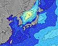 | 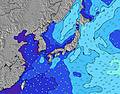 | 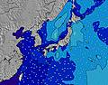 | 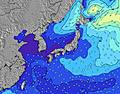 | |||||||||||||
Wave Height (m) Direction Period (s) | SE 16 | SE 17 | SE 17 | SE 16 | SE 16 | SE 16 | SSE 16 | E 10 | E 10 | ESE 10 | ESE 10 | SE 9 | SE 9 | ESE 9 | ESE 9 | ESE 9 | SE 9 | ESE 13 | ESE 12 | ESE 13 |
Wave Graph | ||||||||||||||||||||
1672 | 2794 | 3723 | 4228 | 0 | 0 | 0 | 392 | 255 | 402 | 151 | 353 | 294 | 604 | 591 | 691 | 365 | 497 | 276 | 539 | |
Wind (km/h) | ||||||||||||||||||||
Wind State on-shore cross-onshore cross-shore cross-offshore off-shore glassy | cross-off | cross-off | cross-off | off | cross-off | cross-off | cross-off | cross-off | cross-off | off | cross-off | cross-off | cross-off | off | off | off | cross-off | cross-off | cross-off | cross-off |
High Tide | 8:01PM1.47m | 8:16AM1.31m | 8:25PM1.45m | 9:15AM1.20m | 8:51PM1.43m | 10:41AM1.11m | 9:22PM1.40m | 1:34PM1.10m | 10:02PM1.36m | 4:15PM1.22m | 11:11PM1.32m | 4:28PM1.32m | 00:54AM1.32m | |||||||
Low Tide | 2:17AM0.56m | 2:08PM0.63m | 3:04AM0.53m | 2:35PM0.79m | 4:01AM0.52m | 3:01PM0.95m | 5:15AM0.50m | 3:16PM1.09m | 6:44AM0.44m | 5:53PM1.21m | 8:02AM0.36m | 8:44PM1.20m | ||||||||
— | — | 4:54 | — | — | 4:54 | — | — | 4:56 | — | — | 4:56 | — | — | 4:56 | — | — | 4:58 | — | — | |
6:45 | — | — | 6:44 | — | — | 6:43 | — | — | 6:42 | — | — | 6:40 | — | — | 6:39 | — | — | 6:38 | — | |
mm | — | — | — | — | — | — | — | 2 | 1 | — | 4 | 1 | — | 7 | 4 | — | — | 1 | — | — |
Temp °C | 25 | 23 | 26 | 26 | 24 | 26 | 28 | 26 | 29 | 28 | 25 | 27 | 28 | 26 | 28 | 28 | 26 | 27 | 27 | 25 |
Feels °C | 25 | 21 | 23 | 24 | 23 | 25 | 28 | 28 | 30 | 29 | 27 | 28 | 29 | 29 | 30 | 30 | 30 | 28 | 29 | 24 |
Swell 1 Height (m) Direction Period (s) | SE 16 | SE 17 | SE 17 | SE 16 | SE 16 | SE 16 | SSE 16 | SSE 14 | SSE 14 | S 15 | S 15 | SSW 15 | SSW 15 | SSW 14 | SSW 14 | SSW 14 | SE 9 | SSW 13 | SSW 13 | ESE 13 |
1672 | 2794 | 3723 | 4228 | 5341 | 5796 | 5220 | 3651 | 3517 | 3681 | 3277 | 2379 | 1948 | 1399 | 1224 | 926 | 365 | 563 | 468 | 539 | |
Swell 2 Height (m) Direction Period (s) | SE 20 | E 14 | E 14 | E 13 | — | — | — | — | E 10 | ESE 10 | ESE 10 | SE 9 | SE 9 | SE 9 | SE 9 | SE 9 | SSW 14 | ESE 13 | ESE 12 | SSW 10 |
396 | 34 | 60 | 31 | — | — | — | — | 255 | 80 | 151 | 353 | 294 | 281 | 362 | 343 | 813 | 497 | 276 | 141 | |
Swell 3 Height (m) Direction Period (s) | — | — | — | — | — | — | — | — | E 16 | — | ENE 16 | E 15 | E 15 | E 15 | E 14 | ESE 12 | — | SE 9 | SE 9 | SW 14 |
— | — | — | — | — | — | — | — | 5 | — | 24 | 17 | 17 | 17 | 16 | 81 | — | 90 | 120 | 151 | |
Wind waves Height (m) Direction Period (s) | NE 4 | ENE 4 | NE 4 | — | — | NE 4 | — | E 10 | NE 4 | ESE 10 | — | — | — | ESE 9 | ESE 9 | ESE 9 | — | — | — | — |
17 | 28 | 20 | — | — | 24 | — | 392 | 18 | 402 | — | — | — | 604 | 591 | 691 | — | — | — | — | |
Nearest Offshore or Glassy | ||||||||||||||||||||
Distance (km) | 501 | 440 | 92 | 0 | 440 | 438 | 49 | 27 | 49 | 0 | 49 | 49 | 48 | 0 | 0 | 0 | 0 | 49 | 0 | 1035 |
Best forecast wave conditions in Shizuoka | ||||||||||||||||||||
Best forecast wave conditions in Japan | ||||||||||||||||||||
Header Global | ||||||||||||||||||||
- Map Icons:
 Break
Break Live Wave Height (m)
 Live Wind Speed (km/h)
 Surf Rating (10 Max)
 Ocean Swells (m)
- Wind Speed (km/h)
Latest Updates


FREE! Surf-Forecast.com widget for your website
The surf report / weather widget below is available to embed on third party websites free of charge and provides a summary of our Usami surf forecast. Simply grab the html code snippet that we provide and paste it into your own site. You can choose your preferred language and metric/imperial units for the surf forecast feed to suit users of your site. Click here to get the code.
Information about the Usami Surf forecast
The above surf forecast table for Usami provides essential information for determining whether the surfing conditions will be good over the next 16 days. A general guide to surfing at Usami can be found by selecting the local surf guide option on the grey menu. Our Usami surf forecast is unique since it includes wave energy (power) that defines the real feel of the surf rather than just the height or the period. If you surf the same spot (Usami) regularly then make a mental note of the wave energy from the surf forecast table each time you go. Very soon you may start to choose your surf days based on the wave energy alone combined with our forecast of favourable offshore wind conditions. Our star ratings will help here and of course you will also find the usual wave height and period predictions on our surf forecasts as well as a full break down of the swell components under our advanced users option (to reveal that, click the little Einstein character under the tide times).
Further information to help with frequently asked questions about our surf forecast for Usami may be found under the help tab on the top menu and also by moving your mouse over the question marks on the surf forecast table itself. Please always bear in mind that the forecast is for near-shore open water and local factors at each surf break influence the actual breaking wave height, such as the beach / reef profile, water depths offshore and shelter.
Usami is 4 km (2 miles) from Ito. If you plan a holiday in Shizuoka, look for hotels and other accommodation in Ito. Ito has rooms for a wide range of budgets as well as car hire and transport links.
 Nearest