

Surf Forecasts:

Kuminatu surf forecast from 15 Jul 2026:
- Best quality surf: Tuesday 21 Jul, 9AM (local time) - 5ft (1.5m), 10s period, E swell with glassy winds.
- Most powerful swell: Wednesday 22 Jul, 6PM (local time) - 5.5ft (1.7m), 11s period, ENE swell with 711 kJ wave energy.
- Next surfable swell (1★+): Sunday 19 Jul, 6AM (local time) - 4ft (1.2m), 9s period with ESE swell.
Best Forecast Surf Conditions for Kuminatu this week:
The surf forecast for Kuminatu over the next 16 days: The first swell (rated 1 star or higher) is forecast to arrive on Sunday (Jul 19) at 6AM. The primary swell is predicted to be 1.2m and 9s period with a secondary swell of 0.5m and 8s. The wind is predicted to be glassy as the swell arrives.
The most powerful waves expected at Kuminatu in the next 16 days are 1.7m 11s and forecast to arrive on Wednesday (Jul 22) at 6PM. Winds are predicted to be cross-onshore at the time the swell arrives. The largest open ocean swell (not directed at the beach) is 1.1m 6s period and expected on Wednesday (Jul 22) at 6PM.
| Wave Type | Time (JST) & Date | Wave Height & Period |
|---|---|---|
| Next good surf (1 star+) | 6AM (Sun 19th Jul) | 4ft (1.2m) 9s |
| Best Surf | 9AM (Tue 21st Jul) | 5ft (1.5m) 10s |
| Most Powerful | 6PM (Wed 22nd Jul) | 5.5ft (1.7m) 11s |
Table - best surf conditions forecast for Kuminatu over the next 16 days.
The Lowdown
Alright folks, Rusty here. Let’s have a look at what’s on the cards for Kuminatu over the next couple of weeks.
It’s gonna be a bit of a slow burn, to be honest. The first week is pretty grim, with poor surf conditions and a lot of onshore wind messing things up. The first few days from Wednesday the 15th through to Saturday the 18th are basically a write-off. The swell is small, the wind is mostly cross-on or onshore, and the water is a bit choppy. You’re looking at weak, choppy waves around 2ft to 4ft with a fairly short period. The combined swell energy is weak to moderate (113 to 235). Don’t bother paddling out.
Sunday the 19th shows a slight glimmer, with a marginal forecast. The swell starts to build a touch to 4ft from the east, and the wind eases right off in the morning – almost nothing at 3 mph. The water is sitting at a warm 77°, which is about average for the time of year. It’s still not great, but you might find a few grovelly ones if you’re desperate.
Monday the 20th morning is our first real sign of life. The wind goes glassy, dead calm, with a 4ft easterly swell at 10 seconds. Combined energy is moderate (357) and the wave comment says “expect good surf conditions.” It’s not a standout, but for a Monday morning session, it’ll be clean and fun. The afternoon gets a bit messy with a light onshore breeze.
Tuesday the 21st morning is the first true standout of the period. The glassy conditions are back, with a 5ft easterly swell at 10 seconds. The combined energy jumps to a strong 501, and the forecast says “expect very good surf conditions.” This is the best we’ll see in the first week. Clean, fun waves, perfect for an intermediate. The afternoon does get a bit choppy as the wind swings cross-onshore, so get out early.
Things go quiet again from Wednesday the 22nd through to Saturday the 25th, with a mix of marginal and poor conditions. The swell drops back down, and the wind is mostly onshore again. Not worth a trip.
Sunday the 26th is interesting, but not for the right reasons. The swell is tiny (2ft to 2ft) but the period jumps to a very long 15 seconds. That’s proper groundswell energy, but it’s so small and the wind is cross-onshore, so it’ll be a messy, shut-down mess. The combined energy is moderate (282 to 316), but the wave quality is poor.
Now, the second week brings a change. Conditions improve, and there’s potential for some solid surf.
Monday the 27th morning has a 3ft swell from the SE with a 13-second period, light cross-shore wind, and moderate combined energy (407). It’s marginal, but clean enough for a fun session on a longboard.
Wednesday the 29th is the big one, but it’s a long way out, so keep an eye on it. The swell builds to 5ft – 6ft from the SE with a 15-second period. This is a very long period groundswell, which means it’ll be powerful and have long lulls between sets. The combined energy in the afternoon is a massive 1390 – strong wave energy. The wind is still cross-onshore, which is a shame, but it’s a light breeze. For a point break or reef, this would be pumping, but at a beach break, it might be a bit straight and tough to paddle into. Still, it’s the best size we’ve seen.
Thursday the 30th is the absolute standout. The swell peaks at 7ft from the SE, with a 16-second period, and the combined energy is a massive 3220 – very strong. And here’s the kicker: the wind is a fresh cross-offshore breeze from the NE. That’s clean, offshore wind. For a 7ft groundswell, this is going to be a serious day for experienced surfers. It’s too big for beginners, and the long period will make it powerful and likely a bit tricky at the beach, but if you can handle it, this is the best day on offer. The forecast says “marginal” but with “clean” conditions, so don’t be fooled – this is a special swell window.
Bottom line: The first week is a struggle. Tuesday the 21st morning is your best bet for a clean, fun session in the first week. But the real prize is Thursday the 30th – a big, clean, powerful groundswell for the experienced crew. Mark it in your calendar, but don’t book the time off just yet.
Rusty.
Short Range ForecastLight rain (total 2mm), mostly falling on Thu night. Warm (max 28°C on Wed afternoon, min 25°C on Fri night). Wind will be generally light. | Days 5-7 Weather SummaryMostly dry. Warm (max 29°C on Tue morning, min 24°C on Sat night). Wind will be generally light. | ||||||||||||||||||||
Wed 15 | Thursday 16 | Friday 17 | Saturday 18 | Sunday 19 | Monday 20 | Tuesday 21 | |||||||||||||||
PM | Night | AM | PM | Night | AM | PM | Night | AM | PM | Night | AM | PM | Night | AM | PM | Night | AM | PM | Night | AM | |
Swell Height Map |  |  |  | 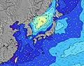 | 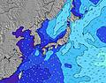 | 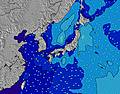 | 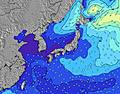 | 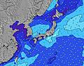 | |||||||||||||
Wave Height (m) Direction Period (s) | E 10 | E 9 | E 8 | E 8 | ESE 9 | E 9 | E 9 | E 8 | ESE 9 | E 9 | ESE 9 | E 9 | E 10 | E 10 | E 10 | E 10 | E 11 | E 10 | E 11 | E 11 | E 11 |
Wave Graph | |||||||||||||||||||||
47 | 102 | 115 | 116 | 186 | 93 | 95 | 143 | 202 | 169 | 289 | 246 | 214 | 216 | 327 | 332 | 449 | 486 | 617 | 652 | 629 | |
Wind (km/h) | |||||||||||||||||||||
Wind State on-shore cross-onshore cross-shore cross-offshore off-shore glassy | cross-on | cross-on | cross-on | cross-on | on | on | on | on | on | on | on | on | on | glassy | glassy | on | cross | glassy | cross-on | cross-on | cross-on |
High Tide | 6:30PM1.49m | 4:59AM1.59m | 7:02PM1.48m | 5:50AM1.55m | 7:32PM1.46m | 6:39AM1.48m | 7:58PM1.44m | 7:29AM1.37m | 8:23PM1.43m | 8:23AM1.24m | 8:48PM1.41m | 9:27AM1.12m | 9:15PM1.38m | 11:06AM1.03m | |||||||
Low Tide | 11:37PM0.93m | 12:03PM-0.03m | 00:17AM0.85m | 12:43PM0.10m | 00:59AM0.78m | 1:19PM0.26m | 1:43AM0.71m | 1:53PM0.43m | 2:30AM0.67m | 2:23PM0.60m | 3:25AM0.63m | 2:53PM0.76m | 4:31AM0.59m | ||||||||
— | — | 4:35 | — | — | 4:35 | — | — | 4:37 | — | — | 4:37 | — | — | 4:37 | — | — | 4:39 | — | — | 4:39 | |
6:53 | — | — | 6:52 | — | — | 6:52 | — | — | 6:52 | — | — | 6:52 | — | — | 6:51 | — | — | 6:51 | — | 6:50 | |
mm | — | — | — | — | 2 | — | — | — | — | — | — | — | — | — | — | — | — | — | — | 1 | 2 |
Temp °C | 28 | 26 | 28 | 28 | 26 | 27 | 27 | 25 | 27 | 26 | 24 | 27 | 27 | 25 | 27 | 27 | 25 | 29 | 28 | 26 | 28 |
Feels °C | 30 | 28 | 32 | 31 | 30 | 29 | 29 | 28 | 29 | 28 | 26 | 29 | 29 | 28 | 31 | 30 | 28 | 32 | 31 | 30 | 32 |
Swell 1 Height (m) Direction Period (s) | E 10 | E 9 | E 8 | E 8 | ESE 9 | E 9 | E 9 | E 8 | ESE 9 | E 9 | ESE 9 | E 9 | E 10 | E 10 | E 10 | E 10 | E 11 | E 10 | E 11 | E 11 | E 11 |
47 | 102 | 115 | 116 | 186 | 93 | 95 | 143 | 202 | 169 | 289 | 246 | 214 | 216 | 327 | 332 | 449 | 486 | 617 | 652 | 629 | |
Swell 2 Height (m) Direction Period (s) | SW 9 | SE 9 | SW 8 | SW 8 | SW 8 | SW 8 | SE 8 | SE 8 | SE 8 | SE 8 | SE 8 | SE 8 | S 8 | SSE 7 | SSE 8 | SE 8 | SSE 8 | SSE 8 | S 8 | SW 8 | SW 4 |
41 | 13 | 18 | 18 | 23 | 20 | 18 | 25 | 25 | 34 | 16 | 31 | 11 | 37 | 26 | 18 | 7 | 13 | 19 | 2 | 3 | |
Swell 3 Height (m) Direction Period (s) | ESE 9 | SE 11 | SSE 9 | SE 10 | SE 10 | SE 10 | SW 8 | SW 7 | SW 7 | SW 7 | S 8 | S 9 | ESE 12 | S 8 | S 7 | ESE 12 | S 8 | SW 7 | ESE 11 | WSW 8 | SSE 7 |
16 | 5 | 8 | 16 | 16 | 15 | 14 | 8 | 8 | 8 | 6 | 14 | 14 | 10 | 4 | 14 | 12 | 2 | 12 | 6 | 11 | |
Wind waves Height (m) Direction Period (s) | S 4 | S 5 | SSW 5 | S 5 | SSE 5 | SE 5 | SSE 5 | S 4 | — | S 4 | — | SSE 8 | SSE 8 | — | — | SW 7 | WSW 6 | — | SW 2 | S 8 | — |
9 | 53 | 32 | 23 | 37 | 58 | 39 | 9 | — | 1 | — | 56 | 67 | — | — | 2 | 4 | — | 1 | 18 | — | |
Nearest Offshore or Glassy | |||||||||||||||||||||
Distance (km) | 21 | 27 | 27 | 21 | 21 | 195 | 91 | 21 | 21 | 91 | 21 | 21 | 21 | 0 | 0 | 21 | 5 | 0 | 21 | 21 | 21 |
Best forecast wave conditions in Chiba | |||||||||||||||||||||
Best forecast wave conditions in Japan | |||||||||||||||||||||
Header Global | |||||||||||||||||||||
- Map Icons:
 Break
Break Live Wave Height (m)
 Live Wind Speed (km/h)
 Surf Rating (10 Max)
 Ocean Swells (m)
- Wind Speed (km/h)


FREE! Surf-Forecast.com widget for your website
The surf report / weather widget below is available to embed on third party websites free of charge and provides a summary of our Kuminatu surf forecast. Simply grab the html code snippet that we provide and paste it into your own site. You can choose your preferred language and metric/imperial units for the surf forecast feed to suit users of your site. Click here to get the code.
Information about the Kuminatu Surf forecast
The above surf forecast table for Kuminatu provides essential information for determining whether the surfing conditions will be good over the next 16 days. A general guide to surfing at Kuminatu can be found by selecting the local surf guide option on the grey menu. Our Kuminatu surf forecast is unique since it includes wave energy (power) that defines the real feel of the surf rather than just the height or the period. If you surf the same spot (Kuminatu) regularly then make a mental note of the wave energy from the surf forecast table each time you go. Very soon you may start to choose your surf days based on the wave energy alone combined with our forecast of favourable offshore wind conditions. Our star ratings will help here and of course you will also find the usual wave height and period predictions on our surf forecasts as well as a full break down of the swell components under our advanced users option (to reveal that, click the little Einstein character under the tide times).
Further information to help with frequently asked questions about our surf forecast for Kuminatu may be found under the help tab on the top menu and also by moving your mouse over the question marks on the surf forecast table itself. Please always bear in mind that the forecast is for near-shore open water and local factors at each surf break influence the actual breaking wave height, such as the beach / reef profile, water depths offshore and shelter.
Kuminatu is 6 km (4 miles) from Katsuura. If you plan a holiday in Chiba, look for hotels and other accommodation in Katsuura. Katsuura has rooms for a wide range of budgets as well as car hire and transport links.
 Nearest