

Surf Forecasts:

Fare Left surf forecast from 3 Aug 2026:
- Best quality surf: Thursday 6 Aug, 5AM (local time) - 4.5ft (1.4m), 18s period, SSW swell with offshore winds.
- Most powerful swell: Sunday 9 Aug, 8AM (local time) - 11ft (3.5m), 16s period, S swell with 6,715 kJ wave energy.
- Next surfable swell (1★+): Sunday 2 Aug, 11PM (local time) - 3.5ft (1.1m), 14s period with SSW swell.
Best Forecast Surf Conditions for Fare Left this week:
The surf forecast for Fare Left over the next 16 days: The first swell (rated 1 star or higher) is forecast to arrive on Sunday (Aug 02) at 11PM. The primary swell is predicted to be 1.1m and 14s period with a secondary swell of 0.9m and 10s. The wind is predicted to be offshore as the swell arrives.
The most powerful waves expected at Fare Left in the next 16 days are 3.5m 16s and forecast to arrive on Sunday (Aug 09) at 8AM. Winds are predicted to be offshore at the time the swell arrives. The largest open ocean swell (not directed at the beach) is 2.5m 8s period and expected on Monday (Aug 10) at 2AM.
| Wave Type | Time (-10) & Date | Wave Height & Period |
|---|---|---|
| Next good surf (1 star+) | 11PM (Sun 2nd Aug) | 3.5ft (1.1m) 14s |
| Best Surf | 5AM (Thu 6th Aug) | 4.5ft (1.4m) 18s |
| Most Powerful | 8AM (Sun 9th Aug) | 11ft (3.5m) 16s |
Table - best surf conditions forecast for Fare Left over the next 16 days.
The Lowdown
Right then, let’s have a look at what’s on the cards for Fare Left over the next couple of weeks.
We’re starting off with a bit of a slow burner, but there’s some serious potential building for the more experienced crew. The water temp is sitting at about 80°, which is pretty much bang on average for this time of year, so no surprises there.
The first few days are a bit of a tease. Sunday the 2nd has some clean, cross-off conditions but the swell is small and a bit junky. Monday the 3rd picks up with a clean, offshore wind and a small 3-ft SSW swell, but the energy is still moderate at best (393). It’s ridable, but nothing to write home about. Tuesday morning the 4th is tiny, but keep an eye on Tuesday afternoon. That’s where things start to get interesting: a clean 4-ft SSW groundswell with a 14-second period, glassy offshore wind from the ENE, and the energy jumps up to 561. That’s a very nice session shaping up, clean and lined up.
Wednesday the 5th is a solid day too. Offshore winds all day, a clean 3-4-ft SW swell, and wave energy in the moderate range (635 and 581). This is good, fun surf for an advanced surfer.
Now, Thursday the 6th sees a jump in size. We’ve got a 5-6-ft to 6-7-ft SSW groundswell with a very long 17-second period. The energy is strong now (1900/2033) but the wind is a bit cross-off and there’s rain showers. It’s a big, powerful swell, and for a reef break like Fare Left, that long period will wrap in nicely. Definitely one for the experienced crew only.
The standout window really opens up from Friday the 7th through to Sunday the 9th. Friday the 7th is excellent: clean, moderate offshore wind, a solid 5-6-ft SSW groundswell with a 15-16 second period, and strong energy (1236-1527). This is top-tier stuff for experienced surfers. Saturday the 8th is even bigger. The morning shows an 8-ft S swell, and the energy is pumping (2457). The wind is offshore, keeping it clean. This is big, powerful, expert-only territory. The afternoon drops back to 4-5-ft but with an 18-second period from the SSW – incredible shape, but again, heavy.
Sunday the 9th is a beast. 10-ft SSW groundswell with a 16-second period, fresh offshore wind, and energy readings of 4692 and 3937. That is serious, serious power. If you’re an expert, this is your day. The swell is huge and the wind is clean, but it's not for the faint of heart.
After that, the swell backs off a bit. Monday the 10th is still excellent (7-ft, strong energy, offshore wind), but Tuesday the 11th onward gets messy. The wind picks up into the 18-22 mph range, and the quality drops. By Wednesday the 12th and Thursday the 13th, we’re looking at poor, blown-out conditions with strong winds and lumpy seas. There’s a gap of poor surf from around the 12th to the 15th.
There’s a flicker of hope on Sunday the 16th with a building 6-ft S swell (17-second period, strong energy 3028) but the wind is cross-off, so it’s not pristine. Monday the 17th sees another 10-ft pulse, but again, it’s cross-off and lumpy.
So, the true standout is the window from Friday 7th August to Sunday 9th August. The best single session? I’d be looking at Saturday 8th August afternoon. The swell drops to 4-5-ft, but the period is a staggering 18 seconds from the SSW, the wind is offshore, and the energy is still massive (2396). That is a very, very long, clean, powerful groundswell on a reef. Perfection for the advanced surfer, but expect crowds – it’s a known spot and it’s “sometimes” busy.
Rusty.
Short Range ForecastMostly dry. Warm (max 26°C on Wed morning, min 24°C on Sun night). Wind will be generally light. | Days 5-7 Weather SummaryLight rain (total 5mm), mostly falling on Thu night. Warm (max 26°C on Wed night, min 25°C on Wed night). Mainly fresh winds. | ||||||||||||||||||
Monday 3 | Tuesday 4 | Wednesday 5 | Thursday 6 | Friday 7 | Saturday 8 | ||||||||||||||
Night | AM | PM | Night | AM | PM | Night | AM | PM | Night | AM | PM | Night | AM | PM | Night | AM | PM | Night | |
Swell Height Map |  |  |  |  | 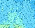 | 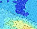 | 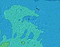 | ||||||||||||
Wave Height (m) Direction Period (s) | SSW 14 | SSW 13 | SSW 14 | S 13 | SSW 13 | SSW 14 | SSW 13 | SSW 13 | SSW 12 | SSW 18 | SSW 17 | SSW 16 | SSW 15 | SSW 15 | SSW 14 | SSW 14 | SSW 14 | SSW 13 | SSW 17 |
Wave Graph | |||||||||||||||||||
415 | 303 | 199 | 331 | 195 | 561 | 465 | 444 | 304 | 609 | 2322 | 1750 | 1488 | 1209 | 1752 | 2650 | 1579 | 1630 | 3486 | |
Wind (km/h) | |||||||||||||||||||
Wind State on-shore cross-onshore cross-shore cross-offshore off-shore glassy | off | off | off | cross-off | cross-off | off | cross-off | off | off | off | off | off | cross-off | off | off | off | cross-off | off | cross-off |
High Tide | 2:18AM0.20m | 2:45PM0.21m | 2:24AM0.19m | 2:55PM0.18m | 2:23AM0.18m | 2:51PM0.15m | 2:08AM0.17m | 2:04PM0.13m | 1:22AM0.16m | 12:06PM0.13m | 00:38AM0.17m | 11:39AM0.15m | 00:28AM0.18m | ||||||
Low Tide | 8:46PM0.06m | 8:39AM0.04m | 8:57PM0.08m | 8:53AM0.06m | 8:52PM0.10m | 8:57AM0.07m | 7:55PM0.11m | 8:25AM0.09m | 6:37PM0.09m | 7:12AM0.10m | 6:07PM0.07m | 6:30AM0.09m | 6:07PM0.04m | ||||||
— | 6:28 | — | — | 6:28 | — | — | 6:26 | — | — | 6:26 | — | — | 6:26 | — | — | 6:26 | — | — | |
5:52 | — | 5:52 | — | — | 5:52 | — | — | 5:52 | — | — | 5:52 | — | — | 5:52 | — | — | 5:52 | — | |
mm | — | — | — | — | — | — | — | — | — | — | — | — | 4 | 1 | — | — | — | — | — |
Temp °C | 25 | 25 | 25 | 25 | 25 | 25 | 25 | 26 | 26 | 26 | 25 | 25 | 25 | 25 | 25 | 25 | 26 | 26 | 25 |
Feels °C | 25 | 26 | 26 | 25 | 26 | 28 | 27 | 28 | 28 | 28 | 26 | 26 | 26 | 24 | 23 | 24 | 25 | 26 | 24 |
Swell 1 Height (m) Direction Period (s) | SSW 14 | SSW 13 | SSW 14 | S 13 | E 7 | SSW 14 | SSW 13 | SSW 13 | ENE 8 | SSW 12 | SSW 17 | SSW 16 | SSW 15 | SSW 15 | SSW 14 | SSW 14 | SSW 14 | SSW 13 | SSW 17 |
415 | 303 | 175 | 331 | 102 | 561 | 465 | 444 | 151 | 378 | 2322 | 1750 | 1488 | 1209 | 1752 | 2650 | 1579 | 1630 | 3486 | |
Swell 2 Height (m) Direction Period (s) | SSE 10 | SSE 9 | SSE 8 | ESE 7 | SSW 13 | E 8 | E 8 | E 8 | SSW 12 | ENE 8 | ENE 8 | ENE 8 | ENE 8 | S 6 | ENE 8 | NE 10 | SSE 7 | S 19 | NW 13 |
163 | 90 | 59 | 9 | 195 | 111 | 148 | 146 | 304 | 123 | 83 | 107 | 104 | 62 | 112 | 23 | 108 | 369 | 7 | |
Swell 3 Height (m) Direction Period (s) | S 17 | ENE 8 | S 14 | NE 12 | SSW 16 | NNE 9 | SW 21 | SSW 20 | SSW 19 | SSW 18 | NNE 10 | NNE 10 | NE 9 | NE 9 | NE 10 | S 18 | E 9 | E 9 | WNW 13 |
291 | 47 | 199 | 22 | 171 | 15 | 116 | 253 | 251 | 609 | 38 | 37 | 22 | 20 | 23 | 25 | 38 | 54 | 17 | |
Wind waves Height (m) Direction Period (s) | E 7 | — | — | ENE 8 | — | — | — | — | — | — | — | — | SE 4 | ENE 8 | ENE 5 | ENE 8 | ENE 6 | ENE 6 | SSE 12 |
54 | — | — | 52 | — | — | — | — | — | — | — | — | 6 | 112 | 19 | 90 | 100 | 68 | 1200 | |
Nearest Offshore or Glassy | |||||||||||||||||||
Distance (km) | 1 | 0 | 0 | 0 | 49 | 0 | 0 | 0 | 0 | 0 | 0 | 1 | 152 | 1 | 0 | 0 | 48 | 0 | 0 |
Best forecast wave conditions in Huahine | |||||||||||||||||||
Best forecast wave conditions in French Polynesia | |||||||||||||||||||
Header Global | |||||||||||||||||||
- Map Icons:
 Break
Break Live Wave Height (m)
 Live Wind Speed (km/h)
 Surf Rating (10 Max)
 Ocean Swells (m)
- Wind Speed (km/h)
Latest Updates


FREE! Surf-Forecast.com widget for your website
The surf report / weather widget below is available to embed on third party websites free of charge and provides a summary of our Fare Left surf forecast. Simply grab the html code snippet that we provide and paste it into your own site. You can choose your preferred language and metric/imperial units for the surf forecast feed to suit users of your site. Click here to get the code.
Information about the Fare Left Surf forecast
The above surf forecast table for Fare Left provides essential information for determining whether the surfing conditions will be good over the next 16 days. A general guide to surfing at Fare Left can be found by selecting the local surf guide option on the grey menu. Our Fare Left surf forecast is unique since it includes wave energy (power) that defines the real feel of the surf rather than just the height or the period. If you surf the same spot (Fare Left) regularly then make a mental note of the wave energy from the surf forecast table each time you go. Very soon you may start to choose your surf days based on the wave energy alone combined with our forecast of favourable offshore wind conditions. Our star ratings will help here and of course you will also find the usual wave height and period predictions on our surf forecasts as well as a full break down of the swell components under our advanced users option (to reveal that, click the little Einstein character under the tide times).
Further information to help with frequently asked questions about our surf forecast for Fare Left may be found under the help tab on the top menu and also by moving your mouse over the question marks on the surf forecast table itself. Please always bear in mind that the forecast is for near-shore open water and local factors at each surf break influence the actual breaking wave height, such as the beach / reef profile, water depths offshore and shelter.
Are you planning a holiday in Huahine? If you are looking for accommodation near Fare Left, camping, hotels and holiday cottages in Huahine, consider staying in Anau which is 77 km (48 miles) away.
 Nearest