

Surf Forecasts:

Teahupo’o surf forecast from 2 Aug 2026:
- Best quality surf: Sunday 2 Aug, 2PM (local time) - 4ft (1.2m), 15s period, SSW swell with cross-offshore winds.
- Most powerful swell: Sunday 9 Aug, 2AM (local time) - 11ft (3.5m), 17s period, SSW swell with 6,840 kJ wave energy.
- Next surfable swell (1★+): Sunday 2 Aug, 2PM (local time) - 4ft (1.2m), 15s period with SSW swell.
Best Forecast Surf Conditions for Teahupo’o this week:
The surf forecast for Teahupo’o over the next 16 days: The first swell (rated 1 star or higher) is forecast to arrive on Sunday (Aug 02) at 2PM. The primary swell is predicted to be 1.2m and 15s period with a secondary swell of 1.3m and 10s. The wind is predicted to be cross-offshore as the swell arrives.
The most powerful waves expected at Teahupo’o in the next 16 days are 3.5m 17s and forecast to arrive on Sunday (Aug 09) at 2AM. Winds are predicted to be cross-offshore at the time the swell arrives. The largest open ocean swell (not directed at the beach) is 1.5m 8s period and expected on Wednesday (Aug 05) at 8AM.
| Wave Type | Time (-10) & Date | Wave Height & Period |
|---|---|---|
| Next good surf (1 star+) | 2PM (Sun 2nd Aug) | 4ft (1.2m) 15s |
| Best Surf | 2PM (Sun 2nd Aug) | 4ft (1.2m) 15s |
| Most Powerful | 2AM (Sun 9th Aug) | 11ft (3.5m) 17s |
Table - best surf conditions forecast for Teahupo’o over the next 16 days.
The Lowdown
Alright, crew, Rusty here. Let’s break it down.
We’ve got a solid run of south-southwest groundswell heading for the reef, and the early part of the week is looking like the winner. Water’s at 79°F, about average for the season.
Sunday starts clean with 4ft of 15-second swell and light cross-off winds. The energy’s moderate, but it’s smooth. It gets a bit better in the afternoon as the energy picks up.
Monday’s a bit smaller and the wind freshens, so it’s just okay.
Tuesday is where it’s at. The wind goes offshore, light in the afternoon, swell bumps to 4ft with a 14-second period. Clean, offshore, and cranking. This is a top window.
Wednesday morning is similar, but the real gem is the afternoon – 2ft of swell with a 20-second period and light offshore wind. That’s a long-period groundswell, and on this reef, it’ll be perfect. High quality.
Thursday the size jumps. Morning is 6ft, afternoon 7ft, both with long periods and light winds. Energy is strong. This is big, heavy Teahupo’o – experts only.
Friday and Saturday get even bigger, pushing 8ft to 10ft, with energy going through the roof. Winds are stronger but still cross-off. This is serious, heavy water.
Sunday holds at 10ft with strong energy. Not for the faint-hearted.
After that, it settles a bit. Monday holds 8ft, but the wind is up. Tuesday is clean again with 7ft and lighter winds, a good window for the brave.
The middle of next week sees the swell drop to 5ft or less, but the wind goes bad, turning it messy. By Thursday, it’s blown out.
The tail end, around the 17th, shows a bit of recovery with a 6ft SE swell and light cross-off winds, but the period is shorter and the quality isn’t the same.
So, the standouts are Tuesday afternoon and Wednesday afternoon – clean, offshore, with good energy and that long-period push. The big days from Thursday through Sunday are for the elite only. After that, it’s a waiting game.
Stay safe.
Rusty.
Short Range ForecastLight rain (total 5mm), mostly falling on Sun night. Warm (max 25°C on Mon afternoon, min 24°C on Sun morning). Winds increasing (light winds from the E on Sun morning, fresh winds from the NE by Mon night). | Days 4-6 Weather SummaryLight rain (total 7mm), mostly falling on Fri morning. Warm (max 25°C on Wed morning, min 24°C on Wed night). Wind will be generally light. | ||||||||||||||||||||
Sunday 2 | Monday 3 | Tuesday 4 | Wednesday 5 | Thursday 6 | Friday 7 | Saturday 8 | |||||||||||||||
AM | PM | Night | AM | PM | Night | AM | PM | Night | AM | PM | Night | AM | PM | Night | AM | PM | Night | AM | PM | Night | |
Swell Height Map |  |  | 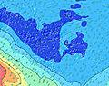 | 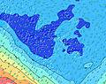 |  | 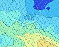 | 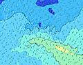 | ||||||||||||||
Wave Height (m) Direction Period (s) | SSW 15 | SSW 14 | SSW 13 | S 15 | SSW 14 | SSW 13 | SSW 16 | SSW 14 | SW 13 | SW 13 | SW 20 | SSW 18 | SSW 17 | SSW 16 | SSW 16 | SSW 15 | SSW 15 | SSW 14 | SSW 14 | SSW 16 | SSW 17 |
Wave Graph | |||||||||||||||||||||
674 | 742 | 514 | 527 | 307 | 298 | 226 | 691 | 509 | 486 | 388 | 785 | 2024 | 2419 | 2172 | 1907 | 2400 | 2346 | 2002 | 4273 | 6840 | |
Wind (km/h) | |||||||||||||||||||||
Wind State on-shore cross-onshore cross-shore cross-offshore off-shore glassy | cross-off | cross-off | cross-off | cross-off | cross-off | off | off | off | off | off | off | cross-off | cross-off | cross | cross-on | cross-off | cross-off | cross-off | cross-off | cross-off | cross-off |
High Tide | 2:31PM0.36m | 2:32AM0.33m | 2:59PM0.33m | 2:54AM0.31m | 3:30PM0.29m | 3:16AM0.29m | 4:13PM0.25m | 3:39AM0.25m | 9:52PM0.22m | 8:23AM0.22m | 10:40PM0.26m | 10:03AM0.27m | 11:09PM0.29m | ||||||||
Low Tide | 8:23AM0.05m | 8:42PM0.09m | 8:51AM0.07m | 9:07PM0.12m | 9:23AM0.10m | 9:33PM0.15m | 10:05AM0.12m | 10:02PM0.19m | 11:40AM0.15m | 4:32AM0.21m | 3:54PM0.13m | 4:36AM0.17m | 4:45PM0.08m | ||||||||
6:22 | — | — | 6:22 | — | — | 6:22 | — | — | 6:20 | — | — | 6:20 | — | — | 6:20 | — | — | 6:20 | — | — | |
— | 5:43 | — | — | 5:43 | — | — | 5:44 | — | — | 5:44 | — | — | 5:44 | — | — | 5:44 | — | — | 5:45 | — | |
mm | — | — | 2 | 1 | — | — | 1 | — | 1 | 1 | — | — | — | — | 2 | 3 | 1 | — | — | — | — |
Temp °C | 24 | 24 | 24 | 24 | 25 | 25 | 25 | 25 | 25 | 25 | 25 | 25 | 24 | 25 | 25 | 24 | 25 | 25 | 25 | 25 | 25 |
Feels °C | 25 | 25 | 24 | 22 | 24 | 23 | 25 | 25 | 26 | 24 | 25 | 27 | 26 | 27 | 26 | 23 | 25 | 24 | 24 | 25 | 25 |
Swell 1 Height (m) Direction Period (s) | SSW 15 | SSW 14 | SSW 13 | S 15 | ESE 7 | ESE 7 | ESE 8 | E 8 | E 8 | E 8 | E 8 | SSW 12 | SSW 17 | SSW 16 | SSW 16 | SSW 15 | SSW 15 | SSW 14 | SSW 14 | SSW 16 | SSW 17 |
674 | 742 | 514 | 527 | 156 | 125 | 207 | 273 | 191 | 196 | 164 | 488 | 2024 | 2419 | 2172 | 1907 | 2400 | 2346 | 2002 | 4273 | 6840 | |
Swell 2 Height (m) Direction Period (s) | SSE 10 | SSE 10 | SSE 9 | SSW 13 | SSW 14 | SSW 13 | SSW 13 | SSW 14 | SW 13 | SW 13 | SW 12 | SSW 18 | SSW 11 | E 8 | E 9 | E 9 | E 8 | NNE 9 | SSW 18 | — | — |
294 | 240 | 154 | 225 | 307 | 298 | 219 | 691 | 509 | 486 | 336 | 785 | 396 | 99 | 127 | 119 | 113 | 8 | 522 | — | — | |
Swell 3 Height (m) Direction Period (s) | E 6 | S 18 | S 17 | SE 7 | S 14 | S 13 | SSW 16 | SSW 24 | SW 21 | SW 20 | SW 20 | E 8 | E 8 | SE 12 | NE 9 | NE 10 | NE 10 | NW 13 | NE 9 | — | — |
24 | 322 | 358 | 59 | 253 | 56 | 226 | 54 | 116 | 388 | 388 | 148 | 127 | 22 | 3 | 4 | 4 | 6 | 3 | — | — | |
Wind waves Height (m) Direction Period (s) | — | — | E 7 | E 6 | — | NE 4 | — | — | — | — | — | — | — | — | S 5 | SSE 6 | SE 6 | ESE 6 | SE 6 | ESE 6 | ESE 6 |
— | — | 87 | 92 | — | 16 | — | — | — | — | — | — | — | — | 77 | 111 | 86 | 191 | 261 | 202 | 209 | |
Nearest Offshore or Glassy | |||||||||||||||||||||
Distance (km) | 0 | 0 | 35 | 72 | 72 | 264 | 0 | 0 | 0 | 0 | 0 | 0 | 0 | 9 | 46 | 228 | 228 | 2658 | 262 | 228 | 268 |
Best forecast wave conditions in Tahiti | |||||||||||||||||||||
Best forecast wave conditions in French Polynesia | |||||||||||||||||||||
Header Global | |||||||||||||||||||||
- Map Icons:
 Break
Break Live Wave Height (m)
 Live Wind Speed (km/h)
 Surf Rating (10 Max)
 Ocean Swells (m)
- Wind Speed (km/h)
Latest Updates


FREE! Surf-Forecast.com widget for your website
The surf report / weather widget below is available to embed on third party websites free of charge and provides a summary of our Teahupo’o surf forecast. Simply grab the html code snippet that we provide and paste it into your own site. You can choose your preferred language and metric/imperial units for the surf forecast feed to suit users of your site. Click here to get the code.
Information about the Teahupo’o Surf forecast
The above surf forecast table for Teahupo’o provides essential information for determining whether the surfing conditions will be good over the next 16 days. A general guide to surfing at Teahupo’o can be found by selecting the local surf guide option on the grey menu. Our Teahupo’o surf forecast is unique since it includes wave energy (power) that defines the real feel of the surf rather than just the height or the period. If you surf the same spot (Teahupo’o) regularly then make a mental note of the wave energy from the surf forecast table each time you go. Very soon you may start to choose your surf days based on the wave energy alone combined with our forecast of favourable offshore wind conditions. Our star ratings will help here and of course you will also find the usual wave height and period predictions on our surf forecasts as well as a full break down of the swell components under our advanced users option (to reveal that, click the little Einstein character under the tide times).
Further information to help with frequently asked questions about our surf forecast for Teahupo’o may be found under the help tab on the top menu and also by moving your mouse over the question marks on the surf forecast table itself. Please always bear in mind that the forecast is for near-shore open water and local factors at each surf break influence the actual breaking wave height, such as the beach / reef profile, water depths offshore and shelter.
Teahupoo is 45 km (28 miles) from Punaauia. If you plan a holiday in Tahiti, look for hotels and other accommodation in Punaauia. Punaauia has rooms for a wide range of budgets as well as car hire and transport links.
 Nearest