

Surf Forecasts:

Rocky Point surf forecast from 3 Aug 2026:
- Best quality surf: Sunday 2 Aug, 8PM (local time) - 2ft (0.6m), 8s period, ENE swell with cross-offshore winds.
- Most powerful swell: Sunday 9 Aug, 8PM (local time) - 7ft (2.2m), 7s period, E swell with 501 kJ wave energy.
- Next surfable swell (1★+): Sunday 2 Aug, 8PM (local time) - 2ft (0.6m), 8s period with ENE swell.
Best Forecast Surf Conditions for Rocky Point this week:
The surf forecast for Rocky Point over the next 16 days: The first swell (rated 1 star or higher) is forecast to arrive on Sunday (Aug 02) at 8PM. The primary swell is predicted to be 0.6m and 8s period with a secondary swell of 0.3m and 7s. The wind is predicted to be cross-offshore as the swell arrives.
The most powerful waves expected at Rocky Point in the next 16 days are 2.2m 7s and forecast to arrive on Sunday (Aug 09) at 8PM. Winds are predicted to be cross-offshore at the time the swell arrives. The largest open ocean swell (not directed at the beach) is 1.7m 6s period and expected on Sunday (Aug 09) at 5AM.
| Wave Type | Time (-10) & Date | Wave Height & Period |
|---|---|---|
| Next good surf (1 star+) | 8PM (Sun 2nd Aug) | 2ft (0.6m) 8s |
| Best Surf | 8PM (Sun 2nd Aug) | 2ft (0.6m) 8s |
| Most Powerful | 8PM (Sun 9th Aug) | 7ft (2.2m) 7s |
Table - best surf conditions forecast for Rocky Point over the next 16 days.
The Lowdown
Alright folks, Rusty here. Let’s have a look at what the next couple of weeks are serving up for Rocky Point. It’s a bit of a mixed bag, so I’ll walk you through it chronologically, telling you when to paddle out and when to stay home.
The outlook starts quiet and builds into a solid run of bigger, more powerful swell. The issue will be the wind; for a while there, it's not playing nice. The water temp is sitting at 79°, which is about average for this time of year, so no drama there.
Sunday, August 2nd afternoon kicks things off. We’ve got tiny 2ft swell from the ENE with a short 8-second period and weak wave energy (49). The wind is a light cross-off from the ESE, making it clean, but honestly, it’s super ordinary. Only a 1/10 score, so don’t expect much.
Monday, August 3rd is a write-off. The swell bumps up a touch to 2-3ft, but it’s messy with a moderate cross-shore chop. Scores are 0/10. It’s not worth it.
Tuesday, August 4th through Wednesday, August 5th sees the swell pick up to 4-4ft, and the energy climbs into the hundreds (166-203). But the wind is cross-on from the ENE, so conditions are choppy. Still scoring 0/10 for surf quality.
We finally get a small window of clean surf on Thursday, August 6th afternoon. The swell drops back to 3ft (ENE, 8 secs) with light cross-off wind from the ESE. Wave energy is low (81). It’s surfable, but again, very ordinary.
Friday, August 7th is back to a moderate cross-shore chop. Not good.
Saturday, August 8th offers some clean waves, with the swell at 4ft, but the period drops to a shocking 5 seconds in the morning, making it a messy windswell. Wave energy is moderate (213) in the afternoon, but the score is still a 0/10. The waves are there, but they’re lacking any punch.
Now things get interesting in size but messy in wind. From Sunday, August 9th to Wednesday, August 12th, we’re looking at solid 6ft to 7ft swell from the E, with period slowly building from 6 to 10 seconds. Wave energy gets strong, hitting 852 by Wednesday morning. The problem? The wind is a fresh to strong breeze, mostly cross-off or cross-shore, creating lumpy conditions. The scores are 0/10, except for a few marginal calls. This is big, powerful, but messy. Not beginner friendly (over 5ft).
Here’s the standout. Thursday, August 13th morning is the real gem. We get a 5ft swell from the ENE with a 10-second period, and the wind turns offshore from the SSE. It’s a fresh breeze, but it’s offshore, meaning clean, lined-up waves. The energy is strong at 523. The score is the best we’ve seen at 2/10. This is the one to circle on the calendar. The afternoon, however, gets wrecked by a gale-force cross-off wind (40 mph) – so it’s a very short window.
The following days, Friday, August 14th to Saturday, August 15th, the swell drops to 2-4ft. We get some offshore wind from the S on Saturday, which is clean, but the wave energy is moderate and the scores are only marginal.
Then on Sunday, August 16th morning, we get another interesting one. A 5ft swell from the W with a short 6-second period, but gentle offshore wind from the S. Wave energy is strong (396). The score is 2/10. It’s a bit of a novelty short-period swell, but clean. The afternoon brings a 2ft very long period (15-second) groundswell from the NW. At a reef and point break like Rocky Point, that long period should wrap in nicely and offer some fun, clean lines, even if it’s small.
Monday, August 17th fades out with tiny 1-2ft swells. Nothing to get excited about.
Bottom line: most of this forecast is so-so, with the wind working against us. The only true standouts are Thursday morning, August 13th for the clean, offshore 5ft swell, and Sunday morning, August 16th for a clean, punchy 5ft swell. Get out there for those windows.
Stay salty,
Rusty
Short Range ForecastLight rain (total 5mm), mostly falling on Tue night. Warm (max 25°C on Sun afternoon, min 24°C on Sun afternoon). Winds increasing (light winds from the ESE on Sun afternoon, fresh winds from the ENE by Mon night). | Days 5-7 Weather SummaryLight rain (total 3mm), mostly falling on Thu night. Warm (max 25°C on Wed afternoon, min 24°C on Thu night). Mainly fresh winds. | |||||||||||||||||||
Sun 2 | Monday 3 | Tuesday 4 | Wednesday 5 | Thursday 6 | Friday 7 | Saturday 8 | ||||||||||||||
PM | Night | AM | PM | Night | AM | PM | Night | AM | PM | Night | AM | PM | Night | AM | PM | Night | AM | PM | Night | |
Swell Height Map |  |  |  | 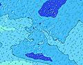 | 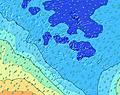 | 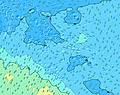 | 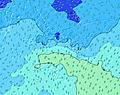 | |||||||||||||
Wave Height (m) Direction Period (s) | ENE 8 | E 8 | E 8 | E 7 | ENE 5 | ENE 8 | ENE 8 | E 8 | ENE 8 | ENE 8 | ENE 8 | ENE 8 | ENE 8 | E 8 | E 8 | E 8 | NNE 9 | E 5 | E 8 | NW 13 |
Wave Graph | ||||||||||||||||||||
34 | 57 | 55 | 86 | 77 | 151 | 155 | 233 | 191 | 161 | 123 | 104 | 81 | 103 | 84 | 84 | 8 | 71 | 205 | 7 | |
Wind (km/h) | ||||||||||||||||||||
Wind State on-shore cross-onshore cross-shore cross-offshore off-shore glassy | cross-off | cross | cross | cross | cross-on | cross-on | cross-on | cross | cross-on | cross-on | cross | cross | cross-off | cross-off | cross | cross | cross | cross-off | cross-off | cross-off |
High Tide | 2:55PM0.30m | 2:49AM0.27m | 3:21PM0.27m | 3:04AM0.25m | 3:52PM0.23m | 3:11AM0.22m | 5:03PM0.19m | 2:14AM0.19m | 10:44PM0.22m | 10:11AM0.20m | 11:12PM0.24m | 10:53AM0.24m | 11:38PM0.27m | |||||||
Low Tide | 9:06PM0.09m | 9:09AM0.07m | 9:32PM0.12m | 9:38AM0.10m | 9:58PM0.15m | 10:19AM0.12m | 10:33PM0.18m | 3:43PM0.14m | 5:21AM0.15m | 4:45PM0.09m | 5:22AM0.11m | 5:19PM0.05m | ||||||||
— | — | 6:22 | — | — | 6:22 | — | — | 6:22 | — | — | 6:20 | — | — | 6:20 | — | — | 6:20 | — | — | |
5:44 | — | — | 5:44 | — | — | 5:45 | — | — | 5:45 | — | — | 5:45 | — | — | 5:45 | — | — | 5:45 | — | |
mm | — | — | — | — | — | — | — | 4 | 1 | — | — | — | — | 2 | 1 | — | — | — | — | 1 |
Temp °C | 25 | 25 | 24 | 25 | 25 | 25 | 25 | 25 | 25 | 25 | 25 | 25 | 25 | 25 | 25 | 25 | 25 | 25 | 25 | 25 |
Feels °C | 27 | 25 | 23 | 24 | 24 | 25 | 27 | 26 | 25 | 27 | 27 | 27 | 27 | 25 | 24 | 24 | 23 | 24 | 25 | 23 |
Swell 1 Height (m) Direction Period (s) | ENE 8 | SW 14 | E 8 | SW 14 | SW 13 | SW 13 | ENE 8 | E 8 | SW 13 | ENE 8 | ENE 8 | ENE 8 | ENE 8 | E 8 | E 8 | SW 15 | SW 14 | SW 14 | SW 13 | SSW 17 |
34 | 47 | 55 | 50 | 44 | 26 | 155 | 149 | 82 | 161 | 123 | 104 | 81 | 103 | 84 | 326 | 346 | 304 | 208 | 608 | |
Swell 2 Height (m) Direction Period (s) | SSW 14 | NE 12 | SW 14 | N 9 | NE 13 | SW 16 | SW 14 | SW 13 | SSW 20 | SW 12 | SW 12 | SSW 17 | SSW 16 | SW 16 | SW 16 | E 8 | NNE 9 | NNE 9 | SSW 18 | NW 13 |
82 | 23 | 46 | 6 | 7 | 40 | 103 | 85 | 37 | 72 | 112 | 200 | 173 | 248 | 287 | 84 | 8 | 8 | 103 | 7 | |
Swell 3 Height (m) Direction Period (s) | N 9 | N 9 | NE 12 | NE 11 | NE 11 | NNE 12 | NNE 12 | NE 12 | NNE 11 | SW 19 | SW 18 | SW 11 | SW 10 | NNE 9 | NNE 9 | NNE 10 | NW 12 | NW 12 | NNE 9 | N 9 |
7 | 6 | 23 | 5 | 5 | 15 | 14 | 23 | 12 | 59 | 82 | 94 | 68 | 8 | 17 | 18 | 6 | 6 | 8 | 1 | |
Wind waves Height (m) Direction Period (s) | ESE 6 | E 8 | — | E 7 | ENE 5 | ENE 8 | — | E 8 | ENE 8 | — | — | — | — | — | SE 5 | SSE 5 | ESE 4 | E 5 | E 8 | E 5 |
8 | 57 | — | 86 | 77 | 151 | — | 233 | 191 | — | — | — | — | — | 4 | 2 | 58 | 71 | 205 | 124 | |
Nearest Offshore or Glassy | ||||||||||||||||||||
Distance (km) | 0 | 31 | 31 | 31 | 233 | 22 | 7 | 22 | 22 | 7 | 7 | 7 | 0 | 41 | 193 | 31 | 232 | 193 | 193 | 3523 |
Best forecast wave conditions in Tahiti | ||||||||||||||||||||
Best forecast wave conditions in French Polynesia | ||||||||||||||||||||
Header Global | ||||||||||||||||||||
- Map Icons:
 Break
Break Live Wave Height (m)
 Live Wind Speed (km/h)
 Surf Rating (10 Max)
 Ocean Swells (m)
- Wind Speed (km/h)
Latest Updates


FREE! Surf-Forecast.com widget for your website
The surf report / weather widget below is available to embed on third party websites free of charge and provides a summary of our Rocky Point surf forecast. Simply grab the html code snippet that we provide and paste it into your own site. You can choose your preferred language and metric/imperial units for the surf forecast feed to suit users of your site. Click here to get the code.
Information about the Rocky Point Surf forecast
The above surf forecast table for Rocky Point provides essential information for determining whether the surfing conditions will be good over the next 16 days. A general guide to surfing at Rocky Point can be found by selecting the local surf guide option on the grey menu. Our Rocky Point surf forecast is unique since it includes wave energy (power) that defines the real feel of the surf rather than just the height or the period. If you surf the same spot (Rocky Point) regularly then make a mental note of the wave energy from the surf forecast table each time you go. Very soon you may start to choose your surf days based on the wave energy alone combined with our forecast of favourable offshore wind conditions. Our star ratings will help here and of course you will also find the usual wave height and period predictions on our surf forecasts as well as a full break down of the swell components under our advanced users option (to reveal that, click the little Einstein character under the tide times).
Further information to help with frequently asked questions about our surf forecast for Rocky Point may be found under the help tab on the top menu and also by moving your mouse over the question marks on the surf forecast table itself. Please always bear in mind that the forecast is for near-shore open water and local factors at each surf break influence the actual breaking wave height, such as the beach / reef profile, water depths offshore and shelter.
Are you planning a holiday in Tahiti? If you are looking for accommodation near Rocky Point, camping, hotels and holiday cottages in Tahiti, consider staying in Papeete which is 18 km (11 miles) away. Other places in and around Tahiti where you can find information about places to rent, and car hire include Faaa which is 20 km (12 miles) away and Punaauia, 24 km (15 miles) away.
 Nearest