

Surf Forecasts:

How big are the waves at Teahupo’o today (03 Aug):
- Morning surf: Morning surf (03 Aug, local time) - 4.5ft (1.4m), 13s period with S swell.
- Afternoon surf: Afternoon surf (03 Aug, local time) - 3ft (0.9m), 14s period with S swell.
- Evening surf: Evening surf (03 Aug, local time) - 2.5ft (0.8m), 14s period with SSW swell.
The current surf forecast for Teahupo’o at 2AM is: 1.2m 13s primary swell from a South-southwest direction and 1.0m 9s secondary swell from a South-southeast direction, 0.8m 7s secondary swell from a East direction (forecast issued at 07:00pm August 02). The wind direction is predicted to be cross-offshore.
| Time (-10) & Date | Wave Height | Wave Period |
|---|---|---|
| Morning (03 Aug) | 4.5ft (1.4m) | 13s |
| Afternoon (03 Aug) | 3ft (0.9m) | 14s |
| Evening (03 Aug) | 2.5ft (0.8m) | 14s |
Table - waves today at Teahupo’o. (Swell directed towards the surf break)
Short Range ForecastMostly dry. Warm (max 25°C on Mon afternoon, min 24°C on Sun night). Mainly fresh winds. | |||||||||||||||||||
Sun 2 | Monday 3 | Tuesday 4 | |||||||||||||||||
5 PM | 8 PM | 11 PM | 2 AM | 5 AM | 8 AM | 11 AM | 2 PM | 5 PM | 8 PM | 11 PM | 2 AM | 5 AM | 8 AM | 11 AM | 2 PM | 5 PM | 8 PM | 11 PM | |
Swell Height Map |  |  |  |  |  | 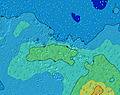 |  | ||||||||||||
Wave Height (m) Direction Period (s) | SSW 14 | SSW 14 | SSW 14 | SSW 13 | S 16 | S 13 | S 15 | SSW 14 | SSW 14 | SSW 14 | SSW 13 | SSW 13 | E 8 | ESE 8 | ESE 8 | SW 14 | SSW 14 | SSW 14 | SW 14 |
Wave Graph | |||||||||||||||||||
742 | 697 | 561 | 514 | 406 | 640 | 527 | 333 | 307 | 257 | 269 | 321 | 222 | 232 | 245 | 476 | 701 | 701 | 581 | |
Wind (km/h) | |||||||||||||||||||
Wind State on-shore cross-onshore cross-shore cross-offshore off-shore glassy | cross | cross | cross-off | cross-off | cross-off | cross-off | cross-off | cross-off | cross-off | cross-off | cross-off | off | off | off | off | off | off | off | cross-off |
High Tide | 2:32AM0.33m | 2:59PM0.33m | 2:54AM0.31m | 3:30PM0.29m | |||||||||||||||
Low Tide | 8:42PM0.09m | 8:51AM0.07m | 9:07PM0.12m | 9:23AM0.10m | 9:33PM0.15m | ||||||||||||||
— | — | — | — | 6:22 | — | — | — | — | — | — | — | 6:22 | — | — | — | — | — | — | |
5:43 | — | — | — | — | — | — | — | 5:43 | — | — | — | — | — | — | — | 5:44 | — | — | |
mm | — | — | — | — | — | — | — | — | — | — | — | — | — | — | — | — | — | — | — |
Temp °C | 24 | 24 | 24 | 24 | 24 | 24 | 24 | 25 | 25 | 25 | 25 | 25 | 25 | 25 | 25 | 25 | 25 | 25 | 25 |
Feels °C | 25 | 24 | 23 | 23 | 23 | 23 | 23 | 24 | 25 | 25 | 23 | 23 | 24 | 25 | 26 | 26 | 27 | 27 | 27 |
Swell 1 Height (m) Direction Period (s) | SSW 14 | SSW 14 | SSW 14 | SSW 13 | SSW 13 | S 13 | S 15 | SSW 14 | ESE 7 | SSW 14 | SSW 13 | ESE 7 | E 8 | ESE 8 | ESE 8 | ESE 8 | E 8 | E 8 | E 8 |
742 | 697 | 561 | 514 | 384 | 640 | 527 | 299 | 143 | 257 | 269 | 147 | 221 | 232 | 245 | 251 | 245 | 235 | 198 | |
Swell 2 Height (m) Direction Period (s) | SSE 10 | SSE 10 | SSE 9 | SSE 9 | SSE 9 | S 16 | SSW 13 | S 14 | SSW 14 | S 13 | S 14 | SSW 13 | SSW 13 | SSW 13 | SSW 13 | SW 14 | SSW 14 | SSW 14 | SW 14 |
240 | 210 | 188 | 154 | 147 | 386 | 225 | 333 | 307 | 167 | 32 | 321 | 222 | 215 | 219 | 476 | 701 | 701 | 581 | |
Swell 3 Height (m) Direction Period (s) | S 18 | S 18 | S 17 | S 17 | S 16 | NE 12 | SE 7 | NE 11 | S 14 | NE 11 | SSE 9 | S 13 | S 12 | SW 16 | SSW 16 | S 12 | SSW 24 | SW 23 | SW 21 |
322 | 308 | 380 | 358 | 406 | 6 | 54 | 5 | 249 | 5 | 16 | 32 | 73 | 129 | 171 | 25 | 54 | 82 | 117 | |
Wind waves Height (m) Direction Period (s) | — | E 7 | E 7 | E 7 | E 7 | E 8 | E 7 | ESE 7 | — | ESE 7 | ESE 7 | NE 4 | — | — | — | — | — | — | — |
— | 44 | 51 | 69 | 69 | 89 | 88 | 156 | — | 167 | 160 | 16 | — | — | — | — | — | — | — | |
Nearest Offshore or Glassy | |||||||||||||||||||
Distance (km) | 9 | 47 | 72 | 35 | 35 | 35 | 35 | 9 | 9 | 9 | 262 | 264 | 0 | 0 | 0 | 0 | 0 | 0 | 0 |
Best forecast wave conditions in Tahiti | |||||||||||||||||||
Best forecast wave conditions in French Polynesia | |||||||||||||||||||
Header Global | |||||||||||||||||||
- Map Icons:
 Break
Break Live Wave Height (m)
 Live Wind Speed (km/h)
 Surf Rating (10 Max)
 Ocean Swells (m)
- Wind Speed (km/h)
Latest Updates


FREE! Surf-Forecast.com widget for your website
The surf report / weather widget below is available to embed on third party websites free of charge and provides a summary of our Teahupo’o surf forecast. Simply grab the html code snippet that we provide and paste it into your own site. You can choose your preferred language and metric/imperial units for the surf forecast feed to suit users of your site. Click here to get the code.
 Nearest