

Surf Forecasts:

Motuau Island surf forecast from 15 Jul 2026:
- Most powerful swell: Wednesday 22 Jul, 2AM (local time) - 4.5ft (1.4m), 6s period, E swell with 138 kJ wave energy.
Best Forecast Surf Conditions for Motuau Island this week:
The most powerful waves expected at Motuau Island in the next 16 days are 1.4m 6s and forecast to arrive on Wednesday (Jul 22) at 2AM. Winds are predicted to be cross-offshore at the time the swell arrives. The largest open ocean swell (not directed at the beach) is 0.9m 11s period and expected on Wednesday (Jul 15) at 2AM.
| Wave Type | Time (-10) & Date | Wave Height & Period |
|---|---|---|
| Next good surf (1 star+) | - | - |
| Best Surf | - | - |
| Most Powerful | 2AM (Wed 22nd Jul) | 4.5ft (1.4m) 6s |
Table - best surf conditions forecast for Motuau Island over the next 16 days.
The Lowdown
G’day, Rusty here. Look, I’m not gonna beat around the bush—this is a rough run for Motuau Island. The whole 16-day window is a write-off for any decent paddle surfing. There’s nothing on offer that’s worth paddling out for, and the conditions just won’t line up. The setup is a reef break, but with the swell being so tiny and the wind often howling, it’s a real shame. The forecast is pretty consistent in its mediocrity, so this blank run is unfortunately normal for the area right now.
We start off Wednesday the 15th into the weekend with tiny 0.7ft swell from the ENE, with a short period of 8 seconds. The wind is offshore from the S, but the wave energy is laughably weak (6–12), and the surf is labeled as poor. It’s like trying to surf a puddle. Thursday the 16th and Friday the 17th see a shift to a long-period WNW groundswell at 15–16 seconds, but the height is still only 0.7ft (energy 27–32). That long period on a reef with no size is just a tease. Saturday the 18th and Sunday the 19th are similar, with the swell dropping to 0.7ft and the wind turning cross-offshore from the SE. By Sunday afternoon, there’s zero energy.
The next week isn’t any better. Monday the 20th sees a tiny bump to 2ft–2ft from the E, with a period of just 5–6 seconds, but the wind is cross-offshore and the energy is still weak (20–32). Tuesday the 21st brings a 4ft east swell, period 6 seconds, and the energy climbs to 104–110, but the wind is a fresh cross-offshore from the ESE at 30–35 km/h, and the surf is still poor. Things get a bit more interesting on Wednesday the 22nd with a 5ft east swell and 6-second period, and energy up to 178. The wind is a strong breeze from the E at 40 km/h, making for a strong cross-shore chop. That’s not a surf setup; that’s a kite surfer’s dream. The combination of significant swell, strong wind, and a reef that’s getting messy cross-chop means it’s far more interesting for kite surfing than paddle surfing. Thursday the 23rd is similar, with a 5ft east swell and a risk of t-storms, onshore NNE wind, and energy at 196. Still poor.
The tail end of the forecast from Saturday the 25th to Sunday the 26th offers a glimmer of hope, but it’s not enough. On Saturday the 25th, a 3ft ENE swell with a period of 9 seconds and energy of 116 shows up, with a cross-offshore SW wind at 35 km/h. It’s clean, but the surf is still poor. Then on Sunday the 26th afternoon, we finally get a label of “surfable waves but very ordinary conditions” with a 3ft ENE swell, 8-second period, and moderate offshore wind from the S (energy 84). It’s the only session in the whole 16 days that isn’t called “poor,” but it’s a score of 1 out of 10—barely worth the walk. After that, Monday the 27th onwards drops back into tiny, weak swell with poor conditions.
So, to sum it up: there are no standouts. The best you’ll get is a very ordinary session on Sunday the 26th afternoon with 3ft waves and clean offshore wind, but don’t expect much. The water temperature is about average for the time of year, so at least you won’t be freezing while you’re sitting there waiting for nothing. For now, give the board a rest and check back later—forecasts can change.
Rusty.
Short Range ForecastMostly dry. Warm (max 24°C on Tue night, min 22°C on Wed night). Mainly fresh winds. | Days 5-7 Weather SummaryMostly dry. Warm (max 25°C on Mon afternoon, min 22°C on Sat night). Wind will be generally light. | ||||||||||||||||||||
Wednesday 15 | Thursday 16 | Friday 17 | Saturday 18 | Sunday 19 | Monday 20 | Tue 21 | |||||||||||||||
Night | AM | PM | Night | AM | PM | Night | AM | PM | Night | AM | PM | Night | AM | PM | Night | AM | PM | Night | AM | PM | |
Swell Height Map |  |  |  | 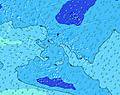 | 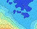 | 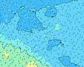 | 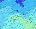 | 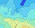 | |||||||||||||
Wave Height (m) Direction Period (s) | ENE 7 | ENE 8 | N 9 | N 9 | WNW 16 | WNW 16 | WNW 16 | WNW 15 | WNW 15 | WNW 15 | WNW 14 | NNE 8 | NNE 9 | NNE 8 | SW 12 | SW 13 | E 5 | E 6 | E 5 | E 6 | E 6 |
Wave Graph | |||||||||||||||||||||
5 | 6 | 6 | 6 | 25 | 25 | 24 | 21 | 22 | 21 | 21 | 7 | 7 | 6 | 0 | 0 | 20 | 32 | 80 | 101 | 106 | |
Wind (km/h) | |||||||||||||||||||||
Wind State on-shore cross-onshore cross-shore cross-offshore off-shore glassy | off | off | off | off | off | off | off | off | off | cross-off | off | off | cross-off | cross-off | cross-off | cross-off | cross-off | cross-off | cross-off | cross-off | cross-off |
High Tide | 1:44AM0.30m | 1:53PM0.34m | 2:14AM0.29m | 2:30PM0.33m | 2:44AM0.28m | 3:07PM0.31m | 3:13AM0.27m | 3:45PM0.29m | 3:42AM0.25m | 4:27PM0.26m | 4:12AM0.22m | 5:32PM0.22m | 4:59AM0.20m | ||||||||
Low Tide | 7:46AM0.03m | 8:16PM0.01m | 8:18AM0.03m | 8:50PM0.04m | 8:51AM0.04m | 9:23PM0.07m | 9:23AM0.06m | 9:56PM0.11m | 9:58AM0.09m | 10:31PM0.14m | 10:38AM0.12m | 11:18PM0.17m | 11:58AM0.15m | ||||||||
— | 6:28 | — | — | 6:28 | — | — | 6:28 | — | — | 6:28 | — | — | 6:26 | — | — | 6:26 | — | — | 6:26 | — | |
5:37 | — | 5:38 | — | — | 5:38 | — | — | 5:38 | — | — | 5:39 | — | — | 5:39 | — | — | 5:39 | — | — | 5:40 | |
mm | — | — | — | — | — | — | — | — | — | — | — | — | — | — | — | — | — | — | — | — | — |
Temp °C | 24 | 23 | 23 | 23 | 23 | 23 | 23 | 23 | 23 | 23 | 23 | 23 | 23 | 23 | 23 | 24 | 24 | 25 | 25 | 25 | 25 |
Feels °C | 21 | 20 | 20 | 19 | 19 | 19 | 19 | 20 | 20 | 21 | 21 | 19 | 20 | 20 | 20 | 22 | 23 | 25 | 24 | 24 | 23 |
Swell 1 Height (m) Direction Period (s) | SW 11 | SW 11 | SW 14 | SW 14 | SW 14 | SSW 14 | SW 13 | SW 13 | SW 12 | SW 12 | SW 11 | SW 11 | SW 10 | SSW 12 | SW 12 | SW 13 | SW 12 | SW 21 | SSW 19 | SSW 18 | SSW 17 |
163 | 115 | 228 | 241 | 206 | 123 | 84 | 82 | 75 | 66 | 57 | 55 | 35 | 90 | 106 | 230 | 149 | 454 | 475 | 553 | 528 | |
Swell 2 Height (m) Direction Period (s) | SSW 15 | SW 14 | ENE 8 | ENE 8 | ENE 8 | ENE 8 | WNW 16 | WNW 15 | WNW 15 | SW 19 | SW 17 | SW 17 | SW 15 | SW 16 | SSW 14 | SW 24 | SSW 22 | SW 12 | SW 11 | SW 11 | W 13 |
158 | 102 | 6 | 6 | 7 | 6 | 24 | 21 | 22 | 56 | 45 | 44 | 35 | 39 | 73 | 151 | 317 | 110 | 58 | 40 | 3 | |
Swell 3 Height (m) Direction Period (s) | ENE 7 | ENE 8 | N 9 | N 9 | WNW 16 | WNW 16 | ENE 8 | N 9 | N 9 | WNW 15 | WNW 14 | NNE 8 | NNE 9 | NNE 8 | SW 15 | SW 18 | SW 16 | SW 15 | SW 14 | W 13 | N 8 |
5 | 6 | 6 | 6 | 25 | 25 | 6 | 6 | 6 | 21 | 21 | 7 | 7 | 6 | 36 | 50 | 121 | 113 | 100 | 3 | 1 | |
Wind waves Height (m) Direction Period (s) | S 3 | S 3 | SSW 3 | SSW 3 | S 3 | SSW 3 | S 3 | S 3 | SSE 3 | ESE 3 | SSE 2 | S 3 | SE 3 | SE 3 | ESE 3 | E 4 | E 5 | E 6 | E 5 | E 6 | E 6 |
6 | 6 | 6 | 3 | 6 | 9 | 6 | 5 | 4 | 1 | 1 | 2 | 5 | 6 | 6 | 15 | 20 | 32 | 80 | 101 | 106 | |
Nearest Offshore or Glassy | |||||||||||||||||||||
Distance (km) | 3849 | 3519 | 3519 | 3528 | 2612 | 2612 | 2612 | 41 | 41 | 41 | 41 | 2612 | 41 | 1163 | 1163 | 42 | 30 | 7 | 36 | 2612 | 2612 |
Best forecast wave conditions in Tahiti | |||||||||||||||||||||
Best forecast wave conditions in French Polynesia | |||||||||||||||||||||
Header Global | |||||||||||||||||||||
- Map Icons:
 Break
Break Live Wave Height (m)
 Live Wind Speed (km/h)
 Surf Rating (10 Max)
 Ocean Swells (m)
- Wind Speed (km/h)


FREE! Surf-Forecast.com widget for your website
The surf report / weather widget below is available to embed on third party websites free of charge and provides a summary of our Motuau Island surf forecast. Simply grab the html code snippet that we provide and paste it into your own site. You can choose your preferred language and metric/imperial units for the surf forecast feed to suit users of your site. Click here to get the code.
Information about the Motuau Island Surf forecast
The above surf forecast table for Motuau Island provides essential information for determining whether the surfing conditions will be good over the next 16 days. A general guide to surfing at Motuau Island can be found by selecting the local surf guide option on the grey menu. Our Motuau Island surf forecast is unique since it includes wave energy (power) that defines the real feel of the surf rather than just the height or the period. If you surf the same spot (Motuau Island) regularly then make a mental note of the wave energy from the surf forecast table each time you go. Very soon you may start to choose your surf days based on the wave energy alone combined with our forecast of favourable offshore wind conditions. Our star ratings will help here and of course you will also find the usual wave height and period predictions on our surf forecasts as well as a full break down of the swell components under our advanced users option (to reveal that, click the little Einstein character under the tide times).
Further information to help with frequently asked questions about our surf forecast for Motuau Island may be found under the help tab on the top menu and also by moving your mouse over the question marks on the surf forecast table itself. Please always bear in mind that the forecast is for near-shore open water and local factors at each surf break influence the actual breaking wave height, such as the beach / reef profile, water depths offshore and shelter.
Are you planning a holiday in Tahiti? If you are looking for accommodation near Motuau Island, camping, hotels and holiday cottages in Tahiti, consider staying in Papeete which is 14 km (9 miles) away. Other places in and around Tahiti where you can find information about places to rent, and car hire include Faaa which is 15 km (9 miles) away and Punaauia, 21 km (13 miles) away.
 Nearest