

Surf Forecasts:

Temae surf forecast from 3 Aug 2026:
- Best quality surf: Thursday 6 Aug, 8AM (local time) - 5ft (1.6m), 18s period, SSW swell with glassy winds.
- Most powerful swell: Sunday 9 Aug, 5AM (local time) - 11ft (3.5m), 16s period, SSW swell with 5,928 kJ wave energy.
- Next surfable swell (1★+): Thursday 6 Aug, 8AM (local time) - 5ft (1.6m), 18s period with SSW swell.
Best Forecast Surf Conditions for Temae this week:
The surf forecast for Temae over the next 16 days: The first swell (rated 1 star or higher) is forecast to arrive on Thursday (Aug 06) at 8AM. The primary swell is predicted to be 1.6m and 18s period with a secondary swell of 1.4m and 13s. The wind is predicted to be glassy as the swell arrives.
The most powerful waves expected at Temae in the next 16 days are 3.5m 16s and forecast to arrive on Sunday (Aug 09) at 5AM. Winds are predicted to be cross-shore at the time the swell arrives. The largest open ocean swell (not directed at the beach) is 1.2m 6s period and expected on Friday (Aug 07) at 8AM.
| Wave Type | Time (-10) & Date | Wave Height & Period |
|---|---|---|
| Next good surf (1 star+) | 8AM (Thu 6th Aug) | 5ft (1.6m) 18s |
| Best Surf | 8AM (Thu 6th Aug) | 5ft (1.6m) 18s |
| Most Powerful | 5AM (Sun 9th Aug) | 11ft (3.5m) 16s |
Table - best surf conditions forecast for Temae over the next 16 days.
The Lowdown
Alright folks, Rusty here. Let’s have a look at what’s cookin’ for Temae over the next couple of weeks.
The outlook is a tough one for paddle surfing. For the first few days, there’s some swell in the water, but it’s getting hammered by onshore winds, making it pretty messy. The real issue is that the wind stays in a bad direction for most of the period, which really limits the quality. We’ll have to wait for a few windows of opportunity, but they are there.
The first real chance you’ll want to circle is on Tuesday, August 6th. The swell is pumping up to 7 ft from the SSW with a solid 17 seconds between waves. That’s a proper groundswell. The combined energy is strong at 2403. The problem is the wind is still onshore from the NE, so it’s going to be a bit of a battle. It’s a marginal call, but if you’re desperate for a paddle, it’s the best on offer in the first week.
Now, hold on to your board, because Saturday, August 10th is the standout. The morning looks a bit average with a cross-on breeze, but the Saturday afternoon session is the one. The wind drops to glassy, absolutely dead calm, and the swell is still a solid 7 ft from the SSW. The period is a punchy 13 seconds, giving it moderate energy at 2074. This is "excellent surf conditions for experienced surfers" – the water will be like a mirror. For a reef break like Temae, glassy conditions are gold. The water temperature is 79°F, which is about average for this time of year, so no surprises there.
The swell gets a bit bigger after that, but the wind turns nasty. Sunday, August 11th sees a big 12 ft SSW groundswell (16 seconds) with a massive energy reading of 5792, but it’s crossed up by a strong 22 mph ESE wind. That’s a messy, lumpy mess. It’ll be more of a kite-surfing scene than a paddle-surfing one.
The second week is a write-off for the most part. The wind stays onshore or cross-onshore, and the swell drops. There’s a small window on Tuesday, August 19th with a 6 ft SSW swell and 15 seconds of period, but a cross-on breeze keeps it from being any good. The energy is a moderate 1673, but it’s too choppy to get excited about.
So, to sum it up: if you’re a solid surfer, the Saturday afternoon, August 10th is the only real standout. Get out there when it’s glassy. The rest of the forecast is a lot of waiting for a clean day that doesn’t really come.
Alright, stay stoked.
Rusty.
Short Range ForecastMostly dry. Warm (max 26°C on Tue night, min 24°C on Mon morning). Winds decreasing (fresh winds from the NE on Mon night, light winds from the NE by Tue afternoon). | Days 4-6 Weather SummaryModerate rain (total 16mm), heaviest on Thu night. Warm (max 26°C on Fri night, min 24°C on Thu night). Mainly fresh winds. | ||||||||||||||||||||
Monday 3 | Tuesday 4 | Wednesday 5 | Thursday 6 | Friday 7 | Saturday 8 | Sunday 9 | |||||||||||||||
AM | PM | Night | AM | PM | Night | AM | PM | Night | AM | PM | Night | AM | PM | Night | AM | PM | Night | AM | PM | Night | |
Swell Height Map |  |  |  |  | 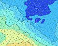 | 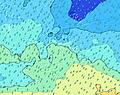 | 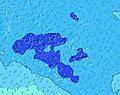 | ||||||||||||||
Wave Height (m) Direction Period (s) | SSW 13 | SSW 14 | SSW 13 | SSW 13 | SSW 14 | SW 13 | SSW 13 | SW 20 | SSW 18 | SSW 17 | SSW 16 | SSW 16 | SSW 16 | SSW 15 | SSW 14 | SSW 14 | SSW 13 | SSW 17 | SSW 16 | SSW 16 | SSW 16 |
Wave Graph | |||||||||||||||||||||
444 | 260 | 222 | 219 | 647 | 509 | 444 | 388 | 785 | 2403 | 2128 | 1588 | 2308 | 2198 | 2553 | 2358 | 1551 | 3730 | 5499 | 4957 | 3369 | |
Wind (km/h) | |||||||||||||||||||||
Wind State on-shore cross-onshore cross-shore cross-offshore off-shore glassy | on | on | on | cross-on | on | cross-on | on | on | cross-on | on | on | cross-on | on | on | on | cross-on | glassy | cross | cross-on | cross | cross-on |
High Tide | 2:44PM0.26m | 2:32AM0.25m | 3:06PM0.23m | 2:43AM0.23m | 3:24PM0.19m | 2:45AM0.21m | 3:27PM0.15m | 1:58AM0.19m | 9:40AM0.14m | 11:56PM0.19m | 10:35AM0.18m | 11:45PM0.21m | 11:06AM0.22m | 11:56PM0.23m | |||||||
Low Tide | 8:38AM0.04m | 8:51PM0.09m | 9:01AM0.06m | 9:04PM0.11m | 9:27AM0.08m | 8:54PM0.13m | 9:56AM0.11m | 6:43PM0.14m | 8:20AM0.14m | 5:09PM0.10m | 5:54AM0.13m | 5:18PM0.06m | 5:37AM0.10m | 5:41PM0.03m | |||||||
6:24 | — | — | 6:22 | — | — | 6:22 | — | — | 6:22 | — | — | 6:22 | — | — | 6:20 | — | — | 6:20 | — | — | |
— | 5:45 | — | — | 5:45 | — | — | 5:45 | — | — | 5:46 | — | — | 5:46 | — | — | 5:46 | — | — | 5:46 | — | |
mm | — | — | — | — | — | — | — | — | — | — | — | 9 | 7 | — | — | — | — | — | 1 | 1 | 17 |
Temp °C | 25 | 25 | 25 | 25 | 25 | 26 | 25 | 26 | 26 | 25 | 25 | 25 | 25 | 25 | 26 | 25 | 26 | 26 | 26 | 26 | 25 |
Feels °C | 24 | 24 | 24 | 25 | 28 | 28 | 27 | 28 | 28 | 28 | 26 | 28 | 24 | 24 | 25 | 24 | 28 | 27 | 23 | 24 | 22 |
Swell 1 Height (m) Direction Period (s) | SSW 13 | SSW 14 | SSW 13 | SSW 13 | SSW 14 | SW 13 | SSW 13 | SW 12 | SSW 12 | SSW 17 | SSW 16 | SSW 16 | SSW 16 | SSW 15 | SSW 14 | SSW 14 | SSW 13 | SSW 17 | SSW 16 | SSW 16 | SSW 16 |
444 | 232 | 222 | 219 | 647 | 509 | 444 | 336 | 378 | 2403 | 2128 | 1588 | 2308 | 2198 | 2553 | 2358 | 1551 | 3730 | 5499 | 4957 | 3369 | |
Swell 2 Height (m) Direction Period (s) | S 16 | S 14 | S 13 | ENE 7 | ENE 8 | ENE 8 | ENE 8 | ENE 8 | SSW 18 | ENE 8 | ENE 8 | ENE 8 | E 8 | E 8 | NNE 9 | NNE 9 | SSW 20 | SSW 13 | NW 13 | ESE 14 | NW 12 |
170 | 260 | 119 | 62 | 83 | 101 | 107 | 113 | 785 | 67 | 63 | 49 | 33 | 33 | 8 | 8 | 301 | 965 | 7 | 19 | 6 | |
Swell 3 Height (m) Direction Period (s) | N 9 | NNE 9 | E 7 | SSW 16 | NE 12 | SW 21 | SSW 20 | SW 20 | ENE 8 | NE 10 | NNE 9 | NE 9 | NNE 9 | NE 10 | NW 12 | NW 12 | S 13 | NW 13 | N 9 | N 9 | N 13 |
6 | 16 | 17 | 171 | 23 | 116 | 336 | 388 | 91 | 24 | 35 | 21 | 31 | 24 | 6 | 6 | 130 | 7 | 2 | 2 | 3 | |
Wind waves Height (m) Direction Period (s) | ENE 8 | ENE 7 | NE 4 | NNE 4 | — | — | — | — | — | — | — | S 4 | ESE 8 | ESE 8 | ESE 6 | E 6 | E 6 | E 6 | E 7 | E 7 | E 7 |
60 | 43 | 21 | 6 | — | — | — | — | — | — | — | 12 | 202 | 171 | 130 | 190 | 92 | 121 | 293 | 330 | 399 | |
Nearest Offshore or Glassy | |||||||||||||||||||||
Distance (km) | 15 | 15 | 200 | 15 | 13 | 7 | 15 | 15 | 13 | 15 | 15 | 7 | 34 | 15 | 15 | 15 | 0 | 2599 | 2599 | 3490 | 2599 |
Best forecast wave conditions in Moorea | |||||||||||||||||||||
Best forecast wave conditions in French Polynesia | |||||||||||||||||||||
Header Global | |||||||||||||||||||||
- Map Icons:
 Break
Break Live Wave Height (m)
 Live Wind Speed (km/h)
 Surf Rating (10 Max)
 Ocean Swells (m)
- Wind Speed (km/h)
Latest Updates


FREE! Surf-Forecast.com widget for your website
The surf report / weather widget below is available to embed on third party websites free of charge and provides a summary of our Temae surf forecast. Simply grab the html code snippet that we provide and paste it into your own site. You can choose your preferred language and metric/imperial units for the surf forecast feed to suit users of your site. Click here to get the code.
Information about the Temae Surf forecast
The above surf forecast table for Temae provides essential information for determining whether the surfing conditions will be good over the next 16 days. A general guide to surfing at Temae can be found by selecting the local surf guide option on the grey menu. Our Temae surf forecast is unique since it includes wave energy (power) that defines the real feel of the surf rather than just the height or the period. If you surf the same spot (Temae) regularly then make a mental note of the wave energy from the surf forecast table each time you go. Very soon you may start to choose your surf days based on the wave energy alone combined with our forecast of favourable offshore wind conditions. Our star ratings will help here and of course you will also find the usual wave height and period predictions on our surf forecasts as well as a full break down of the swell components under our advanced users option (to reveal that, click the little Einstein character under the tide times).
Further information to help with frequently asked questions about our surf forecast for Temae may be found under the help tab on the top menu and also by moving your mouse over the question marks on the surf forecast table itself. Please always bear in mind that the forecast is for near-shore open water and local factors at each surf break influence the actual breaking wave height, such as the beach / reef profile, water depths offshore and shelter.
Temae is 16 km (10 miles) from Faaa. If you plan a holiday in Moorea, look for hotels and other accommodation in Faaa. Faaa has rooms for a wide range of budgets as well as car hire and transport links.
 Nearest