

Surf Forecasts:

Choshi surf forecast from 31 Jul 2026:
- Best quality surf: Tuesday 4 Aug, 6AM (local time) - 10ft (3.0m), 17s period, ESE swell with cross-offshore winds.
- Most powerful swell: Tuesday 4 Aug, 9AM (local time) - 10ft (3.0m), 16s period, ESE swell with 4,660 kJ wave energy.
- Next surfable swell (1★+): Saturday 1 Aug, 6AM (local time) - 1ft (0.3m), 11s period with ESE swell.
Best Forecast Surf Conditions for Choshi this week:
The surf forecast for Choshi over the next 16 days: The first swell (rated 1 star or higher) is forecast to arrive on Saturday (Aug 01) at 6AM. The primary swell is predicted to be 0.4m and 8s period with a secondary swell of 0.3m and 11s. The wind is predicted to be glassy as the swell arrives.
The most powerful waves expected at Choshi in the next 16 days are 3.0m 16s and forecast to arrive on Tuesday (Aug 04) at 9AM. Winds are predicted to be cross-offshore at the time the swell arrives. The largest open ocean swell (not directed at the beach) is 1.4m 7s period and expected on Monday (Aug 03) at 3PM.
| Wave Type | Time (JST) & Date | Wave Height & Period |
|---|---|---|
| Next good surf (1 star+) | 6AM (Sat 1st Aug) | 1ft (0.3m) 11s |
| Best Surf | 6AM (Tue 4th Aug) | 10ft (3.0m) 17s |
| Most Powerful | 9AM (Tue 4th Aug) | 10ft (3.0m) 16s |
Table - best surf conditions forecast for Choshi over the next 16 days.
The Lowdown
Alright, this is Rusty comin’ at ya from the Choshi area. Let’s be straight with you – the start of this forecast window is a bit of a non-event. The first record we’re looking at is Friday morning, and honestly, there’s nothing to write home about. We’ve got a tiny 1.0ft swell rolling in from the East with weak energy, and the wind’s blowing cross-onshore. It’s pretty meager. The water's sittin' at 76°, which is a touch colder than average for this time of year, so bring a thicker suit if you're gettin' in, but right now it’s not really worth it.
Saturday morning on August 1st, things perk up just a notch. The sea turns glassy, dead calm wind from ESE, and that tiny swell is still only 1.0ft, but the period jumps to a long 18 seconds. The combined energy climbs to a moderate 115. It's not gonna be big, but those long-period lines might offer something small and clean for a patient surfer on a log. The wind is the major positive here – glassy conditions are a gift.
Sunday the 2nd of August is where it starts to get more interesting. We get a jump in size to 4ft from the ESE with a nice long period of 16 seconds. The morning shows a cross-off wind from the NNE – clean conditions. The combined energy is a strong 803. This is the first real highlight. Choshi is inconsistent, and it’s an exposed break, so it needs the right angle. The swell is coming from the ESE, which is a decent match. The crowds can be a thing here sometimes, so be ready for a few heads. This Sunday morning session is the standout early in the period.
Monday the 3rd sees even more power, with the swell hitting 6ft and combined energy surging to 2082. The wind holds clean and cross-off in the morning. This is solid, but it’s getting punchy. By Tuesday the 4th and Wednesday the 5th, the swell just hammers the coast. We’re looking at 10ft to 12ft from the ESE and SE, with combined energy readings over 6000 – that’s strong-to-very-strong energy. The wind is clean and cross-off, and tide conditions look good. However, at this size, Choshi is really only for expert surfers. Anything over 8ft here is a big, powerful beast, and with that long period (15-17 seconds groundswell), the waves are gonna have serious punch. This is too big for beginners and intermediates – it’s a heavy, expert-only zone.
After that peak, the swell eases but remains jumbled for a few days. Thursday the 6th and Friday the 7th of August drop back into the 4ft to 8ft range, but the winds turn more onshore, creating bumpy and choppy conditions.
We then hit a gap. From Saturday the 8th through to Wednesday the 12th, conditions are mostly marginal, with onshore and cross-shore winds and variable swell heights. There’s nothing surfable worth recommending during that stretch.
Then we get a true late bloomer. Thursday the 13th of August morning. Look at this: 5ft of swell from the East, clean with a 13-second period, combined energy of 1167, and glassy winds from the South. This is excellent for experienced surfers. The setup is clean, the swell is solid but not crazy, and it’s a beautiful morning. This Thursday is the other standout on the whole forecast. The afternoon turns onshore and choppy again, so get it early.
The final few days of the outlook, August 14th and 15th, see the swell rising again with onshore wind patterns and some big numbers showing up (over 8ft on the 15th), but the winds are cross-on or onshore, making it messy or too big. So, to sum up: don’t bother with the first couple days unless you’re desperate for a tiny glassy wave. Your best windows are Sunday morning the 2nd of August for a clean, mid-range swell, and Thursday morning the 13th of August for cleaner conditions and a solid wave for those with experience.
Rusty.
Short Range ForecastLight rain (total 2mm), mostly falling on Fri afternoon. Warm (max 29°C on Sat afternoon, min 23°C on Sun night). Wind will be generally light. | Days 4-6 Weather SummaryMostly dry. Warm (max 26°C on Wed night, min 23°C on Tue night). Wind will be generally light. | ||||||||||||||||||||
Friday 31 | Saturday 1 | Sunday 2 | Monday 3 | Tuesday 4 | Wednesday 5 | Thursday 6 | |||||||||||||||
AM | PM | Night | AM | PM | Night | AM | PM | Night | AM | PM | Night | AM | PM | Night | AM | PM | Night | AM | PM | Night | |
Swell Height Map |  |  |  | 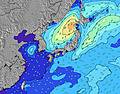 | 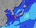 | 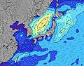 | 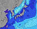 | ||||||||||||||
Wave Height (m) Direction Period (s) | E 9 | SSE 6 | E 11 | E 18 | E 17 | E 15 | ESE 16 | ESE 15 | ESE 15 | ESE 16 | E 18 | E 17 | ESE 16 | ESE 16 | SE 16 | SE 15 | SE 16 | SSE 16 | SSE 17 | SSE 16 | SSE 16 |
Wave Graph | |||||||||||||||||||||
25 | 24 | 24 | 55 | 89 | 163 | 540 | 588 | 845 | 1025 | 2426 | 2237 | 4660 | 4523 | 4342 | 3557 | 4066 | 4025 | 4222 | 3797 | 2214 | |
Wind (km/h) | |||||||||||||||||||||
Wind State on-shore cross-onshore cross-shore cross-offshore off-shore glassy | cross | cross-on | on | glassy | on | glassy | cross-off | cross | cross-off | cross-off | cross-off | cross | cross-off | cross | cross-off | cross-off | cross | cross-on | on | on | on |
High Tide | 6:09PM1.35m | 4:50AM1.47m | 6:29PM1.35m | 5:31AM1.44m | 6:47PM1.36m | 6:15AM1.38m | 7:06PM1.37m | 7:05AM1.29m | 7:26PM1.38m | 8:05AM1.17m | 7:48PM1.39m | 9:30AM1.06m | 8:15PM1.40m | ||||||||
Low Tide | 11:17AM0.16m | 11:21PM0.83m | 11:46AM0.21m | 11:55PM0.76m | 12:15PM0.30m | 00:32AM0.68m | 12:43PM0.43m | 1:14AM0.60m | 1:10PM0.58m | 2:02AM0.53m | 1:35PM0.74m | 3:01AM0.47m | 1:55PM0.90m | ||||||||
4:43 | — | — | 4:43 | — | — | 4:43 | — | — | 4:45 | — | — | 4:46 | — | — | 4:47 | — | — | 4:47 | — | — | |
— | 6:42 | — | — | 6:40 | — | — | 6:40 | — | — | 6:39 | — | — | 6:38 | — | — | 6:37 | — | — | 6:37 | — | |
mm | — | 1 | 1 | — | — | — | — | — | — | — | — | — | — | — | — | — | — | — | — | — | 1 |
Temp °C | 27 | 27 | 26 | 28 | 29 | 27 | 27 | 24 | 23 | 24 | 24 | 25 | 24 | 25 | 24 | 25 | 25 | 26 | 27 | 28 | 27 |
Feels °C | 30 | 29 | 30 | 31 | 32 | 32 | 30 | 23 | 22 | 25 | 24 | 27 | 24 | 25 | 25 | 26 | 27 | 30 | 31 | 31 | 31 |
Swell 1 Height (m) Direction Period (s) | S 7 | SSE 6 | ENE 8 | ENE 7 | ESE 11 | E 15 | ESE 16 | ESE 15 | ESE 15 | ESE 16 | E 18 | E 17 | ESE 16 | ESE 16 | SE 16 | SE 15 | SE 16 | SSE 16 | SSE 17 | SSE 16 | SSE 16 |
22 | 24 | 24 | 21 | 37 | 163 | 540 | 588 | 845 | 1025 | 2426 | 2237 | 4660 | 4523 | 4342 | 3557 | 4066 | 4025 | 4222 | 3797 | 2214 | |
Swell 2 Height (m) Direction Period (s) | E 9 | NE 8 | SSE 7 | ESE 11 | E 17 | ESE 10 | SSE 5 | E 15 | E 14 | SE 18 | SE 17 | SE 16 | E 13 | E 13 | E 13 | E 18 | E 11 | ESE 10 | ESE 10 | ESE 10 | ESE 10 |
25 | 17 | 15 | 39 | 89 | 67 | 4 | 109 | 106 | 826 | 1185 | 1611 | 90 | 86 | 87 | 6 | 267 | 265 | 260 | 214 | 214 | |
Swell 3 Height (m) Direction Period (s) | E 12 | ESE 9 | E 11 | E 18 | NE 7 | ESE 18 | SSW 6 | SSW 5 | SSW 6 | — | — | — | — | — | ENE 18 | ENE 18 | ENE 18 | E 16 | E 16 | E 16 | E 15 |
25 | 17 | 21 | 55 | 14 | 123 | 10 | 6 | 3 | — | — | — | — | — | 33 | 31 | 30 | 21 | 20 | 46 | 40 | |
Wind waves Height (m) Direction Period (s) | — | — | — | — | — | — | NE 7 | NE 4 | NE 5 | NE 6 | NE 7 | ENE 7 | ENE 7 | ENE 7 | — | — | — | — | — | — | — |
— | — | — | — | — | — | 16 | 19 | 50 | 68 | 217 | 193 | 207 | 164 | — | — | — | — | — | — | — | |
Nearest Offshore or Glassy | |||||||||||||||||||||
Distance (km) | 57 | 56 | 56 | 0 | 56 | 0 | 0 | 170 | 117 | 117 | 117 | 37 | 117 | 117 | 117 | 117 | 117 | 117 | 115 | 170 | 117 |
Best forecast wave conditions in Chiba | |||||||||||||||||||||
Best forecast wave conditions in Japan | |||||||||||||||||||||
Header Global | |||||||||||||||||||||
- Map Icons:
 Break
Break Live Wave Height (m)
 Live Wind Speed (km/h)
 Surf Rating (10 Max)
 Ocean Swells (m)
- Wind Speed (km/h)
Latest Updates


FREE! Surf-Forecast.com widget for your website
The surf report / weather widget below is available to embed on third party websites free of charge and provides a summary of our Choshi surf forecast. Simply grab the html code snippet that we provide and paste it into your own site. You can choose your preferred language and metric/imperial units for the surf forecast feed to suit users of your site. Click here to get the code.
Information about the Choshi Surf forecast
The above surf forecast table for Choshi provides essential information for determining whether the surfing conditions will be good over the next 16 days. A general guide to surfing at Choshi can be found by selecting the local surf guide option on the grey menu. Our Choshi surf forecast is unique since it includes wave energy (power) that defines the real feel of the surf rather than just the height or the period. If you surf the same spot (Choshi) regularly then make a mental note of the wave energy from the surf forecast table each time you go. Very soon you may start to choose your surf days based on the wave energy alone combined with our forecast of favourable offshore wind conditions. Our star ratings will help here and of course you will also find the usual wave height and period predictions on our surf forecasts as well as a full break down of the swell components under our advanced users option (to reveal that, click the little Einstein character under the tide times).
Further information to help with frequently asked questions about our surf forecast for Choshi may be found under the help tab on the top menu and also by moving your mouse over the question marks on the surf forecast table itself. Please always bear in mind that the forecast is for near-shore open water and local factors at each surf break influence the actual breaking wave height, such as the beach / reef profile, water depths offshore and shelter.
Choshi is 4 km (2 miles) from Hasaki. If you plan a holiday in Chiba, look for hotels and other accommodation in Hasaki. Hasaki has rooms for a wide range of budgets as well as car hire and transport links.
 Nearest