

Surf Forecasts:

Suruga Bay surf forecast from 3 Aug 2026:
- Best quality surf: Thursday 6 Aug, 9PM (local time) - 11ft (3.5m), 15s period, S swell with cross-shore winds.
- Most powerful swell: Thursday 6 Aug, 6PM (local time) - 11ft (3.5m), 15s period, S swell with 5,034 kJ wave energy.
- Next surfable swell (1★+): Thursday 6 Aug, 9PM (local time) - 11ft (3.5m), 15s period with S swell.
Best Forecast Surf Conditions for Suruga Bay this week:
The surf forecast for Suruga Bay over the next 16 days: The first swell (rated 1 star or higher) is forecast to arrive on Thursday (Aug 06) at 9PM. The primary swell is predicted to be 3.5m and 15s period with a secondary swell of 0.2m and 16s. Another secondary swell of 1.1m and 10s is also forecast. The wind is predicted to be cross-shore as the swell arrives.
The most powerful waves expected at Suruga Bay in the next 16 days are 3.5m 15s and forecast to arrive on Thursday (Aug 06) at 6PM. Winds are predicted to be cross-onshore at the time the swell arrives.
| Wave Type | Time (JST) & Date | Wave Height & Period |
|---|---|---|
| Next good surf (1 star+) | 9PM (Thu 6th Aug) | 11ft (3.5m) 15s |
| Best Surf | 9PM (Thu 6th Aug) | 11ft (3.5m) 15s |
| Most Powerful | 6PM (Thu 6th Aug) | 11ft (3.5m) 15s |
Table - best surf conditions forecast for Suruga Bay over the next 16 days.
The Lowdown
Alright, Rusty here. Let’s talk about the next couple of weeks down at Suruga Bay.
Straight up, the outlook is a tough one for paddle surfers. The first few days of August are kicking off with some real size, but the wind is a problem. That swell is coming in from the SE and SSE, with a solid 5ft to 8ft on the cards, and the period is a very long 16 to 17 seconds. That’s proper groundswell energy, and the combined energy is reading between 1760 and 3594, so there’s plenty of power. But the wind is cross or cross-onshore, with a moderate to fresh breeze, and the reports are calling it marginal or poor. The water is sitting at a warm 81°, which is about average for the time of year, but it won’t help the messy conditions.
The best chance to get something clean is on Tuesday the 11th of August. The swell drops to 5ft, still from the SSW, with a period of 13 seconds, and the combined energy is 1258. The wind is a light cross-shore from the NE, which should keep things reasonably tidy. It’s a breakwater setup, so it can handle that long-period energy better than a beach break, but it’s still a beginner-friendly spot. This is the standout window, but it’s only a morning session, and the afternoon turns cross-onshore and choppy.
After that, the swell fades and the wind just doesn’t play nice. From the 12th onward, the waves are mostly under 4ft, with periods dropping to 10-12 seconds, and the energy is weak, only 182 to 541. The wind is either cross, onshore, or just messy, and the reports are all poor or marginal. The 14th and 15th are particularly flat and sloppy. The 16th brings a brief spike of 6ft from the ESE, but with a fresh cross-shore and a lumpy chop, it’s a write-off.
Honestly, if you’re looking for a clean paddle session, you’ve got a narrow window on the morning of the 11th. For the rest of the run, the setup looks more interesting for the kite crew than us surfers. The wind is consistent, and the swell is there, but it’s not going to be a pretty one for a paddle board.
Rusty.
Short Range ForecastMostly dry. Warm (max 30°C on Thu morning, min 24°C on Mon night). Mainly fresh winds. | Days 5-7 Weather SummaryMostly dry. Warm (max 30°C on Thu afternoon, min 26°C on Sat night). Mainly fresh winds. | |||||||||||||||||||
Mon 3 | Tuesday 4 | Wednesday 5 | Thursday 6 | Friday 7 | Saturday 8 | Sunday 9 | ||||||||||||||
PM | Night | AM | PM | Night | AM | PM | Night | AM | PM | Night | AM | PM | Night | AM | PM | Night | AM | PM | Night | |
Swell Height Map |  |  |  | 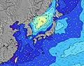 | 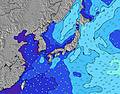 | 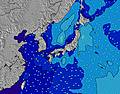 | 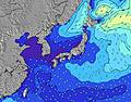 | |||||||||||||
Wave Height (m) Direction Period (s) | SE 16 | SE 16 | SE 17 | SE 16 | SE 16 | SE 16 | SSE 16 | SSE 15 | SSE 15 | S 15 | S 15 | S 15 | S 15 | SSW 15 | SSW 15 | SSW 15 | SSW 15 | SSW 16 | SSW 16 | SSW 16 |
Wave Graph | ||||||||||||||||||||
595 | 776 | 1467 | 1474 | 2140 | 3216 | 3594 | 3516 | 4462 | 4784 | 4618 | 4804 | 4484 | 3474 | 3822 | 3691 | 3371 | 3560 | 3614 | 3222 | |
Wind (km/h) | ||||||||||||||||||||
Wind State on-shore cross-onshore cross-shore cross-offshore off-shore glassy | cross | cross | cross | cross-on | cross | cross | cross | cross | cross | cross-on | cross | cross | cross-on | cross-on | cross-on | cross-on | cross | cross | on | cross-on |
High Tide | 8:36PM1.69m | 8:59AM1.40m | 9:11PM1.64m | 10:09AM1.28m | 9:52PM1.58m | 12:14PM1.20m | 10:43PM1.50m | 3:02PM1.27m | 00:04AM1.44m | 4:11PM1.39m | 1:39AM1.44m | 4:46PM1.49m | 2:47AM1.48m | |||||||
Low Tide | 3:10AM0.65m | 2:49PM0.75m | 4:08AM0.65m | 3:28PM0.92m | 5:20AM0.65m | 4:17PM1.09m | 6:50AM0.62m | 6:01PM1.23m | 8:19AM0.55m | 8:50PM1.25m | 9:22AM0.46m | 10:05PM1.19m | ||||||||
— | — | 4:58 | — | — | 4:58 | — | — | 4:58 | — | — | 5:00 | — | — | 5:01 | — | — | 5:01 | — | — | |
6:47 | — | — | 6:46 | — | — | 6:45 | — | — | 6:45 | — | — | 6:44 | — | — | 6:43 | — | — | 6:42 | — | |
mm | — | — | — | — | — | — | — | — | — | — | — | — | — | — | — | — | — | — | — | — |
Temp °C | 28 | 25 | 27 | 28 | 26 | 29 | 29 | 28 | 30 | 30 | 27 | 29 | 30 | 28 | 29 | 29 | 27 | 28 | 28 | 26 |
Feels °C | 28 | 24 | 25 | 27 | 26 | 28 | 28 | 27 | 29 | 30 | 27 | 28 | 30 | 30 | 29 | 29 | 29 | 27 | 28 | 26 |
Swell 1 Height (m) Direction Period (s) | SE 16 | SE 16 | SE 17 | SE 16 | SE 16 | SE 16 | SSE 16 | SSE 15 | SSE 15 | S 15 | S 15 | S 15 | S 15 | SSW 15 | SSW 15 | SSW 15 | SSW 15 | SSW 16 | SSW 16 | SSW 16 |
595 | 776 | 1467 | 1474 | 2140 | 3216 | 3594 | 3516 | 4462 | 4784 | 4618 | 4804 | 4484 | 3474 | 3822 | 3691 | 3371 | 3560 | 3614 | 3222 | |
Swell 2 Height (m) Direction Period (s) | S 8 | S 8 | E 14 | E 14 | E 13 | E 13 | — | — | E 16 | E 16 | E 16 | E 15 | E 15 | E 10 | E 14 | ESE 12 | SE 9 | SE 9 | SE 9 | ESE 13 |
1 | 1 | 34 | 32 | 31 | 30 | — | — | 5 | 5 | 20 | 17 | 17 | 68 | 16 | 27 | 62 | 41 | 46 | 102 | |
Swell 3 Height (m) Direction Period (s) | — | — | — | — | — | — | — | — | — | — | — | — | — | — | — | — | ESE 12 | ESE 12 | ESE 12 | — |
— | — | — | — | — | — | — | — | — | — | — | — | — | — | — | — | 56 | 52 | 50 | — | |
Wind waves Height (m) Direction Period (s) | E 3 | E 7 | E 8 | ENE 8 | — | — | — | E 10 | E 10 | E 10 | ESE 10 | ESE 9 | ESE 9 | E 9 | ESE 9 | ESE 9 | — | ESE 13 | ESE 13 | ESE 14 |
5 | 39 | 259 | 316 | — | — | — | 145 | 338 | 250 | 574 | 544 | 477 | 486 | 464 | 497 | — | 1069 | 1025 | 1665 | |
Nearest Offshore or Glassy | ||||||||||||||||||||
Distance (km) | 418 | 357 | 15 | 83 | 357 | 354 | 130 | 100 | 130 | 83 | 130 | 130 | 128 | 83 | 83 | 83 | 83 | 130 | 83 | 1024 |
Best forecast wave conditions in Shizuoka | ||||||||||||||||||||
Best forecast wave conditions in Japan | ||||||||||||||||||||
Header Global | ||||||||||||||||||||
- Map Icons:
 Break
Break Live Wave Height (m)
 Live Wind Speed (km/h)
 Surf Rating (10 Max)
 Ocean Swells (m)
- Wind Speed (km/h)
Latest Updates


FREE! Surf-Forecast.com widget for your website
The surf report / weather widget below is available to embed on third party websites free of charge and provides a summary of our Suruga Bay surf forecast. Simply grab the html code snippet that we provide and paste it into your own site. You can choose your preferred language and metric/imperial units for the surf forecast feed to suit users of your site. Click here to get the code.
Information about the Suruga Bay Surf forecast
The above surf forecast table for Suruga Bay provides essential information for determining whether the surfing conditions will be good over the next 16 days. A general guide to surfing at Suruga Bay can be found by selecting the local surf guide option on the grey menu. Our Suruga Bay surf forecast is unique since it includes wave energy (power) that defines the real feel of the surf rather than just the height or the period. If you surf the same spot (Suruga Bay) regularly then make a mental note of the wave energy from the surf forecast table each time you go. Very soon you may start to choose your surf days based on the wave energy alone combined with our forecast of favourable offshore wind conditions. Our star ratings will help here and of course you will also find the usual wave height and period predictions on our surf forecasts as well as a full break down of the swell components under our advanced users option (to reveal that, click the little Einstein character under the tide times).
Further information to help with frequently asked questions about our surf forecast for Suruga Bay may be found under the help tab on the top menu and also by moving your mouse over the question marks on the surf forecast table itself. Please always bear in mind that the forecast is for near-shore open water and local factors at each surf break influence the actual breaking wave height, such as the beach / reef profile, water depths offshore and shelter.
Suruga Bay is 6 km (4 miles) from the city of Sagara. If you plan a holiday in Shizuoka, look for hotels and other accommodation in Sagara. Sagara has rooms for a wide range of budgets as well as car hire and transport links.
 Nearest