

Surf Forecasts:

Hanamizu River surf forecast from 3 Aug 2026:
- Best quality surf: Friday 7 Aug, 3AM (local time) - 7.5ft (2.3m), 14s period, S swell with cross-offshore winds.
- Most powerful swell: Wednesday 5 Aug, 12PM (local time) - 8ft (2.5m), 16s period, SSE swell with 3,294 kJ wave energy.
- Next surfable swell (1★+): Friday 7 Aug, 3AM (local time) - 7.5ft (2.3m), 14s period with S swell.
Best Forecast Surf Conditions for Hanamizu River this week:
The surf forecast for Hanamizu River over the next 16 days: The first swell (rated 1 star or higher) is forecast to arrive on Friday (Aug 07) at 3AM. The primary swell is predicted to be 2.3m and 14s period with a secondary swell of 0.9m and 9s. The wind is predicted to be cross-offshore as the swell arrives.
The most powerful waves expected at Hanamizu River in the next 16 days are 2.5m 16s and forecast to arrive on Wednesday (Aug 05) at 12PM. Winds are predicted to be cross-offshore at the time the swell arrives. The largest open ocean swell (not directed at the beach) is 1.0m 4s period and expected on Wednesday (Aug 05) at 9AM.
| Wave Type | Time (JST) & Date | Wave Height & Period |
|---|---|---|
| Next good surf (1 star+) | 3AM (Fri 7th Aug) | 7.5ft (2.3m) 14s |
| Best Surf | 3AM (Fri 7th Aug) | 7.5ft (2.3m) 14s |
| Most Powerful | 12PM (Wed 5th Aug) | 8ft (2.5m) 16s |
Table - best surf conditions forecast for Hanamizu River over the next 16 days.
The Lowdown
Alright folks, Rusty here. Let’s have a look at what’s on the cards for our local stretch.
Right off the bat, I gotta be straight with you – the next 16 days aren’t sending us any classic, easy-to-score sessions. The whole window is a bit of a mixed bag, with a lot of marginal conditions and tricky winds. There’s a gap of a few days in the middle where the swell really drops away, making it pretty tough to find a decent wave.
The best of the bunch looks like it’ll be on Wednesday, August 5th. We’ve got a solid, long-period groundswell from the SSE hitting 8 ft, with a period of 16 seconds. That’s a lot of water moving around – the combined energy is a hefty 2948 (moderate to strong wave energy). That kind of size is going to be too much for beginners, and the long period means it might stand up a bit too straight on the beach break, so it’ll favour the more experienced crew. The morning is looking clean with a cross-offshore NNE breeze at 16 mph, which is a major positive. The combo of that size, that long period, and clean wind is the standout of the whole forecast. The afternoon gets a bit messy with a cross-shore wind, so the morning is the window.
Thursday, August 6th is still worth a look. The swell is still hanging in there at 8 ft from the S, with a period of 15 seconds. The combined energy is still strong at 2535. The afternoon session actually sees a light SSE onshore breeze which might keep it a bit lumpy, but the morning is cross-shore and a bit choppy. Not as clean as Wednesday, but still some size.
Now, the drop-off is real. From Saturday, August 8th through Thursday, August 14th, the swell steadily fades. We’re looking at heights between 1 ft and 5 ft, with periods dropping from 14 seconds down to 10 seconds. The wind is constantly shifting between cross, cross-on, and cross-off, and the energy values are mostly in the low hundreds or even double digits. There’s a glimmer on Thursday, August 13th in the afternoon when the wind goes glassy at 3 mph out of the north, but the swell is only 2 ft with a 11-second period, giving a combined energy of just 137 (weak). It’s surfable, but very ordinary.
The tail end of the forecast, Sunday, August 16th, sees a little bump back up to 5 ft from the SE with a 12-second period, but the morning cross-offshore wind is the only clean option before the wind turns onshore and the surf gets choppy again.
So, to wrap it up: if you’re an intermediate or expert, Wednesday morning, August 5th is your best bet. Dawn patrol at Hanamizu River (beach/sandbar) for a clean 8 ft SSE groundswell. It’s a fairly consistent spot, but with that kind of size and a NW offshore wind, it could get a bit of a local crowd, so be prepared for company. For the rest of the run, it’s a lot of waiting and watching the forecast.
Rusty.
Short Range ForecastMostly dry. Warm (max 30°C on Thu morning, min 22°C on Mon night). Wind will be generally light. | Days 5-7 Weather SummaryHeavy rain (total 22mm), heaviest during Fri night. Warm (max 30°C on Sun afternoon, min 25°C on Fri night). Wind will be generally light. | ||||||||||||||||||
Tuesday 4 | Wednesday 5 | Thursday 6 | Friday 7 | Saturday 8 | Sunday 9 | ||||||||||||||
Night | AM | PM | Night | AM | PM | Night | AM | PM | Night | AM | PM | Night | AM | PM | Night | AM | PM | Night | |
Swell Height Map |  |  |  |  | 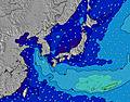 | 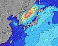 |  | ||||||||||||
Wave Height (m) Direction Period (s) | SE 17 | SE 17 | SE 16 | SE 16 | SSE 16 | SSE 16 | SSE 15 | SSE 14 | S 15 | S 15 | S 14 | SSW 15 | SSW 14 | SSW 14 | SSW 14 | SW 14 | SSW 14 | SSW 14 | SSW 15 |
Wave Graph | |||||||||||||||||||
671 | 1094 | 1474 | 2269 | 2948 | 3142 | 2478 | 2160 | 2424 | 2445 | 1984 | 1459 | 904 | 714 | 735 | 305 | 681 | 561 | 409 | |
Wind (km/h) | |||||||||||||||||||
Wind State on-shore cross-onshore cross-shore cross-offshore off-shore glassy | cross-off | cross-off | cross-on | cross-off | cross-off | cross | cross-off | cross | on | cross | cross | on | cross-on | cross | cross-on | cross-off | cross | cross-on | cross-off |
High Tide | 7:48AM1.28m | 8:05PM1.45m | 8:47AM1.18m | 8:33PM1.43m | 10:12AM1.09m | 9:05PM1.40m | 12:46PM1.07m | 9:50PM1.36m | 3:24PM1.19m | 11:07PM1.33m | 4:05PM1.31m | 00:49AM1.35m | |||||||
Low Tide | 1:55AM0.55m | 1:44PM0.55m | 2:41AM0.50m | 2:14PM0.72m | 3:38AM0.47m | 2:45PM0.88m | 4:53AM0.43m | 3:24PM1.05m | 6:23AM0.36m | 5:48PM1.18m | 7:47AM0.25m | 8:17PM1.17m | |||||||
— | 4:52 | — | — | 4:54 | — | — | 4:54 | — | — | 4:54 | — | — | 4:56 | — | — | 4:56 | — | — | |
6:45 | — | 6:44 | — | — | 6:43 | — | — | 6:42 | — | — | 6:40 | — | — | 6:39 | — | — | 6:38 | — | |
mm | — | — | — | — | — | — | — | — | — | 7 | 4 | 2 | 8 | — | — | — | 1 | — | — |
Temp °C | 24 | 28 | 28 | 25 | 26 | 29 | 27 | 30 | 29 | 27 | 28 | 28 | 27 | 28 | 29 | 26 | 29 | 30 | 26 |
Feels °C | 23 | 25 | 25 | 24 | 24 | 29 | 29 | 32 | 32 | 30 | 31 | 31 | 30 | 31 | 30 | 30 | 30 | 31 | 25 |
Swell 1 Height (m) Direction Period (s) | SE 17 | SE 17 | SE 16 | SE 16 | SSE 16 | SSE 16 | SSE 15 | SSE 14 | S 15 | S 15 | S 14 | SSW 15 | SSW 14 | SSW 14 | SSW 14 | S 10 | SSW 14 | SSW 14 | SSW 15 |
671 | 1094 | 1474 | 2269 | 2948 | 3142 | 2478 | 2160 | 2424 | 2445 | 1984 | 1459 | 904 | 714 | 735 | 226 | 681 | 561 | 409 | |
Swell 2 Height (m) Direction Period (s) | E 14 | E 14 | E 13 | — | — | — | — | E 10 | ESE 10 | ESE 10 | SE 9 | SE 9 | SE 9 | SE 9 | SE 9 | SW 14 | ESE 13 | SE 8 | SE 8 |
4 | 4 | 3 | — | — | — | — | 108 | 111 | 151 | 499 | 114 | 162 | 112 | 39 | 305 | 32 | 25 | 44 | |
Swell 3 Height (m) Direction Period (s) | — | — | — | — | — | — | — | — | — | — | — | — | — | ESE 13 | ESE 12 | ESE 12 | — | ESE 12 | ESE 13 |
— | — | — | — | — | — | — | — | — | — | — | — | — | 32 | 14 | 30 | — | 31 | 35 | |
Wind waves Height (m) Direction Period (s) | NE 3 | NNE 3 | — | — | NNE 4 | — | — | — | — | — | — | — | — | — | SSE 9 | — | — | — | — |
7 | 7 | — | — | 34 | — | — | — | — | — | — | — | — | — | 70 | — | — | — | — | |
Nearest Offshore or Glassy | |||||||||||||||||||
Distance (km) | 463 | 465 | 59 | 465 | 463 | 27 | 12 | 19 | 36 | 19 | 19 | 36 | 19 | 19 | 62 | 0 | 33 | 36 | 1015 |
Best forecast wave conditions in Kanagawa | |||||||||||||||||||
Best forecast wave conditions in Japan | |||||||||||||||||||
Header Global | |||||||||||||||||||
- Map Icons:
 Break
Break Live Wave Height (m)
 Live Wind Speed (km/h)
 Surf Rating (10 Max)
 Ocean Swells (m)
- Wind Speed (km/h)
Latest Updates


FREE! Surf-Forecast.com widget for your website
The surf report / weather widget below is available to embed on third party websites free of charge and provides a summary of our Hanamizu River surf forecast. Simply grab the html code snippet that we provide and paste it into your own site. You can choose your preferred language and metric/imperial units for the surf forecast feed to suit users of your site. Click here to get the code.
Information about the Hanamizu River Surf forecast
The above surf forecast table for Hanamizu River provides essential information for determining whether the surfing conditions will be good over the next 16 days. A general guide to surfing at Hanamizu River can be found by selecting the local surf guide option on the grey menu. Our Hanamizu River surf forecast is unique since it includes wave energy (power) that defines the real feel of the surf rather than just the height or the period. If you surf the same spot (Hanamizu River) regularly then make a mental note of the wave energy from the surf forecast table each time you go. Very soon you may start to choose your surf days based on the wave energy alone combined with our forecast of favourable offshore wind conditions. Our star ratings will help here and of course you will also find the usual wave height and period predictions on our surf forecasts as well as a full break down of the swell components under our advanced users option (to reveal that, click the little Einstein character under the tide times).
Further information to help with frequently asked questions about our surf forecast for Hanamizu River may be found under the help tab on the top menu and also by moving your mouse over the question marks on the surf forecast table itself. Please always bear in mind that the forecast is for near-shore open water and local factors at each surf break influence the actual breaking wave height, such as the beach / reef profile, water depths offshore and shelter.
Hanamizu River is 1 km (1 miles) from Ninomiya. If you plan a holiday in Kanagawa, look for hotels and other accommodation in Ninomiya. Ninomiya has rooms for a wide range of budgets as well as car hire and transport links.
 Nearest