

Surf Forecasts:

Monabe Rivermouth surf forecast from 3 Aug 2026:
- Best quality surf: Friday 7 Aug, 12AM (local time) - 25ft (7.5m), 17s period, SE swell with cross-offshore winds.
- Most powerful swell: Friday 7 Aug, 12AM (local time) - 25ft (7.5m), 17s period, SE swell with 32,983 kJ wave energy.
- Next surfable swell (1★+): Tuesday 4 Aug, 9AM (local time) - 10ft (3.0m), 16s period with ESE swell.
Best Forecast Surf Conditions for Monabe Rivermouth this week:
The surf forecast for Monabe Rivermouth over the next 16 days: The first swell (rated 1 star or higher) is forecast to arrive on Tuesday (Aug 04) at 9AM. The primary swell is predicted to be 3.0m and 16s period with a secondary swell of 2.2m and 8s. The wind is predicted to be glassy as the swell arrives.
The most powerful waves expected at Monabe Rivermouth in the next 16 days are 7.5m 17s and forecast to arrive on Friday (Aug 07) at 12AM. Winds are predicted to be cross-offshore at the time the swell arrives. The largest open ocean swell (not directed at the beach) is 4.5m 16s period and expected on Saturday (Aug 08) at 9AM.
| Wave Type | Time (JST) & Date | Wave Height & Period |
|---|---|---|
| Next good surf (1 star+) | 9AM (Tue 4th Aug) | 10ft (3.0m) 16s |
| Best Surf | 12AM (Fri 7th Aug) | 25ft (7.5m) 17s |
| Most Powerful | 12AM (Fri 7th Aug) | 25ft (7.5m) 17s |
Table - best surf conditions forecast for Monabe Rivermouth over the next 16 days.
The Lowdown
G'day, Rusty here, and I've gotta tell you, the next 16 days are a wild ride, starting with a real bang then a long, frustrating lull. We're kicking off with a proper standout, but you'll need to be patient and pick your moments.
Right off the bat, Monday August 3rd, Monabe Rivermouth is the place to be. The water is a touch warmer than normal, sitting at 85°, and it's glassy. We've got a 5 ft swell rolling in from the ESE, with a very long 16-second period groundswell. The energy is pumping at 1389, and it's going to be clean. This is a rare treat, so if you can get down there Monday morning, do it. Keep in mind, this spot rarely breaks, so when it's on, it's on. Crowds are possible, but it'll be worth it.
The quality builds through the week. Tuesday afternoon the 4th sees it jump to 12 ft, still glassy and from the ESE with a 17-second period. That's a massive 8198 energy reading. Wednesday morning the 5th is the absolute peak for the whole period: 16 ft, glassy, 17-second ESE groundswell, and 13904 energy. But listen, this is big. Anything over 8 ft is only for experts, and 16 ft is serious. This is a ripper, but it's a heavy, heavy wave. The river mouth setup will handle the long period, but it's not for the faint-hearted.
By Thursday the 6th, the swell is up to 23 ft from the SE, still with a 17-second period. The energy is off the charts at 30297. But the wind swings to a cross-offshore and then a cross-shore, and it's blowing 18-19 mph. This setup is looking more interesting for kite surfing than paddle surfing. The sheer size and wind will make it a mess for a standard board.
Then it all goes south. From Friday the 7th, the wind is onshore and the swell drops. There's a massive gap from Saturday the 8th all the way through to Sunday the 16th of August where conditions are just ordinary. You'll see some small waves, but the wind is either cross, cross-on, or the period drops to 8-9 seconds, making it weak and choppy. The energy readings are below 1000, and it's just not worth paddling out.
There is a tiny glimmer on Monday the 17th of August. The wind goes glassy again, and we get a 8 ft, 11-second E swell. That's a bit of a return to form with 1499 energy, but it's a long way off and not the same quality as that first week.
So, to sum it up: the first few days, especially Monday morning, Tuesday afternoon, and Wednesday morning, are the real deal. After that, you're on the beach for a solid week and a half. It's a classic case of a short, sharp hit of glory, then a long wait.
Rusty.
Short Range ForecastLight rain (total 9mm), mostly falling on Mon afternoon. Warm (max 32°C on Wed afternoon, min 25°C on Tue night). Wind will be generally light. | Days 4-6 Weather SummaryModerate rain (total 11mm), heaviest on Sat afternoon. Warm (max 33°C on Thu morning, min 25°C on Sat night). Mainly fresh winds. | ||||||||||||||||||||
Monday 3 | Tuesday 4 | Wednesday 5 | Thursday 6 | Friday 7 | Saturday 8 | Sunday 9 | |||||||||||||||
AM | PM | Night | AM | PM | Night | AM | PM | Night | AM | PM | Night | AM | PM | Night | AM | PM | Night | AM | PM | Night | |
Swell Height Map |  |  |  | 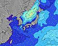 | 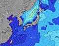 | 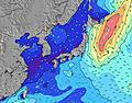 | 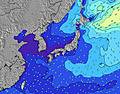 | ||||||||||||||
Wave Height (m) Direction Period (s) | ESE 16 | ESE 16 | ESE 17 | ESE 16 | ESE 17 | ESE 17 | ESE 17 | ESE 17 | SE 16 | SE 17 | SE 17 | SE 17 | SSE 16 | S 16 | S 15 | ESE 10 | ESE 9 | ESE 9 | ESE 9 | ESE 9 | ESE 9 |
Wave Graph | |||||||||||||||||||||
1464 | 1697 | 2895 | 5319 | 7686 | 9553 | 13580 | 17495 | 19640 | 25574 | 28435 | 32983 | 23383 | 11796 | 13062 | 1677 | 1583 | 1638 | 1713 | 1530 | 757 | |
Wind (km/h) | |||||||||||||||||||||
Wind State on-shore cross-onshore cross-shore cross-offshore off-shore glassy | glassy | cross-on | cross | glassy | glassy | glassy | glassy | cross-on | cross-off | cross | cross | cross-off | cross-off | cross | cross-off | cross-off | cross | cross | cross | cross | cross-off |
High Tide | 8:54PM1.75m | 9:05AM1.58m | 9:23PM1.72m | 10:00AM1.47m | 9:57PM1.67m | 11:18AM1.36m | 10:41PM1.60m | 1:19PM1.32m | 11:46PM1.54m | 3:23PM1.42m | 1:20AM1.53m | 4:31PM1.57m | 2:49AM1.60m | ||||||||
Low Tide | 2:33PM0.43m | 3:05AM0.57m | 3:05PM0.59m | 3:51AM0.55m | 3:42PM0.77m | 4:49AM0.54m | 4:29PM0.96m | 6:05AM0.52m | 5:47PM1.13m | 7:38AM0.45m | 8:01PM1.21m | 9:02AM0.31m | 9:40PM1.16m | ||||||||
5:16 | — | — | 5:18 | — | — | 5:18 | — | — | 5:20 | — | — | 5:20 | — | — | 5:20 | — | — | 5:22 | — | — | |
— | 7:02 | — | — | 7:01 | — | — | 7:01 | — | — | 7:00 | — | — | 7:00 | — | — | 6:59 | — | — | 6:58 | — | |
mm | — | 4 | 5 | — | — | — | — | — | — | — | — | — | — | — | 1 | 4 | 5 | 1 | — | — | — |
Temp °C | 31 | 30 | 28 | 27 | 27 | 26 | 31 | 32 | 28 | 33 | 33 | 29 | 32 | 32 | 28 | 28 | 27 | 27 | 30 | 30 | 25 |
Feels °C | 35 | 34 | 33 | 32 | 32 | 30 | 33 | 32 | 31 | 32 | 32 | 29 | 31 | 31 | 29 | 30 | 28 | 28 | 29 | 29 | 26 |
Swell 1 Height (m) Direction Period (s) | ESE 16 | ESE 16 | ESE 17 | ESE 16 | ESE 17 | ESE 17 | ESE 17 | ESE 17 | SE 16 | SE 17 | SE 17 | SE 17 | SSE 16 | S 16 | S 15 | SSW 16 | SSW 16 | SSW 16 | SSW 15 | SSW 14 | SSW 13 |
1464 | 1697 | 2895 | 5319 | 7686 | 9553 | 13580 | 17495 | 19640 | 25574 | 28435 | 30252 | 23383 | 11796 | 13062 | 10674 | 8957 | 8371 | 5953 | 3651 | 2149 | |
Swell 2 Height (m) Direction Period (s) | SE 10 | S 8 | — | — | — | — | — | — | — | — | — | — | — | — | — | SSE 10 | — | — | E 13 | SE 15 | E 13 |
15 | 4 | — | — | — | — | — | — | — | — | — | — | — | — | — | 511 | — | — | 168 | 9 | 414 | |
Swell 3 Height (m) Direction Period (s) | S 8 | S 8 | — | — | — | — | — | — | — | — | — | — | — | — | — | — | — | — | — | — | SE 15 |
5 | 4 | — | — | — | — | — | — | — | — | — | — | — | — | — | — | — | — | — | — | 8 | |
Wind waves Height (m) Direction Period (s) | E 4 | ESE 6 | E 7 | E 8 | E 9 | — | — | — | — | — | E 10 | SE 17 | E 10 | ESE 10 | ESE 10 | ESE 10 | ESE 9 | ESE 9 | ESE 9 | ESE 9 | ESE 9 |
28 | 182 | 311 | 624 | 901 | — | — | — | — | — | 2555 | 32983 | 1827 | 3839 | 1552 | 1677 | 1583 | 1638 | 1713 | 1530 | 757 | |
Nearest Offshore or Glassy | |||||||||||||||||||||
Distance (km) | 0 | 20 | 20 | 20 | 0 | 0 | 0 | 190 | 0 | 559 | 515 | 550 | 528 | 515 | 515 | 515 | 0 | 515 | 580 | 580 | 346 |
Best forecast wave conditions in Shikoku | |||||||||||||||||||||
Best forecast wave conditions in Japan | |||||||||||||||||||||
Header Global | |||||||||||||||||||||
- Map Icons:
 Break
Break Live Wave Height (m)
 Live Wind Speed (km/h)
 Surf Rating (10 Max)
 Ocean Swells (m)
- Wind Speed (km/h)
Latest Updates


FREE! Surf-Forecast.com widget for your website
The surf report / weather widget below is available to embed on third party websites free of charge and provides a summary of our Monabe Rivermouth surf forecast. Simply grab the html code snippet that we provide and paste it into your own site. You can choose your preferred language and metric/imperial units for the surf forecast feed to suit users of your site. Click here to get the code.
Information about the Monabe Rivermouth Surf forecast
The above surf forecast table for Monabe Rivermouth provides essential information for determining whether the surfing conditions will be good over the next 16 days. A general guide to surfing at Monabe Rivermouth can be found by selecting the local surf guide option on the grey menu. Our Monabe Rivermouth surf forecast is unique since it includes wave energy (power) that defines the real feel of the surf rather than just the height or the period. If you surf the same spot (Monabe Rivermouth) regularly then make a mental note of the wave energy from the surf forecast table each time you go. Very soon you may start to choose your surf days based on the wave energy alone combined with our forecast of favourable offshore wind conditions. Our star ratings will help here and of course you will also find the usual wave height and period predictions on our surf forecasts as well as a full break down of the swell components under our advanced users option (to reveal that, click the little Einstein character under the tide times).
Further information to help with frequently asked questions about our surf forecast for Monabe Rivermouth may be found under the help tab on the top menu and also by moving your mouse over the question marks on the surf forecast table itself. Please always bear in mind that the forecast is for near-shore open water and local factors at each surf break influence the actual breaking wave height, such as the beach / reef profile, water depths offshore and shelter.
Monabe Rivermouth is 11 km (7 miles) from the city of Aki. If you plan a holiday in Shikoku, look for hotels and other accommodation in Aki. Aki has rooms for a wide range of budgets as well as car hire and transport links.
 Nearest