

Surf Forecasts:

How big are the waves at Amatu today (03 Aug):
- Morning surf: Morning surf (03 Aug, local time) - 6.5ft (2.0m), 16s period with ESE swell.
- Afternoon surf: Afternoon surf (03 Aug, local time) - 8ft (2.5m), 17s period with SE swell.
- Evening surf: Evening surf (03 Aug, local time) - 10ft (3.0m), 17s period with SE swell.
The current surf forecast for Amatu at 5PM is: 2.5m 17s primary swell from a Southeast direction and 0.5m 14s secondary swell from a East direction, 1.5m 6s secondary swell from a East-northeast direction (forecast issued at 08:00am August 03). The wind direction is predicted to be cross-offshore.
| Time (JST) & Date | Wave Height | Wave Period |
|---|---|---|
| Morning (03 Aug) | 6.5ft (2.0m) | 16s |
| Afternoon (03 Aug) | 8ft (2.5m) | 17s |
| Evening (03 Aug) | 10ft (3.0m) | 17s |
Table - waves today at Amatu. (Swell directed towards the surf break)
Short Range ForecastMostly dry. Warm (max 26°C on Wed afternoon, min 22°C on Mon night). Mainly fresh winds. | ||||||||||||||||||||||
Monday 3 | Tuesday 4 | Wednesday 5 | ||||||||||||||||||||
6 AM | 9 AM | 12 PM | 3 PM | 6 PM | 9 PM | 12 AM | 3 AM | 6 AM | 9 AM | 12 PM | 3 PM | 6 PM | 9 PM | 12 AM | 3 AM | 6 AM | 9 AM | 12 PM | 3 PM | 6 PM | 9 PM | |
Swell Height Map |  |  |  | 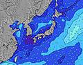 |  |  | 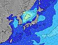 |  | ||||||||||||||
Wave Height (m) Direction Period (s) | ESE 16 | ESE 16 | ESE 16 | SE 17 | SE 17 | SE 17 | SE 16 | SE 16 | SE 16 | SE 16 | SE 16 | SE 16 | SE 16 | SE 16 | SE 16 | SE 16 | SE 16 | SE 16 | SE 16 | SSE 16 | SSE 15 | SSE 15 |
Wave Graph | ||||||||||||||||||||||
2032 | 2058 | 2290 | 3610 | 3730 | 4380 | 4498 | 4899 | 5298 | 5567 | 6029 | 5953 | 6897 | 7862 | 9840 | 10162 | 10064 | 9925 | 10010 | 9888 | 7278 | 6185 | |
Wind (km/h) | ||||||||||||||||||||||
Wind State on-shore cross-onshore cross-shore cross-offshore off-shore glassy | cross-off | cross-off | cross-off | cross-off | cross-off | cross-off | cross-off | cross-off | cross-off | cross-off | cross-off | cross-off | cross-off | cross-off | cross-off | cross-off | cross-off | cross-off | cross-off | cross-off | cross-off | cross-off |
High Tide | 6:53AM1.40m | 7:41PM1.45m | 7:41AM1.31m | 8:03PM1.43m | 8:39AM1.21m | 8:27PM1.41m | ||||||||||||||||
Low Tide | 1:13PM0.42m | 1:46AM0.58m | 1:41PM0.58m | 2:33AM0.54m | 2:09PM0.75m | |||||||||||||||||
4:48 | — | — | — | — | — | — | 4:48 | — | — | — | — | — | — | — | 4:50 | — | — | — | — | — | — | |
— | — | — | — | 6:40 | — | — | — | — | — | — | — | 6:39 | — | — | — | — | — | — | — | 6:38 | — | |
mm | — | — | — | — | — | — | — | — | — | — | — | — | — | — | — | — | — | — | — | — | — | — |
Temp °C | 24 | 24 | 24 | 25 | 24 | 23 | 23 | 23 | 22 | 24 | 25 | 25 | 23 | 23 | 23 | 22 | 22 | 23 | 25 | 26 | 26 | 25 |
Feels °C | 24 | 23 | 23 | 24 | 22 | 21 | 21 | 21 | 20 | 21 | 22 | 22 | 21 | 21 | 22 | 20 | 20 | 22 | 25 | 26 | 28 | 28 |
Swell 1 Height (m) Direction Period (s) | ESE 16 | ESE 16 | ESE 16 | SE 17 | SE 17 | SE 17 | SE 16 | SE 16 | SE 16 | SE 16 | SE 16 | SE 16 | SE 16 | SE 16 | SE 16 | SE 16 | SE 16 | SE 16 | SE 16 | SSE 16 | SSE 15 | SSE 15 |
2032 | 2058 | 2290 | 3610 | 3730 | 4380 | 4498 | 4899 | 5298 | 5567 | 6029 | 5953 | 6897 | 7862 | 9840 | 10162 | 10064 | 9925 | 10010 | 9888 | 7278 | 6185 | |
Swell 2 Height (m) Direction Period (s) | E 14 | SE 21 | SE 20 | E 14 | E 14 | E 14 | E 14 | E 14 | E 14 | E 14 | E 13 | E 13 | ENE 13 | ENE 13 | ENE 13 | ENE 13 | — | — | — | — | ENE 18 | E 10 |
104 | 358 | 673 | 98 | 98 | 96 | 94 | 94 | 96 | 93 | 89 | 87 | 57 | 56 | 57 | 57 | — | — | — | — | 30 | 696 | |
Swell 3 Height (m) Direction Period (s) | — | E 14 | E 14 | — | — | — | — | — | — | — | — | — | — | — | — | — | — | — | — | — | — | ENE 17 |
— | 98 | 97 | — | — | — | — | — | — | — | — | — | — | — | — | — | — | — | — | — | — | 30 | |
Wind waves Height (m) Direction Period (s) | NE 6 | NE 6 | ENE 6 | ENE 7 | ENE 6 | ENE 7 | ENE 7 | ENE 7 | ENE 7 | ENE 8 | ENE 8 | ENE 8 | ENE 8 | ENE 7 | — | — | — | — | — | — | E 8 | — |
80 | 104 | 136 | 175 | 203 | 222 | 223 | 242 | 286 | 336 | 373 | 422 | 411 | 417 | — | — | — | — | — | — | 476 | — | |
Nearest Offshore or Glassy | ||||||||||||||||||||||
Distance (km) | 190 | 519 | 540 | 35 | 540 | 540 | 190 | 190 | 190 | 190 | 190 | 35 | 540 | 540 | 540 | 538 | 538 | 538 | 538 | 35 | 35 | 35 |
Best forecast wave conditions in Chiba | ||||||||||||||||||||||
Best forecast wave conditions in Japan | ||||||||||||||||||||||
Header Global | ||||||||||||||||||||||
- Map Icons:
 Break
Break Live Wave Height (m)
 Live Wind Speed (km/h)
 Surf Rating (10 Max)
 Ocean Swells (m)
- Wind Speed (km/h)
Latest Updates


FREE! Surf-Forecast.com widget for your website
The surf report / weather widget below is available to embed on third party websites free of charge and provides a summary of our Amatu surf forecast. Simply grab the html code snippet that we provide and paste it into your own site. You can choose your preferred language and metric/imperial units for the surf forecast feed to suit users of your site. Click here to get the code.
 Nearest