

Surf Forecasts:

Big Ben surf forecast from 3 Aug 2026:
- Best quality surf: Tuesday 4 Aug, 3AM (local time) - 10ft (3.0m), 16s period, SE swell with cross-offshore winds.
- Most powerful swell: Wednesday 5 Aug, 12PM (local time) - 15ft (4.5m), 16s period, SE swell with 8,828 kJ wave energy.
- Next surfable swell (1★+): Tuesday 4 Aug, 3AM (local time) - 10ft (3.0m), 16s period with SE swell.
Best Forecast Surf Conditions for Big Ben this week:
The surf forecast for Big Ben over the next 16 days: The first swell (rated 1 star or higher) is forecast to arrive on Tuesday (Aug 04) at 3AM. The primary swell is predicted to be 3.0m and 16s period with a secondary swell of 0.5m and 14s. Another secondary swell of 1.6m and 7s is also forecast. The wind is predicted to be cross-offshore as the swell arrives.
The most powerful waves expected at Big Ben in the next 16 days are 4.5m 16s and forecast to arrive on Wednesday (Aug 05) at 12PM. Winds are predicted to be cross-shore at the time the swell arrives. The largest open ocean swell (not directed at the beach) is 1.4m 5s period and expected on Monday (Aug 10) at 3PM.
| Wave Type | Time (JST) & Date | Wave Height & Period |
|---|---|---|
| Next good surf (1 star+) | 3AM (Tue 4th Aug) | 10ft (3.0m) 16s |
| Best Surf | 3AM (Tue 4th Aug) | 10ft (3.0m) 16s |
| Most Powerful | 12PM (Wed 5th Aug) | 15ft (4.5m) 16s |
Table - best surf conditions forecast for Big Ben over the next 16 days.
The Lowdown
Alright, my fellow wave-chasers, Rusty here. Let's break down the next 16 days for our local spot. It's a tale of two extremes.
We're staring down a massive, powerful groundswell. The combined energy at the start is a whopping 7684, which is a whole lot of ocean moving. The only break in the game is Big Ben, a beach and jetty setup that's open to the south-east. Water temp is about normal for this time of year.
The first real action is on Tuesday, August 4th. We're talking a 13ft swell from the ESE with a 16-second period. That's a long-period groundswell. The bad news is a 30 km/h cross-shore wind is making it lumpy. The bigger problem is that 13ft is way too big for a beginner spot. The afternoon is the same story with an 12ft swell from the SE.
Wednesday, August 5th is the one to watch. The morning looks clean with a moderate cross-offshore breeze, and the swell is a monster 15ft from the SE, with a very long 15-second period. The combined energy is 8458. The wind is finally cooperating, but 15ft is strictly for experts. It's a big, powerful groundswell that could be a bit straight for a beach break, but the clean conditions are a huge plus. The afternoon stays big at 15ft, but the wind goes cross-shore and brings the chop.
Thursday, August 6th drops to 12ft from the south, but the 14-second period keeps it punchy. The morning has a gentle cross-shore with a little chop, while the afternoon gets messy with a moderate cross-onshore wind. Still too much for most.
By Friday, August 7th, the swell drops to 8ft, but the wind is cross-onshore and choppy, so it's a no-go. The afternoon is even worse. This trend of poor conditions sticks around through the weekend and into the next week.
We get a couple of clean mornings on Monday, August 10th and Tuesday, August 11th with a cross-offshore breeze, but the swell is a messy 8ft to 8ft from the east with a shorter 12-13 second period. The energy is still decent, but the quality just isn't there.
After that, it's mostly onshore wind and chop until Saturday, August 15th when the swell jumps back up to 10ft from the ESE. The wind is a fresh cross-shore, making it lumpy, and the forecast says it's too big for the break. Sunday, August 16th sees an 8ft swell from the ESE with a 13-second period, but the wind is cross-onshore and the energy is strong at 5089. The forecast is calling it poor.
So, the honest truth for Big Ben is this: The first few days have the most powerful swell, but it's simply too big for this beginner-friendly break. The cleanest conditions are on Wednesday, August 5th, but that's a day for the pros only. For the rest of us, it's a waiting game.
- Rusty
Short Range ForecastMostly dry. Warm (max 29°C on Thu morning, min 22°C on Mon night). Wind will be generally light. | Days 5-7 Weather SummaryLight rain (total 6mm), mostly falling on Thu night. Warm (max 28°C on Fri morning, min 24°C on Sat night). Wind will be generally light. | ||||||||||||||||||
Tuesday 4 | Wednesday 5 | Thursday 6 | Friday 7 | Saturday 8 | Sunday 9 | ||||||||||||||
Night | AM | PM | Night | AM | PM | Night | AM | PM | Night | AM | PM | Night | AM | PM | Night | AM | PM | Night | |
Swell Height Map |  |  |  |  | 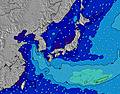 | 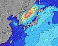 | 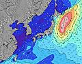 | ||||||||||||
Wave Height (m) Direction Period (s) | SE 16 | ESE 16 | SE 16 | SE 16 | SE 15 | SSE 15 | SSE 14 | S 14 | S 14 | S 14 | SSW 14 | SSW 14 | SSW 14 | SSW 14 | SSW 15 | SSW 15 | SW 16 | SW 16 | SW 16 |
Wave Graph | |||||||||||||||||||
4498 | 7148 | 5953 | 8599 | 8427 | 8487 | 5178 | 4220 | 4321 | 3436 | 2085 | 1913 | 1415 | 1504 | 1648 | 1907 | 1909 | 2214 | 1707 | |
Wind (km/h) | |||||||||||||||||||
Wind State on-shore cross-onshore cross-shore cross-offshore off-shore glassy | cross | cross | cross | cross-off | cross-off | cross | cross-off | cross | cross-on | cross-on | cross-on | cross-on | cross-on | cross-on | cross-on | cross-on | cross-on | cross-on | cross-off |
High Tide | 7:59AM1.30m | 8:06PM1.45m | 9:01AM1.18m | 8:31PM1.43m | 10:40AM1.08m | 9:01PM1.40m | 9:44PM1.36m | 4:28PM1.26m | 11:10PM1.33m | 4:23PM1.35m | 00:59AM1.34m | ||||||||
Low Tide | 1:59AM0.58m | 1:49PM0.67m | 2:48AM0.56m | 2:13PM0.83m | 3:50AM0.55m | 2:28PM0.99m | 5:14AM0.52m | 6:50AM0.45m | 6:32PM1.25m | 8:04AM0.35m | 8:47PM1.21m | ||||||||
— | 4:50 | — | — | 4:50 | — | — | 4:50 | — | — | 4:52 | — | — | 4:52 | — | — | 4:52 | — | — | |
6:40 | — | 6:39 | — | — | 6:38 | — | — | 6:37 | — | — | 6:37 | — | — | 6:36 | — | — | 6:35 | — | |
mm | — | — | — | — | — | — | — | — | — | 2 | 2 | 1 | 1 | — | — | — | — | — | — |
Temp °C | 24 | 25 | 25 | 23 | 26 | 27 | 25 | 29 | 28 | 26 | 28 | 28 | 26 | 28 | 28 | 25 | 28 | 27 | 24 |
Feels °C | 23 | 22 | 23 | 22 | 26 | 28 | 28 | 31 | 30 | 29 | 29 | 29 | 29 | 30 | 30 | 28 | 28 | 26 | 23 |
Swell 1 Height (m) Direction Period (s) | SE 16 | ESE 16 | SE 16 | SE 16 | SE 15 | SSE 15 | SSE 14 | S 14 | S 14 | S 14 | SSW 14 | SE 9 | SE 9 | SE 9 | ESE 9 | ESE 14 | ESE 13 | ESE 13 | E 13 |
4498 | 7148 | 5953 | 8599 | 8427 | 8487 | 5178 | 4220 | 4321 | 3436 | 2085 | 945 | 818 | 599 | 673 | 1469 | 1401 | 1398 | 1538 | |
Swell 2 Height (m) Direction Period (s) | E 14 | E 14 | E 13 | ENE 13 | ENE 18 | — | E 10 | E 10 | ESE 10 | ESE 9 | SE 9 | SSW 14 | SSW 14 | SSW 14 | SSW 15 | SSW 15 | SW 16 | SW 16 | SW 16 |
94 | 93 | 89 | 57 | 31 | — | 510 | 468 | 533 | 506 | 811 | 1913 | 1415 | 1504 | 1648 | 1907 | 1909 | 2214 | 1707 | |
Swell 3 Height (m) Direction Period (s) | — | — | — | — | — | — | ENE 17 | ENE 16 | ENE 16 | ENE 15 | ENE 15 | ENE 15 | ENE 14 | ESE 13 | ENE 14 | ENE 14 | — | — | SSE 9 |
— | — | — | — | — | — | 27 | 25 | 51 | 46 | 42 | 42 | 41 | 183 | 66 | 38 | — | — | 52 | |
Wind waves Height (m) Direction Period (s) | ENE 7 | ENE 7 | ENE 8 | — | — | — | — | — | — | ESE 10 | — | — | — | ESE 9 | — | — | — | — | — |
265 | 443 | 368 | — | — | — | — | — | — | 784 | — | — | — | 732 | — | — | — | — | — | |
Nearest Offshore or Glassy | |||||||||||||||||||
Distance (km) | 532 | 534 | 29 | 534 | 532 | 29 | 29 | 22 | 81 | 35 | 48 | 95 | 35 | 48 | 81 | 22 | 48 | 95 | 1075 |
Best forecast wave conditions in Chiba | |||||||||||||||||||
Best forecast wave conditions in Japan | |||||||||||||||||||
Header Global | |||||||||||||||||||
- Map Icons:
 Break
Break Live Wave Height (m)
 Live Wind Speed (km/h)
 Surf Rating (10 Max)
 Ocean Swells (m)
- Wind Speed (km/h)
Latest Updates


FREE! Surf-Forecast.com widget for your website
The surf report / weather widget below is available to embed on third party websites free of charge and provides a summary of our Big Ben surf forecast. Simply grab the html code snippet that we provide and paste it into your own site. You can choose your preferred language and metric/imperial units for the surf forecast feed to suit users of your site. Click here to get the code.
Information about the Big Ben Surf forecast
The above surf forecast table for Big Ben provides essential information for determining whether the surfing conditions will be good over the next 16 days. A general guide to surfing at Big Ben can be found by selecting the local surf guide option on the grey menu. Our Big Ben surf forecast is unique since it includes wave energy (power) that defines the real feel of the surf rather than just the height or the period. If you surf the same spot (Big Ben) regularly then make a mental note of the wave energy from the surf forecast table each time you go. Very soon you may start to choose your surf days based on the wave energy alone combined with our forecast of favourable offshore wind conditions. Our star ratings will help here and of course you will also find the usual wave height and period predictions on our surf forecasts as well as a full break down of the swell components under our advanced users option (to reveal that, click the little Einstein character under the tide times).
Further information to help with frequently asked questions about our surf forecast for Big Ben may be found under the help tab on the top menu and also by moving your mouse over the question marks on the surf forecast table itself. Please always bear in mind that the forecast is for near-shore open water and local factors at each surf break influence the actual breaking wave height, such as the beach / reef profile, water depths offshore and shelter.
Big Ben is 3 km (2 miles) from Kawaguchi. If you plan a holiday in Chiba, look for hotels and other accommodation in Kawaguchi. Kawaguchi has rooms for a wide range of budgets as well as car hire and transport links.
 Nearest