

Surf Forecasts:

Okuragahama surf forecast from 31 Jul 2026:
- Best quality surf: Wednesday 5 Aug, 12PM (local time) - 18ft (5.5m), 18s period, ESE swell with cross-shore winds.
- Most powerful swell: Thursday 6 Aug, 9AM (local time) - 28ft (8.5m), 17s period, SE swell with 44,846 kJ wave energy.
- Next surfable swell (1★+): Saturday 1 Aug, 9PM (local time) - 1.5ft (0.4m), 11s period with SE swell.
Best Forecast Surf Conditions for Okuragahama this week:
The surf forecast for Okuragahama over the next 16 days: The first swell (rated 1 star or higher) is forecast to arrive on Saturday (Aug 01) at 9PM. The primary swell is predicted to be 0.2m and 18s period with a secondary swell of 0.4m and 11s. Another secondary swell of 0.2m and 15s is also forecast. Another secondary swell of 0.3m and 3s is also forecast. The wind is predicted to be offshore as the swell arrives.
The most powerful waves expected at Okuragahama in the next 16 days are 8.5m 17s and forecast to arrive on Thursday (Aug 06) at 9AM. Winds are predicted to be cross-shore at the time the swell arrives. The largest open ocean swell (not directed at the beach) is 0.5m 5s period and expected on Sunday (Aug 02) at 12PM.
| Wave Type | Time (JST) & Date | Wave Height & Period |
|---|---|---|
| Next good surf (1 star+) | 9PM (Sat 1st Aug) | 1.5ft (0.4m) 11s |
| Best Surf | 12PM (Wed 5th Aug) | 18ft (5.5m) 18s |
| Most Powerful | 9AM (Thu 6th Aug) | 28ft (8.5m) 17s |
Table - best surf conditions forecast for Okuragahama over the next 16 days.
The Lowdown
G’day, Rusty here for the Okuragahama report. We’ve got a strange run ahead, with a lot of energy but not much quality at first, then a couple of real windows where it all comes together.
Right now, the water’s a touch warmer than normal, sitting at 85°, which is a bit above average for this time of year.
The first few days are pretty flat for surf. Saturday morning you’ve got tiny 1ft SE swell, glassy but no wave to ride. That’s the pattern for the weekend – small, clean, but hardly breaking. The real story starts next week. From Sunday morning, a long-period groundswell builds from the ESE, 2ft at 16 seconds, but only the morning session is glassy. By Sunday afternoon the wind swings onshore and it’s messy again.
Monday morning the swell jumps to 5ft ESE, still long period at 16 seconds, but the wind is cross-shore, and the combined energy is strong (1236). It’s marginal-quality, a bit lumpy. Tuesday sees the swell push to 8ft, then 10ft, with a long 17-18 second period and combined energy jumping into the thousands (4463 to 5285). The wind is cross-onshore and fairly choppy, so it’s messy and big – this is expert-only territory, and honestly, the wind is wrecking the shape.
Wednesday morning on the 5th of August is the standout of this whole run. Swell is 16ft from the ESE, 17 seconds – that’s a massive groundswell, very long period, so it’s going to be straight and fast at Okuragahama, a point break. Combined energy is through the roof (14633). The wind is moderate cross-shore, so it’s not perfect, but it’s the best we see all week. By Wednesday afternoon, the swell hits 20ft, cross-shore, energy at 20886 – but it’s too big for this break, really only for the brave and experienced. Thursday and Friday are even bigger, 28ft and 23ft, but the wind is fresh cross-onshore, lumpy, and dangerous. The forecast says it’s too big for this spot, and I’d agree. This is kite-surfing territory, not paddle surfing.
Then it all drops off. Friday the 8th of August morning the swell crashes to 8ft, but the wind is fresh cross-onshore, and the combined energy is 3141. That’s a hard pass. For the next several days, from the 8th through the 12th, it’s poor, onshore, lumpy, and not worth paddling for. There’s a gap of about four days where you’d be better off checking the wind forecast.
The next real chance comes on the 13th of August – Thursday morning has 5ft from the E, 13 seconds, light cross-onshore, marginal. But Thursday afternoon is the glassy gem: 4ft E, 12 seconds, glassy, combined energy 630, and the forecast says very good surf conditions. That’s a window. Friday morning the 14th is also glassy, with 3ft E, 12 seconds, energy 478, decent for a fun, clean session on a point break.
The best of the second week is the 15th of August – Saturday morning 5ft E, 13 seconds, glassy, excellent for experienced surfers, combined energy 1073. And then Sunday the 16th morning: 7ft E, 13 seconds, glassy, 1634 energy, and the forecast says excellent for experienced surfers. That’s the standout of the later run. The swell direction is right on the optimum for Okuragahama, and with glassy conditions, it’ll be clean. Afternoon on those days turns onshore and marginal, so hit the early sessions.
Bottom line: Wednesday the 5th is the big one for the brave, and Sunday the 16th morning is the pick for a cleaner, less intimidating session. Keep an eye on the 13th and 14th for smaller, glassy windows.
Rusty.
Short Range ForecastHeavy rain (total 22mm), heaviest during Mon night. Warm (max 33°C on Sun morning, min 26°C on Mon night). Wind will be generally light. | Days 4-6 Weather SummaryHeavy rain (total 46mm), heaviest during Tue morning. Warm (max 29°C on Wed afternoon, min 26°C on Tue night). Winds increasing (light winds from the NE on Tue night, fresh winds from the ENE by Thu morning). | ||||||||||||||||||||
Saturday 1 | Sunday 2 | Monday 3 | Tuesday 4 | Wednesday 5 | Thursday 6 | Friday 7 | |||||||||||||||
AM | PM | Night | AM | PM | Night | AM | PM | Night | AM | PM | Night | AM | PM | Night | AM | PM | Night | AM | PM | Night | |
Swell Height Map |  |  |  | 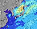 | 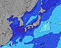 | 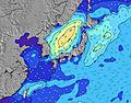 | 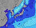 | ||||||||||||||
Wave Height (m) Direction Period (s) | SE 11 | SE 11 | ESE 15 | ESE 16 | ESE 17 | ESE 16 | ESE 16 | ESE 16 | ESE 18 | ESE 17 | ESE 18 | ESE 18 | ESE 17 | ESE 18 | ESE 18 | SE 17 | SE 16 | SE 16 | SSE 16 | SSE 15 | S 14 |
Wave Graph | |||||||||||||||||||||
18 | 29 | 43 | 208 | 229 | 803 | 1224 | 1611 | 3291 | 4090 | 4864 | 9860 | 14633 | 20886 | 34629 | 44846 | 32409 | 28007 | 22810 | 16564 | 4634 | |
Wind (km/h) | |||||||||||||||||||||
Wind State on-shore cross-onshore cross-shore cross-offshore off-shore glassy | glassy | on | off | glassy | on | glassy | cross | cross-on | cross | cross-on | cross-on | cross | cross | cross | cross | cross | cross-on | cross-on | cross-on | cross-on | cross-on |
High Tide | 8:17PM1.95m | 7:57AM1.91m | 8:43PM1.93m | 8:38AM1.84m | 9:11PM1.89m | 9:23AM1.75m | 9:41PM1.84m | 10:18AM1.63m | 10:16PM1.77m | 11:33AM1.52m | 11:02PM1.70m | 1:26PM1.49m | 00:10AM1.64m | ||||||||
Low Tide | 1:52PM0.32m | 2:10AM0.75m | 2:22PM0.40m | 2:45AM0.70m | 2:53PM0.52m | 3:24AM0.66m | 3:26PM0.68m | 4:09AM0.63m | 4:05PM0.86m | 5:06AM0.61m | 4:56PM1.05m | 6:19AM0.59m | 6:19PM1.22m | ||||||||
5:26 | — | — | 5:26 | — | — | 5:28 | — | — | 5:28 | — | — | 5:30 | — | — | 5:30 | — | — | 5:31 | — | — | |
— | 7:10 | — | — | 7:10 | — | — | 7:09 | — | — | 7:08 | — | — | 7:07 | — | — | 7:07 | — | — | 7:06 | — | |
mm | — | — | — | — | — | — | 1 | 2 | 19 | 8 | 3 | 1 | 1 | 1 | 5 | 6 | 6 | 15 | 6 | 7 | 24 |
Temp °C | 32 | 32 | 29 | 33 | 32 | 30 | 30 | 30 | 28 | 27 | 28 | 27 | 28 | 29 | 27 | 28 | 28 | 28 | 28 | 28 | 27 |
Feels °C | 35 | 35 | 33 | 36 | 36 | 35 | 34 | 33 | 32 | 30 | 31 | 30 | 30 | 31 | 29 | 29 | 29 | 29 | 29 | 29 | 28 |
Swell 1 Height (m) Direction Period (s) | SE 11 | SE 11 | SE 11 | ESE 16 | ESE 14 | ESE 16 | ESE 16 | ESE 16 | ESE 18 | ESE 17 | ESE 18 | ESE 18 | ESE 17 | ESE 18 | ESE 18 | SE 17 | SE 16 | SE 16 | SSE 16 | S 16 | S 14 |
18 | 29 | 29 | 208 | 215 | 803 | 1224 | 1611 | 3291 | 4090 | 4864 | 9860 | 14633 | 20886 | 34629 | 40564 | 32409 | 28007 | 22810 | 12908 | 4634 | |
Swell 2 Height (m) Direction Period (s) | ESE 9 | E 18 | ESE 15 | SE 9 | ESE 17 | E 10 | SSE 9 | S 7 | SSE 9 | — | E 9 | — | — | — | — | — | — | — | — | E 16 | E 15 |
7 | 6 | 43 | 21 | 229 | 48 | 8 | 1 | 8 | — | 421 | — | — | — | — | — | — | — | — | 20 | 17 | |
Swell 3 Height (m) Direction Period (s) | E 12 | SE 16 | ESE 18 | E 11 | ENE 8 | SSE 10 | S 7 | — | — | — | — | — | — | — | — | — | — | — | — | — | — |
3 | 10 | 31 | 9 | 23 | 10 | 4 | — | — | — | — | — | — | — | — | — | — | — | — | — | — | |
Wind waves Height (m) Direction Period (s) | — | — | — | — | NNE 4 | — | — | E 5 | E 7 | E 8 | — | — | — | — | — | SE 17 | — | ENE 11 | ESE 11 | SSE 15 | ESE 9 |
— | — | — | — | 12 | — | — | 28 | 243 | 373 | — | — | — | — | — | 44846 | — | 2091 | 3157 | 16564 | 1597 | |
Nearest Offshore or Glassy | |||||||||||||||||||||
Distance (km) | 721 | 720 | 0 | 0 | 264 | 0 | 51 | 117 | 117 | 117 | 117 | 7 | 235 | 747 | 188 | 188 | 761 | 235 | 761 | 761 | 235 |
Best forecast wave conditions in Kyu Shu | |||||||||||||||||||||
Best forecast wave conditions in Japan | |||||||||||||||||||||
Header Global | |||||||||||||||||||||
- Map Icons:
 Break
Break Live Wave Height (m)
 Live Wind Speed (km/h)
 Surf Rating (10 Max)
 Ocean Swells (m)
- Wind Speed (km/h)
Latest Updates


FREE! Surf-Forecast.com widget for your website
The surf report / weather widget below is available to embed on third party websites free of charge and provides a summary of our Okuragahama surf forecast. Simply grab the html code snippet that we provide and paste it into your own site. You can choose your preferred language and metric/imperial units for the surf forecast feed to suit users of your site. Click here to get the code.
Information about the Okuragahama Surf forecast
The above surf forecast table for Okuragahama provides essential information for determining whether the surfing conditions will be good over the next 16 days. A general guide to surfing at Okuragahama can be found by selecting the local surf guide option on the grey menu. Our Okuragahama surf forecast is unique since it includes wave energy (power) that defines the real feel of the surf rather than just the height or the period. If you surf the same spot (Okuragahama) regularly then make a mental note of the wave energy from the surf forecast table each time you go. Very soon you may start to choose your surf days based on the wave energy alone combined with our forecast of favourable offshore wind conditions. Our star ratings will help here and of course you will also find the usual wave height and period predictions on our surf forecasts as well as a full break down of the swell components under our advanced users option (to reveal that, click the little Einstein character under the tide times).
Further information to help with frequently asked questions about our surf forecast for Okuragahama may be found under the help tab on the top menu and also by moving your mouse over the question marks on the surf forecast table itself. Please always bear in mind that the forecast is for near-shore open water and local factors at each surf break influence the actual breaking wave height, such as the beach / reef profile, water depths offshore and shelter.
Okuragahama is 22 km (14 miles) from Nobeoka. If you plan a holiday in Kyu Shu, look for hotels and other accommodation in Nobeoka. Nobeoka has rooms for a wide range of budgets as well as car hire and transport links.
 Nearest