

Surf Forecasts:

Cape Toi surf forecast from 2 Aug 2026:
- Best quality surf: Wednesday 5 Aug, 9AM (local time) - 16ft (5.0m), 17s period, E swell with cross-shore winds.
- Most powerful swell: Friday 7 Aug, 12AM (local time) - 30ft (9.0m), 17s period, SE swell with 47,949 kJ wave energy.
- Next surfable swell (1★+): Wednesday 5 Aug, 9AM (local time) - 16ft (5.0m), 17s period with E swell.
Best Forecast Surf Conditions for Cape Toi this week:
The surf forecast for Cape Toi over the next 16 days: The first swell (rated 1 star or higher) is forecast to arrive on Wednesday (Aug 05) at 9AM. The primary swell is predicted to be 5.0m and 17s period. The wind is predicted to be cross-shore as the swell arrives.
The most powerful waves expected at Cape Toi in the next 16 days are 9.0m 17s and forecast to arrive on Friday (Aug 07) at 12AM. Winds are predicted to be cross-shore at the time the swell arrives. The largest open ocean swell (not directed at the beach) is 7.5m 16s period and expected on Friday (Aug 07) at 9AM.
| Wave Type | Time (JST) & Date | Wave Height & Period |
|---|---|---|
| Next good surf (1 star+) | 9AM (Wed 5th Aug) | 16ft (5.0m) 17s |
| Best Surf | 9AM (Wed 5th Aug) | 16ft (5.0m) 17s |
| Most Powerful | 12AM (Fri 7th Aug) | 30ft (9.0m) 17s |
Table - best surf conditions forecast for Cape Toi over the next 16 days.
The Lowdown
Hey folks, Rusty here. Let’s have a look at what’s heading our way over the next couple of weeks.
Right off the bat, we’ve got a mixed bag. The first few days are a bit of a tease – there’s solid swell, but the wind is making things tricky. The real standout window is Wednesday, August 5th, but you’ll need to be an expert to handle it.
Cape Toi (reef) is our only spot in the game. The water is a warm 85°, which is about normal for this time of year.
Monday, August 3rd, we’re looking at a modest 5ft swell from the ESE with a 16-second period, giving it a proper groundswell feel. Energy is moderate (1377). The wind is a cross-off from the NNE at 12 mph, which is clean. It’s marginal due to tide, but it’s not a total loss. This place is inconsistent, so when it’s on, it’s worth a look. It can get crowded sometimes, so keep that in mind.
Tuesday, August 4th, the swell jumps to 8ft, still from the ESE with a 17-second period. Energy is getting real strong (3500). But the wind is cross from the NE at 16 mph, and the reports say it’s messy. This one is a bit of a pass for the average surfer.
Now, Wednesday, August 5th – this is the one. The swell is pumping at 16ft from the E with a 17-second period. We’re talking massive energy (15322). The wind is cross from the NE at 25 mph, which sounds strong, but the notes say it’s favorable. The problem is, this is way too big for anyone but experts. The reef will be handling a heavy, long-period groundswell, which can be super lined up, but out of control. If you’re not a pro, stay on the beach. This is a true standout for the big-wave crew.
Thursday, August 6th, gets even bigger – 25ft from the ESE with an 18-second period. Energy is insane (36373). The wind is a near gale from the NE at 34 mph. This is pure survival mode. Only the most experienced chargers should even think about it.
From Friday, August 7th, all the way through to the end of the forecast on Tuesday, August 18th, the conditions go downhill. The wind swings onshore and stays strong, blowing out the surf. We’re looking at a long stretch of poor conditions with strong cross-onshore winds and messy, lumpy waves. The swell drops back to 6-10ft, but the wind ruins it. There are a few glimpses of hope on the 12th and 13th with lighter winds, but the swell is weak and the tide is questionable. Basically, after the 6th, it’s a write-off for paddle surfing.
So, to sum it up: the only real shot is that huge Wednesday blow-up for the experts. The rest is a waiting game.
Rusty.
Short Range ForecastModerate rain (total 19mm), heaviest on Mon night. Warm (max 31°C on Mon morning, min 27°C on Mon night). Winds increasing (light winds from the NNE on Mon morning, near gales from the NE by Wed night). | Days 4-6 Weather SummaryHeavy rain (total 76mm), heaviest during Sat night. Warm (max 29°C on Thu morning, min 28°C on Thu morning). Mainly near gales. | ||||||||||||||||||||
Monday 3 | Tuesday 4 | Wednesday 5 | Thursday 6 | Friday 7 | Saturday 8 | Sunday 9 | |||||||||||||||
AM | PM | Night | AM | PM | Night | AM | PM | Night | AM | PM | Night | AM | PM | Night | AM | PM | Night | AM | PM | Night | |
Swell Height Map |  |  |  | 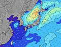 | 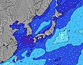 | 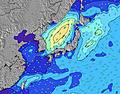 | 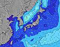 | ||||||||||||||
Wave Height (m) Direction Period (s) | ESE 16 | ESE 16 | ESE 16 | ESE 17 | ESE 17 | E 17 | E 17 | E 18 | ESE 17 | ESE 18 | SE 17 | SE 17 | E 12 | E 11 | E 11 | E 10 | E 10 | ESE 9 | E 9 | E 10 | E 9 |
Wave Graph | |||||||||||||||||||||
1331 | 1576 | 2546 | 3239 | 3910 | 8387 | 15322 | 21630 | 31012 | 32967 | 33331 | 47949 | 11603 | 8613 | 7389 | 4606 | 3258 | 2659 | 2349 | 2794 | 2332 | |
Wind (km/h) | |||||||||||||||||||||
Wind State on-shore cross-onshore cross-shore cross-offshore off-shore glassy | cross-off | cross | cross | cross | cross | cross | cross | cross | cross | cross | cross | cross | cross-on | cross-on | cross-on | cross-on | cross-on | cross-on | cross-on | cross-on | cross-on |
High Tide | 9:07PM1.90m | 9:20AM1.73m | 9:36PM1.85m | 10:16AM1.62m | 10:11PM1.79m | 11:36AM1.51m | 10:57PM1.72m | 1:33PM1.48m | 00:05AM1.66m | 3:28PM1.58m | 1:39AM1.66m | 4:36PM1.73m | |||||||||
Low Tide | 2:47PM0.48m | 3:19AM0.62m | 3:21PM0.66m | 4:05AM0.60m | 4:00PM0.85m | 5:02AM0.59m | 4:51PM1.06m | 6:18AM0.57m | 6:16PM1.23m | 7:51AM0.49m | 8:23PM1.29m | 9:13AM0.35m | 9:54PM1.22m | ||||||||
5:31 | — | — | 5:31 | — | — | 5:33 | — | — | 5:33 | — | — | 5:33 | — | — | 5:33 | — | — | 5:35 | — | — | |
— | 7:08 | — | — | 7:07 | — | — | 7:07 | — | — | 7:07 | — | — | 7:06 | — | — | 7:05 | — | — | 7:04 | — | |
mm | — | 1 | 10 | 2 | 2 | 2 | 1 | — | 1 | 2 | 3 | 10 | 7 | 8 | 13 | 7 | 6 | 20 | 8 | 7 | 12 |
Temp °C | 31 | 30 | 29 | 29 | 29 | 28 | 28 | 29 | 28 | 29 | 29 | 29 | 29 | 29 | 29 | 28 | 28 | 28 | 29 | 28 | 28 |
Feels °C | 32 | 31 | 31 | 30 | 31 | 29 | 26 | 27 | 26 | 25 | 25 | 25 | 25 | 25 | 26 | 24 | 25 | 24 | 26 | 25 | 25 |
Swell 1 Height (m) Direction Period (s) | ESE 16 | ESE 16 | ESE 16 | ESE 17 | ESE 17 | E 17 | E 17 | E 18 | ESE 17 | ESE 18 | SE 17 | SE 17 | SSE 16 | SSE 16 | S 16 | S 14 | S 15 | S 14 | S 14 | S 13 | SSW 13 |
1331 | 1576 | 2546 | 3239 | 3910 | 8387 | 15322 | 21630 | 31012 | 32967 | 33331 | 47949 | 26594 | 26002 | 18000 | 11213 | 9766 | 6699 | 4007 | 3065 | 2676 | |
Swell 2 Height (m) Direction Period (s) | ENE 15 | ENE 15 | SSE 8 | — | — | — | — | — | — | — | — | — | — | — | — | — | ENE 15 | — | — | — | SW 16 |
46 | 43 | 6 | — | — | — | — | — | — | — | — | — | — | — | — | — | 42 | — | — | — | 161 | |
Swell 3 Height (m) Direction Period (s) | SSW 7 | S 7 | — | — | — | — | — | — | — | — | — | — | — | — | — | — | — | — | — | — | SE 15 |
5 | 4 | — | — | — | — | — | — | — | — | — | — | — | — | — | — | — | — | — | — | 9 | |
Wind waves Height (m) Direction Period (s) | — | NE 5 | ENE 6 | ENE 7 | ENE 8 | ENE 9 | — | — | — | ENE 10 | ENE 10 | ENE 11 | E 12 | E 11 | E 11 | E 10 | E 10 | ESE 9 | E 9 | E 10 | E 9 |
— | 35 | 63 | 261 | 395 | 697 | — | — | — | 3406 | 5329 | 5535 | 11603 | 8613 | 7389 | 4606 | 3258 | 2659 | 2349 | 2794 | 2332 | |
Nearest Offshore or Glassy | |||||||||||||||||||||
Distance (km) | 12 | 12 | 12 | 12 | 12 | 12 | 331 | 167 | 331 | 873 | 826 | 864 | 835 | 826 | 826 | 826 | 331 | 826 | 887 | 887 | 268 |
Best forecast wave conditions in Kyu Shu | |||||||||||||||||||||
Best forecast wave conditions in Japan | |||||||||||||||||||||
Header Global | |||||||||||||||||||||
- Map Icons:
 Break
Break Live Wave Height (m)
 Live Wind Speed (km/h)
 Surf Rating (10 Max)
 Ocean Swells (m)
- Wind Speed (km/h)
Latest Updates


FREE! Surf-Forecast.com widget for your website
The surf report / weather widget below is available to embed on third party websites free of charge and provides a summary of our Cape Toi surf forecast. Simply grab the html code snippet that we provide and paste it into your own site. You can choose your preferred language and metric/imperial units for the surf forecast feed to suit users of your site. Click here to get the code.
Information about the Cape Toi Surf forecast
The above surf forecast table for Cape Toi provides essential information for determining whether the surfing conditions will be good over the next 16 days. A general guide to surfing at Cape Toi can be found by selecting the local surf guide option on the grey menu. Our Cape Toi surf forecast is unique since it includes wave energy (power) that defines the real feel of the surf rather than just the height or the period. If you surf the same spot (Cape Toi) regularly then make a mental note of the wave energy from the surf forecast table each time you go. Very soon you may start to choose your surf days based on the wave energy alone combined with our forecast of favourable offshore wind conditions. Our star ratings will help here and of course you will also find the usual wave height and period predictions on our surf forecasts as well as a full break down of the swell components under our advanced users option (to reveal that, click the little Einstein character under the tide times).
Further information to help with frequently asked questions about our surf forecast for Cape Toi may be found under the help tab on the top menu and also by moving your mouse over the question marks on the surf forecast table itself. Please always bear in mind that the forecast is for near-shore open water and local factors at each surf break influence the actual breaking wave height, such as the beach / reef profile, water depths offshore and shelter.
Cape Toi is 15 km (9 miles) from Kushima. If you plan a holiday in Kyu Shu, look for hotels and other accommodation in Kushima. Kushima has rooms for a wide range of budgets as well as car hire and transport links.
 Nearest