

Surf Forecasts:

Westport-The Corner surf forecast from 2 Aug 2026:
- Best quality surf: Monday 3 Aug, 5AM (local time) - 4.5ft (1.4m), 8s period, WNW swell with offshore winds.
- Most powerful swell: Sunday 2 Aug, 8PM (local time) - 6ft (1.8m), 9s period, WNW swell with 493 kJ wave energy.
- Next surfable swell (1★+): Monday 3 Aug, 5AM (local time) - 4.5ft (1.4m), 8s period with WNW swell.
Best Forecast Surf Conditions for Westport-The Corner this week:
The surf forecast for Westport-The Corner over the next 16 days: The first swell (rated 1 star or higher) is forecast to arrive on Monday (Aug 03) at 5AM. The primary swell is predicted to be 1.4m and 8s period with a secondary swell of 0.4m and 13s. The wind is predicted to be offshore as the swell arrives.
The most powerful waves expected at Westport-The Corner in the next 16 days are 1.8m 9s and forecast to arrive on Sunday (Aug 02) at 8PM. Winds are predicted to be cross-offshore at the time the swell arrives.
| Wave Type | Time (PDT) & Date | Wave Height & Period |
|---|---|---|
| Next good surf (1 star+) | 5AM (Mon 3rd Aug) | 4.5ft (1.4m) 8s |
| Best Surf | 5AM (Mon 3rd Aug) | 4.5ft (1.4m) 8s |
| Most Powerful | 8PM (Sun 2nd Aug) | 6ft (1.8m) 9s |
Table - best surf conditions forecast for Westport-The Corner over the next 16 days.
The Lowdown
Alright, this is Rusty, and I’m lookin’ at the surf for Westport-The Corner. Gotta be honest with you, the next couple of weeks aren’t gonna have us jumping out of our skins, but there are a few windows where it cleans up just enough to make it worthwhile.
The overall pattern is a bit of a grind. We’ve got a consistent supply of waist-to-chest high swell coming from the W-NW, but the wind is the real story here. For the first week, it’s mostly cross or cross-onshore, with afternoons getting lumpy and chopped out. The mornings are where it’s at, especially when the wind drops light.
The real standout is Monday morning, August 3rd. The water is sitting at a very warm 63°F, which is much warmer than normal for this time of year – a pleasant surprise. The swell is a clean 4 ft from the WNW, with a short period of 7 seconds. The real kicker is the wind: a light NNW breeze at 3 mph, which is a cross-offshore breeze. That’s the cleanest we’ll see all week, with the combined swell energy sitting at a moderate 243. It’s not going to be a world-class day, but for a beginner-friendly beach/jetty break, that’s the call.
Tuesday morning, August 4th, is a similar story. A little smaller at 4 ft from the WNW, but with a light N breeze at 9 mph, keeping it clean. The energy is a bit lower at 212, but it’ll be a fun, easy paddle out.
After that, the wind turns more onshore, and the surf gets messy. There’s a long stretch from Wednesday the 5th afternoon all the way through to the weekend where the conditions are just poor. The swell sticks around, but the wind is just too strong or on the nose.
Now, looking further out, the second week shows a bit of a pulse. Wednesday, August 12th morning has a sizable 4 ft swell from the WNW, but the wind is straight onshore from the WSW, which is a no-go for paddle surfing. The combined energy is strong at 430, but that setup is honestly more interesting for kite surfing than paddling.
The best bet in that second week is Sunday, August 16th morning. We get a 5 ft swell from the WNW, with a strong combined energy of 580. The wind is a cross breeze from the WNW at 9 mph. It’s still a bit lumpy, but it’s the best of a pretty average bunch. The swell is on the bigger side, so it’s getting towards the top end for beginners, but it’s still manageable.
Overall, keep your eyes on those early mornings in the first week. The forecast is more reliable there. The long-range stuff for the 16th is promising, but don’t book the day off work just yet.
Rusty.
Short Range ForecastMostly dry. Warm (max 23°C on Tue afternoon, min 12°C on Mon morning). Winds decreasing (fresh winds from the NW on Sun afternoon, light winds from the ENE by Mon morning). | Days 4-6 Weather SummaryMostly dry. Warm (max 22°C on Wed morning, min 14°C on Thu night). Wind will be generally light. | ||||||||||||||||||||
Sunday 2 | Monday 3 | Tuesday 4 | Wednesday 5 | Thursday 6 | Friday 7 | Saturday 8 | |||||||||||||||
AM | PM | Night | AM | PM | Night | AM | PM | Night | AM | PM | Night | AM | PM | Night | AM | PM | Night | AM | PM | Night | |
Swell Height Map | 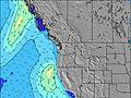 | 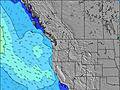 | 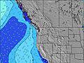 | 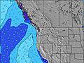 | 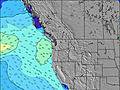 | 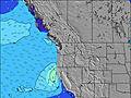 | 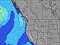 | ||||||||||||||
Wave Height (m) Direction Period (s) | W 9 | WNW 9 | WNW 8 | WNW 7 | WNW 7 | WNW 7 | WNW 7 | NW 7 | WNW 8 | WNW 8 | WNW 8 | WNW 8 | WNW 8 | WNW 8 | WNW 7 | WNW 8 | NW 7 | NW 6 | NW 6 | NW 6 | NW 6 |
Wave Graph | |||||||||||||||||||||
381 | 474 | 298 | 167 | 183 | 145 | 120 | 199 | 242 | 237 | 248 | 208 | 242 | 208 | 178 | 187 | 237 | 194 | 100 | 106 | 96 | |
Wind (km/h) | |||||||||||||||||||||
Wind State on-shore cross-onshore cross-shore cross-offshore off-shore glassy | cross | cross | cross-off | cross-off | cross-off | cross-off | cross-off | cross-off | cross-off | cross-off | cross | cross | cross-on | cross-on | cross-on | cross-on | cross | cross | cross | cross | cross |
High Tide | 4:31PM2.68m | 4:24AM2.45m | 5:03PM2.76m | 5:16AM2.23m | 5:38PM2.81m | 6:19AM2.01m | 6:21PM2.84m | 7:37AM1.85m | 7:15PM2.86m | 9:08AM1.80m | 8:20PM2.88m | 10:35AM1.90m | 9:31PM2.95m | ||||||||
Low Tide | 9:34AM-0.09m | 10:04PM0.52m | 10:07AM0.13m | 10:54PM0.41m | 10:43AM0.40m | 11:51PM0.29m | 11:26AM0.68m | 00:56AM0.18m | 12:19PM0.95m | 2:07AM0.04m | 1:28PM1.16m | 3:19AM-0.14m | 2:49PM1.24m | 4:25AM-0.34m | |||||||
5:56 | — | — | 5:58 | — | — | 5:58 | — | — | 6:00 | — | — | 6:01 | — | — | 6:03 | — | — | 6:03 | — | — | |
— | 8:46 | — | — | 8:45 | — | — | 8:44 | — | — | 8:43 | — | — | 8:40 | — | — | 8:39 | — | — | 8:37 | — | |
mm | — | — | — | — | — | — | — | — | — | — | — | — | — | — | — | — | — | — | — | — | — |
Temp °C | 15 | 16 | 14 | 16 | 18 | 16 | 21 | 23 | 17 | 22 | 21 | 17 | 17 | 17 | 15 | 15 | 15 | 15 | 15 | 16 | 14 |
Feels °C | 13 | 12 | 9 | 15 | 14 | 12 | 18 | 19 | 13 | 20 | 17 | 15 | 17 | 16 | 14 | 14 | 13 | 11 | 12 | 12 | 9 |
Swell 1 Height (m) Direction Period (s) | W 9 | SW 14 | WNW 8 | WNW 7 | SW 13 | WNW 7 | WNW 7 | W 9 | WNW 8 | WNW 8 | SW 15 | WNW 8 | WNW 8 | WNW 8 | WNW 7 | WNW 8 | SW 13 | SW 13 | WNW 11 | WNW 11 | WNW 10 |
381 | 64 | 298 | 167 | 27 | 145 | 120 | 43 | 242 | 237 | 54 | 208 | 242 | 208 | 178 | 187 | 60 | 58 | 23 | 38 | 20 | |
Swell 2 Height (m) Direction Period (s) | SW 14 | SW 19 | SW 13 | SW 13 | WSW 18 | WSW 16 | SW 16 | SW 16 | SW 15 | SW 15 | SW 11 | SW 14 | SW 14 | SW 14 | SW 13 | SW 13 | SW 18 | SW 18 | SW 12 | SW 16 | SW 17 |
67 | 14 | 63 | 27 | 30 | 25 | 66 | 40 | 57 | 55 | 5 | 51 | 50 | 66 | 63 | 61 | 50 | 49 | 40 | 93 | 44 | |
Swell 3 Height (m) Direction Period (s) | SW 19 | — | WSW 18 | SW 18 | — | SW 13 | SW 13 | SW 12 | SW 12 | SW 12 | — | W 18 | SW 11 | SW 20 | W 12 | SW 18 | W 12 | WNW 11 | SW 18 | SW 12 | SW 12 |
15 | — | 31 | 49 | — | 26 | 26 | 6 | 6 | 6 | — | 6 | 5 | 15 | 12 | 13 | 11 | 13 | 49 | 55 | 23 | |
Wind waves Height (m) Direction Period (s) | — | WNW 9 | — | — | WNW 7 | — | — | NW 7 | — | — | WNW 8 | — | — | — | — | — | NW 7 | NW 6 | NW 6 | NW 6 | NW 6 |
— | 474 | — | — | 183 | — | — | 199 | — | — | 248 | — | — | — | — | — | 237 | 194 | 100 | 106 | 96 | |
Nearest Offshore or Glassy | |||||||||||||||||||||
Distance (km) | 149 | 1431 | 99 | 0 | 171 | 0 | 0 | 171 | 0 | 0 | 165 | 57 | 5 | 1442 | 57 | 165 | 165 | 123 | 171 | 802 | 165 |
Best forecast wave conditions in Washington State | |||||||||||||||||||||
Best forecast wave conditions in United States | |||||||||||||||||||||
Header Global | |||||||||||||||||||||
- Map Icons:
 Break
Break Live Wave Height (m)
 Live Wind Speed (km/h)
 Surf Rating (10 Max)
 Ocean Swells (m)
- Wind Speed (km/h)
Latest Updates


FREE! Surf-Forecast.com widget for your website
The surf report / weather widget below is available to embed on third party websites free of charge and provides a summary of our Westport-The Corner surf forecast. Simply grab the html code snippet that we provide and paste it into your own site. You can choose your preferred language and metric/imperial units for the surf forecast feed to suit users of your site. Click here to get the code.
Information about the Westport-The Corner Surf forecast
The above surf forecast table for Westport-The Corner provides essential information for determining whether the surfing conditions will be good over the next 16 days. A general guide to surfing at Westport-The Corner can be found by selecting the local surf guide option on the grey menu. Our Westport-The Corner surf forecast is unique since it includes wave energy (power) that defines the real feel of the surf rather than just the height or the period. If you surf the same spot (Westport-The Corner) regularly then make a mental note of the wave energy from the surf forecast table each time you go. Very soon you may start to choose your surf days based on the wave energy alone combined with our forecast of favourable offshore wind conditions. Our star ratings will help here and of course you will also find the usual wave height and period predictions on our surf forecasts as well as a full break down of the swell components under our advanced users option (to reveal that, click the little Einstein character under the tide times).
Further information to help with frequently asked questions about our surf forecast for Westport-The Corner may be found under the help tab on the top menu and also by moving your mouse over the question marks on the surf forecast table itself. Please always bear in mind that the forecast is for near-shore open water and local factors at each surf break influence the actual breaking wave height, such as the beach / reef profile, water depths offshore and shelter.
Are you planning a vacation in Washington State? If you are looking for accommodation near Westport-The Corner, camping, hotels and condos and appartments in Washington State, consider staying in Aberdeen which is 26 km (16 miles) away. Other places in and around Washington State where you can find information about places to rent, and car hire include Astoria which is 78 km (48 miles) away, Centralia and Olympia.
 Nearest