

Surf Forecasts:

Ocean City surf forecast from 13 Jul 2026:
- Best quality surf: Sunday 19 Jul, 5PM (local time) - 3.5ft (1.0m), 6s period, S swell with cross-offshore winds.
- Most powerful swell: Sunday 19 Jul, 5AM (local time) - 4.5ft (1.4m), 6s period, S swell with 156 kJ wave energy.
- Next surfable swell (1★+): Sunday 19 Jul, 5PM (local time) - 3.5ft (1.0m), 6s period with S swell.
Best Forecast Surf Conditions for Ocean City this week:
The surf forecast for Ocean City over the next 16 days: The first swell (rated 1 star or higher) is forecast to arrive on Sunday (Jul 19) at 5PM. The primary swell is predicted to be 1.0m and 6s period with a secondary swell of 0.7m and 6s. Another secondary swell of 0.1m and 13s is also forecast. The wind is predicted to be cross-offshore as the swell arrives.
The most powerful waves expected at Ocean City in the next 16 days are 1.4m 6s and forecast to arrive on Sunday (Jul 19) at 5AM. Winds are predicted to be cross-offshore at the time the swell arrives. The largest open ocean swell (not directed at the beach) is 0.6m 4s period and expected on Wednesday (Jul 15) at 11AM.
| Wave Type | Time (EDT) & Date | Wave Height & Period |
|---|---|---|
| Next good surf (1 star+) | 5PM (Sun 19th Jul) | 3.5ft (1.0m) 6s |
| Best Surf | 5PM (Sun 19th Jul) | 3.5ft (1.0m) 6s |
| Most Powerful | 5AM (Sun 19th Jul) | 4.5ft (1.4m) 6s |
Table - best surf conditions forecast for Ocean City over the next 16 days.
Alright folks, Rusty here. Let’s be straight with you – the next couple of weeks at Ocean City are looking pretty grim for a paddle. The charts are showing a long stretch of flat, weak conditions, and we’re going to have to wait a while before anything even remotely rideable shows up.
The outlook starts with a real dud. From Monday the 13th right through to Saturday the 19th, the waves are just junk. We’re talking tiny, short-period windswell that’s mostly onshore or cross-shore, with barely any energy. The combined swell energy is in the low double digits for most of that time, hanging around 20 (70 to 10) – that’s barely a ripple. It’s a tough run for anyone looking for a wave.
The first hint of something actually surfable doesn’t come until the afternoon of Sunday the 19th. The wind finally swings cross-offshore, and the swell height ticks up to 3ft from the south, with a period of 6 seconds. The combined energy jumps to 127 (moderate), and the wave comment calls it “surfable waves but very ordinary conditions.” It’s not a standout, but it’s a start. The water temp is about average for the time of year, so no need to worry about a wetsuit or a spring suit.
The best of a pretty average bunch rolls in on Monday morning, July 20th. We’ve got a little 3ft swell from the SSE, but the real winner here is the wind: glassy. Dead flat, clean conditions. The combined energy is 83 (weak), but if you’re keen for a longboard and a sunrise session, this is your window. Just be aware that Ocean City gets crowded often, and with the lack of options, the lineup will be packed.
After that, the forecast gets messy again. The rest of the 16-day window from Tuesday the 21st onwards is a mix of cross-shore winds, lumpy chop, and tiny swell. The combined energy drops back into the teens and twenties. There’s a brief moment on Thursday morning the 23rd where the sea breeze is light and the swell is 2ft from the SE – it’s clean, but you’d be scratching for a ride.
Honestly, if you’re after a paddle, the only real call is that Monday morning the 20th for the glassy conditions. Everything else is a gamble. The setup is so weak and wind-affected that it might be more interesting for the kite surfers than us paddle folk. Keep an eye on the charts, but don’t hold your breath.
Rusty.
Short Range ForecastMostly dry. Warm (max 35°C on Wed afternoon, min 22°C on Mon night). Wind will be generally light. | Days 5-7 Weather SummaryMostly dry. Warm (max 35°C on Thu afternoon, min 23°C on Fri morning). Winds increasing (calm on Thu night, fresh winds from the S by Sat afternoon). | ||||||||||||||||||||
Monday 13 | Tuesday 14 | Wednesday 15 | Thursday 16 | Friday 17 | Saturday 18 | Sun 19 | |||||||||||||||
Night | AM | PM | Night | AM | PM | Night | AM | PM | Night | AM | PM | Night | AM | PM | Night | AM | PM | Night | AM | PM | |
Swell Height Map |  | 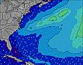 | 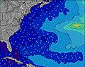 | 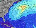 | 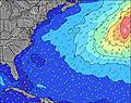 | 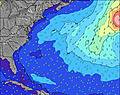 | 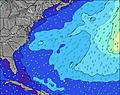 | 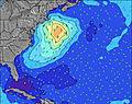 | |||||||||||||
Wave Height (m) Direction Period (s) | ESE 6 | ESE 6 | ESE 6 | E 6 | E 6 | ESE 9 | SSW 4 | SE 9 | SE 9 | S 5 | S 5 | S 5 | ESE 8 | ESE 8 | ESE 8 | ESE 8 | SSE 4 | S 5 | SSE 6 | SSE 6 | S 6 |
Wave Graph | |||||||||||||||||||||
72 | 60 | 43 | 17 | 10 | 8 | 17 | 20 | 20 | 23 | 13 | 13 | 6 | 7 | 7 | 7 | 13 | 42 | 115 | 39 | 84 | |
Wind (km/h) | |||||||||||||||||||||
Wind State on-shore cross-onshore cross-shore cross-offshore off-shore glassy | on | on | on | cross-on | cross | cross | cross-off | cross-off | cross-off | cross-off | cross-off | cross-off | cross-off | cross | on | cross | cross | cross | cross-off | cross-off | cross-off |
High Tide | 7:16AM1.18m | 7:33PM1.53m | 8:11AM1.23m | 8:26PM1.54m | 9:05AM1.27m | 9:19PM1.51m | 9:58AM1.29m | 10:10PM1.46m | 10:52AM1.29m | 11:03PM1.37m | 11:46AM1.28m | 11:54PM1.28m | 12:37PM1.26m | ||||||||
Low Tide | 1:20AM-0.07m | 1:15PM-0.04m | 2:15AM-0.13m | 2:13PM-0.07m | 3:07AM-0.17m | 3:09PM-0.08m | 3:56AM-0.18m | 4:01PM-0.06m | 4:42AM-0.16m | 4:51PM-0.01m | 5:27AM-0.10m | 5:42PM0.06m | 6:12AM-0.03m | 6:34PM0.14m | |||||||
— | 5:46 | — | — | 5:47 | — | — | 5:48 | — | — | 5:48 | — | — | 5:48 | — | — | 5:50 | — | — | 5:50 | — | |
8:24 | — | 8:23 | — | — | 8:23 | — | — | 8:22 | — | — | 8:22 | — | — | 8:22 | — | — | 8:21 | — | — | 8:21 | |
mm | — | — | — | — | — | — | — | — | — | — | — | — | — | — | — | — | — | — | 3 | — | — |
Temp °C | 24 | 23 | 23 | 23 | 23 | 26 | 25 | 29 | 35 | 31 | 30 | 35 | 30 | 23 | 25 | 24 | 26 | 27 | 26 | 28 | 33 |
Feels °C | 22 | 21 | 22 | 23 | 23 | 23 | 22 | 30 | 34 | 30 | 33 | 36 | 33 | 20 | 22 | 21 | 25 | 25 | 24 | 29 | 34 |
Swell 1 Height (m) Direction Period (s) | S 6 | ESE 10 | ESE 6 | E 6 | E 6 | E 6 | ESE 9 | SE 9 | SE 9 | ESE 8 | S 5 | S 5 | SSE 5 | SSE 5 | SSE 5 | ESE 8 | ESE 8 | SE 8 | SSE 6 | SSE 6 | SSE 6 |
3 | 10 | 43 | 17 | 10 | 6 | 16 | 20 | 20 | 7 | 13 | 7 | 4 | 5 | 5 | 7 | 7 | 3 | 115 | 39 | 40 | |
Swell 2 Height (m) Direction Period (s) | — | — | SSE 5 | SSE 5 | SSE 5 | ESE 9 | — | — | — | E 16 | ESE 8 | ESE 8 | ESE 8 | ESE 8 | ESE 8 | NE 4 | NE 4 | E 13 | E 13 | E 13 | E 13 |
— | — | 9 | 5 | 5 | 8 | — | — | — | 5 | 6 | 6 | 6 | 7 | 7 | 1 | 1 | 3 | 3 | 3 | 3 | |
Swell 3 Height (m) Direction Period (s) | — | — | ESE 10 | ESE 9 | ESE 9 | — | — | — | — | — | E 16 | — | — | E 15 | N 3 | E 14 | E 14 | — | E 9 | — | — |
— | — | 9 | 8 | 8 | — | — | — | — | — | 5 | — | — | 4 | 1 | 4 | 4 | — | 1 | — | — | |
Wind waves Height (m) Direction Period (s) | ESE 6 | ESE 6 | — | — | — | S 3 | SSW 4 | SSW 4 | SSW 4 | S 5 | — | S 5 | N 3 | NNE 3 | NE 4 | SSE 5 | SSE 4 | S 5 | — | — | S 6 |
72 | 60 | — | — | — | 4 | 17 | 13 | 12 | 23 | — | 13 | 1 | 3 | 2 | 4 | 13 | 42 | — | — | 84 | |
Nearest Offshore or Glassy | |||||||||||||||||||||
Distance (km) | 676 | 438 | 438 | 438 | 569 | 223 | 261 | 147 | 291 | 83 | 1063 | 582 | 1053 | 1187 | 1053 | 1330 | 1061 | 1507 | 219 | 14 | 0 |
Best forecast wave conditions in Maryland | |||||||||||||||||||||
Best forecast wave conditions in United States | |||||||||||||||||||||
Header Global | |||||||||||||||||||||
- Map Icons:
 Break
Break Live Wave Height (m)
 Live Wind Speed (km/h)
 Surf Rating (10 Max)
 Ocean Swells (m)
- Wind Speed (km/h)


FREE! Surf-Forecast.com widget for your website
The surf report / weather widget below is available to embed on third party websites free of charge and provides a summary of our Ocean City surf forecast. Simply grab the html code snippet that we provide and paste it into your own site. You can choose your preferred language and metric/imperial units for the surf forecast feed to suit users of your site. Click here to get the code.
Information about the Ocean City Surf forecast
The above surf forecast table for Ocean City provides essential information for determining whether the surfing conditions will be good over the next 16 days. A general guide to surfing at Ocean City can be found by selecting the local surf guide option on the grey menu. Our Ocean City surf forecast is unique since it includes wave energy (power) that defines the real feel of the surf rather than just the height or the period. If you surf the same spot (Ocean City) regularly then make a mental note of the wave energy from the surf forecast table each time you go. Very soon you may start to choose your surf days based on the wave energy alone combined with our forecast of favourable offshore wind conditions. Our star ratings will help here and of course you will also find the usual wave height and period predictions on our surf forecasts as well as a full break down of the swell components under our advanced users option (to reveal that, click the little Einstein character under the tide times).
Further information to help with frequently asked questions about our surf forecast for Ocean City may be found under the help tab on the top menu and also by moving your mouse over the question marks on the surf forecast table itself. Please always bear in mind that the forecast is for near-shore open water and local factors at each surf break influence the actual breaking wave height, such as the beach / reef profile, water depths offshore and shelter.
Ocean City is 7 km (4 miles) from Ocean City. If you plan a vacation in Maryland, look for hotels and other accommodation in Ocean City. Ocean City has rooms for a wide range of budgets as well as car hire and transport links.
 Nearest