

Surf Forecasts:

St Andrews State Park surf forecast from 3 Aug 2026:
- Most powerful swell: Monday 3 Aug, 1AM (local time) - 4.5ft (1.3m), 6s period, WSW swell with 112 kJ wave energy.
Best Forecast Surf Conditions for St Andrews State Park this week:
The most powerful waves expected at St Andrews State Park in the next 16 days are 1.3m 6s and forecast to arrive on Monday (Aug 03) at 1AM. Winds are predicted to be cross-onshore at the time the swell arrives. The largest open ocean swell (not directed at the beach) is 0.2m 2s period and expected on Saturday (Aug 08) at 7AM.
| Wave Type | Time (CDT) & Date | Wave Height & Period |
|---|---|---|
| Next good surf (1 star+) | - | - |
| Best Surf | - | - |
| Most Powerful | 1AM (Mon 3rd Aug) | 4.5ft (1.3m) 6s |
Table - best surf conditions forecast for St Andrews State Park over the next 16 days.
The Lowdown
Alright, this is Rusty.
I gotta be straight with you... it’s a tough stretch ahead for surf here at St Andrews State Park. Looking at the whole 16-day window, I’m not seeing a single day that’s worth paddling out for. Nothing. The forecast shows a real flat spell with only tiny, weak, short-period windswell and the wind is almost always onshore or cross-onshore, chopping up whatever little bump there is.
We start off on Sunday, the 2nd of August, with a 4ft swell from the WSW, but it’s a short 6-second period and the wind is onshore. The combined energy is only 113 (moderate), but the conditions are just poor. The water is a warm 86°, about normal for this time of year.
From Monday morning, the 3rd, things drop off fast. We’re looking at waist-high or smaller surf for the next two weeks. The wind is mostly from the SW or W, blowing onshore, so the surface is just messy. There are a few glassy mornings, like on the 9th, 10th, 11th, 14th, and 15th of August, with virtually no wind, but the swell is tiny – under 1ft. It’s clean, but there’s nothing to ride.
The combined energy values are all in the single digits or low double digits, which means the wave energy is extremely weak. It’s about as flat as it gets.
The only time we see a slight bump is towards the very end of the forecast, on the 17th of August, with a 3ft swell from the S, but the period is only 4 seconds and the wind is howling onshore at 15 mph. That’s a complete write-off.
So, the honest truth is this: there are no standout days, no good options, and no surf to speak of in this 16-day window. It’s a blank run. For an exposed beach/jetty setup like this, it’s a normal part of the cycle. You just have to wait for the next system to roll through. Forecasts can change, but right now, it’s a good time to take a break from the water.
Rusty.
Short Range ForecastModerate rain (total 19mm), heaviest on Sun afternoon. Warm (max 30°C on Tue morning, min 27°C on Sun night). Wind will be generally light. | Days 5-7 Weather SummaryHeavy rain (total 42mm), heaviest during Fri afternoon. Warm (max 31°C on Fri morning, min 25°C on Thu night). Wind will be generally light. | |||||||||||||||||||
Sun 2 | Monday 3 | Tuesday 4 | Wednesday 5 | Thursday 6 | Friday 7 | Saturday 8 | ||||||||||||||
PM | Night | AM | PM | Night | AM | PM | Night | AM | PM | Night | AM | PM | Night | AM | PM | Night | AM | PM | Night | |
Swell Height Map |  |  |  |  | 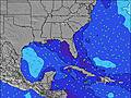 | 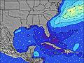 | 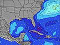 | |||||||||||||
Wave Height (m) Direction Period (s) | WSW 6 | WSW 6 | WSW 6 | WSW 5 | WSW 5 | SW 5 | SW 5 | SW 5 | S 4 | SW 3 | — | S 6 | S 5 | — | SE 4 | SSE 6 | SSE 5 | SSE 5 | S 5 | SSE 6 |
Wave Graph | ||||||||||||||||||||
111 | 112 | 36 | 19 | 11 | 11 | 11 | 5 | 1 | 2 | 0 | 1 | 1 | 0 | 1 | 3 | 5 | 10 | 20 | 11 | |
Wind (km/h) | ||||||||||||||||||||
Wind State on-shore cross-onshore cross-shore cross-offshore off-shore glassy | on | cross-on | cross-on | on | on | cross-on | on | on | cross-on | cross-on | cross-on | cross-off | cross-on | cross-off | off | cross-on | cross-off | off | on | cross |
High Tide | 2:47AM0.30m | 3:12PM0.25m | 2:39AM0.35m | 2:59AM0.41m | 3:42AM0.47m | 4:41AM0.52m | 5:50AM0.56m | |||||||||||||
Low Tide | 7:56PM0.21m | 10:21AM0.23m | 6:10PM0.24m | 12:27PM0.16m | 1:51PM0.10m | 3:07PM0.05m | 4:20PM-0.00m | 5:27PM-0.04m | ||||||||||||
— | — | 6:01 | — | — | 6:03 | — | — | 6:03 | — | — | 6:03 | — | — | 6:05 | — | — | 6:05 | — | — | |
7:36 | — | — | 7:35 | — | — | 7:34 | — | — | 7:32 | — | — | 7:31 | — | — | 7:31 | — | — | 7:30 | — | |
mm | 7 | 7 | 1 | — | — | 1 | — | — | 3 | — | — | — | — | — | — | 42 | — | — | — | 2 |
Temp °C | 29 | 28 | 29 | 29 | 29 | 30 | 30 | 29 | 29 | 29 | 28 | 30 | 29 | 28 | 31 | 29 | 28 | 31 | 29 | 29 |
Feels °C | 31 | 30 | 31 | 29 | 31 | 30 | 30 | 31 | 31 | 30 | 32 | 31 | 30 | 31 | 34 | 30 | 28 | 34 | 31 | 32 |
Swell 1 Height (m) Direction Period (s) | S 10 | — | WSW 6 | S 5 | S 5 | SW 5 | SSE 4 | S 4 | W 3 | — | — | — | S 5 | — | SE 4 | SSE 6 | SSE 5 | — | — | SSE 6 |
2 | — | 36 | 14 | 4 | 11 | 3 | 1 | 1 | — | — | — | 1 | — | 1 | 3 | 5 | — | — | 11 | |
Swell 2 Height (m) Direction Period (s) | — | — | S 6 | — | SW 5 | W 5 | — | — | S 4 | — | — | S 6 | — | — | — | — | — | — | — | — |
— | — | 22 | — | 1 | 1 | — | — | 1 | — | — | 1 | — | — | — | — | — | — | — | — | |
Swell 3 Height (m) Direction Period (s) | — | — | — | — | — | — | — | — | SW 4 | — | — | — | — | — | — | — | — | — | — | — |
— | — | — | — | — | — | — | — | 1 | — | — | — | — | — | — | — | — | — | — | — | |
Wind waves Height (m) Direction Period (s) | WSW 6 | WSW 6 | — | WSW 5 | WSW 5 | — | SW 5 | SW 5 | — | SW 3 | — | — | — | — | — | SSE 3 | — | SSE 5 | S 5 | — |
111 | 112 | — | 19 | 11 | — | 11 | 5 | — | 2 | — | — | — | — | — | 2 | — | 10 | 20 | — | |
Nearest Offshore or Glassy | ||||||||||||||||||||
Distance (km) | 419 | 111 | 1555 | 1170 | 438 | 490 | 420 | 438 | 858 | 430 | 846 | 1769 | 1565 | 1022 | 1022 | 1022 | 719 | 1369 | 419 | 419 |
Best forecast wave conditions in Gulf Coast, Florida | ||||||||||||||||||||
Best forecast wave conditions in United States | ||||||||||||||||||||
Header Global | ||||||||||||||||||||
- Map Icons:
 Break
Break Live Wave Height (m)
 Live Wind Speed (km/h)
 Surf Rating (10 Max)
 Ocean Swells (m)
- Wind Speed (km/h)
Latest Updates


FREE! Surf-Forecast.com widget for your website
The surf report / weather widget below is available to embed on third party websites free of charge and provides a summary of our St Andrews State Park surf forecast. Simply grab the html code snippet that we provide and paste it into your own site. You can choose your preferred language and metric/imperial units for the surf forecast feed to suit users of your site. Click here to get the code.
Information about the St Andrews State Park Surf forecast
The above surf forecast table for St Andrews State Park provides essential information for determining whether the surfing conditions will be good over the next 16 days. A general guide to surfing at St Andrews State Park can be found by selecting the local surf guide option on the grey menu. Our St Andrews State Park surf forecast is unique since it includes wave energy (power) that defines the real feel of the surf rather than just the height or the period. If you surf the same spot (St Andrews State Park) regularly then make a mental note of the wave energy from the surf forecast table each time you go. Very soon you may start to choose your surf days based on the wave energy alone combined with our forecast of favourable offshore wind conditions. Our star ratings will help here and of course you will also find the usual wave height and period predictions on our surf forecasts as well as a full break down of the swell components under our advanced users option (to reveal that, click the little Einstein character under the tide times).
Further information to help with frequently asked questions about our surf forecast for St Andrews State Park may be found under the help tab on the top menu and also by moving your mouse over the question marks on the surf forecast table itself. Please always bear in mind that the forecast is for near-shore open water and local factors at each surf break influence the actual breaking wave height, such as the beach / reef profile, water depths offshore and shelter.
St Andrews State Park is 16 km (10 miles) from Panama City. If you plan a vacation in Gulf Coast, Florida, look for hotels and other accommodation in Panama City. Panama City has rooms for a wide range of budgets as well as car hire and transport links.
 Nearest