

Surf Forecasts:

Afife surf forecast from 3 Aug 2026:
- Best quality surf: Thursday 6 Aug, 7AM (local time) - 2.5ft (0.8m), 9s period, NNW swell with cross-offshore winds.
- Most powerful swell: Wednesday 5 Aug, 7PM (local time) - 5ft (1.5m), 9s period, NW swell with 382 kJ wave energy.
- Next surfable swell (1★+): Monday 3 Aug, 4AM (local time) - 2.5ft (0.7m), 9s period with W swell.
Best Forecast Surf Conditions for Afife this week:
The surf forecast for Afife over the next 16 days: The first swell (rated 1 star or higher) is forecast to arrive on Monday (Aug 03) at 4AM. The primary swell is predicted to be 0.7m and 9s period with a secondary swell of 0.2m and 7s. The wind is predicted to be cross-offshore as the swell arrives.
The most powerful waves expected at Afife in the next 16 days are 1.5m 9s and forecast to arrive on Wednesday (Aug 05) at 7PM. Winds are predicted to be cross-onshore at the time the swell arrives.
| Wave Type | Time (WEST) & Date | Wave Height & Period |
|---|---|---|
| Next good surf (1 star+) | 4AM (Mon 3rd Aug) | 2.5ft (0.7m) 9s |
| Best Surf | 7AM (Thu 6th Aug) | 2.5ft (0.8m) 9s |
| Most Powerful | 7PM (Wed 5th Aug) | 5ft (1.5m) 9s |
Table - best surf conditions forecast for Afife over the next 16 days.
The Lowdown
Alright folks, Rusty here. Let’s have a look at what’s cookin’ for Afife over the next couple of weeks.
Right off the bat, I gotta be straight with you – the first week and a half is a real struggle. We’ve got a lot of "poor surf conditions" and "marginal" calls, with barely a score to get excited about. The water temp is sitting at a pretty normal 67°, so no surprises there, but the wave energy is just... weak. We’re looking at combined swell energy values mostly under 200 (76, 143, 214) – that’s barely a ripple. The swell is small, mostly 2ft to 5ft, coming from the W or NW, with periods all over the place but often short. The wind is a constant problem too – cross, cross-on, and a few onshore spells. It’s a real bummer.
There’s a tiny glimmer on Saturday morning, August 8th. The wind goes glassy, dead calm, with a small 2ft swell from the NNW (7 seconds). The energy is a low 66, and the call is "surfable waves but very ordinary conditions." It’s not a standout, but if you’re desperate, you could get a clean little wave. Then it’s back to the doldrums for another week.
Now, the real story starts to build for the second week. The swell starts to push up, and the energy starts climbing. Thursday morning, August 13th, has a glassy morning with a 3ft WNW swell and energy of 175 – still small, but clean. Not a standout.
The best on offer is Monday, August 17th. The morning session is the call. We’ve got a solid 7ft swell from the NNW, with a combined energy of 384 (moderate) and the wind is a light SSE cross-off, which means clean faces. The rating from the file says "expect good surf conditions." That’s the one. The afternoon sees the swell jump to 8ft with energy at 666, but the wind goes cross-on from the NW, and the file calls it "marginal." So, get in early on the 17th. That 7ft is a bit heavy for beginners, but it’s a proper wave for the rest of us. The period is only 7 seconds though, so it’ll be a bit lumpy and close together, not a classic long-period groundswell.
So, in short: the first 15 days are mostly a write-off. The only real standout is the morning of Monday, August 17th. If you can wait for that, you’ll be stoked. The rest is just watching the horizon.
Rusty.
Short Range ForecastMostly dry. Warm (max 22°C on Tue morning, min 17°C on Sun night). Wind will be generally light. | Days 4-6 Weather SummaryMostly dry. Warm (max 25°C on Thu afternoon, min 16°C on Wed night). Wind will be generally light. | ||||||||||||||||||||
Monday 3 | Tuesday 4 | Wednesday 5 | Thursday 6 | Friday 7 | Saturday 8 | Sunday 9 | |||||||||||||||
AM | PM | Night | AM | PM | Night | AM | PM | Night | AM | PM | Night | AM | PM | Night | AM | PM | Night | AM | PM | Night | |
Swell Height Map |  |  | 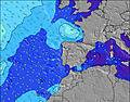 | 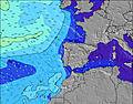 | 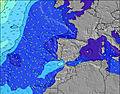 | 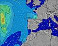 | 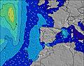 | ||||||||||||||
Wave Height (m) Direction Period (s) | W 9 | W 8 | W 8 | W 9 | W 8 | W 8 | NW 10 | NW 10 | NNW 9 | NNW 9 | NNW 9 | NNW 6 | NNW 10 | NNW 9 | NNW 8 | NNW 8 | W 9 | NW 10 | NW 9 | NW 9 | W 7 |
Wave Graph | |||||||||||||||||||||
127 | 208 | 116 | 120 | 111 | 84 | 145 | 327 | 130 | 127 | 266 | 141 | 72 | 67 | 23 | 23 | 14 | 26 | 41 | 38 | 35 | |
Wind (km/h) | |||||||||||||||||||||
Wind State on-shore cross-onshore cross-shore cross-offshore off-shore glassy | cross-off | cross | cross-off | cross | cross-on | cross | cross | cross-on | cross | cross | cross-on | cross | glassy | cross-on | glassy | cross-on | on | glassy | cross-on | cross-on | glassy |
High Tide | 6:31AM2.68m | 6:45PM2.84m | 7:10AM2.61m | 7:27PM2.71m | 7:56AM2.52m | 8:17PM2.54m | 8:52AM2.42m | 9:22PM2.39m | 10:05AM2.36m | 10:46PM2.31m | 11:30AM2.40m | 00:14AM2.36m | 12:48PM2.58m | 1:28AM2.52m | |||||||
Low Tide | 12:30PM0.41m | 00:59AM0.38m | 1:11PM0.52m | 1:41AM0.50m | 2:00PM0.65m | 2:32AM0.65m | 3:02PM0.77m | 3:39AM0.78m | 4:23PM0.84m | 5:02AM0.84m | 5:54PM0.77m | 6:25AM0.75m | 7:12PM0.57m | ||||||||
6:30 | — | — | 6:31 | — | — | 6:31 | — | — | 6:33 | — | — | 6:33 | — | — | 6:35 | — | — | 6:35 | — | — | |
— | 8:52 | — | — | 8:50 | — | — | 8:49 | — | — | 8:47 | — | — | 8:46 | — | — | 8:45 | — | — | 8:44 | — | |
mm | — | — | — | — | — | — | — | — | — | — | — | — | — | — | — | — | — | — | — | — | — |
Temp °C | 21 | 21 | 20 | 22 | 22 | 19 | 21 | 21 | 18 | 24 | 25 | 21 | 23 | 22 | 19 | 22 | 22 | 18 | 21 | 21 | 18 |
Feels °C | 20 | 23 | 22 | 22 | 23 | 20 | 19 | 18 | 17 | 21 | 22 | 19 | 23 | 21 | 20 | 22 | 22 | 19 | 21 | 21 | 18 |
Swell 1 Height (m) Direction Period (s) | W 9 | W 8 | W 8 | W 9 | W 8 | W 8 | NW 10 | W 7 | NNW 9 | NNW 9 | W 10 | NNW 9 | NW 6 | NNW 9 | NNW 8 | NNW 8 | W 9 | NW 10 | W 7 | W 7 | W 7 |
127 | 208 | 116 | 120 | 111 | 84 | 145 | 26 | 130 | 127 | 48 | 66 | 39 | 67 | 23 | 23 | 14 | 26 | 34 | 35 | 35 | |
Swell 2 Height (m) Direction Period (s) | NNW 8 | NW 8 | NW 8 | NW 11 | NW 11 | NW 10 | W 8 | WNW 10 | WNW 10 | W 10 | SW 12 | WNW 10 | NNW 10 | W 9 | NW 4 | W 9 | NNW 7 | W 6 | NW 9 | NW 9 | NW 8 |
6 | 2 | 2 | 5 | 30 | 44 | 58 | 34 | 34 | 49 | 5 | 30 | 72 | 15 | 4 | 14 | 10 | 6 | 41 | 38 | 33 | |
Swell 3 Height (m) Direction Period (s) | SW 15 | S 15 | SW 14 | N 9 | N 9 | SW 13 | W 10 | SW 12 | W 7 | SW 12 | — | SW 13 | W 9 | S 13 | W 9 | NW 11 | NNW 10 | W 8 | — | — | — |
8 | 4 | 7 | 6 | 6 | 7 | 18 | 6 | 14 | 6 | — | 6 | 15 | 3 | 14 | 4 | 10 | 12 | — | — | — | |
Wind waves Height (m) Direction Period (s) | S 3 | — | — | — | — | — | — | NW 10 | NNW 6 | NW 6 | NNW 9 | NNW 6 | — | — | — | — | — | — | — | — | — |
2 | — | — | — | — | — | — | 327 | 90 | 47 | 266 | 141 | — | — | — | — | — | — | — | — | — | |
Nearest Offshore or Glassy | |||||||||||||||||||||
Distance (km) | 66 | 94 | 0 | 94 | 89 | 4 | 4 | 119 | 10 | 4 | 119 | 4 | 0 | 141 | 4 | 425 | 136 | 4 | 6 | 96 | 0 |
Best forecast wave conditions in Douro and Minho | |||||||||||||||||||||
Best forecast wave conditions in Portugal | |||||||||||||||||||||
Header Global | |||||||||||||||||||||
- Map Icons:
 Break
Break Live Wave Height (m)
 Live Wind Speed (km/h)
 Surf Rating (10 Max)
 Ocean Swells (m)
- Wind Speed (km/h)
Latest Updates


FREE! Surf-Forecast.com widget for your website
The surf report / weather widget below is available to embed on third party websites free of charge and provides a summary of our Afife surf forecast. Simply grab the html code snippet that we provide and paste it into your own site. You can choose your preferred language and metric/imperial units for the surf forecast feed to suit users of your site. Click here to get the code.
Information about the Afife Surf forecast
The above surf forecast table for Afife provides essential information for determining whether the surfing conditions will be good over the next 16 days. A general guide to surfing at Afife can be found by selecting the local surf guide option on the grey menu. Our Afife surf forecast is unique since it includes wave energy (power) that defines the real feel of the surf rather than just the height or the period. If you surf the same spot (Afife) regularly then make a mental note of the wave energy from the surf forecast table each time you go. Very soon you may start to choose your surf days based on the wave energy alone combined with our forecast of favourable offshore wind conditions. Our star ratings will help here and of course you will also find the usual wave height and period predictions on our surf forecasts as well as a full break down of the swell components under our advanced users option (to reveal that, click the little Einstein character under the tide times).
Further information to help with frequently asked questions about our surf forecast for Afife may be found under the help tab on the top menu and also by moving your mouse over the question marks on the surf forecast table itself. Please always bear in mind that the forecast is for near-shore open water and local factors at each surf break influence the actual breaking wave height, such as the beach / reef profile, water depths offshore and shelter.
Afife is 10 km (6 miles) from Viana do Castelo. If you plan a holiday in Douro and Minho, look for hotels and other accommodation in Viana do Castelo. Viana do Castelo has rooms for a wide range of budgets as well as car hire and transport links.
 Nearest